![](/images/other/stat-length.png)
- Randonnées
- Vélo
- France
- Normandie
- Eure
- Arnières-sur-Iton
Arnières-sur-Iton, Eure, Vélo : Les meilleures randonnées, itinéraires, parcours, balades et promenades
1 commentaires
Arnières-sur-Iton : découvrez les meilleures randonnées : 2 v.t.t.. Tous ces circuits, parcours, itinéraires et activités en plein air sont disponibles dans nos applications SityTrail pour smartphones et tablettes.
Les meilleurs parcours (2)
![Randonnée V.T.T. Arnières-sur-Iton - La balade des copains - Arnieres sur Iton - Photo](https://media.geolcdn.com/t/350/260/ext.jpg?maxdim=2&url=https%3A%2F%2Fservices.sitytrail.com%2FGeolivesWS%2FDownloadMedia.ashx%3FTrailID%3D103963%26Media%3D6851_2.jpg)
![V.T.T. V.T.T.](https://static1.geolcdn.com/sitytour/trail-icons/202.png)
Km
#1 - La balade des copains - Arnieres sur Iton
V.T.T.
Difficile
(1)
Arnières-sur-Iton,
Normandie,
Eure,
France
![](/images/other/stat-length.png)
34 km | 41 km-effort
2h 19min
![](https://static1.geolcdn.com/siteimages/upload/files/1508320355ic_sort_den_pos_24dp.png)
482 m
![](https://static1.geolcdn.com/siteimages/upload/files/1508320355ic_sort_den_neg_24dp.png)
483 m
![](https://static1.geolcdn.com/siteimages/upload/files/16400158638029165_repeat_loop_refresh_sync_direction_icon.png)
Oui
tracegps
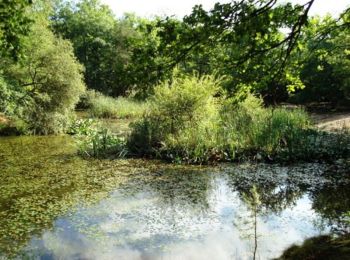
• Voici la randonnée organisée par le club CYCLO LOISIRS D’ÉVREUX: La balade des copains. Je vous propose de profiter d...
![Randonnée V.T.T. Arnières-sur-Iton - voie verte hypodrome - Photo](https://media.geolcdn.com/t/350/260/ext.jpg?maxdim=2&url=https%3A%2F%2Fstatic1.geolcdn.com%2Fsiteimages%2Fupload%2Ffiles%2F1524743154velo.jpg)
![V.T.T. V.T.T.](https://static1.geolcdn.com/sitytour/trail-icons/202.png)
Km
#2 - voie verte hypodrome
V.T.T.
Facile
Arnières-sur-Iton,
Normandie,
Eure,
France
![](/images/other/stat-length.png)
2 km | 2,2 km-effort
8min
![](https://static1.geolcdn.com/siteimages/upload/files/1508320355ic_sort_den_pos_24dp.png)
8 m
![](https://static1.geolcdn.com/siteimages/upload/files/1508320355ic_sort_den_neg_24dp.png)
11 m
![](https://static1.geolcdn.com/siteimages/upload/files/16400158638029165_repeat_loop_refresh_sync_direction_icon.png)
Non
fredtruc27
2 randonnées affichées sur 2
Application GPS de randonnée GRATUITE