


37 km | 41 km-effort
Thésée : découvrez les meilleures randonnées : 4 v.t.t. et 4 v.t.c.. Tous ces circuits, parcours, itinéraires et activités en plein air sont disponibles dans nos applications SityTrail pour smartphones et tablettes.
V.T.T.


• Aller par les petites routes et retour par les bois. Très boueux par endroits.
V.T.T.
• Aller par les petites routes et retour par les bois. Très boueux par endroits.
V.T.T.
• Glissant par temps humide. Chemin de hallage parfois coupé d’où allés et retours.
V.T.T.
• Glissant par temps humide. Chemin de hallage parfois coupé d’où allés et retours.

V.T.T.
• En boucle. Aller par la colline et les vignes. Retour par les berges du Cher.
V.T.T.
• En boucle. Aller par la colline et les vignes. Retour par les berges du Cher.
V.T.T.
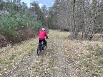
• VTC ou VTT. promenade facile dans de beaux chemins. Beaux bâtiments sur le chemin.
V.T.T.
• VTC ou VTT. promenade facile dans de beaux chemins. Beaux bâtiments sur le chemin.
8 randonnées affichées sur 4
Application GPS de randonnée GRATUITE
 SityTrail
IGN / Instituts géographiques
SityTrail World
Le monde est à vous