![](/images/other/stat-length.png)
- Randonnées
- Vélo
- France
- Occitanie
- Gers
Gers, Occitanie, Vélo : Les meilleures randonnées, itinéraires, parcours, balades et promenades
Gers : découvrez les meilleures randonnées : 14 vélo, 5 vélo de route, 78 v.t.t., 3 v.t.c., 10 cyclotourisme et 8 vélo électrique. Tous ces circuits, parcours, itinéraires et activités en plein air sont disponibles dans nos applications SityTrail pour smartphones et tablettes.
Les meilleurs parcours (118)
![Randonnée V.T.T. L'Isle-Jourdain - Entre Save et coteaux à L'isle Jourdain - Photo](https://media.geolcdn.com/t/350/260/ext.jpg?maxdim=2&url=https%3A%2F%2Fstatic1.geolcdn.com%2Fsiteimages%2Fupload%2Ffiles%2F1524743154velo.jpg)
![V.T.T. V.T.T.](https://static1.geolcdn.com/sitytour/trail-icons/202.png)
Km
V.T.T.
![](/images/other/stat-length.png)
![](https://static1.geolcdn.com/siteimages/upload/files/1508320355ic_sort_den_pos_24dp.png)
![](https://static1.geolcdn.com/siteimages/upload/files/1508320355ic_sort_den_neg_24dp.png)
![](https://static1.geolcdn.com/siteimages/upload/files/16400158638029165_repeat_loop_refresh_sync_direction_icon.png)
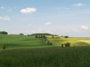
• Le circuit débute à travers les coteaux du Gers. Les pentes deviennent plus raides à mesure que l'on progresse vers l...
![Randonnée V.T.T. Saint-Puy - Autour de Saint_Puy - Photo](https://media.geolcdn.com/t/350/260/367b5912-29f4-4660-974a-ac9eb92576dd.jpg&format=jpg&maxdim=2)
![V.T.T. V.T.T.](https://static1.geolcdn.com/sitytour/trail-icons/202.png)
Km
V.T.T.
![](/images/other/stat-length.png)
![](https://static1.geolcdn.com/siteimages/upload/files/1508320355ic_sort_den_pos_24dp.png)
![](https://static1.geolcdn.com/siteimages/upload/files/1508320355ic_sort_den_neg_24dp.png)
![](https://static1.geolcdn.com/siteimages/upload/files/16400158638029165_repeat_loop_refresh_sync_direction_icon.png)
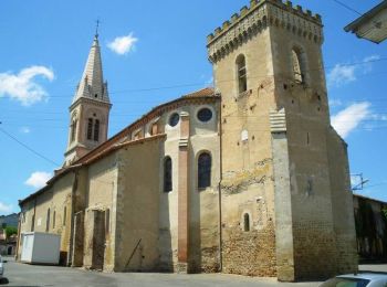
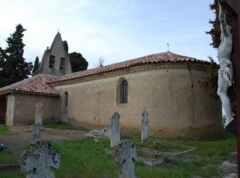
• Départ de l'église pour découvrir les chemins et petites routes autour de Saint-Puy.
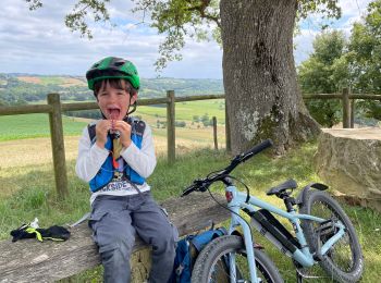
![Randonnée Vélo électrique Saint-Antoine - Saint Antoine -Condom 22/06/2019 - Photo](https://media.geolcdn.com/t/350/260/c29532ff-bc53-419b-84a3-442ce06a82a2.jpg&format=jpg&maxdim=2)
![Vélo électrique Vélo électrique](https://static1.geolcdn.com/sitytour/trail-icons/205.png)
Km
Vélo électrique
![](/images/other/stat-length.png)
![](https://static1.geolcdn.com/siteimages/upload/files/1508320355ic_sort_den_pos_24dp.png)
![](https://static1.geolcdn.com/siteimages/upload/files/1508320355ic_sort_den_neg_24dp.png)
![](https://static1.geolcdn.com/siteimages/upload/files/16400158638029165_repeat_loop_refresh_sync_direction_icon.png)
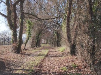
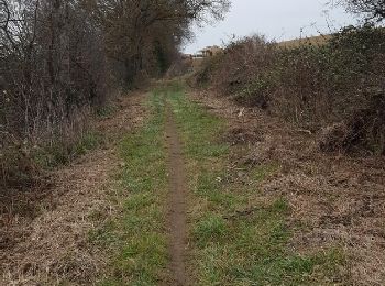
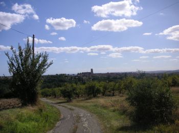
• Chemin de Saint Jacques, troisième étape, 53km bien vallonné 😅
![Randonnée Vélo électrique Montréal - 04-06-19 - Photo](https://media.geolcdn.com/t/350/260/823fbf2d-918d-4557-a071-da280458074a.jpg&format=jpg&maxdim=2)
![Vélo électrique Vélo électrique](https://static1.geolcdn.com/sitytour/trail-icons/205.png)
Km
Vélo électrique
![](/images/other/stat-length.png)
![](https://static1.geolcdn.com/siteimages/upload/files/1508320355ic_sort_den_pos_24dp.png)
![](https://static1.geolcdn.com/siteimages/upload/files/1508320355ic_sort_den_neg_24dp.png)
![](https://static1.geolcdn.com/siteimages/upload/files/16400158638029165_repeat_loop_refresh_sync_direction_icon.png)
• Belle boucle et beaux villages
![Randonnée Vélo Montréal - Montréal - Fourcès - Larressingle - Photo](https://media.geolcdn.com/t/350/260/83486d4f-6345-4995-a2c8-47da1265dffe.jpg&format=jpg&maxdim=2)
![Vélo Vélo](https://static1.geolcdn.com/sitytour/trail-icons/200.png)
Km
Vélo
![](/images/other/stat-length.png)
![](https://static1.geolcdn.com/siteimages/upload/files/1508320355ic_sort_den_pos_24dp.png)
![](https://static1.geolcdn.com/siteimages/upload/files/1508320355ic_sort_den_neg_24dp.png)
![](https://static1.geolcdn.com/siteimages/upload/files/16400158638029165_repeat_loop_refresh_sync_direction_icon.png)
• France Passion: Jean Ladevèze. Domaine de la Boubée (vignoble). Tel: 05 62 29 41 85 43.951177, 0.221320
![Randonnée V.T.T. Encausse - La Colognaise 2017 fin boucle 2 - Photo](https://media.geolcdn.com/t/350/260/ext.jpg?maxdim=2&url=https%3A%2F%2Fservices.sitytrail.com%2FGeolivesWS%2FDownloadMedia.ashx%3FTrailID%3D697163%26Media%3Dfix__20170212181328.jpg)
![V.T.T. V.T.T.](https://static1.geolcdn.com/sitytour/trail-icons/202.png)
Km
V.T.T.
![](/images/other/stat-length.png)
![](https://static1.geolcdn.com/siteimages/upload/files/1508320355ic_sort_den_pos_24dp.png)
![](https://static1.geolcdn.com/siteimages/upload/files/1508320355ic_sort_den_neg_24dp.png)
![](https://static1.geolcdn.com/siteimages/upload/files/16400158638029165_repeat_loop_refresh_sync_direction_icon.png)
• Le challenge de la lomagne
![Randonnée V.T.T. Cologne - La Colognaise 2017 boucle 2 partie 1-2 - Photo](https://media.geolcdn.com/t/350/260/ext.jpg?maxdim=2&url=https%3A%2F%2Fservices.sitytrail.com%2FGeolivesWS%2FDownloadMedia.ashx%3FTrailID%3D697118%26Media%3Dfix__20170212172923.jpg)
![V.T.T. V.T.T.](https://static1.geolcdn.com/sitytour/trail-icons/202.png)
Km
V.T.T.
![](/images/other/stat-length.png)
![](https://static1.geolcdn.com/siteimages/upload/files/1508320355ic_sort_den_pos_24dp.png)
![](https://static1.geolcdn.com/siteimages/upload/files/1508320355ic_sort_den_neg_24dp.png)
![](https://static1.geolcdn.com/siteimages/upload/files/16400158638029165_repeat_loop_refresh_sync_direction_icon.png)
• Challenge de la lomagne
![Randonnée V.T.T. Cologne - La Colognaise boucle 1 - Photo](https://media.geolcdn.com/t/350/260/ext.jpg?maxdim=2&url=https%3A%2F%2Fservices.sitytrail.com%2FGeolivesWS%2FDownloadMedia.ashx%3FTrailID%3D696913%26Media%3Dfix__20170212110537.jpg)
![V.T.T. V.T.T.](https://static1.geolcdn.com/sitytour/trail-icons/202.png)
Km
V.T.T.
![](/images/other/stat-length.png)
![](https://static1.geolcdn.com/siteimages/upload/files/1508320355ic_sort_den_pos_24dp.png)
![](https://static1.geolcdn.com/siteimages/upload/files/1508320355ic_sort_den_neg_24dp.png)
![](https://static1.geolcdn.com/siteimages/upload/files/16400158638029165_repeat_loop_refresh_sync_direction_icon.png)
• Challenge de lomagne
![Randonnée V.T.T. Lagarde-Hachan - Le sentier du Bois du Cerf - Lagarde-Hachan - Photo](https://media.geolcdn.com/t/350/260/ext.jpg?maxdim=2&url=https%3A%2F%2Fservices.sitytrail.com%2FGeolivesWS%2FDownloadMedia.ashx%3FTrailID%3D317070%26Media%3D16214_4.jpg)
![V.T.T. V.T.T.](https://static1.geolcdn.com/sitytour/trail-icons/202.png)
Km
V.T.T.
![](/images/other/stat-length.png)
![](https://static1.geolcdn.com/siteimages/upload/files/1508320355ic_sort_den_pos_24dp.png)
![](https://static1.geolcdn.com/siteimages/upload/files/1508320355ic_sort_den_neg_24dp.png)
![](https://static1.geolcdn.com/siteimages/upload/files/16400158638029165_repeat_loop_refresh_sync_direction_icon.png)
• Circuit proposé par la Communauté de Communes Astarac Arros en Gascogne et l’Association Culture et Tradition en Asta...
![Randonnée V.T.T. Roquelaure - Roquelaure - Castillon-Massas - Photo](https://media.geolcdn.com/t/350/260/ext.jpg?maxdim=2&url=https%3A%2F%2Fservices.sitytrail.com%2FGeolivesWS%2FDownloadMedia.ashx%3FTrailID%3D316847%26Media%3D15915_3.jpg)
![V.T.T. V.T.T.](https://static1.geolcdn.com/sitytour/trail-icons/202.png)
Km
V.T.T.
![](/images/other/stat-length.png)
![](https://static1.geolcdn.com/siteimages/upload/files/1508320355ic_sort_den_pos_24dp.png)
![](https://static1.geolcdn.com/siteimages/upload/files/1508320355ic_sort_den_neg_24dp.png)
![](https://static1.geolcdn.com/siteimages/upload/files/16400158638029165_repeat_loop_refresh_sync_direction_icon.png)
• Boucle de 19 km autour de Roquelaure en empruntant les chemins de la campagne gersoise, et quelques chemins en bordur...
![Randonnée Vélo Saramon - Circuit de 40 Km- Saramon - Photo](https://media.geolcdn.com/t/350/260/ext.jpg?maxdim=2&url=https%3A%2F%2Fservices.sitytrail.com%2FGeolivesWS%2FDownloadMedia.ashx%3FTrailID%3D172950%26Media%3D14429_5.jpg)
![Vélo Vélo](https://static1.geolcdn.com/sitytour/trail-icons/200.png)
Km
Vélo
![](/images/other/stat-length.png)
![](https://static1.geolcdn.com/siteimages/upload/files/1508320355ic_sort_den_pos_24dp.png)
![](https://static1.geolcdn.com/siteimages/upload/files/1508320355ic_sort_den_neg_24dp.png)
![](https://static1.geolcdn.com/siteimages/upload/files/16400158638029165_repeat_loop_refresh_sync_direction_icon.png)
• C'est un circuit d'environ deux heures, classique pour un cyclotouriste Saramonais. Le circuit est varié, compter à p...
![Randonnée Vélo Saramon - Circuit de 48 Km- Saramon - Photo](https://media.geolcdn.com/t/350/260/ext.jpg?maxdim=2&url=https%3A%2F%2Fservices.sitytrail.com%2FGeolivesWS%2FDownloadMedia.ashx%3FTrailID%3D172949%26Media%3D14428_1.jpg)
![Vélo Vélo](https://static1.geolcdn.com/sitytour/trail-icons/200.png)
Km
Vélo
![](/images/other/stat-length.png)
![](https://static1.geolcdn.com/siteimages/upload/files/1508320355ic_sort_den_pos_24dp.png)
![](https://static1.geolcdn.com/siteimages/upload/files/1508320355ic_sort_den_neg_24dp.png)
![](https://static1.geolcdn.com/siteimages/upload/files/16400158638029165_repeat_loop_refresh_sync_direction_icon.png)
• Départ de la place, grande rue, face au Syndicat d'initiative. C'est un circuit à cheval sur quatre vallées (Gimone, ...
![Randonnée Vélo Saramon - Circuit découverte 2 - Saramon - Photo](https://media.geolcdn.com/t/350/260/ext.jpg?maxdim=2&url=https%3A%2F%2Fservices.sitytrail.com%2FGeolivesWS%2FDownloadMedia.ashx%3FTrailID%3D172948%26Media%3D14427_5.jpg)
![Vélo Vélo](https://static1.geolcdn.com/sitytour/trail-icons/200.png)
Km
Vélo
![](/images/other/stat-length.png)
![](https://static1.geolcdn.com/siteimages/upload/files/1508320355ic_sort_den_pos_24dp.png)
![](https://static1.geolcdn.com/siteimages/upload/files/1508320355ic_sort_den_neg_24dp.png)
![](https://static1.geolcdn.com/siteimages/upload/files/16400158638029165_repeat_loop_refresh_sync_direction_icon.png)
• Départ de la place, grande rue, face au Syndicat d'initiative. Partez par "la chaussée", magnifique allée de platanes...
![Randonnée Vélo Saramon - Circuit découverte 1 - Saramon - Photo](https://media.geolcdn.com/t/350/260/ext.jpg?maxdim=2&url=https%3A%2F%2Fservices.sitytrail.com%2FGeolivesWS%2FDownloadMedia.ashx%3FTrailID%3D172947%26Media%3D14426_4.jpg)
![Vélo Vélo](https://static1.geolcdn.com/sitytour/trail-icons/200.png)
Km
Vélo
![](/images/other/stat-length.png)
![](https://static1.geolcdn.com/siteimages/upload/files/1508320355ic_sort_den_pos_24dp.png)
![](https://static1.geolcdn.com/siteimages/upload/files/1508320355ic_sort_den_neg_24dp.png)
![](https://static1.geolcdn.com/siteimages/upload/files/16400158638029165_repeat_loop_refresh_sync_direction_icon.png)
• Départ de la place, grande rue, face au Syndicat d'initiative. Partez en direction du lac et de St. Elix d’Astarac. A...
![Randonnée Vélo Saramon - Circuit découverte 3 - Saramon - Photo](https://media.geolcdn.com/t/350/260/ext.jpg?maxdim=2&url=https%3A%2F%2Fservices.sitytrail.com%2FGeolivesWS%2FDownloadMedia.ashx%3FTrailID%3D172946%26Media%3D14425_5.jpg)
![Vélo Vélo](https://static1.geolcdn.com/sitytour/trail-icons/200.png)
Km
Vélo
![](/images/other/stat-length.png)
![](https://static1.geolcdn.com/siteimages/upload/files/1508320355ic_sort_den_pos_24dp.png)
![](https://static1.geolcdn.com/siteimages/upload/files/1508320355ic_sort_den_neg_24dp.png)
![](https://static1.geolcdn.com/siteimages/upload/files/16400158638029165_repeat_loop_refresh_sync_direction_icon.png)
• Départ de la place, grande rue, face au Syndicat d'initiative. A la sortie du village, direction Seissan, vous passez...
![Randonnée Vélo Saramon - Circuit de 44 Km- Saramon - Photo](https://media.geolcdn.com/t/350/260/ext.jpg?maxdim=2&url=https%3A%2F%2Fservices.sitytrail.com%2FGeolivesWS%2FDownloadMedia.ashx%3FTrailID%3D172945%26Media%3D14424_5.jpg)
![Vélo Vélo](https://static1.geolcdn.com/sitytour/trail-icons/200.png)
Km
Vélo
![](/images/other/stat-length.png)
![](https://static1.geolcdn.com/siteimages/upload/files/1508320355ic_sort_den_pos_24dp.png)
![](https://static1.geolcdn.com/siteimages/upload/files/1508320355ic_sort_den_neg_24dp.png)
![](https://static1.geolcdn.com/siteimages/upload/files/16400158638029165_repeat_loop_refresh_sync_direction_icon.png)
• Départ de la place, grande rue, face au Syndicat d'initiative. A la sortie de Saramon, vous passez par des alignement...
![Randonnée V.T.T. Fleurance - GRP Coeur de Gascogne (en plusieurs jours...) - Photo](https://media.geolcdn.com/t/350/260/ext.jpg?maxdim=2&url=https%3A%2F%2Fservices.sitytrail.com%2FGeolivesWS%2FDownloadMedia.ashx%3FTrailID%3D172639%26Media%3D14008_6.jpg)
![V.T.T. V.T.T.](https://static1.geolcdn.com/sitytour/trail-icons/202.png)
Km
V.T.T.
![](/images/other/stat-length.png)
![](https://static1.geolcdn.com/siteimages/upload/files/1508320355ic_sort_den_pos_24dp.png)
![](https://static1.geolcdn.com/siteimages/upload/files/1508320355ic_sort_den_neg_24dp.png)
![](https://static1.geolcdn.com/siteimages/upload/files/16400158638029165_repeat_loop_refresh_sync_direction_icon.png)
• Le meilleur moyen de connaitre le Gers est encore de parcourir ses routes, chemins, ses espaces. En empruntant cet it...
![Randonnée V.T.T. Mauvezin - Ronde des foies gras - Mauvezin - Photo](https://media.geolcdn.com/t/350/260/ext.jpg?maxdim=2&url=https%3A%2F%2Fservices.sitytrail.com%2FGeolivesWS%2FDownloadMedia.ashx%3FTrailID%3D107310%26Media%3D12199_3.jpg)
![V.T.T. V.T.T.](https://static1.geolcdn.com/sitytour/trail-icons/202.png)
Km
V.T.T.
![](/images/other/stat-length.png)
![](https://static1.geolcdn.com/siteimages/upload/files/1508320355ic_sort_den_pos_24dp.png)
![](https://static1.geolcdn.com/siteimages/upload/files/1508320355ic_sort_den_neg_24dp.png)
![](https://static1.geolcdn.com/siteimages/upload/files/16400158638029165_repeat_loop_refresh_sync_direction_icon.png)
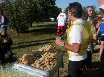
• Circuit de la Ronde des foies gras 2011 dans le Gers à Mauvezin. Parcours plutôt facile pour les VTT avec 3 ou 4 raid...
![Randonnée V.T.T. Samatan - VTT autour de Samatan et Lombez - Photo](https://media.geolcdn.com/t/350/260/ext.jpg?maxdim=2&url=https%3A%2F%2Fservices.sitytrail.com%2FGeolivesWS%2FDownloadMedia.ashx%3FTrailID%3D106535%26Media%3D11094_3.jpg)
![V.T.T. V.T.T.](https://static1.geolcdn.com/sitytour/trail-icons/202.png)
Km
V.T.T.
![](/images/other/stat-length.png)
![](https://static1.geolcdn.com/siteimages/upload/files/1508320355ic_sort_den_pos_24dp.png)
![](https://static1.geolcdn.com/siteimages/upload/files/1508320355ic_sort_den_neg_24dp.png)
![](https://static1.geolcdn.com/siteimages/upload/files/16400158638029165_repeat_loop_refresh_sync_direction_icon.png)
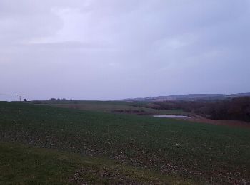
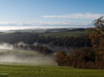
• Cette boucle offre de beaux points de vue sur les coteaux du Gers, et en arrière plan les Pyrénées, par temps clair. ...
![Randonnée V.T.T. Marciac - Marciac avec Sacha - 15 Km - Photo](https://media.geolcdn.com/t/350/260/adf9019e-c9eb-4d25-9692-a83d3841c1ac.jpg&format=jpg&maxdim=2)
![V.T.T. V.T.T.](https://static1.geolcdn.com/sitytour/trail-icons/202.png)
Km
V.T.T.
![](/images/other/stat-length.png)
![](https://static1.geolcdn.com/siteimages/upload/files/1508320355ic_sort_den_pos_24dp.png)
![](https://static1.geolcdn.com/siteimages/upload/files/1508320355ic_sort_den_neg_24dp.png)
![](https://static1.geolcdn.com/siteimages/upload/files/16400158638029165_repeat_loop_refresh_sync_direction_icon.png)
• 22/07/2024
20 randonnées affichées sur 118
Application GPS de randonnée GRATUITE
Activités
Régions proches
- Aignan
- Ansan
- Arblade-le-Bas
- Arblade-le-Haut
- Ardizas
- Aubiet
- Auch
- Aujan-Mournède
- Auradé
- Aurensan
- Aurimont
- Aussos
- Auterive
- Aux-Aussat
- Avensac
- Avéron-Bergelle
- Avezan
- Ayguetinte
- Ayzieu
- Barcelonne-du-Gers
- Barcugnan
- Barran
- Bascous
- Bassoues
- Bazian
- Bazugues
- Beaucaire
- Beaumarchés
- Beaumont
- Bédéchan
- Bellegarde
- Belloc-Saint-Clamens
- Béraut
- Berdoues
- Bernède
- Berrac
- Betcave-Aguin
- Bétous
- Betplan
- Bézéril
- Bezolles
- Bézues-Bajon
- Biran
- Boulaur
- Bourrouillan
- Bretagne-d'Armagnac
- Caillavet
- Cassaigne
- Castelnau d'Auzan Labarrère
- Castelnau-Barbarens
- Castelnau-d'Anglès
- Castelnau-d'Arbieu
- Castelnau-sur-l'Auvignon
- Castelnavet
- Castéra-Lectourois
- Castéra-Verduzan
- Castéron
- Castet-Arrouy
- Castex
- Castillon-Debats
- Castillon-Massas
- Caupenne-d'Armagnac
- Caussens
- Cazaubon
- Cazaux-Savès
- Cazaux-Villecomtal
- Cazaux-d'Anglès
- Cazeneuve
- Céran
- Clermont-Pouyguillès
- Cologne
- Condom
- Courrensan
- Cravencères
- Dému
- Duran
- Durban
- Eauze
- Encausse
- Endoufielle
- Escornebœuf
- Espaon
- Estampes
- Estang
- Estipouy
- Faget-Abbatial
- Flamarens
- Fleurance
- Fourcès
- Gaudonville
- Gaujan
- Gazaupouy
- Gimbrède
- Gimont
- Giscaro
- Gondrin
- Goutz
- Haget
- Homps
- Jegun
- Jû-Belloc
- Juillac
- Juilles
- L'Isle-Arné
- L'Isle-Bouzon
- L'Isle-Jourdain
- L'Isle-de-Noé
- La Romieu
- Labarthe
- Labéjan
- Labrihe
- Ladevèze-Ville
- Lagarde
- Lagarde-Hachan
- Lagardère
- Lagraulet-du-Gers
- Laguian-Mazous
- Lahas
- Lalanne
- Lamaguère
- Lamothe-Goas
- Lanne-Soubiran
- Lannemaignan
- Lannux
- Larée
- Larressingle
- Larroque-sur-l'Osse
- Lasséran
- Lasseube-Propre
- Lauraët
- Lavardens
- Laymont
- Le Brouilh-Monbert
- Le Houga
- Lectoure
- Lelin-Lapujolle
- Lias
- Ligardes
- Lombez
- Loubédat
- Loubersan
- Lourties-Monbrun
- Lupiac
- Luppé-Violles
- Lussan
- Magnan
- Maignaut-Tauzia
- Malabat
- Manciet
- Mansempuy
- Mansencôme
- Marambat
- Maravat
- Marciac
- Marestaing
- Marsan
- Marsolan
- Mas-d'Auvignon
- Masseube
- Maumusson-Laguian
- Mauroux
- Mauvezin
- Meilhan
- Miélan
- Miradoux
- Miramont-Latour
- Miramont-d'Astarac
- Mirande
- Mirannes
- Mirepoix
- Monblanc
- Moncassin
- Monclar-sur-Losse
- Moncorneil-Grazan
- Monferran-Savès
- Monfort
- Mongausy
- Monlaur-Bernet
- Monlezun
- Monlezun-d'Armagnac
- Monpardiac
- Montamat
- Montaut-les-Créneaux
- Montégut
- Montégut-Arros
- Montesquiou
- Montestruc-sur-Gers
- Montpézat
- Montréal
- Mouchan
- Mouchès
- Nizas
- Nogaro
- Nougaroulet
- Noulens
- Orbessan
- Ordan-Larroque
- Ornézan
- Panjas
- Pavie
- Pébées
- Perchède
- Pessan
- Pessoulens
- Peyrusse-Grande
- Peyrusse-Massas
- Plaisance
- Plieux
- Polastron
- Ponsan-Soubiran
- Pouy-Loubrin
- Pouy-Roquelaure
- Pouylebon
- Préchac
- Pujaudran
- Réjaumont
- Riguepeu
- Riscle
- Roquebrune
- Roquefort
- Roquelaure
- Roquepine
- Roques
- Rozès
- Sabazan
- Saint-André
- Saint-Antoine
- Saint-Antonin
- Saint-Arailles
- Saint-Caprais
- Saint-Christaud
- Saint-Clar
- Saint-Cricq
- Saint-Élix-d'Astarac
- Saint-Georges
- Saint-Germé
- Saint-Jean-Poutge
- Saint-Jean-le-Comtal
- Saint-Justin
- Saint-Lary
- Saint-Loube
- Saint-Martin
- Saint-Martin-de-Goyne
- Saint-Médard
- Saint-Mézard
- Saint-Michel
- Saint-Mont
- Saint-Orens-Pouy-Petit
- Saint-Pierre-d'Aubézies
- Saint-Puy
- Saint-Sauvy
- Saint-Soulan
- Sainte-Anne
- Sainte-Christie
- Sainte-Christie-d'Armagnac
- Sainte-Mère
- Sainte-Radegonde
- Salles-d'Armagnac
- Samatan
- Saramon
- Sarraguzan
- Sarrant
- Savignac-Mona
- Ségoufielle
- Seissan
- Sempesserre
- Seysses-Savès
- Simorre
- Sion
- Sirac
- Solomiac
- Tachoires
- Tasque
- Terraube
- Thoux
- Tillac
- Touget
- Tourdun
- Tournecoupe
- Troncens
- Valence-sur-Baïse
- Verlus
- Vic-Fezensac
- Viella
- Villecomtal-sur-Arros
- Villefranche