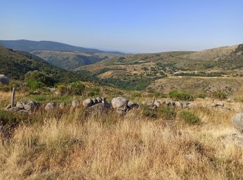
Le Pont-de-Montvert, Pont de Montvert - Sud Mont Lozère, Vélo : Les meilleures randonnées, itinéraires, parcours, balades et promenades

6 commentaires

Le Pont-de-Montvert : découvrez les meilleures randonnées : 20 v.t.t. et 1 vélo électrique. Tous ces circuits, parcours, itinéraires et activités en plein air sont disponibles dans nos applications SityTrail pour smartphones et tablettes.


Les meilleurs parcours (21)

Randonnée V.T.T. Pont de Montvert - Sud Mont Lozère - Bouges Sapet - Photo
V.T.T. 33.434
Km

V.T.T.

Difficile
(1)
Pont de Montvert - Sud Mont Lozère, Occitanie, Lozère, France
33 km | 45 km-effort
5h 13min
863 m
859 m
Oui
jeanguil

Randonnée V.T.T. Pont de Montvert - Sud Mont Lozère - Finiels - Florac 2020 - Photo
V.T.T. 50.557
Km

V.T.T.

Difficile
Pont de Montvert - Sud Mont Lozère, Occitanie, Lozère, France
51 km | 68 km-effort
5h 40min
1105 m
1784 m
Non
JeanPierreNancy

Randonnée V.T.T. Pont de Montvert - Sud Mont Lozère - Boucle pont du Tarn - Photo
V.T.T. 16.355
Km

V.T.T.

Facile
Pont de Montvert - Sud Mont Lozère, Occitanie, Lozère, France
16,4 km | 19,2 km-effort
2h 50min
214 m
214 m
Oui
fb30

• Belle balade

Randonnée V.T.T. Pont de Montvert - Sud Mont Lozère - gourdouse - Photo
V.T.T. 35.894
Km

V.T.T.

Difficile
Pont de Montvert - Sud Mont Lozère, Occitanie, Lozère, France
36 km | 44 km-effort
7h 15min
474 m
967 m
Non
jeanguil

• hopital, mas de la barque, gourdouse, pont du tarn, le pont.

Randonnée V.T.T. Pont de Montvert - Sud Mont Lozère - mas de la barque - Photo
V.T.T. 15.961
Km

V.T.T.

Très facile
Pont de Montvert - Sud Mont Lozère, Occitanie, Lozère, France
16 km | 18,9 km-effort
2h 0min
219 m
219 m
Oui
ledrede30

• départ du mas, l'hôpital et retour par le pont du tarn.

Randonnée V.T.T. Pont de Montvert - Sud Mont Lozère - tout du mas - Photo
V.T.T. 32.018
Km

V.T.T.

Moyen
(1)
Pont de Montvert - Sud Mont Lozère, Occitanie, Lozère, France
32 km | 39 km-effort
2h 8min
520 m
545 m
Non
Fredosolo

Randonnée V.T.T. Pont de Montvert - Sud Mont Lozère - Pont du Tarn 2 - Photo
V.T.T. 17.639
Km

V.T.T.

Facile
Pont de Montvert - Sud Mont Lozère, Occitanie, Lozère, France
17,6 km | 21 km-effort
2h 23min
227 m
231 m
Oui
fb30

Randonnée Vélo électrique Pont de Montvert - Sud Mont Lozère - florac - Photo
Vélo électrique 48.684
Km

Vélo électrique

Très difficile
Pont de Montvert - Sud Mont Lozère, Occitanie, Lozère, France
49 km | 65 km-effort
7h 27min
1082 m
1747 m
Non
sonnier

Randonnée V.T.T. Pont de Montvert - Sud Mont Lozère - Raid Cévennes J 4 - Photo
V.T.T. 44.34
Km

V.T.T.

Difficile
Pont de Montvert - Sud Mont Lozère, Occitanie, Lozère, France
44 km | 60 km-effort
8h 18min
1077 m
1377 m
Non
christinemoisset

Randonnée V.T.T. Pont de Montvert - Sud Mont Lozère - bleymard - Photo
V.T.T. 44.701
Km

V.T.T.

Moyen
Pont de Montvert - Sud Mont Lozère, Occitanie, Lozère, France
45 km | 61 km-effort
8h 3min
1388 m
858 m
Non
joesic

Randonnée V.T.T. Pont de Montvert - Sud Mont Lozère - #08_13062020 - Photo
V.T.T. 12.938
Km

V.T.T.

Très facile
Pont de Montvert - Sud Mont Lozère, Occitanie, Lozère, France
12,9 km | 17,4 km-effort
1h 30min
331 m
333 m
Oui
stef180673

Randonnée V.T.T. Pont de Montvert - Sud Mont Lozère - 07-GTMC-Le Pont de Montvert-St Chély du Tarn - Photo
V.T.T. 65.551
Km

V.T.T.

Très facile
Pont de Montvert - Sud Mont Lozère, Occitanie, Lozère, France
66 km | 86 km-effort
Inconnu
1464 m
1872 m
Non
nicolas54230

Randonnée V.T.T. Pont de Montvert - Sud Mont Lozère - 07 GTMC Le Pont de Montvert-Sainte Enimie - Photo
V.T.T. 65.551
Km

V.T.T.

Facile
Pont de Montvert - Sud Mont Lozère, Occitanie, Lozère, France
66 km | 86 km-effort
29min
1465 m
1873 m
Non
nicolas54230

Randonnée V.T.T. Pont de Montvert - Sud Mont Lozère - Finiels - Florac - Photo
V.T.T. 36.596
Km

V.T.T.

Difficile
Pont de Montvert - Sud Mont Lozère, Occitanie, Lozère, France
37 km | 50 km-effort
2h 43min
831 m
1508 m
Non
JeanPierreNancy

Randonnée V.T.T. Pont de Montvert - Sud Mont Lozère - Stevenson 4 LE PONT-DE-MONTVERT/Cassagnas - Photo
V.T.T. 45.87
Km

V.T.T.

Moyen
Pont de Montvert - Sud Mont Lozère, Occitanie, Lozère, France
46 km | 59 km-effort
4h 9min
937 m
1128 m
Non
Rico20

Randonnée V.T.T. Pont de Montvert - Sud Mont Lozère - 04 Finiels-Florac - Photo
V.T.T. 32.013
Km

V.T.T.

Difficile
Pont de Montvert - Sud Mont Lozère, Occitanie, Lozère, France
32 km | 45 km-effort
2h 47min
831 m
1509 m
Non
nicolas54230

Randonnée V.T.T. Pont de Montvert - Sud Mont Lozère - j 2 môntvert enimie - Photo
V.T.T. 56.288
Km

V.T.T.

Difficile
Pont de Montvert - Sud Mont Lozère, Occitanie, Lozère, France
56 km | 76 km-effort
7h 33min
1387 m
1783 m
Non
jjduvar

Randonnée V.T.T. Pont de Montvert - Sud Mont Lozère - 2018 J1 -Pont de Montvert -Mas de la Barque - Photo
V.T.T. 22.766
Km

V.T.T.

Très facile
Pont de Montvert - Sud Mont Lozère, Occitanie, Lozère, France
23 km | 32 km-effort
2h 10min
811 m
268 m
Non
thierryd

Randonnée V.T.T. Pont de Montvert - Sud Mont Lozère - mas de la barque - Photo
V.T.T. 15.961
Km

V.T.T.

Facile
Pont de Montvert - Sud Mont Lozère, Occitanie, Lozère, France
16 km | 18,9 km-effort
1h 16min
219 m
219 m
Oui
jpfrobert

Randonnée V.T.T. Pont de Montvert - Sud Mont Lozère - FINIES L'HOPITAL - Photo
V.T.T. 23.406
Km

V.T.T.

Facile
Pont de Montvert - Sud Mont Lozère, Occitanie, Lozère, France
23 km | 30 km-effort
Inconnu
532 m
530 m
Oui
FERAUD

20 randonnées affichées sur 21

Application GPS de randonnée GRATUITE

Logo SityTrail SityTrail

IGN / Instituts géographiques

Télécharger SityTrail sur l'App Store Télécharger SityTrail sur Google Play

Logo SityTrail SityTrail World

Le monde est à vous

Télécharger SityTrail sur l'App Store Télécharger SityTrail sur Google Play Télécharger SityTrail sur Huawei AppGallery

Activités

Fermer
Mes abonnements