Château-Arnoux-Saint-Auban, Alpes-de-Haute-Provence, Vélo : Les meilleures randonnées, itinéraires, parcours, balades et promenades

3 commentaires

Château-Arnoux-Saint-Auban : découvrez les meilleures randonnées : 23 v.t.t.. Tous ces circuits, parcours, itinéraires et activités en plein air sont disponibles dans nos applications SityTrail pour smartphones et tablettes.


Les meilleurs parcours (23)

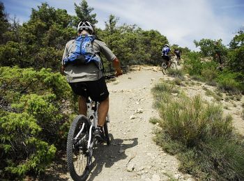
Randonnée V.T.T. Château-Arnoux-Saint-Auban - Le Grand Raid - Château-Arnoux-St-Auban - Base VTT Val de Durance - Photo
V.T.T. 56.19
Km

V.T.T.

Très difficile
Château-Arnoux-Saint-Auban, Provence-Alpes-Côte d'Azur, Alpes-de-Haute-Provence, France
56 km | 75 km-effort
6h 0min
1410 m
1410 m
Oui
tracegps

• Départ de l'Office de Tourisme de Château-Arnoux-St-Auban. Ce circuit n'a pas de balisage spécifique puisqu'il repren...
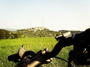
Randonnée V.T.T. Château-Arnoux-Saint-Auban - De Saint Auban à Montfort - Photo
V.T.T. 9.625
Km

V.T.T.

Moyen
Château-Arnoux-Saint-Auban, Provence-Alpes-Côte d'Azur, Alpes-de-Haute-Provence, France
9,6 km | 11,5 km-effort
40min
139 m
140 m
Oui
tracegps

• Joli balade facile.

Randonnée V.T.T. Château-Arnoux-Saint-Auban - Base VTT FFCT Val de Durance - Les Grandes Côtes - Circuit n°13 - Château Arnoux - Photo
V.T.T. 42.455
Km

V.T.T.

Très difficile
Château-Arnoux-Saint-Auban, Provence-Alpes-Côte d'Azur, Alpes-de-Haute-Provence, France
42 km | 59 km-effort
2h 0min
1264 m
1165 m
Non
tracegps

• Les Grandes Côtes est un parcours difficile qui présente un bon dénivelé sur une courte distance, mais surtout il ne ...

Randonnée V.T.T. Château-Arnoux-Saint-Auban - Base VTT FFCT Val de Durance - Le Pas des Boeufs - Circuit n°4 - Château-Arnoux - Photo
V.T.T. 28.098
Km

V.T.T.

Très difficile
Château-Arnoux-Saint-Auban, Provence-Alpes-Côte d'Azur, Alpes-de-Haute-Provence, France
28 km | 38 km-effort
3h 30min
723 m
730 m
Oui
tracegps

• Le Pas des Bœufs est notre fleuron. Un florilège de sensations fortes; des sentiers magnifiques empruntant des vallon...

Randonnée V.T.T. Château-Arnoux-Saint-Auban - vite St auban - Photo
V.T.T. 18.478
Km
GUIDE

V.T.T.

Très facile
Château-Arnoux-Saint-Auban, Provence-Alpes-Côte d'Azur, Alpes-de-Haute-Provence, France
18,5 km | 22 km-effort
3h 22min
277 m
276 m
Oui
Danielba

Randonnée V.T.T. Château-Arnoux-Saint-Auban - votre rob - Photo
V.T.T. 39.622
Km
GUIDE

V.T.T.

Moyen
Château-Arnoux-Saint-Auban, Provence-Alpes-Côte d'Azur, Alpes-de-Haute-Provence, France
40 km | 50 km-effort
6h 17min
810 m
810 m
Oui
Danielba

Randonnée V.T.T. Château-Arnoux-Saint-Auban - Jarlandine 2013 - Photo
V.T.T. 41.162
Km

V.T.T.

Difficile
Château-Arnoux-Saint-Auban, Provence-Alpes-Côte d'Azur, Alpes-de-Haute-Provence, France
41 km | 54 km-effort
4h 51min
998 m
1001 m
Non
BrunoPetignat

• 45 - 2 km

Randonnée V.T.T. Château-Arnoux-Saint-Auban - [PAT] Rando Jarlandine 2012 - Photo
V.T.T. 29.894
Km

V.T.T.

Moyen
Château-Arnoux-Saint-Auban, Provence-Alpes-Côte d'Azur, Alpes-de-Haute-Provence, France
30 km | 36 km-effort
3h 0min
490 m
489 m
Non
spiroudigne

• Trace du parcours 25Km

Randonnée V.T.T. Château-Arnoux-Saint-Auban - 27 juillet  - Photo
V.T.T. 18.881
Km

V.T.T.

Moyen
Château-Arnoux-Saint-Auban, Provence-Alpes-Côte d'Azur, Alpes-de-Haute-Provence, France
18,9 km | 24 km-effort
3h 0min
371 m
371 m
Oui
Juan Pablo

Randonnée V.T.T. Château-Arnoux-Saint-Auban - l escale - Photo
V.T.T. 36.041
Km

V.T.T.

Très difficile
Château-Arnoux-Saint-Auban, Provence-Alpes-Côte d'Azur, Alpes-de-Haute-Provence, France
36 km | 45 km-effort
3h 2min
661 m
624 m
Non
Juan Pablo

Randonnée V.T.T. Château-Arnoux-Saint-Auban - château 1 - Photo
V.T.T. 15.941
Km

V.T.T.

Difficile
Château-Arnoux-Saint-Auban, Provence-Alpes-Côte d'Azur, Alpes-de-Haute-Provence, France
15,9 km | 21 km-effort
2h 16min
381 m
386 m
Oui
Denis05

Randonnée V.T.T. Château-Arnoux-Saint-Auban - maison aou21 - Photo
V.T.T. 22.108
Km

V.T.T.

Très facile
Château-Arnoux-Saint-Auban, Provence-Alpes-Côte d'Azur, Alpes-de-Haute-Provence, France
22 km | 28 km-effort
2h 31min
399 m
482 m
Non
gillesmanfredi

Randonnée V.T.T. Château-Arnoux-Saint-Auban - st jean 5juin21 - Photo
V.T.T. 24.714
Km

V.T.T.

Très facile
Château-Arnoux-Saint-Auban, Provence-Alpes-Côte d'Azur, Alpes-de-Haute-Provence, France
25 km | 33 km-effort
3h 40min
585 m
585 m
Oui
gillesmanfredi

Randonnée V.T.T. Château-Arnoux-Saint-Auban - st-jean v mai21 - Photo
V.T.T. 10.139
Km

V.T.T.

Facile
Château-Arnoux-Saint-Auban, Provence-Alpes-Côte d'Azur, Alpes-de-Haute-Provence, France
10,1 km | 13,5 km-effort
1h 22min
256 m
255 m
Oui
gillesmanfredi

Randonnée V.T.T. Château-Arnoux-Saint-Auban - st jean mai 21 - Photo
V.T.T. 12.061
Km

V.T.T.

Facile
Château-Arnoux-Saint-Auban, Provence-Alpes-Côte d'Azur, Alpes-de-Haute-Provence, France
12,1 km | 16 km-effort
1h 21min
297 m
283 m
Non
gillesmanfredi

Randonnée V.T.T. Château-Arnoux-Saint-Auban - Base VTT FFCT Val de Durance - N°5 : Les chapelles Saint-Donat et Magdeleine - 19642 - UtagawaVTT.com - Photo
V.T.T. 44.556
Km

V.T.T.

Très difficile
Château-Arnoux-Saint-Auban, Provence-Alpes-Côte d'Azur, Alpes-de-Haute-Provence, France
45 km | 58 km-effort
3h 48min
1031 m
1036 m
Oui
Alain Derrives

Randonnée V.T.T. Château-Arnoux-Saint-Auban - VTTAE - Photo
V.T.T. 34.769
Km

V.T.T.

Très difficile
Château-Arnoux-Saint-Auban, Provence-Alpes-Côte d'Azur, Alpes-de-Haute-Provence, France
35 km | 53 km-effort
3h 12min
1358 m
1360 m
Oui
Alain Derrives

Randonnée V.T.T. Château-Arnoux-Saint-Auban - Base VTT FFCT Val de Durance - N°14 : La porte de Lure - Château-Arnoux - 19647 - UtagawaVTT.com - Photo
V.T.T. 34.769
Km

V.T.T.

Très difficile
Château-Arnoux-Saint-Auban, Provence-Alpes-Côte d'Azur, Alpes-de-Haute-Provence, France
35 km | 53 km-effort
3h 21min
1358 m
1360 m
Oui
Alain Derrives

Randonnée V.T.T. Château-Arnoux-Saint-Auban - VTTAE  Peyruis - Photo
V.T.T. 37.684
Km

V.T.T.

Difficile
Château-Arnoux-Saint-Auban, Provence-Alpes-Côte d'Azur, Alpes-de-Haute-Provence, France
38 km | 49 km-effort
3h 12min
855 m
856 m
Oui
derrives

Randonnée V.T.T. Château-Arnoux-Saint-Auban - N°5  La  Chapelle  chateauneuf - Photo
V.T.T. 44.687
Km

V.T.T.

Difficile
Château-Arnoux-Saint-Auban, Provence-Alpes-Côte d'Azur, Alpes-de-Haute-Provence, France
45 km | 58 km-effort
3h 48min
1030 m
1035 m
Oui
derrives

20 randonnées affichées sur 23

Application GPS de randonnée GRATUITE

Logo SityTrail SityTrail

IGN / Instituts géographiques

Télécharger SityTrail sur l'App Store Télécharger SityTrail sur Google Play

Logo SityTrail SityTrail World

Le monde est à vous

Télécharger SityTrail sur l'App Store Télécharger SityTrail sur Google Play Télécharger SityTrail sur Huawei AppGallery

Activités

Fermer
Mes abonnements