La Roque-d'Anthéron, Bouches-du-Rhône, Vélo : Les meilleures randonnées, itinéraires, parcours, balades et promenades

8 commentaires

La Roque-d'Anthéron : découvrez les meilleures randonnées : 10 v.t.t. et 1 v.t.c.. Tous ces circuits, parcours, itinéraires et activités en plein air sont disponibles dans nos applications SityTrail pour smartphones et tablettes.


Les meilleurs parcours (11)
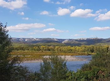
Randonnée V.T.T. La Roque-d'Anthéron - Chemin aménagé le long de la DURANCE - Photo
V.T.T. 13.959
Km

V.T.T.

Très facile
(1)
La Roque-d'Anthéron, Provence-Alpes-Côte d'Azur, Bouches-du-Rhône, France
14 km | 14,9 km-effort
Inconnu
69 m
83 m
Non
dominique dubroca

• Entre La Roque d'Antheron et Mallemort. trés facile

Randonnée V.T.T. La Roque-d'Anthéron - La Roque chaîne des Côtes  - Photo
V.T.T. 29.4
Km

V.T.T.

Facile
La Roque-d'Anthéron, Provence-Alpes-Côte d'Azur, Bouches-du-Rhône, France
29 km | 39 km-effort
2h 53min
717 m
728 m
Non
FERAUD

Randonnée V.T.T. La Roque-d'Anthéron - La Roque d'Antheron Ste Anne  - Photo
V.T.T. 21.547
Km

V.T.T.

Difficile
La Roque-d'Anthéron, Provence-Alpes-Côte d'Azur, Bouches-du-Rhône, France
22 km | 29 km-effort
2h 47min
555 m
556 m
Oui
FERAUD

Randonnée V.T.T. La Roque-d'Anthéron - La Roque-Charleval sens horaire-Sylvain - Photo
V.T.T. 37.909
Km

V.T.T.

Très difficile
La Roque-d'Anthéron, Provence-Alpes-Côte d'Azur, Bouches-du-Rhône, France
38 km | 53 km-effort
3h 39min
1105 m
1113 m
Oui
Alain Derrives

Randonnée V.T.T. La Roque-d'Anthéron - La Roque- Sylvain - Photo
V.T.T. 24.737
Km

V.T.T.

Difficile
La Roque-d'Anthéron, Provence-Alpes-Côte d'Azur, Bouches-du-Rhône, France
25 km | 37 km-effort
2h 35min
952 m
951 m
Oui
Alain Derrives

Randonnée V.T.C. La Roque-d'Anthéron - Durance  - Photo
V.T.C. 32.624
Km

V.T.C.

Difficile
La Roque-d'Anthéron, Provence-Alpes-Côte d'Azur, Bouches-du-Rhône, France
33 km | 35 km-effort
4h 2min
198 m
198 m
Non
d.vibert

Randonnée V.T.T. La Roque-d'Anthéron - -La Roque-Charleval  sylvain - Photo
V.T.T. 37.91
Km

V.T.T.

Très difficile
La Roque-d'Anthéron, Provence-Alpes-Côte d'Azur, Bouches-du-Rhône, France
38 km | 53 km-effort
3h 39min
1105 m
1113 m
Oui
Alain Derrives

Randonnée V.T.T. La Roque-d'Anthéron - la  roque  26 - Photo
V.T.T. 24.437
Km

V.T.T.

Difficile
La Roque-d'Anthéron, Provence-Alpes-Côte d'Azur, Bouches-du-Rhône, France
24 km | 37 km-effort
2h 34min
951 m
924 m
Oui
Alain Derrives

Randonnée V.T.T. La Roque-d'Anthéron - la  roque - Photo
V.T.T. 34.986
Km

V.T.T.

Très facile
La Roque-d'Anthéron, Provence-Alpes-Côte d'Azur, Bouches-du-Rhône, France
35 km | 48 km-effort
3h 1min
942 m
941 m
Oui
derrives

Randonnée V.T.T. La Roque-d'Anthéron - La  roque  chaine  des  cotes - Photo
V.T.T. 29.399
Km

V.T.T.

Facile
La Roque-d'Anthéron, Provence-Alpes-Côte d'Azur, Bouches-du-Rhône, France
29 km | 39 km-effort
2h 30min
715 m
726 m
Non
derrives

Randonnée V.T.T. La Roque-d'Anthéron - Roque d'Anthéron - Chemin de Croix - Photo
V.T.T. 17.345
Km

V.T.T.

Moyen
La Roque-d'Anthéron, Provence-Alpes-Côte d'Azur, Bouches-du-Rhône, France
17,3 km | 25 km-effort
1h 37min
604 m
604 m
Oui
keiser113

11 randonnées affichées sur 11

Application GPS de randonnée GRATUITE

Logo SityTrail SityTrail

IGN / Instituts géographiques

Télécharger SityTrail sur l'App Store Télécharger SityTrail sur Google Play

Logo SityTrail SityTrail World

Le monde est à vous

Télécharger SityTrail sur l'App Store Télécharger SityTrail sur Google Play Télécharger SityTrail sur Huawei AppGallery

Activités

Fermer
Mes abonnements