![](/images/other/stat-length.png)
- Randonnées
- Vélo
- France
- Grand Est
- Ardennes
Ardennes, Grand Est, Vélo : Les meilleures randonnées, itinéraires, parcours, balades et promenades
Ardennes : découvrez les meilleures randonnées : 22 vélo, 18 vélo de route, 218 v.t.t., 15 v.t.c., 14 cyclotourisme et 19 vélo électrique. Tous ces circuits, parcours, itinéraires et activités en plein air sont disponibles dans nos applications SityTrail pour smartphones et tablettes.
Les meilleurs parcours (300)
![Randonnée Vélo électrique Liart - Thiérache ardennaise - Photo](https://media.geolcdn.com/t/350/260/ext.jpg?maxdim=2&url=https%3A%2F%2Fstatic1.geolcdn.com%2Fsiteimages%2Fupload%2Ffiles%2F1524743154velo.jpg)
![Vélo électrique Vélo électrique](https://static1.geolcdn.com/sitytour/trail-icons/205.png)
Km
Vélo électrique
![](/images/other/stat-length.png)
![](https://static1.geolcdn.com/siteimages/upload/files/1508320355ic_sort_den_pos_24dp.png)
![](https://static1.geolcdn.com/siteimages/upload/files/1508320355ic_sort_den_neg_24dp.png)
![](https://static1.geolcdn.com/siteimages/upload/files/16400158638029165_repeat_loop_refresh_sync_direction_icon.png)
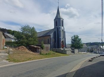
• Belle région. Belles pierres. Beaux villages. Belles églises fortifiées. Beaux châteaux. Surprises toutes les 10 minu...
![Randonnée V.T.C. Douzy - La chartreuse du Mont-Dieu - Photo](https://media.geolcdn.com/t/350/260/ext.jpg?maxdim=2&url=https%3A%2F%2Fstatic1.geolcdn.com%2Fsiteimages%2Fupload%2Ffiles%2F1524743154velo.jpg)
![V.T.C. V.T.C.](https://static1.geolcdn.com/sitytour/trail-icons/203.png)
Km
V.T.C.
![](/images/other/stat-length.png)
![](https://static1.geolcdn.com/siteimages/upload/files/1508320355ic_sort_den_pos_24dp.png)
![](https://static1.geolcdn.com/siteimages/upload/files/1508320355ic_sort_den_neg_24dp.png)
![](https://static1.geolcdn.com/siteimages/upload/files/16400158638029165_repeat_loop_refresh_sync_direction_icon.png)
• Circuit au départ de Douzy en direction de la Chartreuse du Mont Dieu, en passant par Stonne, la Corrérie, Chémery et...
![Randonnée V.T.T. Omicourt - GR14 v02 - Photo](https://media.geolcdn.com/t/350/260/ext.jpg?maxdim=2&url=https%3A%2F%2Fstatic1.geolcdn.com%2Fsiteimages%2Fupload%2Ffiles%2F1524743154velo.jpg)
![V.T.T. V.T.T.](https://static1.geolcdn.com/sitytour/trail-icons/202.png)
Km
V.T.T.
![](/images/other/stat-length.png)
![](https://static1.geolcdn.com/siteimages/upload/files/1508320355ic_sort_den_pos_24dp.png)
![](https://static1.geolcdn.com/siteimages/upload/files/1508320355ic_sort_den_neg_24dp.png)
![](https://static1.geolcdn.com/siteimages/upload/files/16400158638029165_repeat_loop_refresh_sync_direction_icon.png)
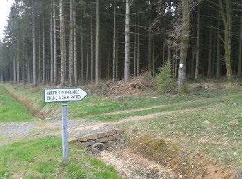
• Tracé empruntant une partie du GR14 qui relie Paris à Malmedy (Belgique.
![Randonnée Vélo de route Hargnies - Rando Étienne 2 2022.08.21 - Photo](https://media.geolcdn.com/t/350/260/9f7443ce-1b21-41b9-b691-e9fb669f3213.jpg&format=jpg&maxdim=2)
![Vélo de route Vélo de route](https://static1.geolcdn.com/sitytour/trail-icons/201.png)
Km
Vélo de route
![](/images/other/stat-length.png)
![](https://static1.geolcdn.com/siteimages/upload/files/1508320355ic_sort_den_pos_24dp.png)
![](https://static1.geolcdn.com/siteimages/upload/files/1508320355ic_sort_den_neg_24dp.png)
![](https://static1.geolcdn.com/siteimages/upload/files/16400158638029165_repeat_loop_refresh_sync_direction_icon.png)
• Hargnies-vencimont
![Randonnée V.T.T. Sedan - 20191006 Yeyette sur la voie verte à Sedan - Photo](https://media.geolcdn.com/t/350/260/b806c0b7-e370-4e14-9be3-9a414d970f45.jpg&format=jpg&maxdim=2)
![V.T.T. V.T.T.](https://static1.geolcdn.com/sitytour/trail-icons/202.png)
Km
V.T.T.
![](/images/other/stat-length.png)
![](https://static1.geolcdn.com/siteimages/upload/files/1508320355ic_sort_den_pos_24dp.png)
![](https://static1.geolcdn.com/siteimages/upload/files/1508320355ic_sort_den_neg_24dp.png)
![](https://static1.geolcdn.com/siteimages/upload/files/16400158638029165_repeat_loop_refresh_sync_direction_icon.png)
• Entre éclaircies et grosses averses
![Randonnée V.T.T. Laval-Morency - Le chêne à 2 pattes - Photo](https://media.geolcdn.com/t/350/260/ext.jpg?maxdim=2&url=https%3A%2F%2Fservices.sitytrail.com%2FGeolivesWS%2FDownloadMedia.ashx%3FTrailID%3D556143%26Media%3Dfix__20160419164503.jpg)
![V.T.T. V.T.T.](https://static1.geolcdn.com/sitytour/trail-icons/202.png)
Km
V.T.T.
![](/images/other/stat-length.png)
![](https://static1.geolcdn.com/siteimages/upload/files/1508320355ic_sort_den_pos_24dp.png)
![](https://static1.geolcdn.com/siteimages/upload/files/1508320355ic_sort_den_neg_24dp.png)
![](https://static1.geolcdn.com/siteimages/upload/files/16400158638029165_repeat_loop_refresh_sync_direction_icon.png)
• Petite boucle empruntant chemins forestiers et petites routes.
![Randonnée V.T.T. Monthermé - Roc La Tour de Montherme 58 1400 (h) - Photo](https://media.geolcdn.com/t/350/260/ext.jpg?maxdim=2&url=https%3A%2F%2Fstatic1.geolcdn.com%2Fsiteimages%2Fupload%2Ffiles%2F1524743154velo.jpg)
![V.T.T. V.T.T.](https://static1.geolcdn.com/sitytour/trail-icons/202.png)
Km
V.T.T.
![](/images/other/stat-length.png)
![](https://static1.geolcdn.com/siteimages/upload/files/1508320355ic_sort_den_pos_24dp.png)
![](https://static1.geolcdn.com/siteimages/upload/files/1508320355ic_sort_den_neg_24dp.png)
![](https://static1.geolcdn.com/siteimages/upload/files/16400158638029165_repeat_loop_refresh_sync_direction_icon.png)
![Randonnée V.T.T. Sévigny-la-Forêt - Forêt domaniale des Pothées - Tremblois lès Rocroi - Photo](https://media.geolcdn.com/t/350/260/ext.jpg?maxdim=2&url=https%3A%2F%2Fservices.sitytrail.com%2FGeolivesWS%2FDownloadMedia.ashx%3FTrailID%3D317967%26Media%3D17409_6.jpg)
![V.T.T. V.T.T.](https://static1.geolcdn.com/sitytour/trail-icons/202.png)
Km
V.T.T.
![](/images/other/stat-length.png)
![](https://static1.geolcdn.com/siteimages/upload/files/1508320355ic_sort_den_pos_24dp.png)
![](https://static1.geolcdn.com/siteimages/upload/files/1508320355ic_sort_den_neg_24dp.png)
![](https://static1.geolcdn.com/siteimages/upload/files/16400158638029165_repeat_loop_refresh_sync_direction_icon.png)
• Itinéraire forestier sur chemins divers (route forestière, coupe-feux, sentes minuscules...). A mi-parcours environ, ...
![Randonnée V.T.T. Sévigny-la-Forêt - Forêt de Tremblois Maubert - Tremblois lès Rocroi - Photo](https://media.geolcdn.com/t/350/260/ext.jpg?maxdim=2&url=https%3A%2F%2Fservices.sitytrail.com%2FGeolivesWS%2FDownloadMedia.ashx%3FTrailID%3D317941%26Media%3D17372_6.jpg)
![V.T.T. V.T.T.](https://static1.geolcdn.com/sitytour/trail-icons/202.png)
Km
V.T.T.
![](/images/other/stat-length.png)
![](https://static1.geolcdn.com/siteimages/upload/files/1508320355ic_sort_den_pos_24dp.png)
![](https://static1.geolcdn.com/siteimages/upload/files/1508320355ic_sort_den_neg_24dp.png)
![](https://static1.geolcdn.com/siteimages/upload/files/16400158638029165_repeat_loop_refresh_sync_direction_icon.png)
• On part en suivant l'ancienne ligne de chemin de fer qu'on laisse sur sa gauche; on reviendra en l'empruntant souvent...
![Randonnée V.T.T. Signy-l'Abbaye - Signy-l'Abbaye, coté sud - Photo](https://media.geolcdn.com/t/350/260/ext.jpg?maxdim=2&url=https%3A%2F%2Fservices.sitytrail.com%2FGeolivesWS%2FDownloadMedia.ashx%3FTrailID%3D317836%26Media%3D17210_4.jpg)
![V.T.T. V.T.T.](https://static1.geolcdn.com/sitytour/trail-icons/202.png)
Km
V.T.T.
![](/images/other/stat-length.png)
![](https://static1.geolcdn.com/siteimages/upload/files/1508320355ic_sort_den_pos_24dp.png)
![](https://static1.geolcdn.com/siteimages/upload/files/1508320355ic_sort_den_neg_24dp.png)
![](https://static1.geolcdn.com/siteimages/upload/files/16400158638029165_repeat_loop_refresh_sync_direction_icon.png)
• Bons chemins, routes forestières, petites routes, champs et bois.
![Randonnée V.T.T. Rouvroy-sur-Audry - De Rouvroy sur Audry à Thin le Moutier - Photo](https://media.geolcdn.com/t/350/260/ext.jpg?maxdim=2&url=https%3A%2F%2Fservices.sitytrail.com%2FGeolivesWS%2FDownloadMedia.ashx%3FTrailID%3D317601%26Media%3D16869_6.jpg)
![V.T.T. V.T.T.](https://static1.geolcdn.com/sitytour/trail-icons/202.png)
Km
V.T.T.
![](/images/other/stat-length.png)
![](https://static1.geolcdn.com/siteimages/upload/files/1508320355ic_sort_den_pos_24dp.png)
![](https://static1.geolcdn.com/siteimages/upload/files/1508320355ic_sort_den_neg_24dp.png)
![](https://static1.geolcdn.com/siteimages/upload/files/16400158638029165_repeat_loop_refresh_sync_direction_icon.png)
• Boucle variée, composée de chemins et petites routes très peu fréquentées dans la campagne et les bois. Difficulté mo...
![Randonnée V.T.T. Cliron - De Charroué à Arreux par Montcornet - Photo](https://media.geolcdn.com/t/350/260/ext.jpg?maxdim=2&url=https%3A%2F%2Fservices.sitytrail.com%2FGeolivesWS%2FDownloadMedia.ashx%3FTrailID%3D317357%26Media%3D16575_6.jpg)
![V.T.T. V.T.T.](https://static1.geolcdn.com/sitytour/trail-icons/202.png)
Km
V.T.T.
![](/images/other/stat-length.png)
![](https://static1.geolcdn.com/siteimages/upload/files/1508320355ic_sort_den_pos_24dp.png)
![](https://static1.geolcdn.com/siteimages/upload/files/1508320355ic_sort_den_neg_24dp.png)
![](https://static1.geolcdn.com/siteimages/upload/files/16400158638029165_repeat_loop_refresh_sync_direction_icon.png)
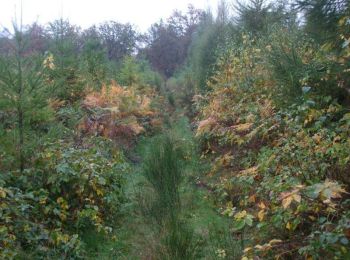
• Circuit forestier avec des passages techniques et boueux et des zigzags bien funs à Arreux. Ils peuvent être évités, ...
![Randonnée V.T.T. Ham-les-Moines - De Ham les Moines à Villaine puis Blambay - Photo](https://media.geolcdn.com/t/350/260/ext.jpg?maxdim=2&url=https%3A%2F%2Fservices.sitytrail.com%2FGeolivesWS%2FDownloadMedia.ashx%3FTrailID%3D317268%26Media%3D16454_6.jpg)
![V.T.T. V.T.T.](https://static1.geolcdn.com/sitytour/trail-icons/202.png)
Km
V.T.T.
![](/images/other/stat-length.png)
![](https://static1.geolcdn.com/siteimages/upload/files/1508320355ic_sort_den_pos_24dp.png)
![](https://static1.geolcdn.com/siteimages/upload/files/1508320355ic_sort_den_neg_24dp.png)
![](https://static1.geolcdn.com/siteimages/upload/files/16400158638029165_repeat_loop_refresh_sync_direction_icon.png)
• Boucle convenant bien à une rando en hiver car il y a peu de risque de rencontrer des chasseurs. Des petites routes t...
![Randonnée V.T.T. Damouzy - De Sorel à Bogny - Damouzy - Photo](https://media.geolcdn.com/t/350/260/ext.jpg?maxdim=2&url=https%3A%2F%2Fservices.sitytrail.com%2FGeolivesWS%2FDownloadMedia.ashx%3FTrailID%3D317153%26Media%3D16302_6.jpg)
![V.T.T. V.T.T.](https://static1.geolcdn.com/sitytour/trail-icons/202.png)
Km
V.T.T.
![](/images/other/stat-length.png)
![](https://static1.geolcdn.com/siteimages/upload/files/1508320355ic_sort_den_pos_24dp.png)
![](https://static1.geolcdn.com/siteimages/upload/files/1508320355ic_sort_den_neg_24dp.png)
![](https://static1.geolcdn.com/siteimages/upload/files/16400158638029165_repeat_loop_refresh_sync_direction_icon.png)
• Circuit forestier varié sans grande difficulté, excepté une descente hyper raide que je vous défie de descendre sans ...
![Randonnée V.T.T. Revin - Révin - Les Bois Bryas - Ri d'Alyse et d'Oignies - Photo](https://media.geolcdn.com/t/350/260/ext.jpg?maxdim=2&url=https%3A%2F%2Fservices.sitytrail.com%2FGeolivesWS%2FDownloadMedia.ashx%3FTrailID%3D317135%26Media%3D16286_6.jpg)
![V.T.T. V.T.T.](https://static1.geolcdn.com/sitytour/trail-icons/202.png)
Km
V.T.T.
![](/images/other/stat-length.png)
![](https://static1.geolcdn.com/siteimages/upload/files/1508320355ic_sort_den_pos_24dp.png)
![](https://static1.geolcdn.com/siteimages/upload/files/1508320355ic_sort_den_neg_24dp.png)
![](https://static1.geolcdn.com/siteimages/upload/files/16400158638029165_repeat_loop_refresh_sync_direction_icon.png)
• Boucle qu'on peut démarrer au pont de Revin (Falières). Chemins de tous styles avec des passages bien techniques et é...
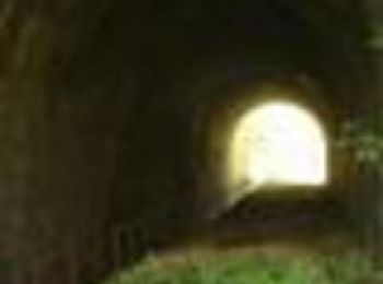
![Randonnée V.T.T. Revin - De Revin à Laifour par les Dames de Meuse - Photo](https://media.geolcdn.com/t/350/260/ext.jpg?maxdim=2&url=https%3A%2F%2Fservices.sitytrail.com%2FGeolivesWS%2FDownloadMedia.ashx%3FTrailID%3D316955%26Media%3D16071_1.jpg)
![V.T.T. V.T.T.](https://static1.geolcdn.com/sitytour/trail-icons/202.png)
Km
V.T.T.
![](/images/other/stat-length.png)
![](https://static1.geolcdn.com/siteimages/upload/files/1508320355ic_sort_den_pos_24dp.png)
![](https://static1.geolcdn.com/siteimages/upload/files/1508320355ic_sort_den_neg_24dp.png)
![](https://static1.geolcdn.com/siteimages/upload/files/16400158638029165_repeat_loop_refresh_sync_direction_icon.png)
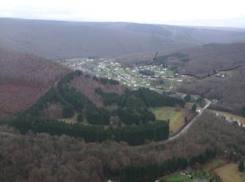
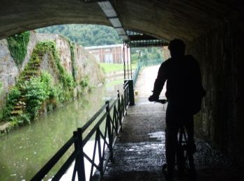
• Départ de la boucle au pont de St Nicolas. Départ calme en contournant Revin par la rive gauche, puis le tunnel et la...
![Randonnée V.T.T. Rocroi - Révin - Dames de Meuse - Anchamps - Photo](https://media.geolcdn.com/t/350/260/ext.jpg?maxdim=2&url=https%3A%2F%2Fservices.sitytrail.com%2FGeolivesWS%2FDownloadMedia.ashx%3FTrailID%3D316865%26Media%3D15946_1.jpg)
![V.T.T. V.T.T.](https://static1.geolcdn.com/sitytour/trail-icons/202.png)
Km
V.T.T.
![](/images/other/stat-length.png)
![](https://static1.geolcdn.com/siteimages/upload/files/1508320355ic_sort_den_pos_24dp.png)
![](https://static1.geolcdn.com/siteimages/upload/files/1508320355ic_sort_den_neg_24dp.png)
![](https://static1.geolcdn.com/siteimages/upload/files/16400158638029165_repeat_loop_refresh_sync_direction_icon.png)
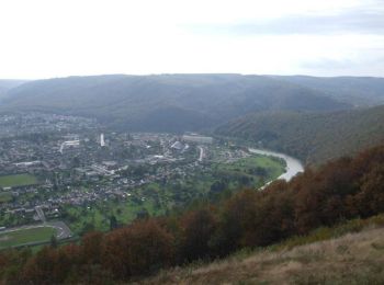
• Boucle démarrant au pont de Saint Nicolas, hameau de Rocroi, à proximité immédiate de Révin et passant par le lac de ...
![Randonnée V.T.T. Remilly-les-Pothées - Hardoncelle - Warby -Froimont - Fosse à l''eau - Photo](https://media.geolcdn.com/t/350/260/ext.jpg?maxdim=2&url=https%3A%2F%2Fservices.sitytrail.com%2FGeolivesWS%2FDownloadMedia.ashx%3FTrailID%3D215291%26Media%3D15724_6.jpg)
![V.T.T. V.T.T.](https://static1.geolcdn.com/sitytour/trail-icons/202.png)
Km
V.T.T.
![](/images/other/stat-length.png)
![](https://static1.geolcdn.com/siteimages/upload/files/1508320355ic_sort_den_pos_24dp.png)
![](https://static1.geolcdn.com/siteimages/upload/files/1508320355ic_sort_den_neg_24dp.png)
![](https://static1.geolcdn.com/siteimages/upload/files/16400158638029165_repeat_loop_refresh_sync_direction_icon.png)
• Boucle mixte: forêt et champs. Chemins de tous styles souvent bien roulants (sentes, chemins, routes forestières,...)...
![Randonnée V.T.T. Neuville-lès-This - Boucle VTT de Neuville lès This à la Fosse à l''Eau - Photo](https://media.geolcdn.com/t/350/260/ext.jpg?maxdim=2&url=https%3A%2F%2Fservices.sitytrail.com%2FGeolivesWS%2FDownloadMedia.ashx%3FTrailID%3D215285%26Media%3D15685_6.jpg)
![V.T.T. V.T.T.](https://static1.geolcdn.com/sitytour/trail-icons/202.png)
Km
V.T.T.
![](/images/other/stat-length.png)
![](https://static1.geolcdn.com/siteimages/upload/files/1508320355ic_sort_den_pos_24dp.png)
![](https://static1.geolcdn.com/siteimages/upload/files/1508320355ic_sort_den_neg_24dp.png)
![](https://static1.geolcdn.com/siteimages/upload/files/16400158638029165_repeat_loop_refresh_sync_direction_icon.png)
• Boucle à dominante forestière avec de beaux passages dans les champs à perte de vue près de la Fosse à l'Eau. Bons ch...
20 randonnées affichées sur 300
Application GPS de randonnée GRATUITE
Activités
Régions proches
- Acy-Romance
- Aiglemont
- Aire
- Alincourt
- Alland'Huy-et-Sausseuil
- Amagne
- Ambly-Fleury
- Anchamps
- Angecourt
- Annelles
- Antheny
- Aouste
- Apremont
- Ardeuil-et-Montfauxelles
- Arnicourt
- Arreux
- Artaise-le-Vivier
- Asfeld
- Attigny
- Aubigny-les-Pothées
- Aubrives
- Auflance
- Auge
- Aussonce
- Authe
- Autrecourt-et-Pourron
- Autruche
- Autry
- Auvillers-les-Forges
- Avançon
- Avaux
- Baâlons
- Bairon-et-ses-Environs
- Balan
- Balham
- Ballay
- Banogne-Recouvrance
- Bar-lès-Buzancy
- Barbaise
- Barby
- Bayonville
- Bazeilles
- Beaumont-en-Argonne
- Belval
- Bergnicourt
- Bertoncourt
- Biermes
- Bièvres
- Blagny
- Blanchefosse-et-Bay
- Blanzy-la-Salonnaise
- Blombay
- Bogny-sur-Meuse
- Bouconville
- Boult-aux-Bois
- Boulzicourt
- Bourcq
- Bourg-Fidèle
- Bouvellemont
- Brécy-Brières
- Brienne-sur-Aisne
- Brieulles-sur-Bar
- Briquenay
- Brognon
- Bulson
- Buzancy
- Carignan
- Cernion
- Chagny
- Chalandry-Elaire
- Champigneul-sur-Vence
- Chappes
- Charbogne
- Charleville-Mézières
- Charnois
- Château-Porcien
- Chatel-Chéhéry
- Chaumont-Porcien
- Chémery-Chéhéry
- Chesnois-Auboncourt
- Cheveuges
- Chevières
- Chilly
- Chooz
- Chuffilly-Roche
- Clavy-Warby
- Cliron
- Condé-lès-Autry
- Condé-lès-Herpy
- Contreuve
- Cornay
- Corny-Machéroménil
- Coucy
- Coulommes-et-Marqueny
- Daigny
- Damouzy
- Deville
- Dom-le-Mesnil
- Dommery
- Donchery
- Doumely-Bégny
- Doux
- Douzy
- Draize
- Écly
- Écordal
- Escombres-et-le-Chesnois
- Estrebay
- Étalle
- Éteignières
- Étrépigny
- Euilly-et-Lombut
- Évigny
- Exermont
- Fagnon
- Faissault
- Falaise
- Faux
- Fépin
- Flaignes-Havys
- Fleigneux
- Fléville
- Flize
- Floing
- Foisches
- Fossé
- Fraillicourt
- Francheval
- Fromelennes
- Fumay
- Gernelle
- Gespunsart
- Girondelle
- Givet
- Givonne
- Givron
- Givry
- Glaire
- Gomont
- Grandchamp
- Grandham
- Grandpré
- Grivy-Loisy
- Gruyères
- Gué-d'Hossus
- Guignicourt-sur-Vence
- Guincourt
- Hagnicourt
- Ham-les-Moines
- Ham-sur-Meuse
- Hannappes
- Hannogne-Saint-Martin
- Haraucourt
- Harcy
- Hargnies
- Harricourt
- Haudrecy
- Haulmé
- Hauteville
- Haybes
- Herbeuval
- Herpy-l'Arlésienne
- Hierges
- Houdilcourt
- Houldizy
- Illy
- Inaumont
- Issancourt-et-Rumel
- Jandun
- Joigny-sur-Meuse
- Jonval
- Juniville
- Justine-Herbigny
- L'Écaille
- L'Échelle
- La Besace
- La Chapelle
- La Croix-aux-Bois
- La Férée
- La Ferté-sur-Chiers
- La Francheville
- La Grandville
- La Horgne
- La Moncelle
- La Neuville-à-Maire
- La Neuville-aux-Joûtes
- La Neuville-en-Tourne-à-Fuy
- La Neuville-lès-Wasigny
- La Sabotterie
- Laifour
- Lalobbe
- Lametz
- Lançon
- Landres-et-Saint-Georges
- Landrichamps
- Launois-sur-Vence
- Laval-Morency
- Le Châtelet-sur-Retourne
- Le Châtelet-sur-Sormonne
- Le Fréty
- Le Mont-Dieu
- Le Thour
- Leffincourt
- Lépron-les-Vallées
- Les Ayvelles
- Les Deux-Villes
- Les Grandes-Armoises
- Les Hautes-Rivières
- Les Mazures
- Les Petites-Armoises
- Létanne
- Liart
- Linay
- Logny-Bogny
- Longwé
- Lucquy
- Lumes
- Maisoncelle-et-Villers
- Malandry
- Maranwez
- Marby
- Marcq
- Margny
- Margut
- Marquigny
- Matton-et-Clémency
- Maubert-Fontaine
- Mazerny
- Ménil-Annelles
- Ménil-Lépinois
- Mesmont
- Messincourt
- Mogues
- Moiry
- Mondigny
- Mont-Laurent
- Mont-Saint-Martin
- Mont-Saint-Remy
- Montcheutin
- Montcornet
- Montcy-Notre-Dame
- Montgon
- Monthermé
- Montigny-sur-Meuse
- Montigny-sur-Vence
- Mouzon
- Murtin-et-Bogny
- Nanteuil-sur-Aisne
- Neuflize
- Neufmaison
- Neufmanil
- Neuville-Day
- Neuville-lès-This
- Neuville-lez-Beaulieu
- Neuvizy
- Noirval
- Nouvion-sur-Meuse
- Nouzonville
- Novion-Porcien
- Novy-Chevrières
- Noyers-Pont-Maugis
- Oches
- Olizy-Primat
- Omicourt
- Omont
- Osnes
- Pauvres
- Perthes
- Poix-Terron
- Pouru-Saint-Remy
- Pouru-aux-Bois
- Prez
- Prix-lès-Mézières
- Puilly-et-Charbeaux
- Puiseux
- Pure
- Quatre-Champs
- Raillicourt
- Rancennes
- Raucourt-et-Flaba
- Regniowez
- Remaucourt
- Remilly-Aillicourt
- Remilly-les-Pothées
- Renneville
- Renwez
- Rethel
- Revin
- Rilly-sur-Aisne
- Rimogne
- Rocquigny
- Rocroi
- Roizy
- Rouvroy-sur-Audry
- Rumigny
- Sailly
- Saint-Aignan
- Saint-Fergeux
- Saint-Germainmont
- Saint-Jean-aux-Bois
- Saint-Juvin
- Saint-Lambert-et-Mont-de-Jeux
- Saint-Laurent
- Saint-Loup-Terrier
- Saint-Loup-en-Champagne
- Saint-Marceau
- Saint-Marcel
- Saint-Menges
- Saint-Pierre-à-Arnes
- Saint-Pierre-sur-Vence
- Saint-Pierremont
- Saint-Remy-le-Petit
- Sainte-Marie
- Sainte-Vaubourg
- Sapogne-et-Feuchères
- Sapogne-sur-Marche
- Saulces-Champenoises
- Saulces-Monclin
- Sault-lès-Rethel
- Sauville
- Savigny-sur-Aisne
- Séchault
- Sécheval
- Sedan
- Semuy
- Senuc
- Seraincourt
- Sery
- Seuil
- Sévigny-Waleppe
- Sévigny-la-Forêt
- Signy-Montlibert
- Signy-l'Abbaye
- Signy-le-Petit
- Singly
- Sommauthe
- Sommerance
- Son
- Sorbon
- Sorcy-Bauthémont
- Sormonne
- Stonne
- Sugny
- Sury
- Suzanne
- Sy
- Tagnon
- Taillette
- Tailly
- Taizy
- Tannay
- Tarzy
- Thelonne
- Thilay
- Thin-le-Moutier
- This
- Thugny-Trugny
- Toges
- Touligny
- Tourcelles-Chaumont
- Tournavaux
- Tournes
- Tourteron
- Tremblois-lès-Carignan
- Tremblois-lès-Rocroi
- Vandy
- Vaux-Champagne
- Vaux-Montreuil
- Vaux-Villaine
- Vaux-lès-Mouron
- Vaux-lès-Mouzon
- Vendresse
- Viel-Saint-Remy
- Vieux-lès-Asfeld
- Ville-sur-Lumes
- Villers-Semeuse
- Villers-devant-Mouzon
- Villers-devant-le-Thour
- Villers-le-Tilleul
- Villers-le-Tourneur
- Villers-sur-Bar
- Villers-sur-le-Mont
- Villy
- Vireux-Molhain
- Vireux-Wallerand
- Vivier-au-Court
- Voncq
- Vouziers
- Vrigne-Meuse
- Vrigne-aux-Bois
- Wadelincourt
- Wagnon
- Warcq
- Warnécourt
- Wasigny
- Wignicourt
- Williers
- Yoncq
- Yvernaumont