![](/images/other/stat-length.png)
- Randonnées
- Vélo
- France
- Auvergne-Rhône-Alpes
- Haute-Savoie
Haute-Savoie, Auvergne-Rhône-Alpes, Vélo : Les meilleures randonnées, itinéraires, parcours, balades et promenades
Haute-Savoie : découvrez les meilleures randonnées : 139 vélo, 159 vélo de route, 622 v.t.t., 13 v.t.c., 17 cyclotourisme et 111 vélo électrique. Tous ces circuits, parcours, itinéraires et activités en plein air sont disponibles dans nos applications SityTrail pour smartphones et tablettes.
Les meilleurs parcours (1051)
![Randonnée V.T.T. Lathuile - VTT des sources du lac d'Annecy - Photo](https://media.geolcdn.com/t/350/260/ext.jpg?maxdim=2&url=https%3A%2F%2Fservices.sitytrail.com%2FGeolivesWS%2FDownloadMedia.ashx%3FTrailID%3D772394%26Media%3Df78b1970-c9e1-4cfd-9ac3-09bdcdfbcdd7.JPG)
![V.T.T. V.T.T.](https://static1.geolcdn.com/sitytour/trail-icons/202.png)
Km
V.T.T.
![](/images/other/stat-length.png)
![](https://static1.geolcdn.com/siteimages/upload/files/1508320355ic_sort_den_pos_24dp.png)
![](https://static1.geolcdn.com/siteimages/upload/files/1508320355ic_sort_den_neg_24dp.png)
![](https://static1.geolcdn.com/siteimages/upload/files/16400158638029165_repeat_loop_refresh_sync_direction_icon.png)
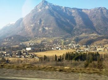
• Une randonnée en VTT entre le village de Faverges et Doussard qui va vous enchante et qui aux files de celle-ci va vo...
![Randonnée V.T.T. Megève - Megeve La Rochebrune - Photo](https://media.geolcdn.com/t/350/260/ext.jpg?maxdim=2&url=https%3A%2F%2Fservices.sitytrail.com%2FGeolivesWS%2FDownloadMedia.ashx%3FTrailID%3D103671%26Media%3D6148_3.jpg)
![V.T.T. V.T.T.](https://static1.geolcdn.com/sitytour/trail-icons/202.png)
Km
V.T.T.
![](/images/other/stat-length.png)
![](https://static1.geolcdn.com/siteimages/upload/files/1508320355ic_sort_den_pos_24dp.png)
![](https://static1.geolcdn.com/siteimages/upload/files/1508320355ic_sort_den_neg_24dp.png)
![](https://static1.geolcdn.com/siteimages/upload/files/16400158638029165_repeat_loop_refresh_sync_direction_icon.png)
• Circuit très dur a la montée, très belle descente.
![Randonnée V.T.T. Yvoire - yvoire -> chens - Photo](https://media.geolcdn.com/t/350/260/1c260ac0-d9bd-4705-ba94-6b915c173879.jpg&format=jpg&maxdim=2)
![V.T.T. V.T.T.](https://static1.geolcdn.com/sitytour/trail-icons/202.png)
Km
V.T.T.
![](/images/other/stat-length.png)
![](https://static1.geolcdn.com/siteimages/upload/files/1508320355ic_sort_den_pos_24dp.png)
![](https://static1.geolcdn.com/siteimages/upload/files/1508320355ic_sort_den_neg_24dp.png)
![](https://static1.geolcdn.com/siteimages/upload/files/16400158638029165_repeat_loop_refresh_sync_direction_icon.png)
![Randonnée V.T.T. Marcellaz-Albanais - Site VTT FFC de l'Albanais - Circuit N°4 Bois aux Loups - Marcellaz-Albanais - Photo](https://media.geolcdn.com/t/350/260/ext.jpg?maxdim=2&url=https%3A%2F%2Fservices.sitytrail.com%2FGeolivesWS%2FDownloadMedia.ashx%3FTrailID%3D191600%26Media%3D15236_1.jpg)
![V.T.T. V.T.T.](https://static1.geolcdn.com/sitytour/trail-icons/202.png)
Km
V.T.T.
![](/images/other/stat-length.png)
![](https://static1.geolcdn.com/siteimages/upload/files/1508320355ic_sort_den_pos_24dp.png)
![](https://static1.geolcdn.com/siteimages/upload/files/1508320355ic_sort_den_neg_24dp.png)
![](https://static1.geolcdn.com/siteimages/upload/files/16400158638029165_repeat_loop_refresh_sync_direction_icon.png)
• Boucle au départ de Marcellaz-Albanais. Suivre le balisage bleu N°4 (Site VTT FFC de l'Albanais).Topo à vendre à 1 € ...
![Randonnée Vélo Scionzier - Vallée de l'Arve et du Giffre - Cluses - Photo](https://media.geolcdn.com/t/350/260/ext.jpg?maxdim=2&url=https%3A%2F%2Fservices.sitytrail.com%2FGeolivesWS%2FDownloadMedia.ashx%3FTrailID%3D191552%26Media%3D15168_1.jpg)
![Vélo Vélo](https://static1.geolcdn.com/sitytour/trail-icons/200.png)
Km
Vélo
![](/images/other/stat-length.png)
![](https://static1.geolcdn.com/siteimages/upload/files/1508320355ic_sort_den_pos_24dp.png)
![](https://static1.geolcdn.com/siteimages/upload/files/1508320355ic_sort_den_neg_24dp.png)
![](https://static1.geolcdn.com/siteimages/upload/files/16400158638029165_repeat_loop_refresh_sync_direction_icon.png)
• Départ de Cluses, direction Marignier. Première difficulté avec la côte d'Ayze puis descente sur Bonnevile. Seconde d...
![V.T.T. V.T.T.](https://static1.geolcdn.com/sitytour/trail-icons/202.png)
Km
V.T.T.
![](/images/other/stat-length.png)
![](https://static1.geolcdn.com/siteimages/upload/files/1508320355ic_sort_den_pos_24dp.png)
![](https://static1.geolcdn.com/siteimages/upload/files/1508320355ic_sort_den_neg_24dp.png)
![](https://static1.geolcdn.com/siteimages/upload/files/16400158638029165_repeat_loop_refresh_sync_direction_icon.png)
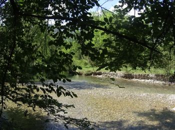
• Voilà une VTT dans la belle vallée du Bouchet une petite randonnée avec de beaux passages dans la vallée et que vas v...
![V.T.T. V.T.T.](https://static1.geolcdn.com/sitytour/trail-icons/202.png)
Km
V.T.T.
![](/images/other/stat-length.png)
![](https://static1.geolcdn.com/siteimages/upload/files/1508320355ic_sort_den_pos_24dp.png)
![](https://static1.geolcdn.com/siteimages/upload/files/1508320355ic_sort_den_neg_24dp.png)
![](https://static1.geolcdn.com/siteimages/upload/files/16400158638029165_repeat_loop_refresh_sync_direction_icon.png)
• Voilà un VTT au départ du village du grand Bornand une randonnée combinée entre 2 randonnées de l'office du tourisme ...
![V.T.T. V.T.T.](https://static1.geolcdn.com/sitytour/trail-icons/202.png)
Km
V.T.T.
![](/images/other/stat-length.png)
![](https://static1.geolcdn.com/siteimages/upload/files/1508320355ic_sort_den_pos_24dp.png)
![](https://static1.geolcdn.com/siteimages/upload/files/1508320355ic_sort_den_neg_24dp.png)
![](https://static1.geolcdn.com/siteimages/upload/files/16400158638029165_repeat_loop_refresh_sync_direction_icon.png)
• Voilà une des 3 randonnées VTT sur le grand bornait une très belle sortie VTT dans une belle région avec des beaux po...
![V.T.T. V.T.T.](https://static1.geolcdn.com/sitytour/trail-icons/202.png)
Km
V.T.T.
![](/images/other/stat-length.png)
![](https://static1.geolcdn.com/siteimages/upload/files/1508320355ic_sort_den_pos_24dp.png)
![](https://static1.geolcdn.com/siteimages/upload/files/1508320355ic_sort_den_neg_24dp.png)
![](https://static1.geolcdn.com/siteimages/upload/files/16400158638029165_repeat_loop_refresh_sync_direction_icon.png)
• Vola un VTT au départ du village du Grand-Bornand une randonnée qui va vous fair découvri la région avec des points d...
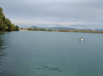
![Randonnée Vélo Lathuile - Le tour du lac d'Annecy - Photo](https://media.geolcdn.com/t/350/260/ext.jpg?maxdim=2&url=https%3A%2F%2Fservices.sitytrail.com%2FGeolivesWS%2FDownloadMedia.ashx%3FTrailID%3D768959%26Media%3D9b069d97-167d-49a5-a77a-ad676b808808.JPG)
![Vélo Vélo](https://static1.geolcdn.com/sitytour/trail-icons/200.png)
Km
Vélo
![](/images/other/stat-length.png)
![](https://static1.geolcdn.com/siteimages/upload/files/1508320355ic_sort_den_pos_24dp.png)
![](https://static1.geolcdn.com/siteimages/upload/files/1508320355ic_sort_den_neg_24dp.png)
![](https://static1.geolcdn.com/siteimages/upload/files/16400158638029165_repeat_loop_refresh_sync_direction_icon.png)
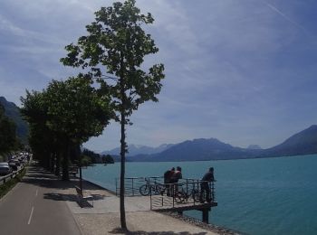
• Le tour du lac d'Annecy . une superbe vue sur le lac et les montagnes, la piste cyclable, la voie verte du bord du la...
![Randonnée V.T.T. Chamonix-Mont-Blanc - vtt à Chamonix - Photo](https://media.geolcdn.com/t/350/260/ext.jpg?maxdim=2&url=https%3A%2F%2Fservices.sitytrail.com%2FGeolivesWS%2FDownloadMedia.ashx%3FTrailID%3D467115%26Media%3D7ce48f5e-712a-47f0-8147-acaa94237d97.jpg)
![V.T.T. V.T.T.](https://static1.geolcdn.com/sitytour/trail-icons/202.png)
Km
V.T.T.
![](/images/other/stat-length.png)
![](https://static1.geolcdn.com/siteimages/upload/files/1508320355ic_sort_den_pos_24dp.png)
![](https://static1.geolcdn.com/siteimages/upload/files/1508320355ic_sort_den_neg_24dp.png)
![](https://static1.geolcdn.com/siteimages/upload/files/16400158638029165_repeat_loop_refresh_sync_direction_icon.png)
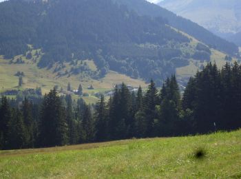
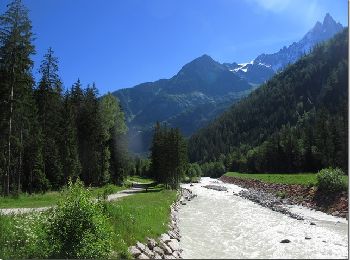
• Une rando en VTT à Chamonix de avec des poins de vue sur le Mont Blanc avec le beaux cour d eaux l'arveyon. entre boi...
![Randonnée V.T.T. La Balme-de-Sillingy - MANDALLAZ super, pas pour débutant. - Photo](https://media.geolcdn.com/t/350/260/ext.jpg?maxdim=2&url=https%3A%2F%2Fstatic1.geolcdn.com%2Fsiteimages%2Fupload%2Ffiles%2F1524743154velo.jpg)
![V.T.T. V.T.T.](https://static1.geolcdn.com/sitytour/trail-icons/202.png)
Km
V.T.T.
![](/images/other/stat-length.png)
![](https://static1.geolcdn.com/siteimages/upload/files/1508320355ic_sort_den_pos_24dp.png)
![](https://static1.geolcdn.com/siteimages/upload/files/1508320355ic_sort_den_neg_24dp.png)
![](https://static1.geolcdn.com/siteimages/upload/files/16400158638029165_repeat_loop_refresh_sync_direction_icon.png)
• Pas trop technique mais physique.
![Randonnée Vélo Annecy - semnoz par quintal - Photo](https://media.geolcdn.com/t/350/260/ext.jpg?maxdim=2&url=https%3A%2F%2Fstatic1.geolcdn.com%2Fsiteimages%2Fupload%2Ffiles%2F1524743154velo.jpg)
![Vélo Vélo](https://static1.geolcdn.com/sitytour/trail-icons/200.png)
Km
Vélo
![](/images/other/stat-length.png)
![](https://static1.geolcdn.com/siteimages/upload/files/1508320355ic_sort_den_pos_24dp.png)
![](https://static1.geolcdn.com/siteimages/upload/files/1508320355ic_sort_den_neg_24dp.png)
![](https://static1.geolcdn.com/siteimages/upload/files/16400158638029165_repeat_loop_refresh_sync_direction_icon.png)
•
![Randonnée V.T.T. La Clusaz - VTT Aravis - Photo](https://media.geolcdn.com/t/350/260/ext.jpg?maxdim=2&url=https%3A%2F%2Fstatic1.geolcdn.com%2Fsiteimages%2Fupload%2Ffiles%2F1524743154velo.jpg)
![V.T.T. V.T.T.](https://static1.geolcdn.com/sitytour/trail-icons/202.png)
Km
V.T.T.
![](/images/other/stat-length.png)
![](https://static1.geolcdn.com/siteimages/upload/files/1508320355ic_sort_den_pos_24dp.png)
![](https://static1.geolcdn.com/siteimages/upload/files/1508320355ic_sort_den_neg_24dp.png)
![](https://static1.geolcdn.com/siteimages/upload/files/16400158638029165_repeat_loop_refresh_sync_direction_icon.png)
•
![Randonnée V.T.T. La Clusaz - Aravis - Photo](https://media.geolcdn.com/t/350/260/ext.jpg?maxdim=2&url=https%3A%2F%2Fstatic1.geolcdn.com%2Fsiteimages%2Fupload%2Ffiles%2F1524743154velo.jpg)
![V.T.T. V.T.T.](https://static1.geolcdn.com/sitytour/trail-icons/202.png)
Km
V.T.T.
![](/images/other/stat-length.png)
![](https://static1.geolcdn.com/siteimages/upload/files/1508320355ic_sort_den_pos_24dp.png)
![](https://static1.geolcdn.com/siteimages/upload/files/1508320355ic_sort_den_neg_24dp.png)
![](https://static1.geolcdn.com/siteimages/upload/files/16400158638029165_repeat_loop_refresh_sync_direction_icon.png)
• Peu de portage / roulant
![Randonnée V.T.T. Moye - 74- Le Gros Foug - Photo](https://media.geolcdn.com/t/350/260/ext.jpg?maxdim=2&url=https%3A%2F%2Fstatic1.geolcdn.com%2Fsiteimages%2Fupload%2Ffiles%2F1524743154velo.jpg)
![V.T.T. V.T.T.](https://static1.geolcdn.com/sitytour/trail-icons/202.png)
Km
V.T.T.
![](/images/other/stat-length.png)
![](https://static1.geolcdn.com/siteimages/upload/files/1508320355ic_sort_den_pos_24dp.png)
![](https://static1.geolcdn.com/siteimages/upload/files/1508320355ic_sort_den_neg_24dp.png)
![](https://static1.geolcdn.com/siteimages/upload/files/16400158638029165_repeat_loop_refresh_sync_direction_icon.png)
• Une petite ballade sympa... Quand ça monte, ça descend toujours après, mais il faut bien remonter... Ne pas se trompe...
![Randonnée V.T.T. Annecy - semnoz 31 8 10 - Photo](https://media.geolcdn.com/t/350/260/ext.jpg?maxdim=2&url=https%3A%2F%2Fstatic1.geolcdn.com%2Fsiteimages%2Fupload%2Ffiles%2F1524743154velo.jpg)
![V.T.T. V.T.T.](https://static1.geolcdn.com/sitytour/trail-icons/202.png)
Km
V.T.T.
![](/images/other/stat-length.png)
![](https://static1.geolcdn.com/siteimages/upload/files/1508320355ic_sort_den_pos_24dp.png)
![](https://static1.geolcdn.com/siteimages/upload/files/1508320355ic_sort_den_neg_24dp.png)
![](https://static1.geolcdn.com/siteimages/upload/files/16400158638029165_repeat_loop_refresh_sync_direction_icon.png)
•
![Randonnée V.T.T. Publier - VTT Bois de Ville Carriere - Photo](https://media.geolcdn.com/t/350/260/ext.jpg?maxdim=2&url=https%3A%2F%2Fstatic1.geolcdn.com%2Fsiteimages%2Fupload%2Ffiles%2F1524743154velo.jpg)
![V.T.T. V.T.T.](https://static1.geolcdn.com/sitytour/trail-icons/202.png)
Km
V.T.T.
![](/images/other/stat-length.png)
![](https://static1.geolcdn.com/siteimages/upload/files/1508320355ic_sort_den_pos_24dp.png)
![](https://static1.geolcdn.com/siteimages/upload/files/1508320355ic_sort_den_neg_24dp.png)
![](https://static1.geolcdn.com/siteimages/upload/files/16400158638029165_repeat_loop_refresh_sync_direction_icon.png)
•
![Randonnée Vélo électrique Doussard - col de Forclas tour du lac d Annecy - Photo](https://media.geolcdn.com/t/350/260/af7b4962-9417-4f5f-9c8e-56fed7afe560.jpg&format=jpg&maxdim=2)
![Vélo électrique Vélo électrique](https://static1.geolcdn.com/sitytour/trail-icons/205.png)
Km
Vélo électrique
![](/images/other/stat-length.png)
![](https://static1.geolcdn.com/siteimages/upload/files/1508320355ic_sort_den_pos_24dp.png)
![](https://static1.geolcdn.com/siteimages/upload/files/1508320355ic_sort_den_neg_24dp.png)
![](https://static1.geolcdn.com/siteimages/upload/files/16400158638029165_repeat_loop_refresh_sync_direction_icon.png)
• une étape à ne pas rater panoramique
![Randonnée Vélo électrique Doussard - tour du lac d Annecy - Photo](https://media.geolcdn.com/t/350/260/2e57f541-488e-4913-8986-cca52229ef69.jpg&format=jpg&maxdim=2)
![Vélo électrique Vélo électrique](https://static1.geolcdn.com/sitytour/trail-icons/205.png)
Km
Vélo électrique
![](/images/other/stat-length.png)
![](https://static1.geolcdn.com/siteimages/upload/files/1508320355ic_sort_den_pos_24dp.png)
![](https://static1.geolcdn.com/siteimages/upload/files/1508320355ic_sort_den_neg_24dp.png)
![](https://static1.geolcdn.com/siteimages/upload/files/16400158638029165_repeat_loop_refresh_sync_direction_icon.png)
• panoramique
20 randonnées affichées sur 1051
Application GPS de randonnée GRATUITE
Activités
Régions proches
- Abondance
- Alby-sur-Chéran
- Alex
- Allèves
- Allinges
- Allonzier-la-Caille
- Amancy
- Ambilly
- Andilly
- Annecy
- Annemasse
- Anthy-sur-Léman
- Arâches-la-Frasse
- Arbusigny
- Archamps
- Arenthon
- Argonay
- Armoy
- Arthaz-Pont-Notre-Dame
- Ayse
- Ballaison
- Bassy
- Beaumont
- Bellevaux
- Bernex
- Bloye
- Bluffy
- Boëge
- Bogève
- Bonne
- Bonnevaux
- Bonneville
- Bons-en-Chablais
- Bossey
- Boussy
- Brenthonne
- Brizon
- Burdignin
- Cercier
- Cernex
- Cervens
- Chainaz-les-Frasses
- Challonges
- Chamonix-Mont-Blanc
- Champanges
- Chapeiry
- Charvonnex
- Châtel
- Châtillon-sur-Cluses
- Chaumont
- Chavannaz
- Chavanod
- Chêne-en-Semine
- Chênex
- Chens-sur-Léman
- Chevaline
- Chevenoz
- Chevrier
- Chilly
- Choisy
- Clarafond-Arcine
- Clermont
- Cluses
- Collonges-sous-Salève
- Combloux
- Contamine-Sarzin
- Contamine-sur-Arve
- Copponex
- Cordon
- Cornier
- Cranves-Sales
- Crempigny-Bonneguête
- Cruseilles
- Cusy
- Cuvat
- Demi-Quartier
- Desingy
- Dingy-Saint-Clair
- Dingy-en-Vuache
- Domancy
- Doussard
- Douvaine
- Draillant
- Droisy
- Duingt
- Éloise
- Entrevernes
- Épagny Metz-Tessy
- Essert-Romand
- Etaux
- Étercy
- Étrembières
- Évian-les-Bains
- Excenevex
- Faucigny
- Faverges-Seythenex
- Feigères
- Fessy
- Féternes
- Fillière
- Fillinges
- Franclens
- Frangy
- Gaillard
- Giez
- Glières-Val-de-Borne
- Groisy
- Gruffy
- Habère-Lullin
- Habère-Poche
- Hauteville-sur-Fier
- Héry-sur-Alby
- Jonzier-Épagny
- Juvigny
- La Balme-de-Sillingy
- La Balme-de-Thuy
- La Baume
- La Chapelle-Rambaud
- La Chapelle-Saint-Maurice
- La Chapelle-d'Abondance
- La Clusaz
- La Côte-d'Arbroz
- La Forclaz
- La Muraz
- La Rivière-Enverse
- La Roche-sur-Foron
- La Tour
- La Vernaz
- Larringes
- Lathuile
- Le Biot
- Le Bouchet-Mont-Charvin
- Le Grand-Bornand
- Le Reposoir
- Le Sappey
- Les Clefs
- Les Contamines-Montjoie
- Les Gets
- Les Houches
- Les Villards-sur-Thônes
- Leschaux
- Lornay
- Lovagny
- Lucinges
- Lugrin
- Lullin
- Lully
- Lyaud
- Machilly
- Magland
- Manigod
- Marcellaz
- Marcellaz-Albanais
- Margencel
- Marignier
- Marigny-Saint-Marcel
- Marin
- Marlioz
- Marnaz
- Massingy
- Massongy
- Maxilly-sur-Léman
- Megève
- Mégevette
- Meillerie
- Menthon-Saint-Bernard
- Menthonnex-en-Bornes
- Menthonnex-sous-Clermont
- Mésigny
- Messery
- Mieussy
- Minzier
- Monnetier-Mornex
- Mont-Saxonnex
- Montagny-les-Lanches
- Montriond
- Morillon
- Morzine
- Moye
- Mûres
- Musièges
- Nancy-sur-Cluses
- Nangy
- Nâves-Parmelan
- Nernier
- Neuvecelle
- Neydens
- Nonglard
- Novel
- Onnion
- Orcier
- Passy
- Peillonnex
- Perrignier
- Pers-Jussy
- Poisy
- Praz-sur-Arly
- Présilly
- Publier
- Quintal
- Reignier-Ésery
- Reyvroz
- Rumilly
- Saint-André-de-Boëge
- Saint-Blaise
- Saint-Cergues
- Saint-Eusèbe
- Saint-Eustache
- Saint-Félix
- Saint-Ferréol
- Saint-Germain-sur-Rhône
- Saint-Gervais-les-Bains
- Saint-Gingolph
- Saint-Jean-d'Aulps
- Saint-Jean-de-Sixt
- Saint-Jean-de-Tholome
- Saint-Jeoire
- Saint-Jorioz
- Saint-Julien-en-Genevois
- Saint-Laurent
- Saint-Paul-en-Chablais
- Saint-Pierre-en-Faucigny
- Saint-Sigismond
- Saint-Sixt
- Saint-Sylvestre
- Sales
- Sallanches
- Sallenôves
- Samoëns
- Savigny
- Saxel
- Scientrier
- Sciez
- Scionzier
- Serraval
- Servoz
- Sevrier
- Seyssel
- Seytroux
- Sillingy
- Sixt-Fer-à-Cheval
- Talloires-Montmin
- Taninges
- Thollon-les-Mémises
- Thônes
- Thonon-les-Bains
- Thusy
- Thyez
- Usinens
- Vacheresse
- Vailly
- Val de Chaise
- Valleiry
- Vallières-sur-Fier
- Vallorcine
- Vanzy
- Vaulx
- Veigy-Foncenex
- Verchaix
- Vers
- Versonnex
- Vétraz-Monthoux
- Veyrier-du-Lac
- Villard
- Villaz
- Ville-en-Sallaz
- Ville-la-Grand
- Villy-le-Bouveret
- Villy-le-Pelloux
- Vinzier
- Viry
- Viuz-en-Sallaz
- Viuz-la-Chiésaz
- Vougy
- Vovray-en-Bornes
- Vulbens
- Yvoire