![](/images/other/stat-length.png)
Ain, Auvergne-Rhône-Alpes, Vélo : Les meilleures randonnées, itinéraires, parcours, balades et promenades
Ain : découvrez les meilleures randonnées : 92 vélo, 98 vélo de route, 649 v.t.t., 27 v.t.c., 16 cyclotourisme et 86 vélo électrique. Tous ces circuits, parcours, itinéraires et activités en plein air sont disponibles dans nos applications SityTrail pour smartphones et tablettes.
Les meilleurs parcours (966)
![Randonnée V.T.T. Arandas - Arandas-Plomb-Plateau de Suerme - Photo](https://media.geolcdn.com/t/350/260/ext.jpg?maxdim=2&url=https%3A%2F%2Fservices.sitytrail.com%2FGeolivesWS%2FDownloadMedia.ashx%3FTrailID%3D790474%26Media%3Dfix__20170716121750.jpg)
![V.T.T. V.T.T.](https://static1.geolcdn.com/sitytour/trail-icons/202.png)
Km
V.T.T.
![](/images/other/stat-length.png)
![](https://static1.geolcdn.com/siteimages/upload/files/1508320355ic_sort_den_pos_24dp.png)
![](https://static1.geolcdn.com/siteimages/upload/files/1508320355ic_sort_den_neg_24dp.png)
![](https://static1.geolcdn.com/siteimages/upload/files/16400158638029165_repeat_loop_refresh_sync_direction_icon.png)
• Très belle randonnée avec de très beau point de vue,traversée de hameau completement isolé. Attention vers le golet d...
![V.T.T. V.T.T.](https://static1.geolcdn.com/sitytour/trail-icons/202.png)
Km
V.T.T.
![](/images/other/stat-length.png)
![](https://static1.geolcdn.com/siteimages/upload/files/1508320355ic_sort_den_pos_24dp.png)
![](https://static1.geolcdn.com/siteimages/upload/files/1508320355ic_sort_den_neg_24dp.png)
![](https://static1.geolcdn.com/siteimages/upload/files/16400158638029165_repeat_loop_refresh_sync_direction_icon.png)
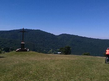
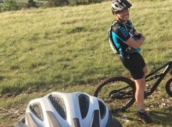
• Grosse sortie avec la Bert qui était en musculaire. Superbe descente par des sentiers que je n’avais jamais fait
![Randonnée V.T.T. Belley - 29-04 - Photo](https://media.geolcdn.com/t/350/260/ext.jpg?maxdim=2&url=https%3A%2F%2Fservices.sitytrail.com%2FGeolivesWS%2FDownloadMedia.ashx%3FTrailID%3D414275%26Media%3Dfix__20150429194314.jpg)
![V.T.T. V.T.T.](https://static1.geolcdn.com/sitytour/trail-icons/202.png)
Km
V.T.T.
![](/images/other/stat-length.png)
![](https://static1.geolcdn.com/siteimages/upload/files/1508320355ic_sort_den_pos_24dp.png)
![](https://static1.geolcdn.com/siteimages/upload/files/1508320355ic_sort_den_neg_24dp.png)
![](https://static1.geolcdn.com/siteimages/upload/files/16400158638029165_repeat_loop_refresh_sync_direction_icon.png)
• Montée longue et difficile depuis Veyrin; par contre la descente sur la cascade de Glandieu est magnifique. Descente ...
![Randonnée V.T.T. Haut Valromey - Espace VTT FFC du Bugey - Circuit n° 16 - Les Plans d'Hotonnes - Photo](https://media.geolcdn.com/t/350/260/ext.jpg?maxdim=2&url=https%3A%2F%2Fservices.sitytrail.com%2FGeolivesWS%2FDownloadMedia.ashx%3FTrailID%3D104583%26Media%3D7976_2.jpg)
![V.T.T. V.T.T.](https://static1.geolcdn.com/sitytour/trail-icons/202.png)
Km
V.T.T.
![](/images/other/stat-length.png)
![](https://static1.geolcdn.com/siteimages/upload/files/1508320355ic_sort_den_pos_24dp.png)
![](https://static1.geolcdn.com/siteimages/upload/files/1508320355ic_sort_den_neg_24dp.png)
![](https://static1.geolcdn.com/siteimages/upload/files/16400158638029165_repeat_loop_refresh_sync_direction_icon.png)
• Espace VTT - FFC du Bugey - Circuit n° 16 - Les Plans d'Hotonnes. Circuit officiel labellisé par la Fédération França...
![Randonnée V.T.T. Haut Valromey - Espace VTT FFC du Bugey - Circuit n° 15 - Les Plans d'Hotonnes - Photo](https://media.geolcdn.com/t/350/260/ext.jpg?maxdim=2&url=https%3A%2F%2Fservices.sitytrail.com%2FGeolivesWS%2FDownloadMedia.ashx%3FTrailID%3D104582%26Media%3D7975_2.jpg)
![V.T.T. V.T.T.](https://static1.geolcdn.com/sitytour/trail-icons/202.png)
Km
V.T.T.
![](/images/other/stat-length.png)
![](https://static1.geolcdn.com/siteimages/upload/files/1508320355ic_sort_den_pos_24dp.png)
![](https://static1.geolcdn.com/siteimages/upload/files/1508320355ic_sort_den_neg_24dp.png)
![](https://static1.geolcdn.com/siteimages/upload/files/16400158638029165_repeat_loop_refresh_sync_direction_icon.png)
• Espace VTT - FFC du Bugey - Circuit n° 15 - Les Plans d'Hotonnes. Circuit officiel labellisé par la Fédération França...
![Randonnée V.T.T. Lélex - Espace VTT FFC Entre Jura et Léman - Circuit n°01 - Les Hautes Combes - Photo](https://media.geolcdn.com/t/350/260/ext.jpg?maxdim=2&url=https%3A%2F%2Fservices.sitytrail.com%2FGeolivesWS%2FDownloadMedia.ashx%3FTrailID%3D102578%26Media%3D3474_1.jpg)
![V.T.T. V.T.T.](https://static1.geolcdn.com/sitytour/trail-icons/202.png)
Km
V.T.T.
![](/images/other/stat-length.png)
![](https://static1.geolcdn.com/siteimages/upload/files/1508320355ic_sort_den_pos_24dp.png)
![](https://static1.geolcdn.com/siteimages/upload/files/1508320355ic_sort_den_neg_24dp.png)
![](https://static1.geolcdn.com/siteimages/upload/files/16400158638029165_repeat_loop_refresh_sync_direction_icon.png)
• Espace VTT FFC Entre Jura et Léman Circuit officiel labellisé par la Fédération Française de Cyclisme. L'espace VTT F...
![Randonnée V.T.T. Plateau d'Hauteville - Espace VTT FFC du Bugey - Circuit n° 01 - Photo](https://media.geolcdn.com/t/350/260/ext.jpg?maxdim=2&url=https%3A%2F%2Fservices.sitytrail.com%2FGeolivesWS%2FDownloadMedia.ashx%3FTrailID%3D101872%26Media%3D2159_1.jpg)
![V.T.T. V.T.T.](https://static1.geolcdn.com/sitytour/trail-icons/202.png)
Km
V.T.T.
![](/images/other/stat-length.png)
![](https://static1.geolcdn.com/siteimages/upload/files/1508320355ic_sort_den_pos_24dp.png)
![](https://static1.geolcdn.com/siteimages/upload/files/1508320355ic_sort_den_neg_24dp.png)
![](https://static1.geolcdn.com/siteimages/upload/files/16400158638029165_repeat_loop_refresh_sync_direction_icon.png)
• Espace VTT - FFC du Bugey no 38 Circuit labellisé par la Fédération Française de Cyclisme. Le relief de moyenne monta...
![Randonnée V.T.T. Aranc - Espace VTT FFC du Bugey - Circuit n° 23 - Photo](https://media.geolcdn.com/t/350/260/ext.jpg?maxdim=2&url=https%3A%2F%2Fservices.sitytrail.com%2FGeolivesWS%2FDownloadMedia.ashx%3FTrailID%3D101622%26Media%3D1805_1.jpg)
![V.T.T. V.T.T.](https://static1.geolcdn.com/sitytour/trail-icons/202.png)
Km
V.T.T.
![](/images/other/stat-length.png)
![](https://static1.geolcdn.com/siteimages/upload/files/1508320355ic_sort_den_pos_24dp.png)
![](https://static1.geolcdn.com/siteimages/upload/files/1508320355ic_sort_den_neg_24dp.png)
![](https://static1.geolcdn.com/siteimages/upload/files/16400158638029165_repeat_loop_refresh_sync_direction_icon.png)
• Espace VTT - FFC du Bugey no 38 Circuit labellisé par la Fédération Française de Cyclisme. Le relief de moyenne monta...
![Randonnée V.T.T. Aranc - Espace VTT FFC du Bugey - Circuit n° 22 variante 2 - Photo](https://media.geolcdn.com/t/350/260/ext.jpg?maxdim=2&url=https%3A%2F%2Fservices.sitytrail.com%2FGeolivesWS%2FDownloadMedia.ashx%3FTrailID%3D101618%26Media%3D1803_1.jpg)
![V.T.T. V.T.T.](https://static1.geolcdn.com/sitytour/trail-icons/202.png)
Km
V.T.T.
![](/images/other/stat-length.png)
![](https://static1.geolcdn.com/siteimages/upload/files/1508320355ic_sort_den_pos_24dp.png)
![](https://static1.geolcdn.com/siteimages/upload/files/1508320355ic_sort_den_neg_24dp.png)
![](https://static1.geolcdn.com/siteimages/upload/files/16400158638029165_repeat_loop_refresh_sync_direction_icon.png)
• Espace VTT - FFC du Bugey no 38 Circuit labellisé par la Fédération Française de Cyclisme. Le relief de moyenne monta...
![Randonnée V.T.T. Cuzieu - Cuzieu Vongnes - Photo](https://media.geolcdn.com/t/350/260/ext.jpg?maxdim=2&url=https%3A%2F%2Fstatic1.geolcdn.com%2Fsiteimages%2Fupload%2Ffiles%2F1524743154velo.jpg)
![V.T.T. V.T.T.](https://static1.geolcdn.com/sitytour/trail-icons/202.png)
Km
V.T.T.
![](/images/other/stat-length.png)
![](https://static1.geolcdn.com/siteimages/upload/files/1508320355ic_sort_den_pos_24dp.png)
![](https://static1.geolcdn.com/siteimages/upload/files/1508320355ic_sort_den_neg_24dp.png)
![](https://static1.geolcdn.com/siteimages/upload/files/16400158638029165_repeat_loop_refresh_sync_direction_icon.png)
• Petit tour entre Cuzieu et Vognes. Profile varié gros chemin et single. Pas de difficulté particulière. Peut être cu...
![Randonnée V.T.T. Pollieu - Entre lac et rivière - Photo](https://media.geolcdn.com/t/350/260/ext.jpg?maxdim=2&url=https%3A%2F%2Fstatic1.geolcdn.com%2Fsiteimages%2Fupload%2Ffiles%2F1524743154velo.jpg)
![V.T.T. V.T.T.](https://static1.geolcdn.com/sitytour/trail-icons/202.png)
Km
V.T.T.
![](/images/other/stat-length.png)
![](https://static1.geolcdn.com/siteimages/upload/files/1508320355ic_sort_den_pos_24dp.png)
![](https://static1.geolcdn.com/siteimages/upload/files/1508320355ic_sort_den_neg_24dp.png)
![](https://static1.geolcdn.com/siteimages/upload/files/16400158638029165_repeat_loop_refresh_sync_direction_icon.png)
• Chavolay et le seran
![Randonnée V.T.T. Belley - Entre Belley et Vognes en passant par le lac de ST Champs - Photo](https://media.geolcdn.com/t/350/260/ext.jpg?maxdim=2&url=https%3A%2F%2Fstatic1.geolcdn.com%2Fsiteimages%2Fupload%2Ffiles%2F1524743154velo.jpg)
![V.T.T. V.T.T.](https://static1.geolcdn.com/sitytour/trail-icons/202.png)
Km
V.T.T.
![](/images/other/stat-length.png)
![](https://static1.geolcdn.com/siteimages/upload/files/1508320355ic_sort_den_pos_24dp.png)
![](https://static1.geolcdn.com/siteimages/upload/files/1508320355ic_sort_den_neg_24dp.png)
![](https://static1.geolcdn.com/siteimages/upload/files/16400158638029165_repeat_loop_refresh_sync_direction_icon.png)
• Belle rando, très variée au milieu des vignes et des bois. De bonnes grimpettes sans difficultés mais difficile à pas...
![Randonnée V.T.T. Andert-et-Condon - Boucle sous Gevrin - Photo](https://media.geolcdn.com/t/350/260/ext.jpg?maxdim=2&url=https%3A%2F%2Fstatic1.geolcdn.com%2Fsiteimages%2Fupload%2Ffiles%2F1524743154velo.jpg)
![V.T.T. V.T.T.](https://static1.geolcdn.com/sitytour/trail-icons/202.png)
Km
V.T.T.
![](/images/other/stat-length.png)
![](https://static1.geolcdn.com/siteimages/upload/files/1508320355ic_sort_den_pos_24dp.png)
![](https://static1.geolcdn.com/siteimages/upload/files/1508320355ic_sort_den_neg_24dp.png)
![](https://static1.geolcdn.com/siteimages/upload/files/16400158638029165_repeat_loop_refresh_sync_direction_icon.png)
• Boucle à battre
![Randonnée V.T.T. Belley - Belley-Colomieu-Appregnin - Photo](https://media.geolcdn.com/t/350/260/ext.jpg?maxdim=2&url=https%3A%2F%2Fstatic1.geolcdn.com%2Fsiteimages%2Fupload%2Ffiles%2F1524743154velo.jpg)
![V.T.T. V.T.T.](https://static1.geolcdn.com/sitytour/trail-icons/202.png)
Km
V.T.T.
![](/images/other/stat-length.png)
![](https://static1.geolcdn.com/siteimages/upload/files/1508320355ic_sort_den_pos_24dp.png)
![](https://static1.geolcdn.com/siteimages/upload/files/1508320355ic_sort_den_neg_24dp.png)
![](https://static1.geolcdn.com/siteimages/upload/files/16400158638029165_repeat_loop_refresh_sync_direction_icon.png)
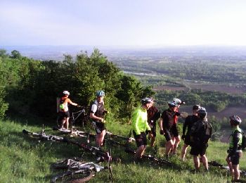
• Un assemblage inédit de boucles connues qui nous a donné un super parcourt varié. Du single, du gros chemin, quelques...
![Randonnée V.T.T. Arboys-en-Bugey - St Boit-La Graye-cascade de Glandieu - Photo](https://media.geolcdn.com/t/350/260/ext.jpg?maxdim=2&url=https%3A%2F%2Fstatic1.geolcdn.com%2Fsiteimages%2Fupload%2Ffiles%2F1524743154velo.jpg)
![V.T.T. V.T.T.](https://static1.geolcdn.com/sitytour/trail-icons/202.png)
Km
V.T.T.
![](/images/other/stat-length.png)
![](https://static1.geolcdn.com/siteimages/upload/files/1508320355ic_sort_den_pos_24dp.png)
![](https://static1.geolcdn.com/siteimages/upload/files/1508320355ic_sort_den_neg_24dp.png)
![](https://static1.geolcdn.com/siteimages/upload/files/16400158638029165_repeat_loop_refresh_sync_direction_icon.png)
• Rando difficile voir très difficile. La montée sur les marches de Conzieu est très raide et technique (pour les très ...
![Randonnée Vélo Mézériat - vonnas - Photo](https://media.geolcdn.com/t/350/260/ext.jpg?maxdim=2&url=https%3A%2F%2Fstatic1.geolcdn.com%2Fsiteimages%2Fupload%2Ffiles%2F1524743154velo.jpg)
![Vélo Vélo](https://static1.geolcdn.com/sitytour/trail-icons/200.png)
Km
Vélo
![](/images/other/stat-length.png)
![](https://static1.geolcdn.com/siteimages/upload/files/1508320355ic_sort_den_pos_24dp.png)
![](https://static1.geolcdn.com/siteimages/upload/files/1508320355ic_sort_den_neg_24dp.png)
![](https://static1.geolcdn.com/siteimages/upload/files/16400158638029165_repeat_loop_refresh_sync_direction_icon.png)
• velo fete du cheval
![Randonnée V.T.T. Tossiat - 15-04-13 - Photo](https://media.geolcdn.com/t/350/260/ext.jpg?maxdim=2&url=https%3A%2F%2Fstatic1.geolcdn.com%2Fsiteimages%2Fupload%2Ffiles%2F1524743154velo.jpg)
![V.T.T. V.T.T.](https://static1.geolcdn.com/sitytour/trail-icons/202.png)
Km
V.T.T.
![](/images/other/stat-length.png)
![](https://static1.geolcdn.com/siteimages/upload/files/1508320355ic_sort_den_pos_24dp.png)
![](https://static1.geolcdn.com/siteimages/upload/files/1508320355ic_sort_den_neg_24dp.png)
![](https://static1.geolcdn.com/siteimages/upload/files/16400158638029165_repeat_loop_refresh_sync_direction_icon.png)
•
![Randonnée V.T.T. Saint-Jean-le-Vieux - rando balcon de l'ain 40km - Photo](https://media.geolcdn.com/t/350/260/ext.jpg?maxdim=2&url=https%3A%2F%2Fstatic1.geolcdn.com%2Fsiteimages%2Fupload%2Ffiles%2F1524743154velo.jpg)
![V.T.T. V.T.T.](https://static1.geolcdn.com/sitytour/trail-icons/202.png)
Km
V.T.T.
![](/images/other/stat-length.png)
![](https://static1.geolcdn.com/siteimages/upload/files/1508320355ic_sort_den_pos_24dp.png)
![](https://static1.geolcdn.com/siteimages/upload/files/1508320355ic_sort_den_neg_24dp.png)
![](https://static1.geolcdn.com/siteimages/upload/files/16400158638029165_repeat_loop_refresh_sync_direction_icon.png)
•
![Randonnée Vélo de route Massignieu-de-Rives - Vignobles du Bugey au départ du Lac du Lit au roi - Photo](https://media.geolcdn.com/t/350/260/3b474186-3ae0-49ac-b153-2b0d64e544fe.jpg&format=jpg&maxdim=2)
![Vélo de route Vélo de route](https://static1.geolcdn.com/sitytour/trail-icons/201.png)
Km
Vélo de route
![](/images/other/stat-length.png)
![](https://static1.geolcdn.com/siteimages/upload/files/1508320355ic_sort_den_pos_24dp.png)
![](https://static1.geolcdn.com/siteimages/upload/files/1508320355ic_sort_den_neg_24dp.png)
![](https://static1.geolcdn.com/siteimages/upload/files/16400158638029165_repeat_loop_refresh_sync_direction_icon.png)
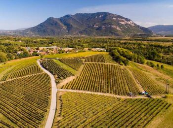
• Circuit vélo - Vignobles du Bugey au départ du Lac du Lit au roi Circuit au relief très limité (250 mètres de dénive...
![Randonnée Vélo de route Cormoranche-sur-Saône - 01 voie verte et bleue macon - Photo](https://media.geolcdn.com/t/350/260/db10580d-accf-4352-a58c-c49df6817574.jpg&format=jpg&maxdim=2)
![Vélo de route Vélo de route](https://static1.geolcdn.com/sitytour/trail-icons/201.png)
Km
Vélo de route
![](/images/other/stat-length.png)
![](https://static1.geolcdn.com/siteimages/upload/files/1508320355ic_sort_den_pos_24dp.png)
![](https://static1.geolcdn.com/siteimages/upload/files/1508320355ic_sort_den_neg_24dp.png)
![](https://static1.geolcdn.com/siteimages/upload/files/16400158638029165_repeat_loop_refresh_sync_direction_icon.png)
20 randonnées affichées sur 966
Application GPS de randonnée GRATUITE
Activités
Régions proches
- Ambérieu-en-Bugey
- Ambérieux-en-Dombes
- Ambléon
- Ambronay
- Ambutrix
- Andert-et-Condon
- Anglefort
- Apremont
- Aranc
- Arandas
- Arbent
- Arbigny
- Arboys-en-Bugey
- Argis
- Armix
- Ars-sur-Formans
- Artemare
- Arvière-en-Valromey
- Asnières-sur-Saône
- Attignat
- Bâgé-Dommartin
- Bâgé-le-Châtel
- Balan
- Baneins
- Béard-Géovreissiat
- Beaupont
- Beauregard
- Béligneux
- Belley
- Belleydoux
- Bellignat
- Bénonces
- Bény
- Béon
- Béréziat
- Bettant
- Bey
- Beynost
- Billiat
- Birieux
- Biziat
- Blyes
- Bohas-Meyriat-Rignat
- Boissey
- Bolozon
- Bouligneux
- Bourg-Saint-Christophe
- Bourg-en-Bresse
- Boyeux-Saint-Jérôme
- Boz
- Brégnier-Cordon
- Brénod
- Brens
- Bresse Vallons
- Bressolles
- Brion
- Briord
- Buellas
- Ceignes
- Cerdon
- Certines
- Cessy
- Ceyzériat
- Ceyzérieu
- Chalamont
- Chaleins
- Chaley
- Challes-la-Montagne
- Challex
- Champagne-en-Valromey
- Champdor-Corcelles
- Champfromier
- Chanay
- Chaneins
- Chanoz-Châtenay
- Charix
- Charnoz-sur-Ain
- Château-Gaillard
- Châtenay
- Châtillon-la-Palud
- Châtillon-sur-Chalaronne
- Chavannes-sur-Reyssouze
- Chaveyriat
- Chazey-Bons
- Chazey-sur-Ain
- Cheignieu-la-Balme
- Chevillard
- Chevroux
- Chevry
- Chézery-Forens
- Civrieux
- Cize
- Cleyzieu
- Coligny
- Collonges
- Colomieu
- Conand
- Condamine
- Condeissiat
- Confort
- Confrançon
- Contrevoz
- Conzieu
- Corbonod
- Corlier
- Cormoranche-sur-Saône
- Cormoz
- Corveissiat
- Courmangoux
- Courtes
- Crans
- Cressin-Rochefort
- Crottet
- Crozet
- Cruzilles-lès-Mépillat
- Culoz
- Curciat-Dongalon
- Curtafond
- Cuzieu
- Dagneux
- Divonne-les-Bains
- Dompierre-sur-Chalaronne
- Dompierre-sur-Veyle
- Domsure
- Dortan
- Douvres
- Drom
- Druillat
- Échallon
- Échenevex
- Évosges
- Faramans
- Fareins
- Farges
- Feillens
- Ferney-Voltaire
- Flaxieu
- Foissiat
- Francheleins
- Frans
- Garnerans
- Géovreisset
- Gex
- Giron
- Gorrevod
- Grand-Corent
- Grièges
- Grilly
- Groissiat
- Groslée-Saint-Benoit
- Guéreins
- Haut Valromey
- Hautecourt-Romanèche
- Illiat
- Injoux-Génissiat
- Innimond
- Izenave
- Izernore
- Izieu
- Jassans-Riottier
- Jasseron
- Jayat
- Journans
- Joyeux
- Jujurieux
- L'Abergement-Clémenciat
- L'Abergement-de-Varey
- La Boisse
- La Burbanche
- La Chapelle-du-Châtelard
- La Tranclière
- Labalme
- Lagnieu
- Laiz
- Lantenay
- Lapeyrouse
- Lavours
- Le Montellier
- Le Plantay
- Le Poizat-Lalleyriat
- Léaz
- Lélex
- Lent
- Les Neyrolles
- Lescheroux
- Leyment
- Leyssard
- Lhuis
- Lompnas
- Loyettes
- Lurcy
- Magnieu
- Maillat
- Malafretaz
- Mantenay-Montlin
- Manziat
- Marboz
- Marchamp
- Marignieu
- Marlieux
- Marsonnas
- Martignat
- Massieux
- Massignieu-de-Rives
- Matafelon-Granges
- Meillonnas
- Mérignat
- Messimy-sur-Saône
- Meximieux
- Mézériat
- Mijoux
- Mionnay
- Miribel
- Misérieux
- Mogneneins
- Montagnat
- Montagnieu
- Montanges
- Montceaux
- Montcet
- Monthieux
- Montluel
- Montmerle-sur-Saône
- Montracol
- Montréal-la-Cluse
- Montrevel-en-Bresse
- Murs-et-Gélignieux
- Nantua
- Neuville-les-Dames
- Neuville-sur-Ain
- Neyron
- Niévroz
- Nivigne et Suran
- Nivollet-Montgriffon
- Nurieux-Volognat
- Oncieu
- Ordonnaz
- Ornex
- Outriaz
- Oyonnax
- Ozan
- Parcieux
- Parves-et-Nattages
- Péron
- Péronnas
- Pérouges
- Perrex
- Peyriat
- Peyrieu
- Peyzieux-sur-Saône
- Pirajoux
- Pizay
- Plagne
- Plateau d'Hauteville
- Polliat
- Pollieu
- Poncin
- Pont-d'Ain
- Pont-de-Vaux
- Pont-de-Veyle
- Port
- Pougny
- Pouillat
- Prémeyzel
- Prémillieu
- Prévessin-Moëns
- Priay
- Ramasse
- Rancé
- Relevant
- Replonges
- Revonnas
- Reyrieux
- Reyssouze
- Rignieux-le-Franc
- Romans
- Rossillon
- Ruffieu
- Saint-Alban
- Saint-André-d'Huiriat
- Saint-André-de-Bâgé
- Saint-André-de-Corcy
- Saint-André-le-Bouchoux
- Saint-André-sur-Vieux-Jonc
- Saint-Bénigne
- Saint-Bernard
- Saint-Cyr-sur-Menthon
- Saint-Denis-en-Bugey
- Saint-Denis-lès-Bourg
- Saint-Didier-d'Aussiat
- Saint-Didier-de-Formans
- Saint-Didier-sur-Chalaronne
- Saint-Éloi
- Saint-Étienne-du-Bois
- Saint-Étienne-sur-Chalaronne
- Saint-Étienne-sur-Reyssouze
- Saint-Genis-Pouilly
- Saint-Genis-sur-Menthon
- Saint-Georges-sur-Renon
- Saint-Germain-de-Joux
- Saint-Germain-les-Paroisses
- Saint-Germain-sur-Renon
- Saint-Jean-de-Gonville
- Saint-Jean-de-Niost
- Saint-Jean-de-Thurigneux
- Saint-Jean-le-Vieux
- Saint-Jean-sur-Reyssouze
- Saint-Jean-sur-Veyle
- Saint-Julien-sur-Veyle
- Saint-Just
- Saint-Laurent-sur-Saône
- Saint-Marcel
- Saint-Martin-de-Bavel
- Saint-Martin-du-Frêne
- Saint-Martin-du-Mont
- Saint-Martin-le-Châtel
- Saint-Maurice-de-Beynost
- Saint-Maurice-de-Gourdans
- Saint-Maurice-de-Rémens
- Saint-Nizier-le-Bouchoux
- Saint-Nizier-le-Désert
- Saint-Paul-de-Varax
- Saint-Rambert-en-Bugey
- Saint-Rémy
- Saint-Sorlin-en-Bugey
- Saint-Sulpice
- Saint-Trivier-de-Courtes
- Saint-Trivier-sur-Moignans
- Saint-Vulbas
- Sainte-Croix
- Sainte-Euphémie
- Sainte-Julie
- Sainte-Olive
- Salavre
- Samognat
- Sandrans
- Sault-Brénaz
- Sauverny
- Savigneux
- Ségny
- Seillonnaz
- Sergy
- Sermoyer
- Serrières-de-Briord
- Serrières-sur-Ain
- Servas
- Servignat
- Seyssel
- Simandre-sur-Suran
- Sonthonnax-la-Montagne
- Souclin
- Sulignat
- Surjoux-Lhopital
- Talissieu
- Tenay
- Thil
- Thoiry
- Thoissey
- Torcieu
- Tossiat
- Toussieux
- Tramoyes
- Trévoux
- Val-Revermont
- Valeins
- Valromey-sur-Séran
- Valserhône
- Vandeins
- Varambon
- Vaux-en-Bugey
- Verjon
- Vernoux
- Versailleux
- Versonnex
- Vesancy
- Vescours
- Vésines
- Vieu-d'Izenave
- Villars-les-Dombes
- Villebois
- Villemotier
- Villeneuve
- Villereversure
- Villes
- Villette-sur-Ain
- Villieu-Loyes-Mollon
- Viriat
- Virieu-le-Grand
- Virignin
- Vongnes
- Vonnas