![](/images/other/stat-length.png)
Pezinok, okres Pezinok : Les meilleures randonnées, itinéraires, parcours, balades et promenades
Pezinok : découvrez les meilleures randonnées : 3 pédestres. Tous ces circuits, parcours, itinéraires et activités en plein air sont disponibles dans nos applications SityTrail pour smartphones et tablettes.
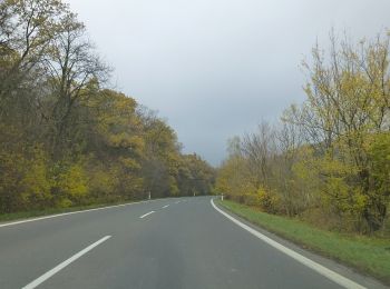
Les meilleurs parcours (3)
![Randonnée A pied okres Pezinok - Vinohradnícky náučný chodník - Photo](https://media.geolcdn.com/t/350/260/80ad6446-2348-40df-ba43-4ba3c84e22e7.jpeg&format=jpg&maxdim=2)
![A pied A pied](https://static1.geolcdn.com/sitytour/trail-icons/100.png)
Km
A pied
![](/images/other/stat-length.png)
![](https://static1.geolcdn.com/siteimages/upload/files/1508320355ic_sort_den_pos_24dp.png)
![](https://static1.geolcdn.com/siteimages/upload/files/1508320355ic_sort_den_neg_24dp.png)
![](https://static1.geolcdn.com/siteimages/upload/files/16400158638029165_repeat_loop_refresh_sync_direction_icon.png)
• Oficiálne stránky mesta Pezinok a MsÚ Pezinok Site web: https://www.pezinok.sk/?yggid=247
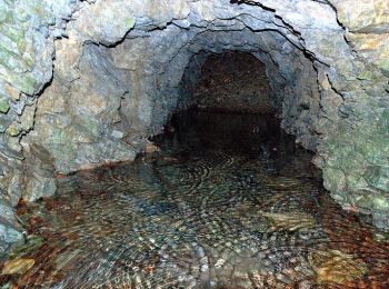
![Randonnée A pied okres Pezinok - Lesnícky náučný chodník Pece - Čertov kopec - Photo](https://media.geolcdn.com/t/350/260/f371d2e7-47c7-4a98-92af-3d410f42d94c.jpeg&format=jpg&maxdim=2)
![A pied A pied](https://static1.geolcdn.com/sitytour/trail-icons/100.png)
Km
A pied
![](/images/other/stat-length.png)
![](https://static1.geolcdn.com/siteimages/upload/files/1508320355ic_sort_den_pos_24dp.png)
![](https://static1.geolcdn.com/siteimages/upload/files/1508320355ic_sort_den_neg_24dp.png)
![](https://static1.geolcdn.com/siteimages/upload/files/16400158638029165_repeat_loop_refresh_sync_direction_icon.png)
• Symbole: education
![Randonnée A pied okres Pezinok - Banský náučný chodník Pezinok - Photo](https://media.geolcdn.com/t/350/260/431eec12-faff-4131-83e9-afc7795f228a.jpeg&format=jpg&maxdim=2)
![A pied A pied](https://static1.geolcdn.com/sitytour/trail-icons/100.png)
Km
A pied
![](/images/other/stat-length.png)
![](https://static1.geolcdn.com/siteimages/upload/files/1508320355ic_sort_den_pos_24dp.png)
![](https://static1.geolcdn.com/siteimages/upload/files/1508320355ic_sort_den_neg_24dp.png)
![](https://static1.geolcdn.com/siteimages/upload/files/16400158638029165_repeat_loop_refresh_sync_direction_icon.png)
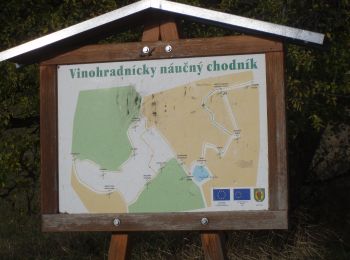
• Randonnée créée par Malokarpatský banícky spolok. Symbole: education
3 randonnées affichées sur 3
Application GPS de randonnée GRATUITE