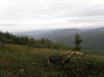
![](/images/other/stat-length.png)
- Randonnées
- Outdoor
- Slovaquie
- Région de Trenčín
Région de Trenčín, Slovaquie : Les meilleures randonnées, itinéraires, parcours, balades et promenades
Région de Trenčín : découvrez les meilleures randonnées : 46 pédestres. Tous ces circuits, parcours, itinéraires et activités en plein air sont disponibles dans nos applications SityTrail pour smartphones et tablettes.
Les meilleurs parcours (46)
![Randonnée A pied okres Nové Mesto nad Váhom - Náučný chodník Brestovec - Stará Myjava - Topolecká - Photo](https://media.geolcdn.com/t/350/260/0f1a443f-2206-4c7f-8559-a63027eb9211.jpeg&format=jpg&maxdim=2)
![A pied A pied](https://static1.geolcdn.com/sitytour/trail-icons/100.png)
Km
A pied
![](/images/other/stat-length.png)
![](https://static1.geolcdn.com/siteimages/upload/files/1508320355ic_sort_den_pos_24dp.png)
![](https://static1.geolcdn.com/siteimages/upload/files/1508320355ic_sort_den_neg_24dp.png)
![](https://static1.geolcdn.com/siteimages/upload/files/16400158638029165_repeat_loop_refresh_sync_direction_icon.png)
• Symbole: education
![Randonnée A pied okres Trenčín - Jastrabská](https://media.geolcdn.com/t/350/260/f5d2ba1c-1e38-4c67-a22d-c29bd6bc1e9a.jpeg&format=jpg&maxdim=2)
![A pied A pied](https://static1.geolcdn.com/sitytour/trail-icons/100.png)
Km
A pied
![](/images/other/stat-length.png)
![](https://static1.geolcdn.com/siteimages/upload/files/1508320355ic_sort_den_pos_24dp.png)
![](https://static1.geolcdn.com/siteimages/upload/files/1508320355ic_sort_den_neg_24dp.png)
![](https://static1.geolcdn.com/siteimages/upload/files/16400158638029165_repeat_loop_refresh_sync_direction_icon.png)
• Randonnée créée par Obec Trenčianske Jastrabie. Symbole: white:black
![Randonnée A pied okres Trenčín - IVV6 - VLADOV CHODNÍK (maratónska trasa) - Photo](https://media.geolcdn.com/t/350/260/6431251b-aa09-4a8f-af79-8add328de865.jpeg&format=jpg&maxdim=2)
![A pied A pied](https://static1.geolcdn.com/sitytour/trail-icons/100.png)
Km
A pied
![](/images/other/stat-length.png)
![](https://static1.geolcdn.com/siteimages/upload/files/1508320355ic_sort_den_pos_24dp.png)
![](https://static1.geolcdn.com/siteimages/upload/files/1508320355ic_sort_den_neg_24dp.png)
![](https://static1.geolcdn.com/siteimages/upload/files/16400158638029165_repeat_loop_refresh_sync_direction_icon.png)
• Randonnée créée par KST. Symbole: none
![Randonnée A pied okres Trenčín - Náučný chodník Putovanie za živou vodou - Photo](https://media.geolcdn.com/t/350/260/ac746b1f-6dc8-4b61-94b6-b4ce8051929e.jpeg&format=jpg&maxdim=2)
![A pied A pied](https://static1.geolcdn.com/sitytour/trail-icons/100.png)
Km
A pied
![](/images/other/stat-length.png)
![](https://static1.geolcdn.com/siteimages/upload/files/1508320355ic_sort_den_pos_24dp.png)
![](https://static1.geolcdn.com/siteimages/upload/files/1508320355ic_sort_den_neg_24dp.png)
![](https://static1.geolcdn.com/siteimages/upload/files/16400158638029165_repeat_loop_refresh_sync_direction_icon.png)
• Symbole: none
![Randonnée A pied okres Považská Bystrica - SK-Local marking made by village Slopna. There are guidepost with defined color for paths, but without physical marking. There are no guideposts outside the Slopna territory even if the path is ending elsewhere. - Photo](https://media.geolcdn.com/t/350/260/c7c1c3c4-4fca-4c0a-906b-a25ff26e4233.jpeg&format=jpg&maxdim=2)
![A pied A pied](https://static1.geolcdn.com/sitytour/trail-icons/100.png)
Km
A pied
![](/images/other/stat-length.png)
![](https://static1.geolcdn.com/siteimages/upload/files/1508320355ic_sort_den_pos_24dp.png)
![](https://static1.geolcdn.com/siteimages/upload/files/1508320355ic_sort_den_neg_24dp.png)
![](https://static1.geolcdn.com/siteimages/upload/files/16400158638029165_repeat_loop_refresh_sync_direction_icon.png)
• Randonnée créée par Obec Slopná. Local marking made by village Slopna. There are guidepost with defined color for pa...
![Randonnée A pied okres Trenčín - IVV5 - JANOV CHODNÍK (dlhá rodinná trasa) - Photo](https://media.geolcdn.com/t/350/260/4b9f1942-e6b0-405b-a1d0-c332aba9276a.jpeg&format=jpg&maxdim=2)
![A pied A pied](https://static1.geolcdn.com/sitytour/trail-icons/100.png)
Km
A pied
![](/images/other/stat-length.png)
![](https://static1.geolcdn.com/siteimages/upload/files/1508320355ic_sort_den_pos_24dp.png)
![](https://static1.geolcdn.com/siteimages/upload/files/1508320355ic_sort_den_neg_24dp.png)
![](https://static1.geolcdn.com/siteimages/upload/files/16400158638029165_repeat_loop_refresh_sync_direction_icon.png)
• Randonnée créée par KST. Symbole: none
![Randonnée A pied okres Trenčín - IVV4 - ANKIN CHODNÍK (stredná rodinná trasa) - Photo](https://media.geolcdn.com/t/350/260/4b9f1942-e6b0-405b-a1d0-c332aba9276a.jpeg&format=jpg&maxdim=2)
![A pied A pied](https://static1.geolcdn.com/sitytour/trail-icons/100.png)
Km
A pied
![](/images/other/stat-length.png)
![](https://static1.geolcdn.com/siteimages/upload/files/1508320355ic_sort_den_pos_24dp.png)
![](https://static1.geolcdn.com/siteimages/upload/files/1508320355ic_sort_den_neg_24dp.png)
![](https://static1.geolcdn.com/siteimages/upload/files/16400158638029165_repeat_loop_refresh_sync_direction_icon.png)
• Randonnée créée par KST. Symbole: none
![Randonnée A pied okres Trenčín - IVV3 - STANOV CHODNÍK (krátka rodinná trasa) - Photo](https://media.geolcdn.com/t/350/260/b6c4c4f3-797f-4a80-8ec5-cec452c9efff.jpeg&format=jpg&maxdim=2)
![A pied A pied](https://static1.geolcdn.com/sitytour/trail-icons/100.png)
Km
A pied
![](/images/other/stat-length.png)
![](https://static1.geolcdn.com/siteimages/upload/files/1508320355ic_sort_den_pos_24dp.png)
![](https://static1.geolcdn.com/siteimages/upload/files/1508320355ic_sort_den_neg_24dp.png)
![](https://static1.geolcdn.com/siteimages/upload/files/16400158638029165_repeat_loop_refresh_sync_direction_icon.png)
• Randonnée créée par KST. Symbole: none
![Randonnée A pied okres Trenčín - IVV2 - JIRKOV CHODNÍK (dôchodcovská trasa) - Photo](https://media.geolcdn.com/t/350/260/9d79371f-43e4-403b-88ef-047fd77a3821.jpeg&format=jpg&maxdim=2)
![A pied A pied](https://static1.geolcdn.com/sitytour/trail-icons/100.png)
Km
A pied
![](/images/other/stat-length.png)
![](https://static1.geolcdn.com/siteimages/upload/files/1508320355ic_sort_den_pos_24dp.png)
![](https://static1.geolcdn.com/siteimages/upload/files/1508320355ic_sort_den_neg_24dp.png)
![](https://static1.geolcdn.com/siteimages/upload/files/16400158638029165_repeat_loop_refresh_sync_direction_icon.png)
• Randonnée créée par KST. Symbole: none
![Randonnée A pied okres Trenčín - IVV1 - MARTIN CHODNÍK (kočíkova trasa) - Photo](https://media.geolcdn.com/t/350/260/2c914681-0078-4832-9751-40a0134d2d40.jpeg&format=jpg&maxdim=2)
![A pied A pied](https://static1.geolcdn.com/sitytour/trail-icons/100.png)
Km
A pied
![](/images/other/stat-length.png)
![](https://static1.geolcdn.com/siteimages/upload/files/1508320355ic_sort_den_pos_24dp.png)
![](https://static1.geolcdn.com/siteimages/upload/files/1508320355ic_sort_den_neg_24dp.png)
![](https://static1.geolcdn.com/siteimages/upload/files/16400158638029165_repeat_loop_refresh_sync_direction_icon.png)
• Randonnée créée par KST. Symbole: none
![Randonnée A pied okres Trenčín - Kyslíková dráha - Photo](https://media.geolcdn.com/t/350/260/2c914681-0078-4832-9751-40a0134d2d40.jpeg&format=jpg&maxdim=2)
![A pied A pied](https://static1.geolcdn.com/sitytour/trail-icons/100.png)
Km
A pied
![](/images/other/stat-length.png)
![](https://static1.geolcdn.com/siteimages/upload/files/1508320355ic_sort_den_pos_24dp.png)
![](https://static1.geolcdn.com/siteimages/upload/files/1508320355ic_sort_den_neg_24dp.png)
![](https://static1.geolcdn.com/siteimages/upload/files/16400158638029165_repeat_loop_refresh_sync_direction_icon.png)
• Symbole: major Site web: http://stary.trencin.sk/index.php?s-cv-contentID=12288&s-cv-embeddedID=kyslikova_draha
![Randonnée A pied okres Trenčín - Mitická dvadsiatka - TRASA D – 25 km - Photo](https://media.geolcdn.com/t/350/260/52631547-5193-4600-bf87-dfcdf8992972.jpeg&format=jpg&maxdim=2)
![A pied A pied](https://static1.geolcdn.com/sitytour/trail-icons/100.png)
Km
A pied
![](/images/other/stat-length.png)
![](https://static1.geolcdn.com/siteimages/upload/files/1508320355ic_sort_den_pos_24dp.png)
![](https://static1.geolcdn.com/siteimages/upload/files/1508320355ic_sort_den_neg_24dp.png)
![](https://static1.geolcdn.com/siteimages/upload/files/16400158638029165_repeat_loop_refresh_sync_direction_icon.png)
• https://www.trencianskemitice.sk/oznamy/miticka-dvadsiatka-2018.html Symbole: major Site web: https://www.trencian...
![Randonnée A pied okres Trenčín - Mitická dvadsiatka - TRASA A – 20 km - Photo](https://media.geolcdn.com/t/350/260/226136a2-7a13-4dbd-9b0a-4d3f6e52a39b.jpeg&format=jpg&maxdim=2)
![A pied A pied](https://static1.geolcdn.com/sitytour/trail-icons/100.png)
Km
A pied
![](/images/other/stat-length.png)
![](https://static1.geolcdn.com/siteimages/upload/files/1508320355ic_sort_den_pos_24dp.png)
![](https://static1.geolcdn.com/siteimages/upload/files/1508320355ic_sort_den_neg_24dp.png)
![](https://static1.geolcdn.com/siteimages/upload/files/16400158638029165_repeat_loop_refresh_sync_direction_icon.png)
• https://www.trencianskemitice.sk/oznamy/miticka-dvadsiatka-2018.html Symbole: major Site web: https://www.trencian...
![Randonnée A pied okres Trenčín - Mitická dvadsiatka - TRASA B – 10 km - Photo](https://media.geolcdn.com/t/350/260/226136a2-7a13-4dbd-9b0a-4d3f6e52a39b.jpeg&format=jpg&maxdim=2)
![A pied A pied](https://static1.geolcdn.com/sitytour/trail-icons/100.png)
Km
A pied
![](/images/other/stat-length.png)
![](https://static1.geolcdn.com/siteimages/upload/files/1508320355ic_sort_den_pos_24dp.png)
![](https://static1.geolcdn.com/siteimages/upload/files/1508320355ic_sort_den_neg_24dp.png)
![](https://static1.geolcdn.com/siteimages/upload/files/16400158638029165_repeat_loop_refresh_sync_direction_icon.png)
• https://www.trencianskemitice.sk/oznamy/miticka-dvadsiatka-2018.html Symbole: major Site web: https://www.trencian...
![Randonnée A pied okres Trenčín - Soblahovská 35-ka - Photo](https://media.geolcdn.com/t/350/260/b3692ef4-7d05-4222-8a83-8f116777015b.jpeg&format=jpg&maxdim=2)
![A pied A pied](https://static1.geolcdn.com/sitytour/trail-icons/100.png)
Km
A pied
![](/images/other/stat-length.png)
![](https://static1.geolcdn.com/siteimages/upload/files/1508320355ic_sort_den_pos_24dp.png)
![](https://static1.geolcdn.com/siteimages/upload/files/1508320355ic_sort_den_neg_24dp.png)
![](https://static1.geolcdn.com/siteimages/upload/files/16400158638029165_repeat_loop_refresh_sync_direction_icon.png)
• https://www.soblahov.sk/soblahovska-35-ka/ Symbole: major
![Randonnée A pied okres Trenčín - Soblahovská 35-ka - 15km okruh - Photo](https://media.geolcdn.com/t/350/260/3677c767-9a84-49bb-a0bc-68c9973250bf.jpeg&format=jpg&maxdim=2)
![A pied A pied](https://static1.geolcdn.com/sitytour/trail-icons/100.png)
Km
A pied
![](/images/other/stat-length.png)
![](https://static1.geolcdn.com/siteimages/upload/files/1508320355ic_sort_den_pos_24dp.png)
![](https://static1.geolcdn.com/siteimages/upload/files/1508320355ic_sort_den_neg_24dp.png)
![](https://static1.geolcdn.com/siteimages/upload/files/16400158638029165_repeat_loop_refresh_sync_direction_icon.png)
• https://www.soblahov.sk/soblahovska-35-ka/ Symbole: major
![Randonnée A pied okres Trenčín - Po skale na Baske - Photo](https://media.geolcdn.com/t/350/260/3bcd2c2a-781f-4d7e-b787-30bd1a2e6e03.jpeg&format=jpg&maxdim=2)
![A pied A pied](https://static1.geolcdn.com/sitytour/trail-icons/100.png)
Km
A pied
![](/images/other/stat-length.png)
![](https://static1.geolcdn.com/siteimages/upload/files/1508320355ic_sort_den_pos_24dp.png)
![](https://static1.geolcdn.com/siteimages/upload/files/1508320355ic_sort_den_neg_24dp.png)
![](https://static1.geolcdn.com/siteimages/upload/files/16400158638029165_repeat_loop_refresh_sync_direction_icon.png)
• Symbole: local
![Randonnée A pied okres Nové Mesto nad Váhom - Náučný chodník](https://media.geolcdn.com/t/350/260/78a70c3e-736c-4af8-ae10-1c85d80d0053.jpeg&format=jpg&maxdim=2)
![A pied A pied](https://static1.geolcdn.com/sitytour/trail-icons/100.png)
Km
A pied
![](/images/other/stat-length.png)
![](https://static1.geolcdn.com/siteimages/upload/files/1508320355ic_sort_den_pos_24dp.png)
![](https://static1.geolcdn.com/siteimages/upload/files/1508320355ic_sort_den_neg_24dp.png)
![](https://static1.geolcdn.com/siteimages/upload/files/16400158638029165_repeat_loop_refresh_sync_direction_icon.png)
• Symbole: education
![Randonnée A pied okres Trenčín - Náučný chodník Čvirigovec - Photo](https://media.geolcdn.com/t/350/260/adfed5d2-1eaf-4afd-b69b-d016f1dbb781.jpeg&format=jpg&maxdim=2)
![A pied A pied](https://static1.geolcdn.com/sitytour/trail-icons/100.png)
Km
A pied
![](/images/other/stat-length.png)
![](https://static1.geolcdn.com/siteimages/upload/files/1508320355ic_sort_den_pos_24dp.png)
![](https://static1.geolcdn.com/siteimages/upload/files/1508320355ic_sort_den_neg_24dp.png)
![](https://static1.geolcdn.com/siteimages/upload/files/16400158638029165_repeat_loop_refresh_sync_direction_icon.png)
• Symbole: education
![Randonnée A pied okres Myjava - Brezová - Košariská - Photo](https://media.geolcdn.com/t/350/260/3a263a23-42bf-442b-b573-4ba98f9dc3d7.jpeg&format=jpg&maxdim=2)
![A pied A pied](https://static1.geolcdn.com/sitytour/trail-icons/100.png)
Km
A pied
![](/images/other/stat-length.png)
![](https://static1.geolcdn.com/siteimages/upload/files/1508320355ic_sort_den_pos_24dp.png)
![](https://static1.geolcdn.com/siteimages/upload/files/1508320355ic_sort_den_neg_24dp.png)
![](https://static1.geolcdn.com/siteimages/upload/files/16400158638029165_repeat_loop_refresh_sync_direction_icon.png)
• Randonnée créée par KST. Symbole: education
20 randonnées affichées sur 46
Application GPS de randonnée GRATUITE