


5 km | 6,2 km-effort
Mértola : découvrez les meilleures randonnées : 3 pédestres. Tous ces circuits, parcours, itinéraires et activités en plein air sont disponibles dans nos applications SityTrail pour smartphones et tablettes.
A pied


• Deixando para trás a povoação de Corte Gafo de Baixo, o percurso segue por uma paisagem de montado de azinho que dá l...
A pied
• Randonnée créée par Parque Natural do Vale do Guadiana.

Marche
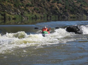
• bord du Guadiana
3 randonnées affichées sur 3
Application GPS de randonnée GRATUITE
 SityTrail
IGN / Instituts géographiques
SityTrail World
Le monde est à vous