


19 km | 31 km-effort
Nouvelle-Zélande : découvrez les 165 meilleurs circuits de randonnée pédestre ou à vélo. Notre catalogue préparé à la main par nos randonneurs regorge de superbes paysages qui n'attendent qu'à être explorés. Téléchargez ces itinéraires dans SityTrail, notre application de GPS de randonnée gratuite disponible sur Android et iOS.
A pied


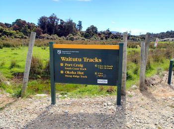
• Site web: https://en.wikipedia.org/wiki/Hump_Ridge_Track
A pied
• Site web: https://en.wikipedia.org/wiki/Hump_Ridge_Track
A pied
• Site web: https://en.wikipedia.org/wiki/Hump_Ridge_Track
A pied
• Randonnée créée par Department of Conservation.
A pied
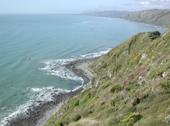
• Enjoy magnificent views over Banks Peninsula, the Canterbury plains, Southern Alps and Pacific Ocean on this track, w...
A pied
• Randonnée créée par Hutt City.
A pied
• "official" distance does not include ferry crossing of about 4 km from Devonport to CBD
A pied
• Site web: https://www.teararoa.org.nz/northland/
A pied
• Randonnée créée par Wellington City Council. Site web: https://wellington.govt.nz/recreation/enjoy-the-outdoors/wa...
A pied
• Randonnée créée par Wellington City Council.
A pied
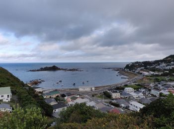
• Randonnée créée par Porirua City Council.
A pied
• Climb to a lookout for spectacular views, or continue to the summit of Mount Te Kinga. Site web: https://www.doc.gov...
A pied
• Randonnée créée par Porirua City Council. Site web: https://poriruacity.govt.nz/discover-porirua/walking-biking/wa...
A pied
• Randonnée créée par Bay of Islands Walkways Trust.
A pied
• Randonnée créée par Department of Conservation.
A pied
• Site web: http://tracks.org.nz/track/show/1358
A pied
• Randonnée créée par Department of Conservation.
A pied
• Randonnée créée par Wellington City Council from Wellington Station to Ngauranga and NZTA on to Johnsonville as part ...
A pied
• Randonnée créée par Nelson City Council.
A pied
• Randonnée créée par Department of Conservation.
20 randonnées affichées sur 165
Application GPS de randonnée GRATUITE
 SityTrail
IGN / Instituts géographiques
SityTrail World
Le monde est à vous