![](/images/other/stat-length.png)
- Randonnées
- Outdoor
- Italie
- Latium
- Rieti
Rieti, Latium : Les meilleures randonnées, itinéraires, parcours, balades et promenades
Rieti : découvrez les meilleures randonnées : 86 pédestres. Tous ces circuits, parcours, itinéraires et activités en plein air sont disponibles dans nos applications SityTrail pour smartphones et tablettes.
Les meilleurs parcours (86)
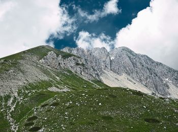
![Randonnée A pied Micigliano - Antrodoco - Micigliano - Rifugio](https://media.geolcdn.com/t/350/260/27749bdd-ee40-4758-80d6-57725fcd9955.jpeg&format=jpg&maxdim=2)
![A pied A pied](https://static1.geolcdn.com/sitytour/trail-icons/100.png)
Km
A pied
![](/images/other/stat-length.png)
![](https://static1.geolcdn.com/siteimages/upload/files/1508320355ic_sort_den_pos_24dp.png)
![](https://static1.geolcdn.com/siteimages/upload/files/1508320355ic_sort_den_neg_24dp.png)
![](https://static1.geolcdn.com/siteimages/upload/files/16400158638029165_repeat_loop_refresh_sync_direction_icon.png)
• Randonnée créée par CAI Antrodoco.
![Randonnée A pied Fara in Sabina - CAI 351: Fara Sabina - Farfa - Mompeo - Photo](https://media.geolcdn.com/t/350/260/f4a046e9-6c5d-4086-a904-56cda0881c33.jpeg&format=jpg&maxdim=2)
![A pied A pied](https://static1.geolcdn.com/sitytour/trail-icons/100.png)
Km
A pied
![](/images/other/stat-length.png)
![](https://static1.geolcdn.com/siteimages/upload/files/1508320355ic_sort_den_pos_24dp.png)
![](https://static1.geolcdn.com/siteimages/upload/files/1508320355ic_sort_den_neg_24dp.png)
![](https://static1.geolcdn.com/siteimages/upload/files/16400158638029165_repeat_loop_refresh_sync_direction_icon.png)
• Randonnée créée par CAI.
![Randonnée A pied Poggio Bustone - Poggio Bustone – Prati S.Giacomo – Cima D’Arme - Photo](https://media.geolcdn.com/t/350/260/c0ba222b-6684-4839-8ebc-870418c68057.jpeg&format=jpg&maxdim=2)
![A pied A pied](https://static1.geolcdn.com/sitytour/trail-icons/100.png)
Km
A pied
![](/images/other/stat-length.png)
![](https://static1.geolcdn.com/siteimages/upload/files/1508320355ic_sort_den_pos_24dp.png)
![](https://static1.geolcdn.com/siteimages/upload/files/1508320355ic_sort_den_neg_24dp.png)
![](https://static1.geolcdn.com/siteimages/upload/files/16400158638029165_repeat_loop_refresh_sync_direction_icon.png)
• Randonnée créée par CAI Rieti.
![Randonnée A pied Poggio Bustone - Poggio Bustone – Valle Petrinara – Cima D’Arme - Photo](https://media.geolcdn.com/t/350/260/f03f61ac-4410-4851-93d8-8c36e664aa61.jpeg&format=jpg&maxdim=2)
![A pied A pied](https://static1.geolcdn.com/sitytour/trail-icons/100.png)
Km
A pied
![](/images/other/stat-length.png)
![](https://static1.geolcdn.com/siteimages/upload/files/1508320355ic_sort_den_pos_24dp.png)
![](https://static1.geolcdn.com/siteimages/upload/files/1508320355ic_sort_den_neg_24dp.png)
![](https://static1.geolcdn.com/siteimages/upload/files/16400158638029165_repeat_loop_refresh_sync_direction_icon.png)
• Randonnée créée par CAI Rieti.
![Randonnée A pied Antrodoco - Antrodoco - Gole del Velino - Sigillo - Photo](https://media.geolcdn.com/t/350/260/9dfac350-c038-4785-afc9-0e33d73b32bc.jpeg&format=jpg&maxdim=2)
![A pied A pied](https://static1.geolcdn.com/sitytour/trail-icons/100.png)
Km
A pied
![](/images/other/stat-length.png)
![](https://static1.geolcdn.com/siteimages/upload/files/1508320355ic_sort_den_pos_24dp.png)
![](https://static1.geolcdn.com/siteimages/upload/files/1508320355ic_sort_den_neg_24dp.png)
![](https://static1.geolcdn.com/siteimages/upload/files/16400158638029165_repeat_loop_refresh_sync_direction_icon.png)
• Randonnée créée par CAI Antrodoco.
![Randonnée A pied Leonessa - Leonessa - Monte Tilia - Photo](https://media.geolcdn.com/t/350/260/640af0bf-5c36-48e2-b9e1-f8f936a98679.jpeg&format=jpg&maxdim=2)
![A pied A pied](https://static1.geolcdn.com/sitytour/trail-icons/100.png)
Km
A pied
![](/images/other/stat-length.png)
![](https://static1.geolcdn.com/siteimages/upload/files/1508320355ic_sort_den_pos_24dp.png)
![](https://static1.geolcdn.com/siteimages/upload/files/1508320355ic_sort_den_neg_24dp.png)
![](https://static1.geolcdn.com/siteimages/upload/files/16400158638029165_repeat_loop_refresh_sync_direction_icon.png)
• Randonnée créée par CAI Leonessa.
![Randonnée A pied Rocca Sinibalda - Rocca Sinibalda - Longone - Varco Sabino - Photo](https://media.geolcdn.com/t/350/260/c44fc386-8cd7-4ec3-bd23-081734fe6230.jpeg&format=jpg&maxdim=2)
![A pied A pied](https://static1.geolcdn.com/sitytour/trail-icons/100.png)
Km
A pied
![](/images/other/stat-length.png)
![](https://static1.geolcdn.com/siteimages/upload/files/1508320355ic_sort_den_pos_24dp.png)
![](https://static1.geolcdn.com/siteimages/upload/files/1508320355ic_sort_den_neg_24dp.png)
![](https://static1.geolcdn.com/siteimages/upload/files/16400158638029165_repeat_loop_refresh_sync_direction_icon.png)
• Randonnée créée par CAI.
![Randonnée A pied Paganico Sabino - Paganico – F.te Palumbo – Le Grotte - Photo](https://media.geolcdn.com/t/350/260/8ce38778-b0c7-470c-b2e2-04022ac56577.jpeg&format=jpg&maxdim=2)
![A pied A pied](https://static1.geolcdn.com/sitytour/trail-icons/100.png)
Km
A pied
![](/images/other/stat-length.png)
![](https://static1.geolcdn.com/siteimages/upload/files/1508320355ic_sort_den_pos_24dp.png)
![](https://static1.geolcdn.com/siteimages/upload/files/1508320355ic_sort_den_neg_24dp.png)
![](https://static1.geolcdn.com/siteimages/upload/files/16400158638029165_repeat_loop_refresh_sync_direction_icon.png)
• Randonnée créée par Riserva Navegna e Cervia.
![Randonnée A pied Ascrea - Ascrea – M.te Navegna - Photo](https://media.geolcdn.com/t/350/260/052e01d0-9453-444d-a88d-fe3f3cab3004.jpeg&format=jpg&maxdim=2)
![A pied A pied](https://static1.geolcdn.com/sitytour/trail-icons/100.png)
Km
A pied
![](/images/other/stat-length.png)
![](https://static1.geolcdn.com/siteimages/upload/files/1508320355ic_sort_den_pos_24dp.png)
![](https://static1.geolcdn.com/siteimages/upload/files/1508320355ic_sort_den_neg_24dp.png)
![](https://static1.geolcdn.com/siteimages/upload/files/16400158638029165_repeat_loop_refresh_sync_direction_icon.png)
• Randonnée créée par Riserva Navegna e Cervia.
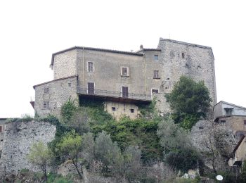
![Randonnée A pied Rocca Sinibalda - Castel di Tora - M.te Navegna - Photo](https://media.geolcdn.com/t/350/260/0298d2b1-7618-4813-be7d-472443354472.jpeg&format=jpg&maxdim=2)
![A pied A pied](https://static1.geolcdn.com/sitytour/trail-icons/100.png)
Km
A pied
![](/images/other/stat-length.png)
![](https://static1.geolcdn.com/siteimages/upload/files/1508320355ic_sort_den_pos_24dp.png)
![](https://static1.geolcdn.com/siteimages/upload/files/1508320355ic_sort_den_neg_24dp.png)
![](https://static1.geolcdn.com/siteimages/upload/files/16400158638029165_repeat_loop_refresh_sync_direction_icon.png)
• Randonnée créée par Riserva Navegna e Cervia.
![Randonnée A pied Ascrea - Ascrea - Mirandella - F.te le Forche - Photo](https://media.geolcdn.com/t/350/260/052e01d0-9453-444d-a88d-fe3f3cab3004.jpeg&format=jpg&maxdim=2)
![A pied A pied](https://static1.geolcdn.com/sitytour/trail-icons/100.png)
Km
A pied
![](/images/other/stat-length.png)
![](https://static1.geolcdn.com/siteimages/upload/files/1508320355ic_sort_den_pos_24dp.png)
![](https://static1.geolcdn.com/siteimages/upload/files/1508320355ic_sort_den_neg_24dp.png)
![](https://static1.geolcdn.com/siteimages/upload/files/16400158638029165_repeat_loop_refresh_sync_direction_icon.png)
• Randonnée créée par Riserva Navegna e Cervia.
![Randonnée A pied Paganico Sabino - Paganico - C.le Pobbio - M.te Cervia - Photo](https://media.geolcdn.com/t/350/260/052e01d0-9453-444d-a88d-fe3f3cab3004.jpeg&format=jpg&maxdim=2)
![A pied A pied](https://static1.geolcdn.com/sitytour/trail-icons/100.png)
Km
A pied
![](/images/other/stat-length.png)
![](https://static1.geolcdn.com/siteimages/upload/files/1508320355ic_sort_den_pos_24dp.png)
![](https://static1.geolcdn.com/siteimages/upload/files/1508320355ic_sort_den_neg_24dp.png)
![](https://static1.geolcdn.com/siteimages/upload/files/16400158638029165_repeat_loop_refresh_sync_direction_icon.png)
• Randonnée créée par Riserva Navegna e Cervia.
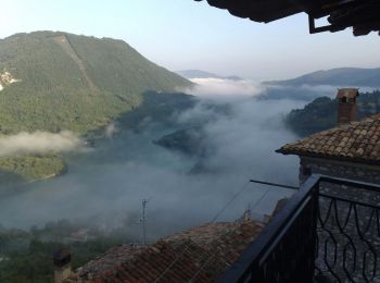
![Randonnée A pied Paganico Sabino - Paganico - Monte Cervia - Photo](https://media.geolcdn.com/t/350/260/8ce38778-b0c7-470c-b2e2-04022ac56577.jpeg&format=jpg&maxdim=2)
![A pied A pied](https://static1.geolcdn.com/sitytour/trail-icons/100.png)
Km
A pied
![](/images/other/stat-length.png)
![](https://static1.geolcdn.com/siteimages/upload/files/1508320355ic_sort_den_pos_24dp.png)
![](https://static1.geolcdn.com/siteimages/upload/files/1508320355ic_sort_den_neg_24dp.png)
![](https://static1.geolcdn.com/siteimages/upload/files/16400158638029165_repeat_loop_refresh_sync_direction_icon.png)
• Randonnée créée par Riserva Navegna e Cervia.
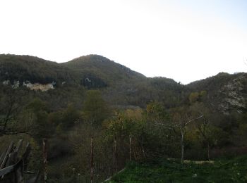
![Randonnée A pied Nespolo - Nespolo - Il Rio - Photo](https://media.geolcdn.com/t/350/260/861f28ca-efbd-4dad-9cac-6d4e1d2c6466.jpeg&format=jpg&maxdim=2)
![A pied A pied](https://static1.geolcdn.com/sitytour/trail-icons/100.png)
Km
A pied
![](/images/other/stat-length.png)
![](https://static1.geolcdn.com/siteimages/upload/files/1508320355ic_sort_den_pos_24dp.png)
![](https://static1.geolcdn.com/siteimages/upload/files/1508320355ic_sort_den_neg_24dp.png)
![](https://static1.geolcdn.com/siteimages/upload/files/16400158638029165_repeat_loop_refresh_sync_direction_icon.png)
• Randonnée créée par Riserva Navegna e Cervia.
![Randonnée A pied Collalto Sabino - Colle Martino - Nespolo - Photo](https://media.geolcdn.com/t/350/260/33012fb8-652d-41dd-9b15-94b2e26f5295.jpeg&format=jpg&maxdim=2)
![A pied A pied](https://static1.geolcdn.com/sitytour/trail-icons/100.png)
Km
A pied
![](/images/other/stat-length.png)
![](https://static1.geolcdn.com/siteimages/upload/files/1508320355ic_sort_den_pos_24dp.png)
![](https://static1.geolcdn.com/siteimages/upload/files/1508320355ic_sort_den_neg_24dp.png)
![](https://static1.geolcdn.com/siteimages/upload/files/16400158638029165_repeat_loop_refresh_sync_direction_icon.png)
• Randonnée créée par Riserva Navegna e Cervia.
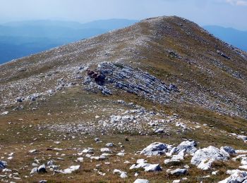
![Randonnée A pied Antrodoco - Rocca di Corno - Monte Nuria - Photo](https://media.geolcdn.com/t/350/260/da61dbdb-e134-4d03-91e5-77b260b6b00a.jpeg&format=jpg&maxdim=2)
![A pied A pied](https://static1.geolcdn.com/sitytour/trail-icons/100.png)
Km
A pied
![](/images/other/stat-length.png)
![](https://static1.geolcdn.com/siteimages/upload/files/1508320355ic_sort_den_pos_24dp.png)
![](https://static1.geolcdn.com/siteimages/upload/files/1508320355ic_sort_den_neg_24dp.png)
![](https://static1.geolcdn.com/siteimages/upload/files/16400158638029165_repeat_loop_refresh_sync_direction_icon.png)
• Randonnée créée par CAI Antrodoco.
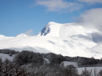
![Randonnée A pied Antrodoco - Antrodoco - Cinque Confini - Photo](https://media.geolcdn.com/t/350/260/ef46c7fe-759a-43cb-b00d-47058f4c8fc5.jpeg&format=jpg&maxdim=2)
![A pied A pied](https://static1.geolcdn.com/sitytour/trail-icons/100.png)
Km
A pied
![](/images/other/stat-length.png)
![](https://static1.geolcdn.com/siteimages/upload/files/1508320355ic_sort_den_pos_24dp.png)
![](https://static1.geolcdn.com/siteimages/upload/files/1508320355ic_sort_den_neg_24dp.png)
![](https://static1.geolcdn.com/siteimages/upload/files/16400158638029165_repeat_loop_refresh_sync_direction_icon.png)
• Randonnée créée par CAI Antrodoco.
![Randonnée A pied Leonessa - Fontenuova - Monte di Cambio - Photo](https://media.geolcdn.com/t/350/260/f45f8e24-f15d-4641-96af-6a0a3afcc8db.jpeg&format=jpg&maxdim=2)
![A pied A pied](https://static1.geolcdn.com/sitytour/trail-icons/100.png)
Km
A pied
![](/images/other/stat-length.png)
![](https://static1.geolcdn.com/siteimages/upload/files/1508320355ic_sort_den_pos_24dp.png)
![](https://static1.geolcdn.com/siteimages/upload/files/1508320355ic_sort_den_neg_24dp.png)
![](https://static1.geolcdn.com/siteimages/upload/files/16400158638029165_repeat_loop_refresh_sync_direction_icon.png)
• Randonnée créée par CAI Leonessa.
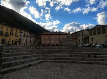
![Randonnée A pied Micigliano - Leonessa - Rifugio](https://media.geolcdn.com/t/350/260/0f17516f-14e6-4035-b1a8-1d0e6f0a48d3.jpeg&format=jpg&maxdim=2)
![A pied A pied](https://static1.geolcdn.com/sitytour/trail-icons/100.png)
Km
A pied
![](/images/other/stat-length.png)
![](https://static1.geolcdn.com/siteimages/upload/files/1508320355ic_sort_den_pos_24dp.png)
![](https://static1.geolcdn.com/siteimages/upload/files/1508320355ic_sort_den_neg_24dp.png)
![](https://static1.geolcdn.com/siteimages/upload/files/16400158638029165_repeat_loop_refresh_sync_direction_icon.png)
• Randonnée créée par CAI Leonessa.
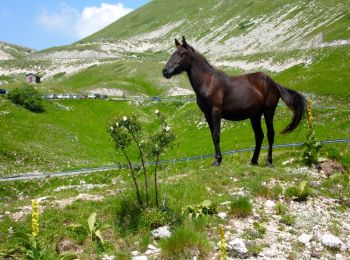
![Randonnée A pied Leonessa - Leonessa - Pian de' Valli - Photo](https://media.geolcdn.com/t/350/260/2c2b7146-0a32-485d-b97c-e652dbd2dfc5.jpeg&format=jpg&maxdim=2)
![A pied A pied](https://static1.geolcdn.com/sitytour/trail-icons/100.png)
Km
A pied
![](/images/other/stat-length.png)
![](https://static1.geolcdn.com/siteimages/upload/files/1508320355ic_sort_den_pos_24dp.png)
![](https://static1.geolcdn.com/siteimages/upload/files/1508320355ic_sort_den_neg_24dp.png)
![](https://static1.geolcdn.com/siteimages/upload/files/16400158638029165_repeat_loop_refresh_sync_direction_icon.png)
• Randonnée créée par CAI Rieti.
20 randonnées affichées sur 86
Application GPS de randonnée GRATUITE
Activités
Régions proches
- Accumoli
- Amatrice
- Antrodoco
- Ascrea
- Borgo Velino
- Borgorose
- Cantalice
- Cantalupo in Sabina
- Castel di Tora
- Castelnuovo di Farfa
- Cittaducale
- Cittareale
- Collalto Sabino
- Collegiove
- Collevecchio
- Contigliano
- Fara in Sabina
- Greccio
- Leonessa
- Marcetelli
- Micigliano
- Mompeo
- Montebuono
- Montopoli di Sabina
- Nespolo
- Orvinio
- Paganico Sabino
- Petrella Salto
- Poggio Bustone
- Poggio Catino
- Poggio Mirteto
- Poggio Moiano
- Poggio San Lorenzo
- Posta
- Rieti
- Rivodutri
- Rocca Sinibalda
- Scandriglia
- Selci
- Stimigliano
- Tarano
- Torri in Sabina
- Varco Sabino