![](/images/other/stat-length.png)
- Randonnées
- Outdoor
- Italie
- Lombardie
- Brescia
- Borno
Borno, Brescia : Les meilleures randonnées, itinéraires, parcours, balades et promenades
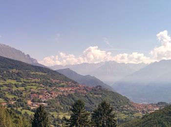
Borno : découvrez les meilleures randonnées : 32 pédestres. Tous ces circuits, parcours, itinéraires et activités en plein air sont disponibles dans nos applications SityTrail pour smartphones et tablettes.
Les meilleurs parcours (32)
![Randonnée A pied Borno - Sentiero delle pietre e degli Dei - Photo](https://media.geolcdn.com/t/350/260/3faf213d-3b46-4728-b8d4-0365a279735a.jpeg&format=jpg&maxdim=2)
![A pied A pied](https://static1.geolcdn.com/sitytour/trail-icons/100.png)
Km
A pied
![](/images/other/stat-length.png)
![](https://static1.geolcdn.com/siteimages/upload/files/1508320355ic_sort_den_pos_24dp.png)
![](https://static1.geolcdn.com/siteimages/upload/files/1508320355ic_sort_den_neg_24dp.png)
![](https://static1.geolcdn.com/siteimages/upload/files/16400158638029165_repeat_loop_refresh_sync_direction_icon.png)
• Descrizione del percorso: Da Piazza Giovanni Paolo II percorrere via Vittorio Emanuele e imboccare viale Marconi. Olt...
![Randonnée A pied Borno - Trekking dell'Altopiano del Sole - Photo](https://media.geolcdn.com/t/350/260/726c06fc-babe-4740-aace-a8f70bd7bade.jpeg&format=jpg&maxdim=2)
![A pied A pied](https://static1.geolcdn.com/sitytour/trail-icons/100.png)
Km
A pied
![](/images/other/stat-length.png)
![](https://static1.geolcdn.com/siteimages/upload/files/1508320355ic_sort_den_pos_24dp.png)
![](https://static1.geolcdn.com/siteimages/upload/files/1508320355ic_sort_den_neg_24dp.png)
![](https://static1.geolcdn.com/siteimages/upload/files/16400158638029165_repeat_loop_refresh_sync_direction_icon.png)
• Randonnée créée par GAL Val di Scalve Vallecamonica. Symbole: unmarked
![Randonnée A pied Borno - Trekking tra malghe e menhir anello 8: Trekking menhir e incisioni rupestri - Photo](https://media.geolcdn.com/t/350/260/3faf213d-3b46-4728-b8d4-0365a279735a.jpeg&format=jpg&maxdim=2)
![A pied A pied](https://static1.geolcdn.com/sitytour/trail-icons/100.png)
Km
A pied
![](/images/other/stat-length.png)
![](https://static1.geolcdn.com/siteimages/upload/files/1508320355ic_sort_den_pos_24dp.png)
![](https://static1.geolcdn.com/siteimages/upload/files/1508320355ic_sort_den_neg_24dp.png)
![](https://static1.geolcdn.com/siteimages/upload/files/16400158638029165_repeat_loop_refresh_sync_direction_icon.png)
• Randonnée créée par Consorzio Forestale Pizzo Camino. Symbole: unmarked
![Randonnée A pied Borno - Sentiero dei ciclamini - Photo](https://media.geolcdn.com/t/350/260/6caa6a28-6de0-4006-91a2-073524dfb97f.jpeg&format=jpg&maxdim=2)
![A pied A pied](https://static1.geolcdn.com/sitytour/trail-icons/100.png)
Km
A pied
![](/images/other/stat-length.png)
![](https://static1.geolcdn.com/siteimages/upload/files/1508320355ic_sort_den_pos_24dp.png)
![](https://static1.geolcdn.com/siteimages/upload/files/1508320355ic_sort_den_neg_24dp.png)
![](https://static1.geolcdn.com/siteimages/upload/files/16400158638029165_repeat_loop_refresh_sync_direction_icon.png)
• Descrizione del percorso: Da Piazza Giovanni Paolo II costeggiare il lato destro del Municipio e percorre via Fonte P...
![Randonnée A pied Borno - Sentiero del Paradiso - Photo](https://media.geolcdn.com/t/350/260/3faf213d-3b46-4728-b8d4-0365a279735a.jpeg&format=jpg&maxdim=2)
![A pied A pied](https://static1.geolcdn.com/sitytour/trail-icons/100.png)
Km
A pied
![](/images/other/stat-length.png)
![](https://static1.geolcdn.com/siteimages/upload/files/1508320355ic_sort_den_pos_24dp.png)
![](https://static1.geolcdn.com/siteimages/upload/files/1508320355ic_sort_den_neg_24dp.png)
![](https://static1.geolcdn.com/siteimages/upload/files/16400158638029165_repeat_loop_refresh_sync_direction_icon.png)
• Descrizione del percorso: Dal centro del paese si sale subito per Via S. Fermo. Alle frecce direzionali a destra per ...
![Randonnée A pied Borno - Sentiero del falco pellegrino - Photo](https://media.geolcdn.com/t/350/260/3faf213d-3b46-4728-b8d4-0365a279735a.jpeg&format=jpg&maxdim=2)
![A pied A pied](https://static1.geolcdn.com/sitytour/trail-icons/100.png)
Km
A pied
![](/images/other/stat-length.png)
![](https://static1.geolcdn.com/siteimages/upload/files/1508320355ic_sort_den_pos_24dp.png)
![](https://static1.geolcdn.com/siteimages/upload/files/1508320355ic_sort_den_neg_24dp.png)
![](https://static1.geolcdn.com/siteimages/upload/files/16400158638029165_repeat_loop_refresh_sync_direction_icon.png)
• Descrizione del percorso: Da Piazza Giovanni Paolo II percorrere via Vittorio Veneto per raggiungere la piazza della ...
![Randonnée A pied Borno - Sentiero delle streghe - Photo](https://media.geolcdn.com/t/350/260/2f4cdf68-26b7-4b33-9a1d-91910de23095.jpeg&format=jpg&maxdim=2)
![A pied A pied](https://static1.geolcdn.com/sitytour/trail-icons/100.png)
Km
A pied
![](/images/other/stat-length.png)
![](https://static1.geolcdn.com/siteimages/upload/files/1508320355ic_sort_den_pos_24dp.png)
![](https://static1.geolcdn.com/siteimages/upload/files/1508320355ic_sort_den_neg_24dp.png)
![](https://static1.geolcdn.com/siteimages/upload/files/16400158638029165_repeat_loop_refresh_sync_direction_icon.png)
• Descrizione del percorso: Da Piazza Giovanni Paolo II percorrere via Vittorio Emanuele e imboccare a sinistra viale M...
![Randonnée A pied Borno - Sentiero dei ruscelli canterini - Photo](https://media.geolcdn.com/t/350/260/826432c1-abe1-42db-a2fa-57f4ba06f92e.jpeg&format=jpg&maxdim=2)
![A pied A pied](https://static1.geolcdn.com/sitytour/trail-icons/100.png)
Km
A pied
![](/images/other/stat-length.png)
![](https://static1.geolcdn.com/siteimages/upload/files/1508320355ic_sort_den_pos_24dp.png)
![](https://static1.geolcdn.com/siteimages/upload/files/1508320355ic_sort_den_neg_24dp.png)
![](https://static1.geolcdn.com/siteimages/upload/files/16400158638029165_repeat_loop_refresh_sync_direction_icon.png)
• Descrizione del percorso: Da Piazza Giovanni Paolo II percorrere via Vittorio Veneto per raggiungere la piazza della ...
![Randonnée A pied Borno - Sentiero sogno Presolana - Photo](https://media.geolcdn.com/t/350/260/3faf213d-3b46-4728-b8d4-0365a279735a.jpeg&format=jpg&maxdim=2)
![A pied A pied](https://static1.geolcdn.com/sitytour/trail-icons/100.png)
Km
A pied
![](/images/other/stat-length.png)
![](https://static1.geolcdn.com/siteimages/upload/files/1508320355ic_sort_den_pos_24dp.png)
![](https://static1.geolcdn.com/siteimages/upload/files/1508320355ic_sort_den_neg_24dp.png)
![](https://static1.geolcdn.com/siteimages/upload/files/16400158638029165_repeat_loop_refresh_sync_direction_icon.png)
• Descrizione del percorso: Da Piazza Giovanni Paolo II percorrere via Vittorio Veneto per raggiungere località Dassa. ...
![Randonnée A pied Borno - Sentiero delle Palete - Photo](https://media.geolcdn.com/t/350/260/3faf213d-3b46-4728-b8d4-0365a279735a.jpeg&format=jpg&maxdim=2)
![A pied A pied](https://static1.geolcdn.com/sitytour/trail-icons/100.png)
Km
A pied
![](/images/other/stat-length.png)
![](https://static1.geolcdn.com/siteimages/upload/files/1508320355ic_sort_den_pos_24dp.png)
![](https://static1.geolcdn.com/siteimages/upload/files/1508320355ic_sort_den_neg_24dp.png)
![](https://static1.geolcdn.com/siteimages/upload/files/16400158638029165_repeat_loop_refresh_sync_direction_icon.png)
• Descrizione del percorso: Da Piazza Giovanni Paolo II percorrere via San Fermo sino alle frecce direzionali, seguire ...
![Randonnée A pied Borno - Sentiero dell'insolito comignolo - Photo](https://media.geolcdn.com/t/350/260/3faf213d-3b46-4728-b8d4-0365a279735a.jpeg&format=jpg&maxdim=2)
![A pied A pied](https://static1.geolcdn.com/sitytour/trail-icons/100.png)
Km
A pied
![](/images/other/stat-length.png)
![](https://static1.geolcdn.com/siteimages/upload/files/1508320355ic_sort_den_pos_24dp.png)
![](https://static1.geolcdn.com/siteimages/upload/files/1508320355ic_sort_den_neg_24dp.png)
![](https://static1.geolcdn.com/siteimages/upload/files/16400158638029165_repeat_loop_refresh_sync_direction_icon.png)
• Descrizione del percorso: Da Piazza Giovanni Paolo II percorrere via San Fermo sino alle frecce direzionali; seguire ...
![Randonnée A pied Borno - Percorso dell'acqua - Photo](https://media.geolcdn.com/t/350/260/826432c1-abe1-42db-a2fa-57f4ba06f92e.jpeg&format=jpg&maxdim=2)
![A pied A pied](https://static1.geolcdn.com/sitytour/trail-icons/100.png)
Km
A pied
![](/images/other/stat-length.png)
![](https://static1.geolcdn.com/siteimages/upload/files/1508320355ic_sort_den_pos_24dp.png)
![](https://static1.geolcdn.com/siteimages/upload/files/1508320355ic_sort_den_neg_24dp.png)
![](https://static1.geolcdn.com/siteimages/upload/files/16400158638029165_repeat_loop_refresh_sync_direction_icon.png)
• Randonnée créée par Comune di Borno. Symbole: unmarked
![Randonnée A pied Borno - Percorso dei frutti di bosco - Photo](https://media.geolcdn.com/t/350/260/59fa9449-978d-41cc-b299-f8989e9bfe34.jpeg&format=jpg&maxdim=2)
![A pied A pied](https://static1.geolcdn.com/sitytour/trail-icons/100.png)
Km
A pied
![](/images/other/stat-length.png)
![](https://static1.geolcdn.com/siteimages/upload/files/1508320355ic_sort_den_pos_24dp.png)
![](https://static1.geolcdn.com/siteimages/upload/files/1508320355ic_sort_den_neg_24dp.png)
![](https://static1.geolcdn.com/siteimages/upload/files/16400158638029165_repeat_loop_refresh_sync_direction_icon.png)
• Randonnée créée par Comune di Borno. Symbole: unmarked
![Randonnée A pied Borno - Sentiero degli abeti rossi - Photo](https://media.geolcdn.com/t/350/260/3faf213d-3b46-4728-b8d4-0365a279735a.jpeg&format=jpg&maxdim=2)
![A pied A pied](https://static1.geolcdn.com/sitytour/trail-icons/100.png)
Km
A pied
![](/images/other/stat-length.png)
![](https://static1.geolcdn.com/siteimages/upload/files/1508320355ic_sort_den_pos_24dp.png)
![](https://static1.geolcdn.com/siteimages/upload/files/1508320355ic_sort_den_neg_24dp.png)
![](https://static1.geolcdn.com/siteimages/upload/files/16400158638029165_repeat_loop_refresh_sync_direction_icon.png)
• Descrizione del percorso: Da Piazza Giovanni Paolo II percorrere via San Fermo sino alle frecce direzionali: sceglier...
![Randonnée A pied Borno - Trekking tra malghe e menhir anello 5: Mignone - Agolo - Averta - Photo](https://media.geolcdn.com/t/350/260/3faf213d-3b46-4728-b8d4-0365a279735a.jpeg&format=jpg&maxdim=2)
![A pied A pied](https://static1.geolcdn.com/sitytour/trail-icons/100.png)
Km
A pied
![](/images/other/stat-length.png)
![](https://static1.geolcdn.com/siteimages/upload/files/1508320355ic_sort_den_pos_24dp.png)
![](https://static1.geolcdn.com/siteimages/upload/files/1508320355ic_sort_den_neg_24dp.png)
![](https://static1.geolcdn.com/siteimages/upload/files/16400158638029165_repeat_loop_refresh_sync_direction_icon.png)
• Randonnée créée par Consorzio Forestale Pizzo Camino. Symbole: unmarked
![Randonnée A pied Borno - Trekking tra malghe e menhir anello 2: Mine - Monte Altissimo - Plai - Borno - Photo](https://media.geolcdn.com/t/350/260/826432c1-abe1-42db-a2fa-57f4ba06f92e.jpeg&format=jpg&maxdim=2)
![A pied A pied](https://static1.geolcdn.com/sitytour/trail-icons/100.png)
Km
A pied
![](/images/other/stat-length.png)
![](https://static1.geolcdn.com/siteimages/upload/files/1508320355ic_sort_den_pos_24dp.png)
![](https://static1.geolcdn.com/siteimages/upload/files/1508320355ic_sort_den_neg_24dp.png)
![](https://static1.geolcdn.com/siteimages/upload/files/16400158638029165_repeat_loop_refresh_sync_direction_icon.png)
• Randonnée créée par Consorzio Forestale Pizzo Camino. Symbole: unmarked
![Randonnée A pied Borno - Trekking tra malghe e menhir anello 4: Borno - Zumella - Moren - Photo](https://media.geolcdn.com/t/350/260/4219e119-1904-415d-b4b6-4ff158207711.jpeg&format=jpg&maxdim=2)
![A pied A pied](https://static1.geolcdn.com/sitytour/trail-icons/100.png)
Km
A pied
![](/images/other/stat-length.png)
![](https://static1.geolcdn.com/siteimages/upload/files/1508320355ic_sort_den_pos_24dp.png)
![](https://static1.geolcdn.com/siteimages/upload/files/1508320355ic_sort_den_neg_24dp.png)
![](https://static1.geolcdn.com/siteimages/upload/files/16400158638029165_repeat_loop_refresh_sync_direction_icon.png)
• Randonnée créée par Consorzio Forestale Pizzo Camino. Symbole: unmarked
![Randonnée A pied Borno - Percorso della memoria - Photo](https://media.geolcdn.com/t/350/260/4219e119-1904-415d-b4b6-4ff158207711.jpeg&format=jpg&maxdim=2)
![A pied A pied](https://static1.geolcdn.com/sitytour/trail-icons/100.png)
Km
A pied
![](/images/other/stat-length.png)
![](https://static1.geolcdn.com/siteimages/upload/files/1508320355ic_sort_den_pos_24dp.png)
![](https://static1.geolcdn.com/siteimages/upload/files/1508320355ic_sort_den_neg_24dp.png)
![](https://static1.geolcdn.com/siteimages/upload/files/16400158638029165_repeat_loop_refresh_sync_direction_icon.png)
• Randonnée créée par Comune di Borno. Symbole: unmarked
![Randonnée A pied Borno - Alta Via delle Orobie Orientali - Photo](https://media.geolcdn.com/t/350/260/3faf213d-3b46-4728-b8d4-0365a279735a.jpeg&format=jpg&maxdim=2)
![A pied A pied](https://static1.geolcdn.com/sitytour/trail-icons/100.png)
Km
A pied
![](/images/other/stat-length.png)
![](https://static1.geolcdn.com/siteimages/upload/files/1508320355ic_sort_den_pos_24dp.png)
![](https://static1.geolcdn.com/siteimages/upload/files/1508320355ic_sort_den_neg_24dp.png)
![](https://static1.geolcdn.com/siteimages/upload/files/16400158638029165_repeat_loop_refresh_sync_direction_icon.png)
• Randonnée créée par Club Alpino Italiano. DA COMPLETARE E VERIFICARE Symbole: 6 on white red flag
![Randonnée A pied Borno - Borno - Lazzaretti - Fonte Pizzoli - Balestrini - Photo](https://media.geolcdn.com/t/350/260/4219e119-1904-415d-b4b6-4ff158207711.jpeg&format=jpg&maxdim=2)
![A pied A pied](https://static1.geolcdn.com/sitytour/trail-icons/100.png)
Km
A pied
![](/images/other/stat-length.png)
![](https://static1.geolcdn.com/siteimages/upload/files/1508320355ic_sort_den_pos_24dp.png)
![](https://static1.geolcdn.com/siteimages/upload/files/1508320355ic_sort_den_neg_24dp.png)
![](https://static1.geolcdn.com/siteimages/upload/files/16400158638029165_repeat_loop_refresh_sync_direction_icon.png)
• Randonnée créée par Club Alpino Italiano - Sezione di Borno. Symbole: 112 on white red flag
20 randonnées affichées sur 32
Application GPS de randonnée GRATUITE