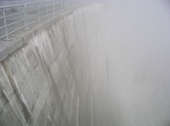
![](/images/other/stat-length.png)
- Randonnées
- Outdoor
- Italie
- Piémont
- Coni
Coni, Piémont : Les meilleures randonnées, itinéraires, parcours, balades et promenades
Coni : découvrez les meilleures randonnées : 411 pédestres et 20 à vélo ou VTT. Tous ces circuits, parcours, itinéraires et activités en plein air sont disponibles dans nos applications SityTrail pour smartphones et tablettes.
Les meilleurs parcours (459)
![Randonnée Marche Pontechianale - ITALIE BELLINO CHIANALE . TOUR DU PAIN DU SUCRE . AR. O - Photo](https://media.geolcdn.com/t/350/260/605ee47c-e413-41ea-82a5-10806d48b77c.jpg&format=jpg&maxdim=2)
![Marche Marche](https://static1.geolcdn.com/sitytour/trail-icons/101.png)
Km
Marche
![](/images/other/stat-length.png)
![](https://static1.geolcdn.com/siteimages/upload/files/1508320355ic_sort_den_pos_24dp.png)
![](https://static1.geolcdn.com/siteimages/upload/files/1508320355ic_sort_den_neg_24dp.png)
![](https://static1.geolcdn.com/siteimages/upload/files/16400158638029165_repeat_loop_refresh_sync_direction_icon.png)
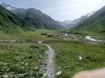
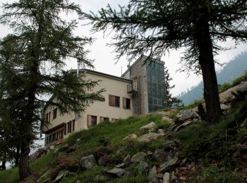
• AR PAS PU TRAVERSER TORRENT . PAS PU ALLER JUSQU AU REFUGE CAGLIARDONE
![Randonnée A pied Vinadio - Via Alpina Red R141 - Photo](https://media.geolcdn.com/t/350/260/e6824d5d-4c86-4be1-803c-c747aafeef5a.jpeg&format=jpg&maxdim=2)
![A pied A pied](https://static1.geolcdn.com/sitytour/trail-icons/100.png)
Km
A pied
![](/images/other/stat-length.png)
![](https://static1.geolcdn.com/siteimages/upload/files/1508320355ic_sort_den_pos_24dp.png)
![](https://static1.geolcdn.com/siteimages/upload/files/1508320355ic_sort_den_neg_24dp.png)
![](https://static1.geolcdn.com/siteimages/upload/files/16400158638029165_repeat_loop_refresh_sync_direction_icon.png)
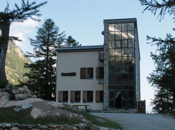
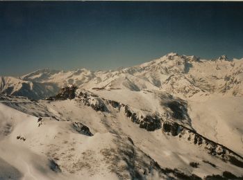
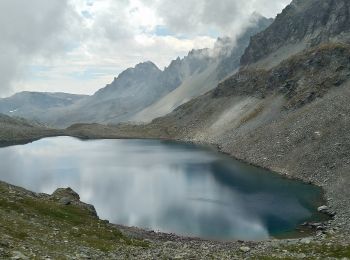
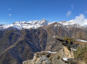
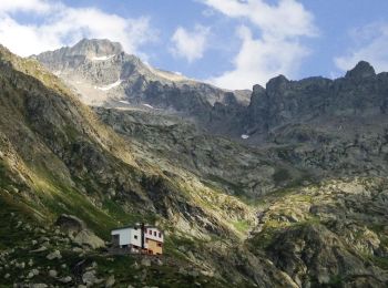
• From the Malinvern hut a steep trail, through larch woods and pastures, climbs to Lake Malinvern, continues along scr...
![Randonnée A pied Limone Piemonte - IT01 - Giro della Veuva - Photo](https://media.geolcdn.com/t/350/260/8539e04b-7adb-4491-a672-d3abcacf1a5f.jpeg&format=jpg&maxdim=2)
![A pied A pied](https://static1.geolcdn.com/sitytour/trail-icons/100.png)
Km
A pied
![](/images/other/stat-length.png)
![](https://static1.geolcdn.com/siteimages/upload/files/1508320355ic_sort_den_pos_24dp.png)
![](https://static1.geolcdn.com/siteimages/upload/files/1508320355ic_sort_den_neg_24dp.png)
![](https://static1.geolcdn.com/siteimages/upload/files/16400158638029165_repeat_loop_refresh_sync_direction_icon.png)
• Site web: https://www.bwebmap.it/maps/limoneOutdoor/
![Randonnée A pied Vinadio - Tour du Lausfer - Photo](https://media.geolcdn.com/t/350/260/cc4c2b4d-e173-4a84-be7d-4686c9701dd6.jpeg&format=jpg&maxdim=2)
![A pied A pied](https://static1.geolcdn.com/sitytour/trail-icons/100.png)
Km
A pied
![](/images/other/stat-length.png)
![](https://static1.geolcdn.com/siteimages/upload/files/1508320355ic_sort_den_pos_24dp.png)
![](https://static1.geolcdn.com/siteimages/upload/files/1508320355ic_sort_den_neg_24dp.png)
![](https://static1.geolcdn.com/siteimages/upload/files/16400158638029165_repeat_loop_refresh_sync_direction_icon.png)
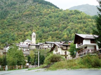
• Randonnée pédestre - Haut pays : Au départ du Sanctuaire de Sainte-Anne (2 035 mètres) Site web: https://randoxygene...
![Randonnée A pied Limone Piemonte - FR-L50 - Photo](https://media.geolcdn.com/t/350/260/6d3ea39a-115a-45b8-b72b-affc956c7cc8.jpeg&format=jpg&maxdim=2)
![A pied A pied](https://static1.geolcdn.com/sitytour/trail-icons/100.png)
Km
A pied
![](/images/other/stat-length.png)
![](https://static1.geolcdn.com/siteimages/upload/files/1508320355ic_sort_den_pos_24dp.png)
![](https://static1.geolcdn.com/siteimages/upload/files/1508320355ic_sort_den_neg_24dp.png)
![](https://static1.geolcdn.com/siteimages/upload/files/16400158638029165_repeat_loop_refresh_sync_direction_icon.png)
• Symbole: some old white red flags
![Randonnée A pied La Morra - Sentiero di Sant'Anna - Photo](https://media.geolcdn.com/t/350/260/c6c15de5-98fe-4fd6-b39b-77646a38f995.jpeg&format=jpg&maxdim=2)
![A pied A pied](https://static1.geolcdn.com/sitytour/trail-icons/100.png)
Km
A pied
![](/images/other/stat-length.png)
![](https://static1.geolcdn.com/siteimages/upload/files/1508320355ic_sort_den_pos_24dp.png)
![](https://static1.geolcdn.com/siteimages/upload/files/1508320355ic_sort_den_neg_24dp.png)
![](https://static1.geolcdn.com/siteimages/upload/files/16400158638029165_repeat_loop_refresh_sync_direction_icon.png)
• Club Alpino Italiano Sezione di SEREGNO
![Randonnée A pied Costigliole Saluzzo - ECNAU920000 - Photo](https://media.geolcdn.com/t/350/260/0a6d470f-ed26-4948-8211-150b5c98c3bd.jpeg&format=jpg&maxdim=2)
![A pied A pied](https://static1.geolcdn.com/sitytour/trail-icons/100.png)
Km
A pied
![](/images/other/stat-length.png)
![](https://static1.geolcdn.com/siteimages/upload/files/1508320355ic_sort_den_pos_24dp.png)
![](https://static1.geolcdn.com/siteimages/upload/files/1508320355ic_sort_den_neg_24dp.png)
![](https://static1.geolcdn.com/siteimages/upload/files/16400158638029165_repeat_loop_refresh_sync_direction_icon.png)
• Symbole: U92 on white red flag
![Randonnée A pied Chiusa di Pesio - (SI E05) Rifugio Garelli - Limonetto - Photo](https://media.geolcdn.com/t/350/260/f5d9b28a-d5c2-4d89-a74f-6caf7a60659c.jpeg&format=jpg&maxdim=2)
![A pied A pied](https://static1.geolcdn.com/sitytour/trail-icons/100.png)
Km
A pied
![](/images/other/stat-length.png)
![](https://static1.geolcdn.com/siteimages/upload/files/1508320355ic_sort_den_pos_24dp.png)
![](https://static1.geolcdn.com/siteimages/upload/files/1508320355ic_sort_den_neg_24dp.png)
![](https://static1.geolcdn.com/siteimages/upload/files/16400158638029165_repeat_loop_refresh_sync_direction_icon.png)
• Sentiero Italia CAI 2019
![Randonnée A pied Garessio - (SI G28V) Colle San Bernardo di Garessio (bivio A26) - Garessio - Photo](https://media.geolcdn.com/t/350/260/7241f45b-c605-4031-bd7e-5fe119376cbd.jpeg&format=jpg&maxdim=2)
![A pied A pied](https://static1.geolcdn.com/sitytour/trail-icons/100.png)
Km
A pied
![](/images/other/stat-length.png)
![](https://static1.geolcdn.com/siteimages/upload/files/1508320355ic_sort_den_pos_24dp.png)
![](https://static1.geolcdn.com/siteimages/upload/files/1508320355ic_sort_den_neg_24dp.png)
![](https://static1.geolcdn.com/siteimages/upload/files/16400158638029165_repeat_loop_refresh_sync_direction_icon.png)
• Sentiero Italia CAI 2019
![Randonnée A pied La Morra - Sentiero delle Grandi Vigne - Photo](https://media.geolcdn.com/t/350/260/43d3d41a-5f8e-4719-8944-ef0d3221c9db.jpeg&format=jpg&maxdim=2)
![A pied A pied](https://static1.geolcdn.com/sitytour/trail-icons/100.png)
Km
A pied
![](/images/other/stat-length.png)
![](https://static1.geolcdn.com/siteimages/upload/files/1508320355ic_sort_den_pos_24dp.png)
![](https://static1.geolcdn.com/siteimages/upload/files/1508320355ic_sort_den_neg_24dp.png)
![](https://static1.geolcdn.com/siteimages/upload/files/16400158638029165_repeat_loop_refresh_sync_direction_icon.png)
• Club Alpino Italiano Sezione di SEREGNO
![Randonnée A pied Crissolo - (SI E22) Rifugio Quintino Sella - Rifugio Barbara Lowrie (Grange del Pis) - Photo](https://media.geolcdn.com/t/350/260/4eb9b25a-b061-458c-929f-b70437b5fe4d.jpeg&format=jpg&maxdim=2)
![A pied A pied](https://static1.geolcdn.com/sitytour/trail-icons/100.png)
Km
A pied
![](/images/other/stat-length.png)
![](https://static1.geolcdn.com/siteimages/upload/files/1508320355ic_sort_den_pos_24dp.png)
![](https://static1.geolcdn.com/siteimages/upload/files/1508320355ic_sort_den_neg_24dp.png)
![](https://static1.geolcdn.com/siteimages/upload/files/16400158638029165_repeat_loop_refresh_sync_direction_icon.png)
• Sentiero Italia CAI 2019
![Randonnée A pied Pontechianale - (SI E21) Pontechianale, Borgata Maddalena - Rifugio Quintino Sella - Photo](https://media.geolcdn.com/t/350/260/7397e95f-539c-46f0-a42e-fcf678024743.jpeg&format=jpg&maxdim=2)
![A pied A pied](https://static1.geolcdn.com/sitytour/trail-icons/100.png)
Km
A pied
![](/images/other/stat-length.png)
![](https://static1.geolcdn.com/siteimages/upload/files/1508320355ic_sort_den_pos_24dp.png)
![](https://static1.geolcdn.com/siteimages/upload/files/1508320355ic_sort_den_neg_24dp.png)
![](https://static1.geolcdn.com/siteimages/upload/files/16400158638029165_repeat_loop_refresh_sync_direction_icon.png)
• Sentiero Italia CAI 2019
![Randonnée A pied Stroppo - (SI E18) Bassura di Stroppo - Elva, Borgata Serre - Photo](https://media.geolcdn.com/t/350/260/cddae2e8-1d84-4dca-9895-2a80b3068013.jpeg&format=jpg&maxdim=2)
![A pied A pied](https://static1.geolcdn.com/sitytour/trail-icons/100.png)
Km
A pied
![](/images/other/stat-length.png)
![](https://static1.geolcdn.com/siteimages/upload/files/1508320355ic_sort_den_pos_24dp.png)
![](https://static1.geolcdn.com/siteimages/upload/files/1508320355ic_sort_den_neg_24dp.png)
![](https://static1.geolcdn.com/siteimages/upload/files/16400158638029165_repeat_loop_refresh_sync_direction_icon.png)
• Sentiero Italia CAI 2019
![Randonnée A pied Vinadio - (SI E13) Sant'Anna di Vinadio - Vinadio Frazione Strepeis - Photo](https://media.geolcdn.com/t/350/260/2964e30b-263b-42c3-aa1c-ecaafebd0df1.jpeg&format=jpg&maxdim=2)
![A pied A pied](https://static1.geolcdn.com/sitytour/trail-icons/100.png)
Km
A pied
![](/images/other/stat-length.png)
![](https://static1.geolcdn.com/siteimages/upload/files/1508320355ic_sort_den_pos_24dp.png)
![](https://static1.geolcdn.com/siteimages/upload/files/1508320355ic_sort_den_neg_24dp.png)
![](https://static1.geolcdn.com/siteimages/upload/files/16400158638029165_repeat_loop_refresh_sync_direction_icon.png)
• Sentiero Italia CAI 2019
![Randonnée A pied Sambuco - (SI E15) Sambuco - Santuario di San Magno - Photo](https://media.geolcdn.com/t/350/260/4bbd7aae-cef8-4376-a14d-eeffcf7171f3.jpeg&format=jpg&maxdim=2)
![A pied A pied](https://static1.geolcdn.com/sitytour/trail-icons/100.png)
Km
A pied
![](/images/other/stat-length.png)
![](https://static1.geolcdn.com/siteimages/upload/files/1508320355ic_sort_den_pos_24dp.png)
![](https://static1.geolcdn.com/siteimages/upload/files/1508320355ic_sort_den_neg_24dp.png)
![](https://static1.geolcdn.com/siteimages/upload/files/16400158638029165_repeat_loop_refresh_sync_direction_icon.png)
• Sentiero Italia CAI 2019
![Randonnée A pied Valdieri - (SI E11) Terme di Valdieri - Rifugio Citta' di Ceva al Malinvern - Photo](https://media.geolcdn.com/t/350/260/dda7d996-3e6c-4f32-87fa-c957c2add5ff.jpeg&format=jpg&maxdim=2)
![A pied A pied](https://static1.geolcdn.com/sitytour/trail-icons/100.png)
Km
A pied
![](/images/other/stat-length.png)
![](https://static1.geolcdn.com/siteimages/upload/files/1508320355ic_sort_den_pos_24dp.png)
![](https://static1.geolcdn.com/siteimages/upload/files/1508320355ic_sort_den_neg_24dp.png)
![](https://static1.geolcdn.com/siteimages/upload/files/16400158638029165_repeat_loop_refresh_sync_direction_icon.png)
• Sentiero Italia CAI 2019
![Randonnée A pied Vinadio - (SI E12) Rifugio Citta' di Ceva al Malinvern - Sant'Anna di Vinadio - Photo](https://media.geolcdn.com/t/350/260/e6824d5d-4c86-4be1-803c-c747aafeef5a.jpeg&format=jpg&maxdim=2)
![A pied A pied](https://static1.geolcdn.com/sitytour/trail-icons/100.png)
Km
A pied
![](/images/other/stat-length.png)
![](https://static1.geolcdn.com/siteimages/upload/files/1508320355ic_sort_den_pos_24dp.png)
![](https://static1.geolcdn.com/siteimages/upload/files/1508320355ic_sort_den_neg_24dp.png)
![](https://static1.geolcdn.com/siteimages/upload/files/16400158638029165_repeat_loop_refresh_sync_direction_icon.png)
• Sentiero Italia CAI 2019
![Randonnée A pied Entracque - (SI E09) Rifugio Rifugio Soria-Ellena - Rifugio Genova-Figari - Photo](https://media.geolcdn.com/t/350/260/ec6a9177-7d6a-4a25-935f-96e3a497e4d3.jpeg&format=jpg&maxdim=2)
![A pied A pied](https://static1.geolcdn.com/sitytour/trail-icons/100.png)
Km
A pied
![](/images/other/stat-length.png)
![](https://static1.geolcdn.com/siteimages/upload/files/1508320355ic_sort_den_pos_24dp.png)
![](https://static1.geolcdn.com/siteimages/upload/files/1508320355ic_sort_den_neg_24dp.png)
![](https://static1.geolcdn.com/siteimages/upload/files/16400158638029165_repeat_loop_refresh_sync_direction_icon.png)
• Sentiero Italia CAI 2019
![Randonnée A pied Entracque - (SI E08) Trinità - Rifugio Rifugio Soria-Ellena - Photo](https://media.geolcdn.com/t/350/260/9d870791-fa8d-43d0-852c-f44add602ffe.jpeg&format=jpg&maxdim=2)
![A pied A pied](https://static1.geolcdn.com/sitytour/trail-icons/100.png)
Km
A pied
![](/images/other/stat-length.png)
![](https://static1.geolcdn.com/siteimages/upload/files/1508320355ic_sort_den_pos_24dp.png)
![](https://static1.geolcdn.com/siteimages/upload/files/1508320355ic_sort_den_neg_24dp.png)
![](https://static1.geolcdn.com/siteimages/upload/files/16400158638029165_repeat_loop_refresh_sync_direction_icon.png)
• Sentiero Italia CAI 2019
![Randonnée A pied Ormea - (SI E03) Rifugio Mongioie - Rifugio Havis De Giorgio - Photo](https://media.geolcdn.com/t/350/260/90800e37-da92-47f1-a5c5-12ee9a586798.jpeg&format=jpg&maxdim=2)
![A pied A pied](https://static1.geolcdn.com/sitytour/trail-icons/100.png)
Km
A pied
![](/images/other/stat-length.png)
![](https://static1.geolcdn.com/siteimages/upload/files/1508320355ic_sort_den_pos_24dp.png)
![](https://static1.geolcdn.com/siteimages/upload/files/1508320355ic_sort_den_neg_24dp.png)
![](https://static1.geolcdn.com/siteimages/upload/files/16400158638029165_repeat_loop_refresh_sync_direction_icon.png)
• Sentiero Italia CAI 2019
20 randonnées affichées sur 459
Application GPS de randonnée GRATUITE
Activités
Régions proches
- Acceglio
- Aisone
- Alba
- Albaretto della Torre
- Argentera
- Arguello
- Bagnasco
- Bagnolo Piemonte
- Barbaresco
- Barge
- Barolo
- Battifollo
- Bellino
- Bene Vagienna
- Bernezzo
- Bonvicino
- Borgo San Dalmazzo
- Borgomale
- Boves
- Bra
- Briga Alta
- Brossasco
- Busca
- Canosio
- Caprauna
- Caraglio
- Cartignano
- Castagnito
- Castelletto Stura
- Castelmagno
- Castiglione Falletto
- Celle di Macra
- Ceresole Alba
- Cerreto Langhe
- Cervasca
- Cervere
- Châteaudauphin
- Cherasco
- Chiusa di Pesio
- Coni
- Cortemilia
- Cossano Belbo
- Costigliole Saluzzo
- Cravanzana
- Crissolo
- Demonte
- Diano d'Alba
- Dogliani
- Dronero
- Elva
- Entracque
- Envie
- Fossano
- Frabosa Sottana
- Gaiola
- Garessio
- Genola
- Gorzegno
- Grinzane Cavour
- La Morra
- Lequio Berria
- Lequio Tanaro
- Limone Piemonte
- Macra
- Manta
- Marmora
- Melle
- Moiola
- Monastero di Vasco
- Monforte d'Alba
- Montà
- Montaldo di Mondovì
- Montanera
- Montelupo Albese
- Montemale di Cuneo
- Monterosso Grana
- Monteu Roero
- Narzole
- Neive
- Novello
- Oncino
- Ormea
- Ostana
- Paesana
- Pamparato
- Peveragno
- Pietraporzio
- Piobesi d'Alba
- Pocapaglia
- Pontechianale
- Pradleves
- Prazzo
- Prunetto
- Rittana
- Roaschia
- Roccabruna
- Roccaforte Mondovì
- Roccasparvera
- Roccavione
- Roddino
- Rossana
- Saliceto
- Salmour
- Saluces
- Sambuco
- Sampeyre
- San Damiano Macra
- Sanfront
- Sant'Albano Stura
- Santo Stefano Belbo
- Savigliano
- Serralunga d'Alba
- Serravalle Langhe
- Sinio
- Somano
- Sommariva Perno
- Stroppo
- Treiso
- Trezzo Tinella
- Trinità
- Valdieri
- Valgrana
- Valloriate
- Verduno
- Vernante
- Vezza d'Alba
- Vignolo
- Villar San Costanzo
- Vinadio