![](/images/other/stat-length.png)
- Randonnées
- Outdoor
- Italie
- Toscane
- Prato
Prato, Toscane : Les meilleures randonnées, itinéraires, parcours, balades et promenades
Prato : découvrez les meilleures randonnées : 41 pédestres. Tous ces circuits, parcours, itinéraires et activités en plein air sont disponibles dans nos applications SityTrail pour smartphones et tablettes.
Les meilleurs parcours (41)
![Randonnée A pied Cantagallo - Sentiero CAI 16B - Sez. Prato - Photo](https://media.geolcdn.com/t/350/260/bd6df49a-5f41-4e92-9229-54a0259d152b.jpeg&format=jpg&maxdim=2)
![A pied A pied](https://static1.geolcdn.com/sitytour/trail-icons/100.png)
Km
A pied
![](/images/other/stat-length.png)
![](https://static1.geolcdn.com/siteimages/upload/files/1508320355ic_sort_den_pos_24dp.png)
![](https://static1.geolcdn.com/siteimages/upload/files/1508320355ic_sort_den_neg_24dp.png)
![](https://static1.geolcdn.com/siteimages/upload/files/16400158638029165_repeat_loop_refresh_sync_direction_icon.png)
• Randonnée créée par Club Alpino Italiano.
![Randonnée A pied Montemurlo - Sentiero CAI 12B - Sez. Prato - Photo](https://media.geolcdn.com/t/350/260/bef775d3-3f54-4e87-9c3d-840ffd72bb4d.jpeg&format=jpg&maxdim=2)
![A pied A pied](https://static1.geolcdn.com/sitytour/trail-icons/100.png)
Km
A pied
![](/images/other/stat-length.png)
![](https://static1.geolcdn.com/siteimages/upload/files/1508320355ic_sort_den_pos_24dp.png)
![](https://static1.geolcdn.com/siteimages/upload/files/1508320355ic_sort_den_neg_24dp.png)
![](https://static1.geolcdn.com/siteimages/upload/files/16400158638029165_repeat_loop_refresh_sync_direction_icon.png)
• Randonnée créée par Club Alpino Italiano. Symbole: red and white stripes
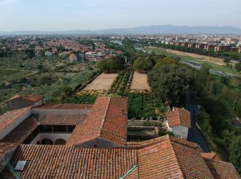
![Randonnée A pied Prato - Percorso pedecollinare - Photo](https://media.geolcdn.com/t/350/260/80d62f58-fc32-45b4-b36e-639f4b9b4cba.jpeg&format=jpg&maxdim=2)
![A pied A pied](https://static1.geolcdn.com/sitytour/trail-icons/100.png)
Km
A pied
![](/images/other/stat-length.png)
![](https://static1.geolcdn.com/siteimages/upload/files/1508320355ic_sort_den_pos_24dp.png)
![](https://static1.geolcdn.com/siteimages/upload/files/1508320355ic_sort_den_neg_24dp.png)
![](https://static1.geolcdn.com/siteimages/upload/files/16400158638029165_repeat_loop_refresh_sync_direction_icon.png)
• Randonnée créée par Comune di Prato.
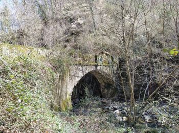
![Randonnée A pied Cantagallo - Sentiero CAI 38A - Sez. Prato - Photo](https://media.geolcdn.com/t/350/260/4b10be51-e798-4e5a-9ed2-55245ad910bf.jpeg&format=jpg&maxdim=2)
![A pied A pied](https://static1.geolcdn.com/sitytour/trail-icons/100.png)
Km
A pied
![](/images/other/stat-length.png)
![](https://static1.geolcdn.com/siteimages/upload/files/1508320355ic_sort_den_pos_24dp.png)
![](https://static1.geolcdn.com/siteimages/upload/files/1508320355ic_sort_den_neg_24dp.png)
![](https://static1.geolcdn.com/siteimages/upload/files/16400158638029165_repeat_loop_refresh_sync_direction_icon.png)
• Randonnée créée par Club Alpino Italiano.
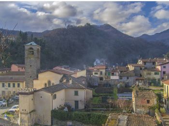
![Randonnée A pied Vernio - IT-58 - Photo](https://media.geolcdn.com/t/350/260/87e4160d-74cd-4f5a-882e-91d5685a05d3.jpeg&format=jpg&maxdim=2)
![A pied A pied](https://static1.geolcdn.com/sitytour/trail-icons/100.png)
Km
A pied
![](/images/other/stat-length.png)
![](https://static1.geolcdn.com/siteimages/upload/files/1508320355ic_sort_den_pos_24dp.png)
![](https://static1.geolcdn.com/siteimages/upload/files/1508320355ic_sort_den_neg_24dp.png)
![](https://static1.geolcdn.com/siteimages/upload/files/16400158638029165_repeat_loop_refresh_sync_direction_icon.png)
• Randonnée créée par CAI Prato.
![Randonnée A pied Vernio - (SI L11) Montepiano - Cascina di Spedaletto - Photo](https://media.geolcdn.com/t/350/260/17063757-2186-474e-8f86-3c2ec9b183d4.jpeg&format=jpg&maxdim=2)
![A pied A pied](https://static1.geolcdn.com/sitytour/trail-icons/100.png)
Km
A pied
![](/images/other/stat-length.png)
![](https://static1.geolcdn.com/siteimages/upload/files/1508320355ic_sort_den_pos_24dp.png)
![](https://static1.geolcdn.com/siteimages/upload/files/1508320355ic_sort_den_neg_24dp.png)
![](https://static1.geolcdn.com/siteimages/upload/files/16400158638029165_repeat_loop_refresh_sync_direction_icon.png)
• Sentiero Italia CAI 2019
![Randonnée A pied Cantagallo - IT-21A - Photo](https://media.geolcdn.com/t/350/260/1bfb7699-8bc7-419f-a5c9-1dd65c99257d.jpeg&format=jpg&maxdim=2)
![A pied A pied](https://static1.geolcdn.com/sitytour/trail-icons/100.png)
Km
A pied
![](/images/other/stat-length.png)
![](https://static1.geolcdn.com/siteimages/upload/files/1508320355ic_sort_den_pos_24dp.png)
![](https://static1.geolcdn.com/siteimages/upload/files/1508320355ic_sort_den_neg_24dp.png)
![](https://static1.geolcdn.com/siteimages/upload/files/16400158638029165_repeat_loop_refresh_sync_direction_icon.png)
• Randonnée créée par CAI Prato.
![Randonnée A pied Vernio - Sentiero CAI 27 - Se. Prato - Photo](https://media.geolcdn.com/t/350/260/989557dc-7de2-4d1c-96d8-793eaeeb7573.jpeg&format=jpg&maxdim=2)
![A pied A pied](https://static1.geolcdn.com/sitytour/trail-icons/100.png)
Km
A pied
![](/images/other/stat-length.png)
![](https://static1.geolcdn.com/siteimages/upload/files/1508320355ic_sort_den_pos_24dp.png)
![](https://static1.geolcdn.com/siteimages/upload/files/1508320355ic_sort_den_neg_24dp.png)
![](https://static1.geolcdn.com/siteimages/upload/files/16400158638029165_repeat_loop_refresh_sync_direction_icon.png)
• Randonnée créée par CAI Prato.
![Randonnée A pied Poggio a Caiano - Sentiero CAI 1 - Sez. Prato - Photo](https://media.geolcdn.com/t/350/260/0ae11e92-f6fd-4957-b727-3c8f6626dc7d.jpeg&format=jpg&maxdim=2)
![A pied A pied](https://static1.geolcdn.com/sitytour/trail-icons/100.png)
Km
A pied
![](/images/other/stat-length.png)
![](https://static1.geolcdn.com/siteimages/upload/files/1508320355ic_sort_den_pos_24dp.png)
![](https://static1.geolcdn.com/siteimages/upload/files/1508320355ic_sort_den_neg_24dp.png)
![](https://static1.geolcdn.com/siteimages/upload/files/16400158638029165_repeat_loop_refresh_sync_direction_icon.png)
• Randonnée créée par Club Alpino Italiano.
![Randonnée A pied Cantagallo - Sentiero CAI 21 - Sez. Prato - Photo](https://media.geolcdn.com/t/350/260/eceb1073-e55d-4a3f-9354-2cbbc377bcb7.jpeg&format=jpg&maxdim=2)
![A pied A pied](https://static1.geolcdn.com/sitytour/trail-icons/100.png)
Km
A pied
![](/images/other/stat-length.png)
![](https://static1.geolcdn.com/siteimages/upload/files/1508320355ic_sort_den_pos_24dp.png)
![](https://static1.geolcdn.com/siteimages/upload/files/1508320355ic_sort_den_neg_24dp.png)
![](https://static1.geolcdn.com/siteimages/upload/files/16400158638029165_repeat_loop_refresh_sync_direction_icon.png)
• Randonnée créée par CAI Prato.
![Randonnée A pied Vaiano - Sentiero CAI 14/A - Sez. Prato - Photo](https://media.geolcdn.com/t/350/260/36e4116d-5434-4dec-8b86-3b8c75361b38.jpeg&format=jpg&maxdim=2)
![A pied A pied](https://static1.geolcdn.com/sitytour/trail-icons/100.png)
Km
A pied
![](/images/other/stat-length.png)
![](https://static1.geolcdn.com/siteimages/upload/files/1508320355ic_sort_den_pos_24dp.png)
![](https://static1.geolcdn.com/siteimages/upload/files/1508320355ic_sort_den_neg_24dp.png)
![](https://static1.geolcdn.com/siteimages/upload/files/16400158638029165_repeat_loop_refresh_sync_direction_icon.png)
• Randonnée créée par Club Alpino Italiano.
![Randonnée A pied Cantagallo - Sentiero CAI 52 - Sez. Prato - Photo](https://media.geolcdn.com/t/350/260/12d82488-ef44-4298-957f-a055d917fdba.jpeg&format=jpg&maxdim=2)
![A pied A pied](https://static1.geolcdn.com/sitytour/trail-icons/100.png)
Km
A pied
![](/images/other/stat-length.png)
![](https://static1.geolcdn.com/siteimages/upload/files/1508320355ic_sort_den_pos_24dp.png)
![](https://static1.geolcdn.com/siteimages/upload/files/1508320355ic_sort_den_neg_24dp.png)
![](https://static1.geolcdn.com/siteimages/upload/files/16400158638029165_repeat_loop_refresh_sync_direction_icon.png)
• Randonnée créée par Club Alpino Italiano.
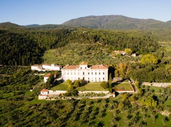
![Randonnée A pied Montemurlo - Sentiero CAI 12C - Sez. Prato - Photo](https://media.geolcdn.com/t/350/260/c7c60d45-0dfd-4ded-ac73-2a15c44ff12c.jpeg&format=jpg&maxdim=2)
![A pied A pied](https://static1.geolcdn.com/sitytour/trail-icons/100.png)
Km
A pied
![](/images/other/stat-length.png)
![](https://static1.geolcdn.com/siteimages/upload/files/1508320355ic_sort_den_pos_24dp.png)
![](https://static1.geolcdn.com/siteimages/upload/files/1508320355ic_sort_den_neg_24dp.png)
![](https://static1.geolcdn.com/siteimages/upload/files/16400158638029165_repeat_loop_refresh_sync_direction_icon.png)
• Randonnée créée par Club Alpino Italiano.
![Randonnée A pied Montemurlo - Sentiero CAI 70 - Sez. Prato - Photo](https://media.geolcdn.com/t/350/260/5506dcce-e8bf-4754-9a64-97346957515c.jpeg&format=jpg&maxdim=2)
![A pied A pied](https://static1.geolcdn.com/sitytour/trail-icons/100.png)
Km
A pied
![](/images/other/stat-length.png)
![](https://static1.geolcdn.com/siteimages/upload/files/1508320355ic_sort_den_pos_24dp.png)
![](https://static1.geolcdn.com/siteimages/upload/files/1508320355ic_sort_den_neg_24dp.png)
![](https://static1.geolcdn.com/siteimages/upload/files/16400158638029165_repeat_loop_refresh_sync_direction_icon.png)
• Randonnée créée par Club Alpino Italiano.
![Randonnée A pied Cantagallo - Sentiero CAI 14 - Sez. Prato - Photo](https://media.geolcdn.com/t/350/260/96c516f0-4244-4105-8df7-fa5691ea1754.jpeg&format=jpg&maxdim=2)
![A pied A pied](https://static1.geolcdn.com/sitytour/trail-icons/100.png)
Km
A pied
![](/images/other/stat-length.png)
![](https://static1.geolcdn.com/siteimages/upload/files/1508320355ic_sort_den_pos_24dp.png)
![](https://static1.geolcdn.com/siteimages/upload/files/1508320355ic_sort_den_neg_24dp.png)
![](https://static1.geolcdn.com/siteimages/upload/files/16400158638029165_repeat_loop_refresh_sync_direction_icon.png)
• Randonnée créée par Club Alpino Italiano.
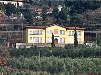
![Randonnée A pied Vaiano - Sentiero CAI 46B - Sez. Prato - Photo](https://media.geolcdn.com/t/350/260/fde66ef7-7066-4c0f-afb7-40c2cb8db337.jpeg&format=jpg&maxdim=2)
![A pied A pied](https://static1.geolcdn.com/sitytour/trail-icons/100.png)
Km
A pied
![](/images/other/stat-length.png)
![](https://static1.geolcdn.com/siteimages/upload/files/1508320355ic_sort_den_pos_24dp.png)
![](https://static1.geolcdn.com/siteimages/upload/files/1508320355ic_sort_den_neg_24dp.png)
![](https://static1.geolcdn.com/siteimages/upload/files/16400158638029165_repeat_loop_refresh_sync_direction_icon.png)
• Randonnée créée par Club Alpino Italiano.
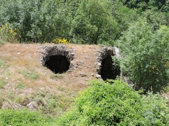
![Randonnée A pied Cantagallo - Sentiero CAI 48 - Sez. Prato - Photo](https://media.geolcdn.com/t/350/260/72ab061c-03b8-4bc0-913e-3669b406a029.jpeg&format=jpg&maxdim=2)
![A pied A pied](https://static1.geolcdn.com/sitytour/trail-icons/100.png)
Km
A pied
![](/images/other/stat-length.png)
![](https://static1.geolcdn.com/siteimages/upload/files/1508320355ic_sort_den_pos_24dp.png)
![](https://static1.geolcdn.com/siteimages/upload/files/1508320355ic_sort_den_neg_24dp.png)
![](https://static1.geolcdn.com/siteimages/upload/files/16400158638029165_repeat_loop_refresh_sync_direction_icon.png)
• Randonnée créée par Club Alpino Italiano.
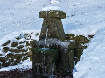
![Randonnée A pied Cantagallo - Sentiero CAI 15 - Sez. Prato - Photo](https://media.geolcdn.com/t/350/260/197d6158-6c47-4408-b31d-6b0aa2c01dbe.jpeg&format=jpg&maxdim=2)
![A pied A pied](https://static1.geolcdn.com/sitytour/trail-icons/100.png)
Km
A pied
![](/images/other/stat-length.png)
![](https://static1.geolcdn.com/siteimages/upload/files/1508320355ic_sort_den_pos_24dp.png)
![](https://static1.geolcdn.com/siteimages/upload/files/1508320355ic_sort_den_neg_24dp.png)
![](https://static1.geolcdn.com/siteimages/upload/files/16400158638029165_repeat_loop_refresh_sync_direction_icon.png)
• Randonnée créée par CAI Prato.
![Randonnée A pied Vernio - Sentiero CAI 64 - Sez. Prato - Photo](https://media.geolcdn.com/t/350/260/64edd719-90ea-4d3b-baad-8a54f62e9f0b.jpeg&format=jpg&maxdim=2)
![A pied A pied](https://static1.geolcdn.com/sitytour/trail-icons/100.png)
Km
A pied
![](/images/other/stat-length.png)
![](https://static1.geolcdn.com/siteimages/upload/files/1508320355ic_sort_den_pos_24dp.png)
![](https://static1.geolcdn.com/siteimages/upload/files/1508320355ic_sort_den_neg_24dp.png)
![](https://static1.geolcdn.com/siteimages/upload/files/16400158638029165_repeat_loop_refresh_sync_direction_icon.png)
• Randonnée créée par Club Alpino Italiano.
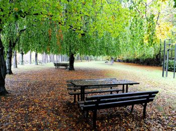
![Randonnée A pied Vernio - Sentiero CAI 23 - Sez. Prato - Photo](https://media.geolcdn.com/t/350/260/c63cdb72-942b-4f9b-aff6-145ca52e61cf.jpeg&format=jpg&maxdim=2)
![A pied A pied](https://static1.geolcdn.com/sitytour/trail-icons/100.png)
Km
A pied
![](/images/other/stat-length.png)
![](https://static1.geolcdn.com/siteimages/upload/files/1508320355ic_sort_den_pos_24dp.png)
![](https://static1.geolcdn.com/siteimages/upload/files/1508320355ic_sort_den_neg_24dp.png)
![](https://static1.geolcdn.com/siteimages/upload/files/16400158638029165_repeat_loop_refresh_sync_direction_icon.png)
• Randonnée créée par CAI Prato.
20 randonnées affichées sur 41
Application GPS de randonnée GRATUITE