![](/images/other/stat-length.png)
- Randonnées
- Outdoor
- Italie
- Trentin-Haut-Adige
- Provincia di Trento
- Primiero San Martino di Castrozza
Primiero San Martino di Castrozza, Provincia di Trento : Les meilleures randonnées, itinéraires, parcours, balades et promenades
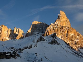
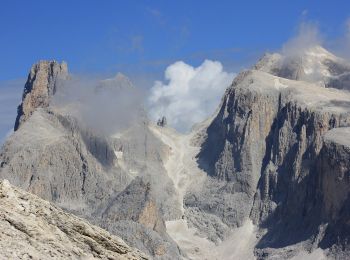
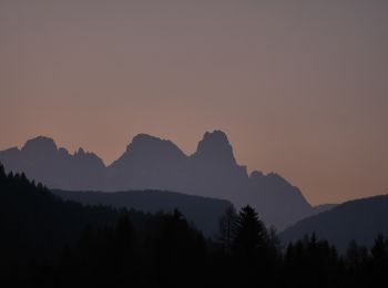
Primiero San Martino di Castrozza : découvrez les meilleures randonnées : 56 pédestres. Tous ces circuits, parcours, itinéraires et activités en plein air sont disponibles dans nos applications SityTrail pour smartphones et tablettes.
Les meilleurs parcours (57)
![Randonnée A pied Primiero San Martino di Castrozza - IT-751 - Photo](https://media.geolcdn.com/t/350/260/84125359-dad4-4994-a82a-7c7aa611646c.jpeg&format=jpg&maxdim=2)
![A pied A pied](https://static1.geolcdn.com/sitytour/trail-icons/100.png)
Km
A pied
![](/images/other/stat-length.png)
![](https://static1.geolcdn.com/siteimages/upload/files/1508320355ic_sort_den_pos_24dp.png)
![](https://static1.geolcdn.com/siteimages/upload/files/1508320355ic_sort_den_neg_24dp.png)
![](https://static1.geolcdn.com/siteimages/upload/files/16400158638029165_repeat_loop_refresh_sync_direction_icon.png)
• Randonnée créée par CAI Agordo.
![Randonnée A pied Primiero San Martino di Castrozza - IT-E721 - Photo](https://media.geolcdn.com/t/350/260/8548f0b4-26f1-46be-b602-727f00605ed6.jpeg&format=jpg&maxdim=2)
![A pied A pied](https://static1.geolcdn.com/sitytour/trail-icons/100.png)
Km
A pied
![](/images/other/stat-length.png)
![](https://static1.geolcdn.com/siteimages/upload/files/1508320355ic_sort_den_pos_24dp.png)
![](https://static1.geolcdn.com/siteimages/upload/files/1508320355ic_sort_den_neg_24dp.png)
![](https://static1.geolcdn.com/siteimages/upload/files/16400158638029165_repeat_loop_refresh_sync_direction_icon.png)
• Randonnée créée par Società degli Alpinisti Tridentini. Site web: http://www.sat.tn.it/
![Randonnée A pied Primiero San Martino di Castrozza - IT-E734 - Photo](https://media.geolcdn.com/t/350/260/fa921124-561d-43d4-aeba-7bfbbacb523a.jpeg&format=jpg&maxdim=2)
![A pied A pied](https://static1.geolcdn.com/sitytour/trail-icons/100.png)
Km
A pied
![](/images/other/stat-length.png)
![](https://static1.geolcdn.com/siteimages/upload/files/1508320355ic_sort_den_pos_24dp.png)
![](https://static1.geolcdn.com/siteimages/upload/files/1508320355ic_sort_den_neg_24dp.png)
![](https://static1.geolcdn.com/siteimages/upload/files/16400158638029165_repeat_loop_refresh_sync_direction_icon.png)
• Randonnée créée par Società degli Alpinisti Tridentini. Site web: http://www.sat.tn.it/
![Randonnée A pied Primiero San Martino di Castrozza - (SI C15S) Passo Rolle - Costazza - Campigolo di Vezzana - Forcella Venegia - Passo Valles - Forcella Pradazzo - Corda degli Zingari - Passo San Pellegrino - Rifugio Fuciade - Photo](https://media.geolcdn.com/t/350/260/b85f7f30-48e1-4a74-8883-4749ac500480.jpeg&format=jpg&maxdim=2)
![A pied A pied](https://static1.geolcdn.com/sitytour/trail-icons/100.png)
Km
A pied
![](/images/other/stat-length.png)
![](https://static1.geolcdn.com/siteimages/upload/files/1508320355ic_sort_den_pos_24dp.png)
![](https://static1.geolcdn.com/siteimages/upload/files/1508320355ic_sort_den_neg_24dp.png)
![](https://static1.geolcdn.com/siteimages/upload/files/16400158638029165_repeat_loop_refresh_sync_direction_icon.png)
• Sentiero Italia CAI 2019
![Randonnée A pied Primiero San Martino di Castrozza - Sentiero delle Regade - Photo](https://media.geolcdn.com/t/350/260/ce68e574-f43f-44ee-b55c-3bafa717991c.jpeg&format=jpg&maxdim=2)
![A pied A pied](https://static1.geolcdn.com/sitytour/trail-icons/100.png)
Km
A pied
![](/images/other/stat-length.png)
![](https://static1.geolcdn.com/siteimages/upload/files/1508320355ic_sort_den_pos_24dp.png)
![](https://static1.geolcdn.com/siteimages/upload/files/1508320355ic_sort_den_neg_24dp.png)
![](https://static1.geolcdn.com/siteimages/upload/files/16400158638029165_repeat_loop_refresh_sync_direction_icon.png)
• Randonnée créée par Società degli Alpinisti Tridentini. Site web: http://www.sat.tn.it/
![Randonnée A pied Primiero San Martino di Castrozza - Sentiero](https://media.geolcdn.com/t/350/260/7e216a47-7f46-4255-a891-ac4960f9fa9e.jpeg&format=jpg&maxdim=2)
![A pied A pied](https://static1.geolcdn.com/sitytour/trail-icons/100.png)
Km
A pied
![](/images/other/stat-length.png)
![](https://static1.geolcdn.com/siteimages/upload/files/1508320355ic_sort_den_pos_24dp.png)
![](https://static1.geolcdn.com/siteimages/upload/files/1508320355ic_sort_den_neg_24dp.png)
![](https://static1.geolcdn.com/siteimages/upload/files/16400158638029165_repeat_loop_refresh_sync_direction_icon.png)
• Randonnée créée par Società degli Alpinisti Tridentini. Site web: http://www.sat.tn.it/
![Randonnée A pied Primiero San Martino di Castrozza - IT-E723 - Photo](https://media.geolcdn.com/t/350/260/09a2ba9a-4c38-4094-8c64-d1315e143e0b.jpeg&format=jpg&maxdim=2)
![A pied A pied](https://static1.geolcdn.com/sitytour/trail-icons/100.png)
Km
A pied
![](/images/other/stat-length.png)
![](https://static1.geolcdn.com/siteimages/upload/files/1508320355ic_sort_den_pos_24dp.png)
![](https://static1.geolcdn.com/siteimages/upload/files/1508320355ic_sort_den_neg_24dp.png)
![](https://static1.geolcdn.com/siteimages/upload/files/16400158638029165_repeat_loop_refresh_sync_direction_icon.png)
• Randonnée créée par Società degli Alpinisti Tridentini. Site web: http://www.sat.tn.it/
![Randonnée A pied Primiero San Martino di Castrozza - IT-E731 - Photo](https://media.geolcdn.com/t/350/260/119cbe61-bf06-48ee-a97e-5918cf0e8b59.jpeg&format=jpg&maxdim=2)
![A pied A pied](https://static1.geolcdn.com/sitytour/trail-icons/100.png)
Km
A pied
![](/images/other/stat-length.png)
![](https://static1.geolcdn.com/siteimages/upload/files/1508320355ic_sort_den_pos_24dp.png)
![](https://static1.geolcdn.com/siteimages/upload/files/1508320355ic_sort_den_neg_24dp.png)
![](https://static1.geolcdn.com/siteimages/upload/files/16400158638029165_repeat_loop_refresh_sync_direction_icon.png)
• Randonnée créée par Società degli Alpinisti Tridentini. Site web: http://www.sat.tn.it/
![Randonnée A pied Primiero San Martino di Castrozza - Sentiero dei Finanzieri - Photo](https://media.geolcdn.com/t/350/260/d779bbad-5c23-4da1-96c7-1672a9159eb6.jpeg&format=jpg&maxdim=2)
![A pied A pied](https://static1.geolcdn.com/sitytour/trail-icons/100.png)
Km
A pied
![](/images/other/stat-length.png)
![](https://static1.geolcdn.com/siteimages/upload/files/1508320355ic_sort_den_pos_24dp.png)
![](https://static1.geolcdn.com/siteimages/upload/files/1508320355ic_sort_den_neg_24dp.png)
![](https://static1.geolcdn.com/siteimages/upload/files/16400158638029165_repeat_loop_refresh_sync_direction_icon.png)
• Randonnée créée par Società degli Alpinisti Tridentini. Site web: http://www.sat.tn.it/
![Randonnée A pied Primiero San Martino di Castrozza - Sentiero del Mulaz](https://media.geolcdn.com/t/350/260/eca4567e-539b-455f-8f7b-147eae70f6e1.jpeg&format=jpg&maxdim=2)
![A pied A pied](https://static1.geolcdn.com/sitytour/trail-icons/100.png)
Km
A pied
![](/images/other/stat-length.png)
![](https://static1.geolcdn.com/siteimages/upload/files/1508320355ic_sort_den_pos_24dp.png)
![](https://static1.geolcdn.com/siteimages/upload/files/1508320355ic_sort_den_neg_24dp.png)
![](https://static1.geolcdn.com/siteimages/upload/files/16400158638029165_repeat_loop_refresh_sync_direction_icon.png)
• Randonnée créée par Società degli Alpinisti Tridentini. Site web: http://www.sat.tn.it/
![Randonnée A pied Primiero San Martino di Castrozza - IT-E710A - Photo](https://media.geolcdn.com/t/350/260/95291aeb-500b-44d4-915d-1164145e8cd5.jpeg&format=jpg&maxdim=2)
![A pied A pied](https://static1.geolcdn.com/sitytour/trail-icons/100.png)
Km
A pied
![](/images/other/stat-length.png)
![](https://static1.geolcdn.com/siteimages/upload/files/1508320355ic_sort_den_pos_24dp.png)
![](https://static1.geolcdn.com/siteimages/upload/files/1508320355ic_sort_den_neg_24dp.png)
![](https://static1.geolcdn.com/siteimages/upload/files/16400158638029165_repeat_loop_refresh_sync_direction_icon.png)
• Randonnée créée par Società degli Alpinisti Tridentini. Site web: http://www.sat.tn.it/
![Randonnée A pied Primiero San Martino di Castrozza - IT-E719 - Photo](https://media.geolcdn.com/t/350/260/fa921124-561d-43d4-aeba-7bfbbacb523a.jpeg&format=jpg&maxdim=2)
![A pied A pied](https://static1.geolcdn.com/sitytour/trail-icons/100.png)
Km
A pied
![](/images/other/stat-length.png)
![](https://static1.geolcdn.com/siteimages/upload/files/1508320355ic_sort_den_pos_24dp.png)
![](https://static1.geolcdn.com/siteimages/upload/files/1508320355ic_sort_den_neg_24dp.png)
![](https://static1.geolcdn.com/siteimages/upload/files/16400158638029165_repeat_loop_refresh_sync_direction_icon.png)
• Randonnée créée par Società degli Alpinisti Tridentini. Site web: http://www.sat.tn.it/
![Randonnée A pied Primiero San Martino di Castrozza - Sentiero attrezzato della Lasta moia - Photo](https://media.geolcdn.com/t/350/260/397e196c-3ea2-45af-a436-9b6948f41909.jpeg&format=jpg&maxdim=2)
![A pied A pied](https://static1.geolcdn.com/sitytour/trail-icons/100.png)
Km
A pied
![](/images/other/stat-length.png)
![](https://static1.geolcdn.com/siteimages/upload/files/1508320355ic_sort_den_pos_24dp.png)
![](https://static1.geolcdn.com/siteimages/upload/files/1508320355ic_sort_den_neg_24dp.png)
![](https://static1.geolcdn.com/siteimages/upload/files/16400158638029165_repeat_loop_refresh_sync_direction_icon.png)
• Randonnée créée par Società degli Alpinisti Tridentini. Site web: http://www.sat.tn.it/
![Randonnée A pied Primiero San Martino di Castrozza - IT-E629 - Photo](https://media.geolcdn.com/t/350/260/ed22bf8c-fc30-4e8b-852f-bf05a4ba9be6.jpeg&format=jpg&maxdim=2)
![A pied A pied](https://static1.geolcdn.com/sitytour/trail-icons/100.png)
Km
A pied
![](/images/other/stat-length.png)
![](https://static1.geolcdn.com/siteimages/upload/files/1508320355ic_sort_den_pos_24dp.png)
![](https://static1.geolcdn.com/siteimages/upload/files/1508320355ic_sort_den_neg_24dp.png)
![](https://static1.geolcdn.com/siteimages/upload/files/16400158638029165_repeat_loop_refresh_sync_direction_icon.png)
• Randonnée créée par Società degli Alpinisti Tridentini. Site web: http://www.sat.tn.it/
![Randonnée A pied Primiero San Martino di Castrozza - IT-E347 - Photo](https://media.geolcdn.com/t/350/260/179ab676-da91-4e6f-b559-96bc1e0a7619.jpeg&format=jpg&maxdim=2)
![A pied A pied](https://static1.geolcdn.com/sitytour/trail-icons/100.png)
Km
A pied
![](/images/other/stat-length.png)
![](https://static1.geolcdn.com/siteimages/upload/files/1508320355ic_sort_den_pos_24dp.png)
![](https://static1.geolcdn.com/siteimages/upload/files/1508320355ic_sort_den_neg_24dp.png)
![](https://static1.geolcdn.com/siteimages/upload/files/16400158638029165_repeat_loop_refresh_sync_direction_icon.png)
• Randonnée créée par Società degli Alpinisti Tridentini. Site web: http://www.sat.tn.it/
![Randonnée A pied Primiero San Martino di Castrozza - Sentiero di Val Zanchetta - Photo](https://media.geolcdn.com/t/350/260/b34d075d-0991-49f1-9074-9aebb04f9022.jpeg&format=jpg&maxdim=2)
![A pied A pied](https://static1.geolcdn.com/sitytour/trail-icons/100.png)
Km
A pied
![](/images/other/stat-length.png)
![](https://static1.geolcdn.com/siteimages/upload/files/1508320355ic_sort_den_pos_24dp.png)
![](https://static1.geolcdn.com/siteimages/upload/files/1508320355ic_sort_den_neg_24dp.png)
![](https://static1.geolcdn.com/siteimages/upload/files/16400158638029165_repeat_loop_refresh_sync_direction_icon.png)
• Randonnée créée par Società degli Alpinisti Tridentini. Site web: http://www.sat.tn.it/
![Randonnée A pied Primiero San Martino di Castrozza - IT-E337 - Photo](https://media.geolcdn.com/t/350/260/982f5301-08ff-44d7-aa75-1c8e51f9644d.jpeg&format=jpg&maxdim=2)
![A pied A pied](https://static1.geolcdn.com/sitytour/trail-icons/100.png)
Km
A pied
![](/images/other/stat-length.png)
![](https://static1.geolcdn.com/siteimages/upload/files/1508320355ic_sort_den_pos_24dp.png)
![](https://static1.geolcdn.com/siteimages/upload/files/1508320355ic_sort_den_neg_24dp.png)
![](https://static1.geolcdn.com/siteimages/upload/files/16400158638029165_repeat_loop_refresh_sync_direction_icon.png)
• Randonnée créée par Società degli Alpinisti Tridentini. Site web: http://www.sat.tn.it/
![Randonnée A pied Primiero San Martino di Castrozza - IT-E356 - Photo](https://media.geolcdn.com/t/350/260/c3e727d9-2083-4e53-8b8f-4ed8767b8737.jpeg&format=jpg&maxdim=2)
![A pied A pied](https://static1.geolcdn.com/sitytour/trail-icons/100.png)
Km
A pied
![](/images/other/stat-length.png)
![](https://static1.geolcdn.com/siteimages/upload/files/1508320355ic_sort_den_pos_24dp.png)
![](https://static1.geolcdn.com/siteimages/upload/files/1508320355ic_sort_den_neg_24dp.png)
![](https://static1.geolcdn.com/siteimages/upload/files/16400158638029165_repeat_loop_refresh_sync_direction_icon.png)
• Randonnée créée par Società degli Alpinisti Tridentini. Site web: http://www.sat.tn.it/
![Randonnée A pied Primiero San Martino di Castrozza - IT-E711 - Photo](https://media.geolcdn.com/t/350/260/a79128b9-3901-4b88-be86-d2e626318250.jpeg&format=jpg&maxdim=2)
![A pied A pied](https://static1.geolcdn.com/sitytour/trail-icons/100.png)
Km
A pied
![](/images/other/stat-length.png)
![](https://static1.geolcdn.com/siteimages/upload/files/1508320355ic_sort_den_pos_24dp.png)
![](https://static1.geolcdn.com/siteimages/upload/files/1508320355ic_sort_den_neg_24dp.png)
![](https://static1.geolcdn.com/siteimages/upload/files/16400158638029165_repeat_loop_refresh_sync_direction_icon.png)
• Randonnée créée par Società degli Alpinisti Tridentini. Site web: http://www.sat.tn.it/
![Randonnée A pied Primiero San Martino di Castrozza - Sentiero di Calaita - Photo](https://media.geolcdn.com/t/350/260/bde6e44f-1a17-4518-b6c0-fe3fde7dc587.jpeg&format=jpg&maxdim=2)
![A pied A pied](https://static1.geolcdn.com/sitytour/trail-icons/100.png)
Km
A pied
![](/images/other/stat-length.png)
![](https://static1.geolcdn.com/siteimages/upload/files/1508320355ic_sort_den_pos_24dp.png)
![](https://static1.geolcdn.com/siteimages/upload/files/1508320355ic_sort_den_neg_24dp.png)
![](https://static1.geolcdn.com/siteimages/upload/files/16400158638029165_repeat_loop_refresh_sync_direction_icon.png)
• Randonnée créée par Società degli Alpinisti Tridentini. Site web: http://www.sat.tn.it/
20 randonnées affichées sur 57
Application GPS de randonnée GRATUITE