![](/images/other/stat-length.png)
- Randonnées
- Outdoor
- Italie
- Émilie-Romagne
- Parma
- Monchio delle Corti
Monchio delle Corti, Parma : Les meilleures randonnées, itinéraires, parcours, balades et promenades
Monchio delle Corti : découvrez les meilleures randonnées : 6 pédestres. Tous ces circuits, parcours, itinéraires et activités en plein air sont disponibles dans nos applications SityTrail pour smartphones et tablettes.
Les meilleurs parcours (6)
![Randonnée A pied Monchio delle Corti - Percorso Blu delle Frazioni - Photo](https://media.geolcdn.com/t/350/260/464d5f1c-4a3b-4344-847a-968b2932da98.jpeg&format=jpg&maxdim=2)
![A pied A pied](https://static1.geolcdn.com/sitytour/trail-icons/100.png)
Km
A pied
![](/images/other/stat-length.png)
![](https://static1.geolcdn.com/siteimages/upload/files/1508320355ic_sort_den_pos_24dp.png)
![](https://static1.geolcdn.com/siteimages/upload/files/1508320355ic_sort_den_neg_24dp.png)
![](https://static1.geolcdn.com/siteimages/upload/files/16400158638029165_repeat_loop_refresh_sync_direction_icon.png)
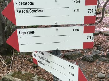
• Randonnée créée par Parchi del Ducato. relation maintained by Capataz (CAI Parma) Symbole: blue symbols
![Randonnée A pied Monchio delle Corti - (SI L22) Pratospilla - Bivio Lago Santo Parmense (719-729-723) - Photo](https://media.geolcdn.com/t/350/260/4d1db123-abaf-41e1-956e-6d8eff92bf7e.jpeg&format=jpg&maxdim=2)
![A pied A pied](https://static1.geolcdn.com/sitytour/trail-icons/100.png)
Km
A pied
![](/images/other/stat-length.png)
![](https://static1.geolcdn.com/siteimages/upload/files/1508320355ic_sort_den_pos_24dp.png)
![](https://static1.geolcdn.com/siteimages/upload/files/1508320355ic_sort_den_neg_24dp.png)
![](https://static1.geolcdn.com/siteimages/upload/files/16400158638029165_repeat_loop_refresh_sync_direction_icon.png)
• Sentiero Italia CAI 2019
![Randonnée A pied Monchio delle Corti - Rigoso-Lago Squincio-Lago Verdarolo-Prato Spilla - Photo](https://media.geolcdn.com/t/350/260/14daddb7-7796-45e9-b67b-d77b5ef3f4c3.jpeg&format=jpg&maxdim=2)
![A pied A pied](https://static1.geolcdn.com/sitytour/trail-icons/100.png)
Km
A pied
![](/images/other/stat-length.png)
![](https://static1.geolcdn.com/siteimages/upload/files/1508320355ic_sort_den_pos_24dp.png)
![](https://static1.geolcdn.com/siteimages/upload/files/1508320355ic_sort_den_neg_24dp.png)
![](https://static1.geolcdn.com/siteimages/upload/files/16400158638029165_repeat_loop_refresh_sync_direction_icon.png)
• Randonnée créée par Club Alpino Italiano - sezione di Parma. relation maintained by Capataz (CAI Parma) Symbole: 70...
![Randonnée A pied Monchio delle Corti - Prato Spilla - Lago Ballano - Lago Verde - Lago Martino - Photo](https://media.geolcdn.com/t/350/260/39606c00-baca-4260-a168-9060d19b2fc8.jpeg&format=jpg&maxdim=2)
![A pied A pied](https://static1.geolcdn.com/sitytour/trail-icons/100.png)
Km
A pied
![](/images/other/stat-length.png)
![](https://static1.geolcdn.com/siteimages/upload/files/1508320355ic_sort_den_pos_24dp.png)
![](https://static1.geolcdn.com/siteimages/upload/files/1508320355ic_sort_den_neg_24dp.png)
![](https://static1.geolcdn.com/siteimages/upload/files/16400158638029165_repeat_loop_refresh_sync_direction_icon.png)
• Randonnée créée par Club Alpino Italiano - sezione di Parma. relation maintained by Capataz (CAI Parma) Symbole: 70...
![Randonnée A pied Monchio delle Corti - Torrente Colla - Rio dei Frasconi - Passo di Compione - Photo](https://media.geolcdn.com/t/350/260/02063b1e-e97f-4927-9eb0-842e46bc4b6d.jpeg&format=jpg&maxdim=2)
![A pied A pied](https://static1.geolcdn.com/sitytour/trail-icons/100.png)
Km
A pied
![](/images/other/stat-length.png)
![](https://static1.geolcdn.com/siteimages/upload/files/1508320355ic_sort_den_pos_24dp.png)
![](https://static1.geolcdn.com/siteimages/upload/files/1508320355ic_sort_den_neg_24dp.png)
![](https://static1.geolcdn.com/siteimages/upload/files/16400158638029165_repeat_loop_refresh_sync_direction_icon.png)
• Randonnée créée par Club Alpino Italiano - sezione di Parma. relation maintained by Capataz (CAI Parma) Symbole: 70...
![Randonnée A pied Monchio delle Corti - Percorso Verde delle Frazioni - Photo](https://media.geolcdn.com/t/350/260/ext.jpg?maxdim=2&url=https%3A%2F%2Fstatic1.geolcdn.com%2Fsiteimages%2Fupload%2Ffiles%2F1545311037marcheuse_200dpi.jpg)
![A pied A pied](https://static1.geolcdn.com/sitytour/trail-icons/100.png)
Km
A pied
![](/images/other/stat-length.png)
![](https://static1.geolcdn.com/siteimages/upload/files/1508320355ic_sort_den_pos_24dp.png)
![](https://static1.geolcdn.com/siteimages/upload/files/1508320355ic_sort_den_neg_24dp.png)
![](https://static1.geolcdn.com/siteimages/upload/files/16400158638029165_repeat_loop_refresh_sync_direction_icon.png)
• Randonnée créée par Parchi del Ducato. relation maintained by Capataz (CAI Parma) Symbole: green symbols
6 randonnées affichées sur 6
Application GPS de randonnée GRATUITE