![](/images/other/stat-length.png)
- Randonnées
- Outdoor
- Italie
- Émilie-Romagne
- Piacenza
Piacenza, Émilie-Romagne : Les meilleures randonnées, itinéraires, parcours, balades et promenades
Piacenza : découvrez les meilleures randonnées : 69 pédestres et 2 à vélo ou VTT. Tous ces circuits, parcours, itinéraires et activités en plein air sont disponibles dans nos applications SityTrail pour smartphones et tablettes.
Les meilleurs parcours (71)
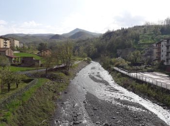
![Randonnée A pied Ferriere - Ferriere - Canadello - Lago Moo - Lago Bino - Photo](https://media.geolcdn.com/t/350/260/f949da74-7e81-41ad-aa20-6c5705d5e5ec.jpeg&format=jpg&maxdim=2)
![A pied A pied](https://static1.geolcdn.com/sitytour/trail-icons/100.png)
Km
A pied
![](/images/other/stat-length.png)
![](https://static1.geolcdn.com/siteimages/upload/files/1508320355ic_sort_den_pos_24dp.png)
![](https://static1.geolcdn.com/siteimages/upload/files/1508320355ic_sort_den_neg_24dp.png)
![](https://static1.geolcdn.com/siteimages/upload/files/16400158638029165_repeat_loop_refresh_sync_direction_icon.png)
• Symbole: 021 on white red flags
![Randonnée A pied Bobbio - Perino - Oratorio di Pietra Parcellara - Photo](https://media.geolcdn.com/t/350/260/56f170c5-84f0-41a8-a508-bfa080e4d4ab.jpeg&format=jpg&maxdim=2)
![A pied A pied](https://static1.geolcdn.com/sitytour/trail-icons/100.png)
Km
A pied
![](/images/other/stat-length.png)
![](https://static1.geolcdn.com/siteimages/upload/files/1508320355ic_sort_den_pos_24dp.png)
![](https://static1.geolcdn.com/siteimages/upload/files/1508320355ic_sort_den_neg_24dp.png)
![](https://static1.geolcdn.com/siteimages/upload/files/16400158638029165_repeat_loop_refresh_sync_direction_icon.png)
• Randonnée créée par Comune di Travo. Symbole: 167 on white red flags
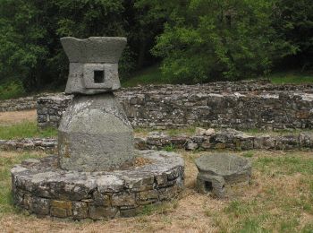
![Randonnée A pied Lugagnano Val d'Arda - Velleia - Prato delle Lame - Madonna del Monte - Photo](https://media.geolcdn.com/t/350/260/8737efe7-823d-4bf8-ad33-33d344e334b7.jpeg&format=jpg&maxdim=2)
![A pied A pied](https://static1.geolcdn.com/sitytour/trail-icons/100.png)
Km
A pied
![](/images/other/stat-length.png)
![](https://static1.geolcdn.com/siteimages/upload/files/1508320355ic_sort_den_pos_24dp.png)
![](https://static1.geolcdn.com/siteimages/upload/files/1508320355ic_sort_den_neg_24dp.png)
![](https://static1.geolcdn.com/siteimages/upload/files/16400158638029165_repeat_loop_refresh_sync_direction_icon.png)
• Symbole: 911 on white red flags
![Randonnée A pied Vernasca - Vernasca - Monte La Ciocca - Franchini - Vigoleno - Photo](https://media.geolcdn.com/t/350/260/cfe94daa-78d8-41bf-b758-a25bbafcc285.jpeg&format=jpg&maxdim=2)
![A pied A pied](https://static1.geolcdn.com/sitytour/trail-icons/100.png)
Km
A pied
![](/images/other/stat-length.png)
![](https://static1.geolcdn.com/siteimages/upload/files/1508320355ic_sort_den_pos_24dp.png)
![](https://static1.geolcdn.com/siteimages/upload/files/1508320355ic_sort_den_neg_24dp.png)
![](https://static1.geolcdn.com/siteimages/upload/files/16400158638029165_repeat_loop_refresh_sync_direction_icon.png)
• Symbole: 931 on white red flags
![Randonnée A pied Vernasca - Vigoleno - Monte Cergallina - Vernasca - Photo](https://media.geolcdn.com/t/350/260/32c8d1c0-b3bf-4848-a219-e35d7814503c.jpeg&format=jpg&maxdim=2)
![A pied A pied](https://static1.geolcdn.com/sitytour/trail-icons/100.png)
Km
A pied
![](/images/other/stat-length.png)
![](https://static1.geolcdn.com/siteimages/upload/files/1508320355ic_sort_den_pos_24dp.png)
![](https://static1.geolcdn.com/siteimages/upload/files/1508320355ic_sort_den_neg_24dp.png)
![](https://static1.geolcdn.com/siteimages/upload/files/16400158638029165_repeat_loop_refresh_sync_direction_icon.png)
• Symbole: 929 on white red flags
![Randonnée A pied Bettola - Chiesa di Calenzano - Pradovera - Colla - Photo](https://media.geolcdn.com/t/350/260/28312c36-b376-4f61-a888-3736e7aaa67a.jpeg&format=jpg&maxdim=2)
![A pied A pied](https://static1.geolcdn.com/sitytour/trail-icons/100.png)
Km
A pied
![](/images/other/stat-length.png)
![](https://static1.geolcdn.com/siteimages/upload/files/1508320355ic_sort_den_pos_24dp.png)
![](https://static1.geolcdn.com/siteimages/upload/files/1508320355ic_sort_den_neg_24dp.png)
![](https://static1.geolcdn.com/siteimages/upload/files/16400158638029165_repeat_loop_refresh_sync_direction_icon.png)
• Symbole: 155 on white red flags
![Randonnée A pied Pianello Val Tidone - Anello del Monte Sereno - Photo](https://media.geolcdn.com/t/350/260/aabe2da5-399c-44e8-a013-19371a16c525.jpeg&format=jpg&maxdim=2)
![A pied A pied](https://static1.geolcdn.com/sitytour/trail-icons/100.png)
Km
A pied
![](/images/other/stat-length.png)
![](https://static1.geolcdn.com/siteimages/upload/files/1508320355ic_sort_den_pos_24dp.png)
![](https://static1.geolcdn.com/siteimages/upload/files/1508320355ic_sort_den_neg_24dp.png)
![](https://static1.geolcdn.com/siteimages/upload/files/16400158638029165_repeat_loop_refresh_sync_direction_icon.png)
• Symbole: 225 on white red flags
![Randonnée A pied Bobbio - Monteventano - Casa Colombani - Passo Caldarola - Photo](https://media.geolcdn.com/t/350/260/20c4fc8f-f1c1-4c92-a8ff-6a71de1534af.jpeg&format=jpg&maxdim=2)
![A pied A pied](https://static1.geolcdn.com/sitytour/trail-icons/100.png)
Km
A pied
![](/images/other/stat-length.png)
![](https://static1.geolcdn.com/siteimages/upload/files/1508320355ic_sort_den_pos_24dp.png)
![](https://static1.geolcdn.com/siteimages/upload/files/1508320355ic_sort_den_neg_24dp.png)
![](https://static1.geolcdn.com/siteimages/upload/files/16400158638029165_repeat_loop_refresh_sync_direction_icon.png)
• Symbole: 205 on white red flags
![Randonnée A pied Coli - I Mazzucchi - Monte Sant'Agostino - Monte Capra - Percorso 151 - Photo](https://media.geolcdn.com/t/350/260/ca11182b-31d6-4690-a43c-aaf6f405d613.jpeg&format=jpg&maxdim=2)
![A pied A pied](https://static1.geolcdn.com/sitytour/trail-icons/100.png)
Km
A pied
![](/images/other/stat-length.png)
![](https://static1.geolcdn.com/siteimages/upload/files/1508320355ic_sort_den_pos_24dp.png)
![](https://static1.geolcdn.com/siteimages/upload/files/1508320355ic_sort_den_neg_24dp.png)
![](https://static1.geolcdn.com/siteimages/upload/files/16400158638029165_repeat_loop_refresh_sync_direction_icon.png)
• Symbole: 159 on white red flags
![Randonnée A pied Coli - Boioli - Caminata Boselli - Monte Tre Sorelle - Gavi - Photo](https://media.geolcdn.com/t/350/260/81b0a52f-55fe-476f-b674-7667d3b63ea1.jpeg&format=jpg&maxdim=2)
![A pied A pied](https://static1.geolcdn.com/sitytour/trail-icons/100.png)
Km
A pied
![](/images/other/stat-length.png)
![](https://static1.geolcdn.com/siteimages/upload/files/1508320355ic_sort_den_pos_24dp.png)
![](https://static1.geolcdn.com/siteimages/upload/files/1508320355ic_sort_den_neg_24dp.png)
![](https://static1.geolcdn.com/siteimages/upload/files/16400158638029165_repeat_loop_refresh_sync_direction_icon.png)
• Symbole: 163 on white red flags
![Randonnée A pied Coli - Percorso 151 - Boioli - Monte Armelio - Percorso 163 - Photo](https://media.geolcdn.com/t/350/260/bd2359cf-3c7f-48b7-8667-45008a9e656b.jpeg&format=jpg&maxdim=2)
![A pied A pied](https://static1.geolcdn.com/sitytour/trail-icons/100.png)
Km
A pied
![](/images/other/stat-length.png)
![](https://static1.geolcdn.com/siteimages/upload/files/1508320355ic_sort_den_pos_24dp.png)
![](https://static1.geolcdn.com/siteimages/upload/files/1508320355ic_sort_den_neg_24dp.png)
![](https://static1.geolcdn.com/siteimages/upload/files/16400158638029165_repeat_loop_refresh_sync_direction_icon.png)
• Symbole: 161 on white red flags
![Randonnée A pied Coli - Perino - Concrena - Passo di Santa Barbara - Sella del Generale - Monte Aserei - Percorso 001 - Photo](https://media.geolcdn.com/t/350/260/33b0c98a-ae0d-4ba2-952a-8b8bb9f73100.jpeg&format=jpg&maxdim=2)
![A pied A pied](https://static1.geolcdn.com/sitytour/trail-icons/100.png)
Km
A pied
![](/images/other/stat-length.png)
![](https://static1.geolcdn.com/siteimages/upload/files/1508320355ic_sort_den_pos_24dp.png)
![](https://static1.geolcdn.com/siteimages/upload/files/1508320355ic_sort_den_neg_24dp.png)
![](https://static1.geolcdn.com/siteimages/upload/files/16400158638029165_repeat_loop_refresh_sync_direction_icon.png)
• Symbole: 151 on white red flags
![Randonnée A pied Farini - Villanova - Monte Mangiapane - Piani d'Aglio - Pradovera - Photo](https://media.geolcdn.com/t/350/260/be14cf4b-e2a1-4fcc-919b-8d06c1299634.jpeg&format=jpg&maxdim=2)
![A pied A pied](https://static1.geolcdn.com/sitytour/trail-icons/100.png)
Km
A pied
![](/images/other/stat-length.png)
![](https://static1.geolcdn.com/siteimages/upload/files/1508320355ic_sort_den_pos_24dp.png)
![](https://static1.geolcdn.com/siteimages/upload/files/1508320355ic_sort_den_neg_24dp.png)
![](https://static1.geolcdn.com/siteimages/upload/files/16400158638029165_repeat_loop_refresh_sync_direction_icon.png)
• Symbole: 153 on white red flags
![Randonnée A pied Rivergaro - Rivergaro - Monte Dinavolo - Passo del Cerro - Passo della Cappelletta - Ciregna - Passo del Mercatello - Passo Crociglia - Prato della Cipolla - Passo Zovallo - Photo](https://media.geolcdn.com/t/350/260/2854b14c-e263-4049-b515-a5253da04e86.jpeg&format=jpg&maxdim=2)
![A pied A pied](https://static1.geolcdn.com/sitytour/trail-icons/100.png)
Km
A pied
![](/images/other/stat-length.png)
![](https://static1.geolcdn.com/siteimages/upload/files/1508320355ic_sort_den_pos_24dp.png)
![](https://static1.geolcdn.com/siteimages/upload/files/1508320355ic_sort_den_neg_24dp.png)
![](https://static1.geolcdn.com/siteimages/upload/files/16400158638029165_repeat_loop_refresh_sync_direction_icon.png)
• Symbole: 001 on white red flags
![Randonnée A pied Corte Brugnatella - Marsaglia - Lago - Poggio Rondino - Montarsolo - Pieve di Montarsolo - Pietranera - Photo](https://media.geolcdn.com/t/350/260/61155e54-6ecd-4859-af8e-487ddd297bea.jpeg&format=jpg&maxdim=2)
![A pied A pied](https://static1.geolcdn.com/sitytour/trail-icons/100.png)
Km
A pied
![](/images/other/stat-length.png)
![](https://static1.geolcdn.com/siteimages/upload/files/1508320355ic_sort_den_pos_24dp.png)
![](https://static1.geolcdn.com/siteimages/upload/files/1508320355ic_sort_den_neg_24dp.png)
![](https://static1.geolcdn.com/siteimages/upload/files/16400158638029165_repeat_loop_refresh_sync_direction_icon.png)
• Symbole: 145 on white red flags
![Randonnée A pied Zerba - Cerreto - Zerba - Monte Lesimina - Monte Lesima - Photo](https://media.geolcdn.com/t/350/260/866125f6-f020-4811-aab5-3857125ee91e.jpeg&format=jpg&maxdim=2)
![A pied A pied](https://static1.geolcdn.com/sitytour/trail-icons/100.png)
Km
A pied
![](/images/other/stat-length.png)
![](https://static1.geolcdn.com/siteimages/upload/files/1508320355ic_sort_den_pos_24dp.png)
![](https://static1.geolcdn.com/siteimages/upload/files/1508320355ic_sort_den_neg_24dp.png)
![](https://static1.geolcdn.com/siteimages/upload/files/16400158638029165_repeat_loop_refresh_sync_direction_icon.png)
• Symbole: 123 on white red flags
![Randonnée A pied Pianello Val Tidone - IT-213 - Photo](https://media.geolcdn.com/t/350/260/d1525c1d-40be-40c7-8320-82d07e7203f6.jpeg&format=jpg&maxdim=2)
![A pied A pied](https://static1.geolcdn.com/sitytour/trail-icons/100.png)
Km
A pied
![](/images/other/stat-length.png)
![](https://static1.geolcdn.com/siteimages/upload/files/1508320355ic_sort_den_pos_24dp.png)
![](https://static1.geolcdn.com/siteimages/upload/files/1508320355ic_sort_den_neg_24dp.png)
![](https://static1.geolcdn.com/siteimages/upload/files/16400158638029165_repeat_loop_refresh_sync_direction_icon.png)
• Symbole: 213 on white red flag
![Randonnée A pied Alta Val Tidone - IT-221 - Photo](https://media.geolcdn.com/t/350/260/749eda71-89fb-42d5-9739-807e2744c15c.jpeg&format=jpg&maxdim=2)
![A pied A pied](https://static1.geolcdn.com/sitytour/trail-icons/100.png)
Km
A pied
![](/images/other/stat-length.png)
![](https://static1.geolcdn.com/siteimages/upload/files/1508320355ic_sort_den_pos_24dp.png)
![](https://static1.geolcdn.com/siteimages/upload/files/1508320355ic_sort_den_neg_24dp.png)
![](https://static1.geolcdn.com/siteimages/upload/files/16400158638029165_repeat_loop_refresh_sync_direction_icon.png)
• Randonnée créée par CAI Piacenza. Symbole: 221 on white red flag Site web: https://www.caipiacenza.it/
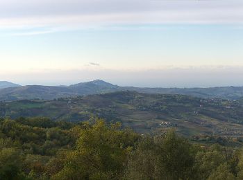
![Randonnée A pied Alta Val Tidone - IT-223 - Photo](https://media.geolcdn.com/t/350/260/0199cdd5-2743-4421-abd8-3ae9a42a7c0b.jpeg&format=jpg&maxdim=2)
![A pied A pied](https://static1.geolcdn.com/sitytour/trail-icons/100.png)
Km
A pied
![](/images/other/stat-length.png)
![](https://static1.geolcdn.com/siteimages/upload/files/1508320355ic_sort_den_pos_24dp.png)
![](https://static1.geolcdn.com/siteimages/upload/files/1508320355ic_sort_den_neg_24dp.png)
![](https://static1.geolcdn.com/siteimages/upload/files/16400158638029165_repeat_loop_refresh_sync_direction_icon.png)
• Randonnée créée par CAI Piacenza. Symbole: 223 on white red flag Site web: https://www.caipiacenza.it/
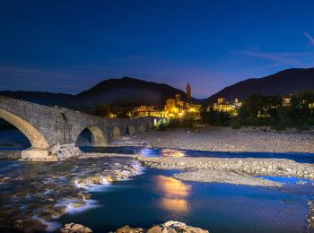
![Randonnée A pied Corte Brugnatella - IT-143 - Photo](https://media.geolcdn.com/t/350/260/8180adf3-5f52-4c43-8a16-6e0af8054bf8.jpeg&format=jpg&maxdim=2)
![A pied A pied](https://static1.geolcdn.com/sitytour/trail-icons/100.png)
Km
A pied
![](/images/other/stat-length.png)
![](https://static1.geolcdn.com/siteimages/upload/files/1508320355ic_sort_den_pos_24dp.png)
![](https://static1.geolcdn.com/siteimages/upload/files/1508320355ic_sort_den_neg_24dp.png)
![](https://static1.geolcdn.com/siteimages/upload/files/16400158638029165_repeat_loop_refresh_sync_direction_icon.png)
• Randonnée créée par Club Alpino Italiano. Symbole: White red flag
20 randonnées affichées sur 71
Application GPS de randonnée GRATUITE