![](/images/other/stat-length.png)
- Randonnées
- Outdoor
- Hongrie
- Grande plaine et nord
- Nógrád megye
- Szurdokpüspöki
Szurdokpüspöki, Nógrád megye : Les meilleures randonnées, itinéraires, parcours, balades et promenades
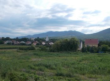
Szurdokpüspöki : découvrez les meilleures randonnées : 5 pédestres. Tous ces circuits, parcours, itinéraires et activités en plein air sont disponibles dans nos applications SityTrail pour smartphones et tablettes.
Les meilleurs parcours (5)
![Randonnée A pied Szurdokpüspöki - Mária Út M56-01 - Photo](https://media.geolcdn.com/t/350/260/2bc93b56-8d7b-4a64-b65d-8ffada04e206.jpeg&format=jpg&maxdim=2)
![A pied A pied](https://static1.geolcdn.com/sitytour/trail-icons/100.png)
Km
A pied
![](/images/other/stat-length.png)
![](https://static1.geolcdn.com/siteimages/upload/files/1508320355ic_sort_den_pos_24dp.png)
![](https://static1.geolcdn.com/siteimages/upload/files/1508320355ic_sort_den_neg_24dp.png)
![](https://static1.geolcdn.com/siteimages/upload/files/16400158638029165_repeat_loop_refresh_sync_direction_icon.png)
• Randonnée créée par MUTKE.
![Randonnée A pied Szurdokpüspöki - P3 (Pásztó-Muzsla tető) - Photo](https://media.geolcdn.com/t/350/260/30a210c6-3454-4688-be41-523ead2c5efe.jpeg&format=jpg&maxdim=2)
![A pied A pied](https://static1.geolcdn.com/sitytour/trail-icons/100.png)
Km
A pied
![](/images/other/stat-length.png)
![](https://static1.geolcdn.com/siteimages/upload/files/1508320355ic_sort_den_pos_24dp.png)
![](https://static1.geolcdn.com/siteimages/upload/files/1508320355ic_sort_den_neg_24dp.png)
![](https://static1.geolcdn.com/siteimages/upload/files/16400158638029165_repeat_loop_refresh_sync_direction_icon.png)
• Symbole: red triangle
![Randonnée A pied Szurdokpüspöki - Z+ (Szurdokpüspöki) - Photo](https://media.geolcdn.com/t/350/260/ccd35f38-b2dc-40e2-91d5-1b7af52cbda0.jpeg&format=jpg&maxdim=2)
![A pied A pied](https://static1.geolcdn.com/sitytour/trail-icons/100.png)
Km
A pied
![](/images/other/stat-length.png)
![](https://static1.geolcdn.com/siteimages/upload/files/1508320355ic_sort_den_pos_24dp.png)
![](https://static1.geolcdn.com/siteimages/upload/files/1508320355ic_sort_den_neg_24dp.png)
![](https://static1.geolcdn.com/siteimages/upload/files/16400158638029165_repeat_loop_refresh_sync_direction_icon.png)
• Folytatódik észak-kelet felé, együtt a P+ jelzéssel.
![Randonnée A pied Szurdokpüspöki - P+ (Rózsaszentmárton-Tilalmas tető) - Photo](https://media.geolcdn.com/t/350/260/ca933011-a22d-435d-821b-6c0269fbc536.jpeg&format=jpg&maxdim=2)
![A pied A pied](https://static1.geolcdn.com/sitytour/trail-icons/100.png)
Km
A pied
![](/images/other/stat-length.png)
![](https://static1.geolcdn.com/siteimages/upload/files/1508320355ic_sort_den_pos_24dp.png)
![](https://static1.geolcdn.com/siteimages/upload/files/1508320355ic_sort_den_neg_24dp.png)
![](https://static1.geolcdn.com/siteimages/upload/files/16400158638029165_repeat_loop_refresh_sync_direction_icon.png)
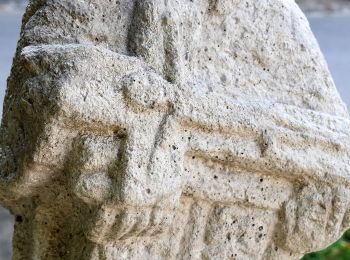
• Symbole: red cross
![Randonnée A pied Szurdokpüspöki - Z3 (Sóbánya-patak-Muzsla-tető) - Photo](https://media.geolcdn.com/t/350/260/ext.jpg?maxdim=2&url=https%3A%2F%2Fstatic1.geolcdn.com%2Fsiteimages%2Fupload%2Ffiles%2F1545311037marcheuse_200dpi.jpg)
![A pied A pied](https://static1.geolcdn.com/sitytour/trail-icons/100.png)
Km
A pied
![](/images/other/stat-length.png)
![](https://static1.geolcdn.com/siteimages/upload/files/1508320355ic_sort_den_pos_24dp.png)
![](https://static1.geolcdn.com/siteimages/upload/files/1508320355ic_sort_den_neg_24dp.png)
![](https://static1.geolcdn.com/siteimages/upload/files/16400158638029165_repeat_loop_refresh_sync_direction_icon.png)
• Symbole: green triangle
5 randonnées affichées sur 5
Application GPS de randonnée GRATUITE