![](/images/other/stat-length.png)
- Randonnées
- Outdoor
- Hongrie
- Hongrie centrale
Hongrie centrale, Hongrie : Les meilleures randonnées, itinéraires, parcours, balades et promenades
Hongrie centrale : découvrez les meilleures randonnées : 168 pédestres et 3 à vélo ou VTT. Tous ces circuits, parcours, itinéraires et activités en plein air sont disponibles dans nos applications SityTrail pour smartphones et tablettes.
Les meilleurs parcours (174)
![Randonnée A pied Ipolydamásd - Z+ Letkés - Photo](https://media.geolcdn.com/t/350/260/ba923c56-303a-4e23-b32f-11bef08891cb.jpeg&format=jpg&maxdim=2)
![A pied A pied](https://static1.geolcdn.com/sitytour/trail-icons/100.png)
Km
A pied
![](/images/other/stat-length.png)
![](https://static1.geolcdn.com/siteimages/upload/files/1508320355ic_sort_den_pos_24dp.png)
![](https://static1.geolcdn.com/siteimages/upload/files/1508320355ic_sort_den_neg_24dp.png)
![](https://static1.geolcdn.com/siteimages/upload/files/16400158638029165_repeat_loop_refresh_sync_direction_icon.png)
• Randonnée créée par BTHE.
![Randonnée A pied Inconnu - Normafa Kardioösvény (Normafa - János-hegy - Normafa) - Photo](https://media.geolcdn.com/t/350/260/a210dd18-a33c-4463-a3e0-26216e4297bb.jpeg&format=jpg&maxdim=2)
![A pied A pied](https://static1.geolcdn.com/sitytour/trail-icons/100.png)
Km
A pied
![](/images/other/stat-length.png)
![](https://static1.geolcdn.com/siteimages/upload/files/1508320355ic_sort_den_pos_24dp.png)
![](https://static1.geolcdn.com/siteimages/upload/files/1508320355ic_sort_den_neg_24dp.png)
![](https://static1.geolcdn.com/siteimages/upload/files/16400158638029165_repeat_loop_refresh_sync_direction_icon.png)
• Symbole: red T
![Randonnée A pied Pilisborosjenő - Pilisborosjenői Kevélyhegyi Tanösvény 1. (Pilisborosjenő - Kevély-nyereg - Pilisborosjenő) - Photo](https://media.geolcdn.com/t/350/260/14983b78-bf28-4244-a347-271dbd7f79f9.jpeg&format=jpg&maxdim=2)
![A pied A pied](https://static1.geolcdn.com/sitytour/trail-icons/100.png)
Km
A pied
![](/images/other/stat-length.png)
![](https://static1.geolcdn.com/siteimages/upload/files/1508320355ic_sort_den_pos_24dp.png)
![](https://static1.geolcdn.com/siteimages/upload/files/1508320355ic_sort_den_neg_24dp.png)
![](https://static1.geolcdn.com/siteimages/upload/files/16400158638029165_repeat_loop_refresh_sync_direction_icon.png)
• Symbole: blue T
![Randonnée A pied Mogyoród - Z+ (Mogyoród, Szent László kilátó - Mogyoród, Sikáros) - Photo](https://media.geolcdn.com/t/350/260/124728ef-2489-4a32-8b65-e17277a36598.jpeg&format=jpg&maxdim=2)
![A pied A pied](https://static1.geolcdn.com/sitytour/trail-icons/100.png)
Km
A pied
![](/images/other/stat-length.png)
![](https://static1.geolcdn.com/siteimages/upload/files/1508320355ic_sort_den_pos_24dp.png)
![](https://static1.geolcdn.com/siteimages/upload/files/1508320355ic_sort_den_neg_24dp.png)
![](https://static1.geolcdn.com/siteimages/upload/files/16400158638029165_repeat_loop_refresh_sync_direction_icon.png)
• Randonnée créée par Margita 344,2 TSE.
![Randonnée A pied Szigethalom - Tököli S+ - Photo](https://media.geolcdn.com/t/350/260/2b21d3e1-66be-4d60-826f-cfed0cdf9ce3.jpeg&format=jpg&maxdim=2)
![A pied A pied](https://static1.geolcdn.com/sitytour/trail-icons/100.png)
Km
A pied
![](/images/other/stat-length.png)
![](https://static1.geolcdn.com/siteimages/upload/files/1508320355ic_sort_den_pos_24dp.png)
![](https://static1.geolcdn.com/siteimages/upload/files/1508320355ic_sort_den_neg_24dp.png)
![](https://static1.geolcdn.com/siteimages/upload/files/16400158638029165_repeat_loop_refresh_sync_direction_icon.png)
• Randonnée créée par Pilisi Parkerdő Zrt..
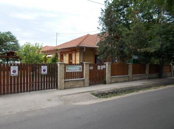
![Randonnée A pied Tököl - P4 (Tököli parkerdő-Szigethalom HÉV) - Photo](https://media.geolcdn.com/t/350/260/9b4ed709-91b8-4cc9-8bbe-78eb7dcf619b.jpeg&format=jpg&maxdim=2)
![A pied A pied](https://static1.geolcdn.com/sitytour/trail-icons/100.png)
Km
A pied
![](/images/other/stat-length.png)
![](https://static1.geolcdn.com/siteimages/upload/files/1508320355ic_sort_den_pos_24dp.png)
![](https://static1.geolcdn.com/siteimages/upload/files/1508320355ic_sort_den_neg_24dp.png)
![](https://static1.geolcdn.com/siteimages/upload/files/16400158638029165_repeat_loop_refresh_sync_direction_icon.png)
• Symbole: red square
![Randonnée A pied Gödöllő - P+ (Szadai Lovas SE - Gödöllő Királyi Kastély) - Photo](https://media.geolcdn.com/t/350/260/f11b0b60-4bd9-44a8-8fc3-8a35e024c2bd.jpeg&format=jpg&maxdim=2)
![A pied A pied](https://static1.geolcdn.com/sitytour/trail-icons/100.png)
Km
A pied
![](/images/other/stat-length.png)
![](https://static1.geolcdn.com/siteimages/upload/files/1508320355ic_sort_den_pos_24dp.png)
![](https://static1.geolcdn.com/siteimages/upload/files/1508320355ic_sort_den_neg_24dp.png)
![](https://static1.geolcdn.com/siteimages/upload/files/16400158638029165_repeat_loop_refresh_sync_direction_icon.png)
• Randonnée créée par Margita 344,2 TSE.
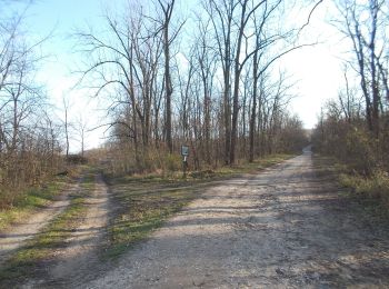
![Randonnée A pied Isaszeg - Z+ (Isaszeg, körforgalom - Honvédsírok) - Photo](https://media.geolcdn.com/t/350/260/8e8f7828-f430-4a46-a2bb-7d0e5ffb9dc0.jpeg&format=jpg&maxdim=2)
![A pied A pied](https://static1.geolcdn.com/sitytour/trail-icons/100.png)
Km
A pied
![](/images/other/stat-length.png)
![](https://static1.geolcdn.com/siteimages/upload/files/1508320355ic_sort_den_pos_24dp.png)
![](https://static1.geolcdn.com/siteimages/upload/files/1508320355ic_sort_den_neg_24dp.png)
![](https://static1.geolcdn.com/siteimages/upload/files/16400158638029165_repeat_loop_refresh_sync_direction_icon.png)
• Randonnée créée par Isaszegi Természetbarát Klub.
![Randonnée A pied Veresegyház - S+ (Veresegyház - Szada) - Photo](https://media.geolcdn.com/t/350/260/0ea936fc-b6e3-4552-b815-8526a9992a47.jpeg&format=jpg&maxdim=2)
![A pied A pied](https://static1.geolcdn.com/sitytour/trail-icons/100.png)
Km
A pied
![](/images/other/stat-length.png)
![](https://static1.geolcdn.com/siteimages/upload/files/1508320355ic_sort_den_pos_24dp.png)
![](https://static1.geolcdn.com/siteimages/upload/files/1508320355ic_sort_den_neg_24dp.png)
![](https://static1.geolcdn.com/siteimages/upload/files/16400158638029165_repeat_loop_refresh_sync_direction_icon.png)
• Randonnée créée par Margita 344,2 TSE.
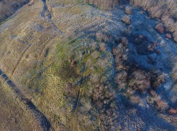
![Randonnée A pied Kerepes - S▲ (Kerepes - Szár-hegy - Szilasliget) - Photo](https://media.geolcdn.com/t/350/260/0ec27192-a2f0-4a79-bfe5-5d424b65e258.jpeg&format=jpg&maxdim=2)
![A pied A pied](https://static1.geolcdn.com/sitytour/trail-icons/100.png)
Km
A pied
![](/images/other/stat-length.png)
![](https://static1.geolcdn.com/siteimages/upload/files/1508320355ic_sort_den_pos_24dp.png)
![](https://static1.geolcdn.com/siteimages/upload/files/1508320355ic_sort_den_neg_24dp.png)
![](https://static1.geolcdn.com/siteimages/upload/files/16400158638029165_repeat_loop_refresh_sync_direction_icon.png)
• Randonnée créée par Margita 344,2 TSE.
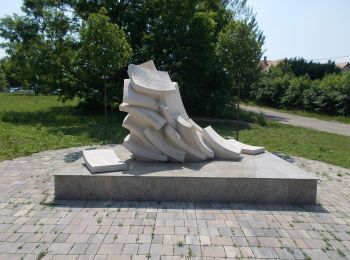
![Randonnée A pied Őrbottyán - Z+ (Erdőkertes - Őrbottyán) - Photo](https://media.geolcdn.com/t/350/260/b6f70283-b318-4625-82d3-26358d7b5ed8.jpeg&format=jpg&maxdim=2)
![A pied A pied](https://static1.geolcdn.com/sitytour/trail-icons/100.png)
Km
A pied
![](/images/other/stat-length.png)
![](https://static1.geolcdn.com/siteimages/upload/files/1508320355ic_sort_den_pos_24dp.png)
![](https://static1.geolcdn.com/siteimages/upload/files/1508320355ic_sort_den_neg_24dp.png)
![](https://static1.geolcdn.com/siteimages/upload/files/16400158638029165_repeat_loop_refresh_sync_direction_icon.png)
• Randonnée créée par Margita 344,2 TSE.
![Randonnée A pied Galgahévíz - K+ (Galgahévíz - Bikató - Pajavölgy) - Photo](https://media.geolcdn.com/t/350/260/4be9046b-28f6-4654-9d57-d1682ef55481.jpeg&format=jpg&maxdim=2)
![A pied A pied](https://static1.geolcdn.com/sitytour/trail-icons/100.png)
Km
A pied
![](/images/other/stat-length.png)
![](https://static1.geolcdn.com/siteimages/upload/files/1508320355ic_sort_den_pos_24dp.png)
![](https://static1.geolcdn.com/siteimages/upload/files/1508320355ic_sort_den_neg_24dp.png)
![](https://static1.geolcdn.com/siteimages/upload/files/16400158638029165_repeat_loop_refresh_sync_direction_icon.png)
• Randonnée créée par Margita 344,2 TSE.
![Randonnée A pied Inconnu - Hárs-hegyi tanösvény (Szent Ferenc Kórház - Szépjuhászné - Szent Ferenc Kórház) - Photo](https://media.geolcdn.com/t/350/260/ef274c3a-3838-46c3-be36-1bb2cf221eb5.jpeg&format=jpg&maxdim=2)
![A pied A pied](https://static1.geolcdn.com/sitytour/trail-icons/100.png)
Km
A pied
![](/images/other/stat-length.png)
![](https://static1.geolcdn.com/siteimages/upload/files/1508320355ic_sort_den_pos_24dp.png)
![](https://static1.geolcdn.com/siteimages/upload/files/1508320355ic_sort_den_neg_24dp.png)
![](https://static1.geolcdn.com/siteimages/upload/files/16400158638029165_repeat_loop_refresh_sync_direction_icon.png)
• Symbole: red T
![Randonnée A pied Szokolya - Z+ (Száraz Fák - Szokolya) - Photo](https://media.geolcdn.com/t/350/260/324d17e7-1f7a-44f6-a52c-2ea1af88c844.jpeg&format=jpg&maxdim=2)
![A pied A pied](https://static1.geolcdn.com/sitytour/trail-icons/100.png)
Km
A pied
![](/images/other/stat-length.png)
![](https://static1.geolcdn.com/siteimages/upload/files/1508320355ic_sort_den_pos_24dp.png)
![](https://static1.geolcdn.com/siteimages/upload/files/1508320355ic_sort_den_neg_24dp.png)
![](https://static1.geolcdn.com/siteimages/upload/files/16400158638029165_repeat_loop_refresh_sync_direction_icon.png)
• Randonnée créée par Műanyag SC.
![Randonnée A pied Pécel - Z+ (Isaszeg Z - Pécel Z) - Photo](https://media.geolcdn.com/t/350/260/af226a0f-4bbc-413a-baaa-6477c87eae03.jpeg&format=jpg&maxdim=2)
![A pied A pied](https://static1.geolcdn.com/sitytour/trail-icons/100.png)
Km
A pied
![](/images/other/stat-length.png)
![](https://static1.geolcdn.com/siteimages/upload/files/1508320355ic_sort_den_pos_24dp.png)
![](https://static1.geolcdn.com/siteimages/upload/files/1508320355ic_sort_den_neg_24dp.png)
![](https://static1.geolcdn.com/siteimages/upload/files/16400158638029165_repeat_loop_refresh_sync_direction_icon.png)
• Randonnée créée par Isaszegi Természetbarát Klub.
![Randonnée A pied Inconnu - K négyzet - Photo](https://media.geolcdn.com/t/350/260/94bdb959-a7c7-4f17-8e05-cee5d6b65fa3.jpeg&format=jpg&maxdim=2)
![A pied A pied](https://static1.geolcdn.com/sitytour/trail-icons/100.png)
Km
A pied
![](/images/other/stat-length.png)
![](https://static1.geolcdn.com/siteimages/upload/files/1508320355ic_sort_den_pos_24dp.png)
![](https://static1.geolcdn.com/siteimages/upload/files/1508320355ic_sort_den_neg_24dp.png)
![](https://static1.geolcdn.com/siteimages/upload/files/16400158638029165_repeat_loop_refresh_sync_direction_icon.png)
• Symbole: blue square
![Randonnée A pied Csobánka - Szent-kúti ösvény (Csobánkai templomok - Szent-kút - Csobánkai templomok) - Photo](https://media.geolcdn.com/t/350/260/c74d6ead-46a6-497e-9a19-a7c178723719.jpeg&format=jpg&maxdim=2)
![A pied A pied](https://static1.geolcdn.com/sitytour/trail-icons/100.png)
Km
A pied
![](/images/other/stat-length.png)
![](https://static1.geolcdn.com/siteimages/upload/files/1508320355ic_sort_den_pos_24dp.png)
![](https://static1.geolcdn.com/siteimages/upload/files/1508320355ic_sort_den_neg_24dp.png)
![](https://static1.geolcdn.com/siteimages/upload/files/16400158638029165_repeat_loop_refresh_sync_direction_icon.png)
• Symbole: red T
![Randonnée A pied Csobánka - Mackó-barlang ösvény (Csobánka, Oszoly-pihenő - Mackó-barlang - Csobánka, Oszoly-pihenő) - Photo](https://media.geolcdn.com/t/350/260/d4a5edbe-f94f-45e1-a16e-3979cff6bfe2.jpeg&format=jpg&maxdim=2)
![A pied A pied](https://static1.geolcdn.com/sitytour/trail-icons/100.png)
Km
A pied
![](/images/other/stat-length.png)
![](https://static1.geolcdn.com/siteimages/upload/files/1508320355ic_sort_den_pos_24dp.png)
![](https://static1.geolcdn.com/siteimages/upload/files/1508320355ic_sort_den_neg_24dp.png)
![](https://static1.geolcdn.com/siteimages/upload/files/16400158638029165_repeat_loop_refresh_sync_direction_icon.png)
• Symbole: red T
![Randonnée A pied Pomáz - Erdőszéli ösvény (Csobánka, Margitliget - Csobánkai-nyereg - Csobánkai templomok) - Photo](https://media.geolcdn.com/t/350/260/ca53fcb1-e725-4d7a-bae7-24cc7f094d41.jpeg&format=jpg&maxdim=2)
![A pied A pied](https://static1.geolcdn.com/sitytour/trail-icons/100.png)
Km
A pied
![](/images/other/stat-length.png)
![](https://static1.geolcdn.com/siteimages/upload/files/1508320355ic_sort_den_pos_24dp.png)
![](https://static1.geolcdn.com/siteimages/upload/files/1508320355ic_sort_den_neg_24dp.png)
![](https://static1.geolcdn.com/siteimages/upload/files/16400158638029165_repeat_loop_refresh_sync_direction_icon.png)
• Symbole: red T
![Randonnée A pied Üröm - Ürömi tanösvény - Déli útvonal (Üröm, Templom tér - Péter-hegy - Üröm, Templom tér) - Photo](https://media.geolcdn.com/t/350/260/c69cb42e-1888-4e85-97d8-696333d3bc3a.jpeg&format=jpg&maxdim=2)
![A pied A pied](https://static1.geolcdn.com/sitytour/trail-icons/100.png)
Km
A pied
![](/images/other/stat-length.png)
![](https://static1.geolcdn.com/siteimages/upload/files/1508320355ic_sort_den_pos_24dp.png)
![](https://static1.geolcdn.com/siteimages/upload/files/1508320355ic_sort_den_neg_24dp.png)
![](https://static1.geolcdn.com/siteimages/upload/files/16400158638029165_repeat_loop_refresh_sync_direction_icon.png)
• Symbole: red T
20 randonnées affichées sur 174
Application GPS de randonnée GRATUITE