


13,5 km | 21 km-effort
Conca : découvrez les meilleures randonnées : 32 pédestres et 2 à vélo ou VTT. Tous ces circuits, parcours, itinéraires et activités en plein air sont disponibles dans nos applications SityTrail pour smartphones et tablettes.
Marche


Marche
• xxx
Marche
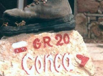
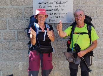
• Dernière étape

Marche
• Interminable descente
Marche
• Praliti Coca
Marche
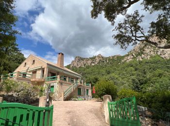
• GR 20® du refuge d'I Paliri à Conca - dernière étape, n°15 Conca, à 20 km au nord de Porto-Vecchio, n'est pas située ...
Trail
Marche
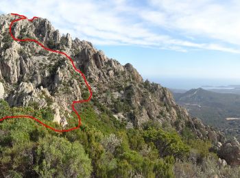
• La Punta d'Ortu est la plus haute des trois pointes qui surplombent le village de Conca et sont visibles de partout. ...
Marche

Marche
• Le sommet de Punta D'Ortu est un superbe belvédère côté mer et côté montagne. Une sente un peu ténue à partir du GR20...

V.T.T.
• Favone Zonza
Marche
• 14/06/2009
Marche
• 13/06/2009
Marche
• 12,7 km, +1199m, - 412m, 5h36
Marche
• Première étape GR20 en partant par le sud...
Marche
• 1 Refuge d'i Paliri 1055m 2 Refuge d'Asinau 1536m .....Sommet Incudine 2134m 3 Refuge d'Usciolu Alpine 1740m. .......
Marche
• au départ de Conca, GR 20 retour à la casade Punta Pinzuta
Marche
• GR 20 au départ de Conca aller retour
Marche
• Du Refuge D'I Palieri a Conca
Marche
• Première étape du GR 20 dans le sens sud-nord
20 randonnées affichées sur 34
Application GPS de randonnée GRATUITE
 SityTrail
IGN / Instituts géographiques
SityTrail World
Le monde est à vous