


12,8 km | 17,2 km-effort
Gentioux-Pigerolles : découvrez les meilleures randonnées : 7 pédestres et 2 à vélo ou VTT. Tous ces circuits, parcours, itinéraires et activités en plein air sont disponibles dans nos applications SityTrail pour smartphones et tablettes.
Marche


• Peu de pentes , passages ombragés, tourbières
V.T.T.
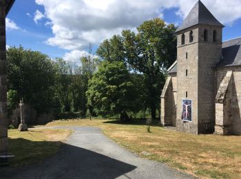
• Partant du célèbre Monument aux Morts de Gentioux, le circuit se dirige vers le nord, à travers la forêt pour rejoind...
Marche
• Partant du célèbre Monument aux Morts de Gentioux, le circuit se dirige vers le nord, à travers la forêt pour rejoind...
V.T.T.
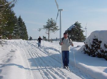
• Panoramas sur les éoliennes du plateau de Gentioux-Peyrelevade, les Monts d'Auvergne et le petit ruisseau de Cubaynes.

Marche
• Panoramas sur les éoliennes du plateau de Gentioux-Peyrelevade, les Monts d'Auvergne et le petit ruisseau de Cubaynes.

Marche
Marche
Marche
Marche
9 randonnées affichées sur 9
Application GPS de randonnée GRATUITE
 SityTrail
IGN / Instituts géographiques
SityTrail World
Le monde est à vous