


10,2 km | 12,8 km-effort
Caubeyres : découvrez les meilleures randonnées : 6 pédestres, 5 à vélo ou VTT et 1 parcours équestres. Tous ces circuits, parcours, itinéraires et activités en plein air sont disponibles dans nos applications SityTrail pour smartphones et tablettes.

A pied


• Randonnée créée par CDT47.
Marche
• Bien ombragé
Cheval
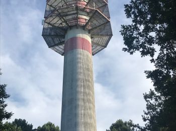
• Caubeyres - Pays d'Albret. Caubeyres Communauté de Communes du Val d’Albret. Le panorama du château, une vue fugitive...

V.T.T.
• Caubeyres - Pays d'Albret. Caubeyres Communauté de Communes du Val d’Albret. Le panorama du château, une vue fugitive...

Marche
• Caubeyres - Pays d'Albret. Caubeyres Communauté de Communes du Val d’Albret. Le panorama du château, une vue fugitive...

V.T.C.
• Une petite course pour du chocolat

Marche
• Sortie épicerie à pied par la route 285
V.T.T.
• Ballade de soir en forêt à l’ombre.. chemin très roulant malgré qq passages de sable Chevreuil et lièvre
V.T.T.
• Route et chemin pour chercher ombre et points d’eau pour notre chien
V.T.T.
• Route , chemin et piste Passage devant l’église de St Julien Pause visite chez habitants
Marche
• Juste dans le bois à l’ouest du chalet avec de bonnes senteurs des pins
Marche
• Petit tour à faire le latin avec un bâton pour enlever les toiles d’araignées et à pied à cause des chemins parfois d...
12 randonnées affichées sur 12
Application GPS de randonnée GRATUITE
 SityTrail
IGN / Instituts géographiques
SityTrail World
Le monde est à vous