


6,9 km | 8,7 km-effort
Lafage-sur-Sombre : découvrez les meilleures randonnées : 4 pédestres, 2 à vélo ou VTT et 1 parcours équestres. Tous ces circuits, parcours, itinéraires et activités en plein air sont disponibles dans nos applications SityTrail pour smartphones et tablettes.

Marche


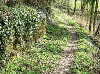
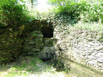
• Bois et moulins - Lafage sur Sombre - Pays d'Égletons. Autrefois nombreux, les moulins de la Sombre se succédaient : ...

Cheval
• Sur les traces du Tacot - Lafage sur Sombre - Pays d'Égletons. Le Tacot, petit train à vapeur qui arpentât le premier...
V.T.T.
• Sur les traces du Tacot - Lafage sur Sombre - Pays d'Égletons. Le Tacot, petit train à vapeur qui arpentât le premier...

Marche
• Sur les traces du Tacot - Lafage sur Sombre - Pays d'Égletons. Le Tacot, petit train à vapeur qui arpentât le premier...
V.T.T.
• Bois et moulins - Lafage sur Sombre - Pays d'Égletons. Autrefois nombreux, les moulins de la Sombre se succédaient : ...

A pied
A pied
7 randonnées affichées sur 7
Application GPS de randonnée GRATUITE
 SityTrail
IGN / Instituts géographiques
SityTrail World
Le monde est à vous