


13,3 km | 18,2 km-effort
Saint-Yrieix-le-Déjalat : découvrez les meilleures randonnées : 4 pédestres et 1 à vélo ou VTT. Tous ces circuits, parcours, itinéraires et activités en plein air sont disponibles dans nos applications SityTrail pour smartphones et tablettes.
V.T.T.


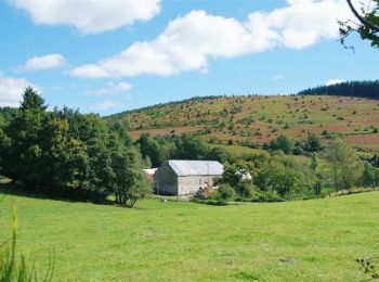
• La Butte de Montamar - Saint Yrieix le Déjalat - Pays d'Egletons. Panorama sur les puys et fraîcheur des fonds de val...

Marche
• La Butte de Montamar - Saint Yrieix le Déjalat - Pays d'Egletons. Panorama sur les puys et fraîcheur des fonds de val...

Marche
• Départ sur la piste des molles (500m de la route de St Yrieix). on passe près de Viellemaison, au bout du chemin qui ...
Marche
• Cheminer avec prudence le long de la D 18 même si l'on croise très peu de voitures ! Un peu trop de bitume sur le par...

A pied
5 randonnées affichées sur 5
Application GPS de randonnée GRATUITE
 SityTrail
IGN / Instituts géographiques
SityTrail World
Le monde est à vous