![](/images/other/stat-length.png)
- Randonnées
- Outdoor
- France
- Centre-Val de Loire
- Indre-et-Loire
- Le Louroux
Le Louroux, Indre-et-Loire : Les meilleures randonnées, itinéraires, parcours, balades et promenades
Le Louroux : découvrez les meilleures randonnées : 5 pédestres. Tous ces circuits, parcours, itinéraires et activités en plein air sont disponibles dans nos applications SityTrail pour smartphones et tablettes.
Les meilleurs parcours (5)
![Randonnée Marche Le Louroux - le Louroux - variante PR Boucle 2 - 17km 105m 3h45 (45mn) - 2023 09 27 - Photo](https://media.geolcdn.com/t/350/260/58898b0e-a0ff-42d6-aa8d-bf53b51214af.jpg&format=jpg&maxdim=2)
![Marche Marche](https://static1.geolcdn.com/sitytour/trail-icons/101.png)
Km
Marche
![](/images/other/stat-length.png)
![](https://static1.geolcdn.com/siteimages/upload/files/1508320355ic_sort_den_pos_24dp.png)
![](https://static1.geolcdn.com/siteimages/upload/files/1508320355ic_sort_den_neg_24dp.png)
![](https://static1.geolcdn.com/siteimages/upload/files/16400158638029165_repeat_loop_refresh_sync_direction_icon.png)
• le Louroux - variante du PR Boucle 2 le Louroux - 17km 105m 3h45 (45mn) - 2023 09 27
![Randonnée Marche Le Louroux - Le Louroux - boucle 1 - 20.9km 100m 4h45 (35mn) - 2019 07 28 - Photo](https://media.geolcdn.com/t/350/260/e4937dd1-0db1-4584-903c-0de16f5ebd84.jpg&format=jpg&maxdim=2)
![Marche Marche](https://static1.geolcdn.com/sitytour/trail-icons/101.png)
Km
Marche
![](/images/other/stat-length.png)
![](https://static1.geolcdn.com/siteimages/upload/files/1508320355ic_sort_den_pos_24dp.png)
![](https://static1.geolcdn.com/siteimages/upload/files/1508320355ic_sort_den_neg_24dp.png)
![](https://static1.geolcdn.com/siteimages/upload/files/16400158638029165_repeat_loop_refresh_sync_direction_icon.png)
• Le Louroux - boucle 1 - 20.9km 100m 4h45 (35mn) - 2019 07 28
![Randonnée A pied Le Louroux - Étang du Louroux - Photo](https://media.geolcdn.com/t/350/260/067cd358-23cf-4f13-bcee-73ccbeccde6e.jpeg&format=jpg&maxdim=2)
![A pied A pied](https://static1.geolcdn.com/sitytour/trail-icons/100.png)
Km
A pied
![](/images/other/stat-length.png)
![](https://static1.geolcdn.com/siteimages/upload/files/1508320355ic_sort_den_pos_24dp.png)
![](https://static1.geolcdn.com/siteimages/upload/files/1508320355ic_sort_den_neg_24dp.png)
![](https://static1.geolcdn.com/siteimages/upload/files/16400158638029165_repeat_loop_refresh_sync_direction_icon.png)
![Randonnée Marche Le Louroux - le Louroux - Photo](https://media.geolcdn.com/t/350/260/a5d0e937-5079-42e0-8aa4-569e450591d6.jpg&format=jpg&maxdim=2)
![Marche Marche](https://static1.geolcdn.com/sitytour/trail-icons/101.png)
Km
Marche
![](/images/other/stat-length.png)
![](https://static1.geolcdn.com/siteimages/upload/files/1508320355ic_sort_den_pos_24dp.png)
![](https://static1.geolcdn.com/siteimages/upload/files/1508320355ic_sort_den_neg_24dp.png)
![](https://static1.geolcdn.com/siteimages/upload/files/16400158638029165_repeat_loop_refresh_sync_direction_icon.png)
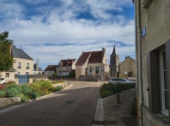
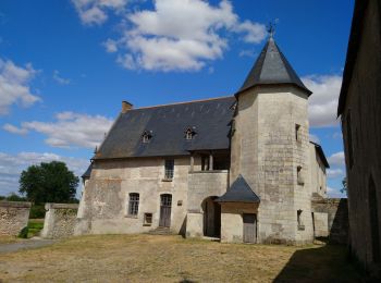
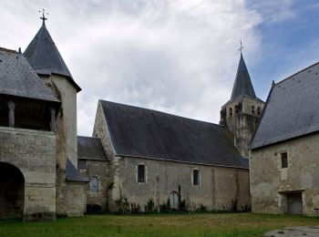
• Le Louroux est un espace naturel bien aménagé pour regarder les oiseaux. la randonée ce termine par la visite du prie...
![Randonnée Marche Le Louroux - Le Louroux/Manthelan - Photo](https://media.geolcdn.com/t/350/260/ext.jpg?maxdim=2&url=https%3A%2F%2Fstatic1.geolcdn.com%2Fsiteimages%2Fupload%2Ffiles%2F1553511878bg_sport_marche.png)
![Marche Marche](https://static1.geolcdn.com/sitytour/trail-icons/101.png)
Km
Marche
![](/images/other/stat-length.png)
![](https://static1.geolcdn.com/siteimages/upload/files/1508320355ic_sort_den_pos_24dp.png)
![](https://static1.geolcdn.com/siteimages/upload/files/1508320355ic_sort_den_neg_24dp.png)
![](https://static1.geolcdn.com/siteimages/upload/files/16400158638029165_repeat_loop_refresh_sync_direction_icon.png)
5 randonnées affichées sur 5
Application GPS de randonnée GRATUITE