Athée-sur-Cher, Indre-et-Loire : Les meilleures randonnées, itinéraires, parcours, balades et promenades

1 commentaires

Athée-sur-Cher : découvrez les meilleures randonnées : 9 pédestres et 1 à vélo ou VTT. Tous ces circuits, parcours, itinéraires et activités en plein air sont disponibles dans nos applications SityTrail pour smartphones et tablettes.


Les meilleurs parcours (10)
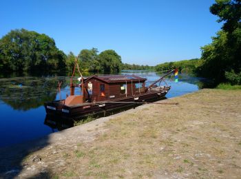
Randonnée Marche Athée-sur-Cher - Athée-sur-Cher - Port Chandon - 18km 140m 4h05 - 2022 07 24 - Photo
Marche 17.956
Km
GUIDE

Marche

Facile
Athée-sur-Cher, Centre-Val de Loire, Indre-et-Loire, France
18 km | 19,8 km-effort
4h 5min
140 m
141 m
Oui
Orcal37

• Athée-sur-Cher - Port Chandon - 18km 140m 4h05 - 2022 07 24

Randonnée Marche Athée-sur-Cher - Athée-sur-Cher - la Halbutterie - 18.6km 155m 3h50 - 2006 05 14 - Photo
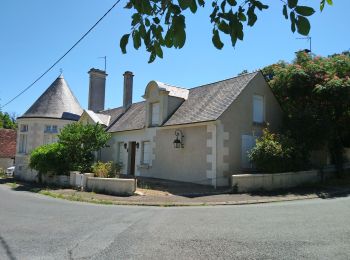
Marche 18.62
Km
GUIDE

Marche

Facile
Athée-sur-Cher, Centre-Val de Loire, Indre-et-Loire, France
18,6 km | 21 km-effort
3h 50min
156 m
156 m
Oui
Orcal37

• Athée-sur-Cher - la Halbutterie - 18.6km 155m 3h50 - 2006 05 14

Randonnée Marche Athée-sur-Cher - Nitray - Bléré (pont rocade) AR - 13.8km 125m 2h25 - 2015 11 15 - Photo
Marche 13.801
Km
GUIDE

Marche

Facile
Athée-sur-Cher, Centre-Val de Loire, Indre-et-Loire, France
13,8 km | 15,5 km-effort
2h 25min
125 m
125 m
Oui
Orcal37

• Nitray - Bléré (pont rocade) AR - 13.8km 125m 2h25 - 2015 11 15 Photo du point de départ.
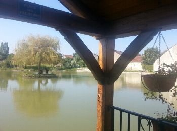
Randonnée Marche Athée-sur-Cher - Athée sur Cher - Photo
Marche 20.848
Km

Marche

Facile
(1)
Athée-sur-Cher, Centre-Val de Loire, Indre-et-Loire, France
21 km | 23 km-effort
4h 15min
164 m
163 m
Oui
danaubrac

• Grand tour de la commune, à travers champs, bois et vignes

Randonnée Marche Athée-sur-Cher -  b - Photo
Marche 15.445
Km

Marche

Très facile
Athée-sur-Cher, Centre-Val de Loire, Indre-et-Loire, France
15,4 km | 17 km-effort
18min
115 m
121 m
Non
johonled

• cyx

Randonnée Marche Athée-sur-Cher - Athée sur Cher - Photo
Marche 12.616
Km

Marche

Facile
Athée-sur-Cher, Centre-Val de Loire, Indre-et-Loire, France
12,6 km | 14,3 km-effort
3h 9min
128 m
130 m
Oui
LEMENIO

• Départ place de l'église: à l'arrivée aux abords du cher,il est possible de prendre le chemin qui longe la rivière (p...

Randonnée Marche Athée-sur-Cher - port chandon - Photo
Marche 7.212
Km

Marche

Facile
Athée-sur-Cher, Centre-Val de Loire, Indre-et-Loire, France
7,2 km | 8,2 km-effort
1h 40min
73 m
72 m
Oui
jeanjean37

Randonnée V.T.C. Athée-sur-Cher - port chandon Chenonceau  - Photo
V.T.C. 29.677
Km

V.T.C.

Moyen
Athée-sur-Cher, Centre-Val de Loire, Indre-et-Loire, France
30 km | 33 km-effort
1h 59min
236 m
236 m
Oui
jeanjean37

Randonnée Marche Athée-sur-Cher - port chandon la boissiere - Photo
Marche 6.032
Km

Marche

Très facile
Athée-sur-Cher, Centre-Val de Loire, Indre-et-Loire, France
6 km | 7 km-effort
1h 23min
72 m
72 m
Oui
jeanjean37

Randonnée Marche Athée-sur-Cher - athee 1 - Photo
Marche 8.22
Km

Marche

Très facile
Athée-sur-Cher, Centre-Val de Loire, Indre-et-Loire, France
8,2 km | 9,6 km-effort
2h 10min
104 m
100 m
Non
murph

10 randonnées affichées sur 10

Application GPS de randonnée GRATUITE

Logo SityTrail SityTrail

IGN / Instituts géographiques

Télécharger SityTrail sur l'App Store Télécharger SityTrail sur Google Play

Logo SityTrail SityTrail World

Le monde est à vous

Télécharger SityTrail sur l'App Store Télécharger SityTrail sur Google Play Télécharger SityTrail sur Huawei AppGallery

Activités

Fermer
Mes abonnements