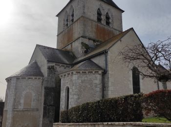
Saint-Bohaire, Loir-et-Cher : Les meilleures randonnées, itinéraires, parcours, balades et promenades

Saint-Bohaire : découvrez les meilleures randonnées : 8 pédestres. Tous ces circuits, parcours, itinéraires et activités en plein air sont disponibles dans nos applications SityTrail pour smartphones et tablettes.


Les meilleurs parcours (8)

Randonnée Marche Saint-Bohaire - Randonnée de Saint Notaire, reconnaissance BBR - Photo
Marche 14.532
Km

Marche

Très facile
Saint-Bohaire, Centre-Val de Loire, Loir-et-Cher, France
14,5 km | 16,7 km-effort
3h 2min
165 m
165 m
Oui
Ecureuiltrailer

• Agréable parcours, varié.

Randonnée Marche Saint-Bohaire - St Bohaire AD - Photo
Marche 17.016
Km

Marche

Facile
Saint-Bohaire, Centre-Val de Loire, Loir-et-Cher, France
17 km | 19,2 km-effort
3h 41min
165 m
167 m
Non
christ41

• rando sans problème

Randonnée Marche Saint-Bohaire - St Bohaire  - Photo
Marche 14.414
Km

Marche

Saint-Bohaire, Centre-Val de Loire, Loir-et-Cher, France
14,4 km | 16,5 km-effort
3h 14min
155 m
154 m
Oui
chantal hahusseau

• Départ tennis

Randonnée Marche Saint-Bohaire - BBR ST BOHAIRE 15 - Photo
Marche 14.872
Km

Marche

Très facile
Saint-Bohaire, Centre-Val de Loire, Loir-et-Cher, France
14,9 km | 17,3 km-effort
1h 0min
184 m
185 m
Oui
Mopti

Randonnée Marche Saint-Bohaire - saint Bohaire - Photo
Marche 16.983
Km

Marche

Très difficile
Saint-Bohaire, Centre-Val de Loire, Loir-et-Cher, France
17 km | 19,3 km-effort
3h 23min
171 m
174 m
Oui
laurence41

Randonnée Marche Saint-Bohaire - ferme de la voce. st bohaire  - Photo
Marche 15.787
Km

Marche

Très facile
Saint-Bohaire, Centre-Val de Loire, Loir-et-Cher, France
15,8 km | 18,1 km-effort
3h 27min
176 m
166 m
Oui
Véronique Lamure

Randonnée Marche Saint-Bohaire - Chatulay - Photo
Marche 5.882
Km

Marche

Très facile
Saint-Bohaire, Centre-Val de Loire, Loir-et-Cher, France
5,9 km | 6,6 km-effort
1h 38min
52 m
53 m
Oui
gerardbenchetrit

Randonnée Marche Saint-Bohaire - Saint Bohaire14.9 - Photo
Marche 14.925
Km

Marche

Très facile
Saint-Bohaire, Centre-Val de Loire, Loir-et-Cher, France
14,9 km | 17,4 km-effort
3h 58min
185 m
185 m
Oui
murph

8 randonnées affichées sur 8

Application GPS de randonnée GRATUITE

Logo SityTrail SityTrail

IGN / Instituts géographiques

Télécharger SityTrail sur l'App Store Télécharger SityTrail sur Google Play

Logo SityTrail SityTrail World

Le monde est à vous

Télécharger SityTrail sur l'App Store Télécharger SityTrail sur Google Play Télécharger SityTrail sur Huawei AppGallery

Activités

Fermer
Mes abonnements