


4 km | 4,4 km-effort
Lys-Haut-Layon : découvrez les meilleures randonnées : 25 pédestres et 1 à vélo ou VTT. Tous ces circuits, parcours, itinéraires et activités en plein air sont disponibles dans nos applications SityTrail pour smartphones et tablettes.
A pied


• Randonnée créée par Office de Tourisme du Vihiersois Haut-Layon.

A pied
• Randonnée créée par Office de Tourisme du Vihiersois Haut-Layon.
A pied
• Randonnée créée par Office de Tourisme du Vihiersois Haut-Layon.
A pied
• Randonnée créée par Office de Tourisme du Vihiersois Haut-Layon.
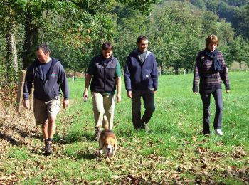
Marche

A pied
• Randonnée créée par Office de Tourisme du Vihiersois Haut-Layon.
A pied
• Randonnée créée par Office de Tourisme du Vihiersois Haut-Layon.
A pied
• Randonnée créée par Office de Tourisme du Vihiersois Haut-Layon.
A pied
• Randonnée créée par Office de Tourisme du Vihiersois Haut-Layon. Site web: https://www.ot-cholet.fr/grand-public/d...
A pied
• Randonnée créée par Office de Tourisme du Vihiersois Haut-Layon.
A pied
• Randonnée créée par Office de Tourisme du Vihiersois Haut-Layon.
Marche
• Ce parcours vous fait déambuler à travers la plaine et la vigne, entrecoupé par un passage en forêt de Brignon. Passa...
Marche
• Le parcours, entre les trois monts sur lesquels est situé la commune de Trémont, traverse le vignoble du Haut layon. ...
Marche
• Attention! Tronçons inondés en période de hautes eaux. Cette boucle autour de Vihiers, grosse agglomération entre Lay...
Marche
• L'itinéraire débute par la traversée de vastes plaines ouvertes, se prolonge dans les bois puis continue en alternant...
Marche
• Cette promenade entre vignes et hameaux vous fera découvrir un patrimoine rural de qualité: chateaux, manoirs, maison...
Marche
• Ce parcours champêtre, entre prairies et cultures diverses, vous offrira un beau panorama sur l'ensemble d ela campag...
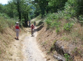
V.T.T.
• Espace VTT - FFC des Coteaux du Layon Circuit labellisé par la Fédération Française de Cyclisme. Un circuit entre Vih...

Quad
• Rando

Marche
• Départ place de l 'église
20 randonnées affichées sur 27
Application GPS de randonnée GRATUITE
 SityTrail
IGN / Instituts géographiques
SityTrail World
Le monde est à vous