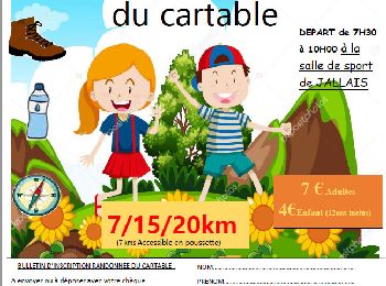
![](/images/other/stat-length.png)
- Randonnées
- Outdoor
- France
- Pays de la Loire
- Maine-et-Loire
- Beaupréau-en-Mauges
Beaupréau-en-Mauges, Maine-et-Loire : Les meilleures randonnées, itinéraires, parcours, balades et promenades
Beaupréau-en-Mauges : découvrez les meilleures randonnées : 33 pédestres et 8 à vélo ou VTT. Tous ces circuits, parcours, itinéraires et activités en plein air sont disponibles dans nos applications SityTrail pour smartphones et tablettes.
Les meilleurs parcours (45)
![Randonnée Course à pied Beaupréau-en-Mauges - abbaye andreze - Photo](https://media.geolcdn.com/t/350/260/ext.jpg?maxdim=2&url=https%3A%2F%2Fservices.sitytrail.com%2FGeolivesWS%2FDownloadMedia.ashx%3FTrailID%3D427408%26Media%3Dfix__20150529182454.jpg)
![Course à pied Course à pied](https://static1.geolcdn.com/sitytour/trail-icons/103.png)
Km
Course à pied
![](/images/other/stat-length.png)
![](https://static1.geolcdn.com/siteimages/upload/files/1508320355ic_sort_den_pos_24dp.png)
![](https://static1.geolcdn.com/siteimages/upload/files/1508320355ic_sort_den_neg_24dp.png)
![](https://static1.geolcdn.com/siteimages/upload/files/16400158638029165_repeat_loop_refresh_sync_direction_icon.png)
• variée
![Randonnée Course à pied Beaupréau-en-Mauges - andreze - Photo](https://media.geolcdn.com/t/350/260/ext.jpg?maxdim=2&url=https%3A%2F%2Fservices.sitytrail.com%2FGeolivesWS%2FDownloadMedia.ashx%3FTrailID%3D413503%26Media%3Dfix__20150428182640.jpg)
![Course à pied Course à pied](https://static1.geolcdn.com/sitytour/trail-icons/103.png)
Km
Course à pied
![](/images/other/stat-length.png)
![](https://static1.geolcdn.com/siteimages/upload/files/1508320355ic_sort_den_pos_24dp.png)
![](https://static1.geolcdn.com/siteimages/upload/files/1508320355ic_sort_den_neg_24dp.png)
![](https://static1.geolcdn.com/siteimages/upload/files/16400158638029165_repeat_loop_refresh_sync_direction_icon.png)
• roulant
![Randonnée Marche Beaupréau-en-Mauges - gesté - lac thévinière - Photo](https://media.geolcdn.com/t/350/260/ext.jpg?maxdim=2&url=https%3A%2F%2Fservices.sitytrail.com%2FGeolivesWS%2FDownloadMedia.ashx%3FTrailID%3D210245%26Media%3Dfix__20130804172229.jpg)
![Marche Marche](https://static1.geolcdn.com/sitytour/trail-icons/101.png)
Km
Marche
![](/images/other/stat-length.png)
![](https://static1.geolcdn.com/siteimages/upload/files/1508320355ic_sort_den_pos_24dp.png)
![](https://static1.geolcdn.com/siteimages/upload/files/1508320355ic_sort_den_neg_24dp.png)
![](https://static1.geolcdn.com/siteimages/upload/files/16400158638029165_repeat_loop_refresh_sync_direction_icon.png)
•
![Randonnée Marche Beaupréau-en-Mauges - gesté - lac thévinière - Photo](https://media.geolcdn.com/t/350/260/ext.jpg?maxdim=2&url=https%3A%2F%2Fservices.sitytrail.com%2FGeolivesWS%2FDownloadMedia.ashx%3FTrailID%3D210244%26Media%3Dfix__20130804165930.jpg)
![Marche Marche](https://static1.geolcdn.com/sitytour/trail-icons/101.png)
Km
Marche
![](/images/other/stat-length.png)
![](https://static1.geolcdn.com/siteimages/upload/files/1508320355ic_sort_den_pos_24dp.png)
![](https://static1.geolcdn.com/siteimages/upload/files/1508320355ic_sort_den_neg_24dp.png)
![](https://static1.geolcdn.com/siteimages/upload/files/16400158638029165_repeat_loop_refresh_sync_direction_icon.png)
•
![Randonnée Marche Beaupréau-en-Mauges - les 2 chapelles - Photo](https://media.geolcdn.com/t/350/260/ext.jpg?maxdim=2&url=https%3A%2F%2Fservices.sitytrail.com%2FGeolivesWS%2FDownloadMedia.ashx%3FTrailID%3D140570%26Media%3D20120722095810.jpeg)
![Marche Marche](https://static1.geolcdn.com/sitytour/trail-icons/101.png)
Km
Marche
![](/images/other/stat-length.png)
![](https://static1.geolcdn.com/siteimages/upload/files/1508320355ic_sort_den_pos_24dp.png)
![](https://static1.geolcdn.com/siteimages/upload/files/1508320355ic_sort_den_neg_24dp.png)
![](https://static1.geolcdn.com/siteimages/upload/files/16400158638029165_repeat_loop_refresh_sync_direction_icon.png)
•
![Randonnée Marche Beaupréau-en-Mauges - parc du château à Beaupreau - Photo](https://media.geolcdn.com/t/350/260/ext.jpg?maxdim=2&url=https%3A%2F%2Fservices.sitytrail.com%2FGeolivesWS%2FDownloadMedia.ashx%3FTrailID%3D567022%26Media%3Dfix__20160510110605.jpg)
![Marche Marche](https://static1.geolcdn.com/sitytour/trail-icons/101.png)
Km
Marche
![](/images/other/stat-length.png)
![](https://static1.geolcdn.com/siteimages/upload/files/1508320355ic_sort_den_pos_24dp.png)
![](https://static1.geolcdn.com/siteimages/upload/files/1508320355ic_sort_den_neg_24dp.png)
![](https://static1.geolcdn.com/siteimages/upload/files/16400158638029165_repeat_loop_refresh_sync_direction_icon.png)
![Randonnée V.T.T. Beaupréau-en-Mauges - Rando de l'omelette - Le Pin en Mauges - Photo](https://media.geolcdn.com/t/350/260/ext.jpg?maxdim=2&url=https%3A%2F%2Fservices.sitytrail.com%2FGeolivesWS%2FDownloadMedia.ashx%3FTrailID%3D103865%26Media%3D6668_1.jpg)
![V.T.T. V.T.T.](https://static1.geolcdn.com/sitytour/trail-icons/202.png)
Km
V.T.T.
![](/images/other/stat-length.png)
![](https://static1.geolcdn.com/siteimages/upload/files/1508320355ic_sort_den_pos_24dp.png)
![](https://static1.geolcdn.com/siteimages/upload/files/1508320355ic_sort_den_neg_24dp.png)
![](https://static1.geolcdn.com/siteimages/upload/files/16400158638029165_repeat_loop_refresh_sync_direction_icon.png)
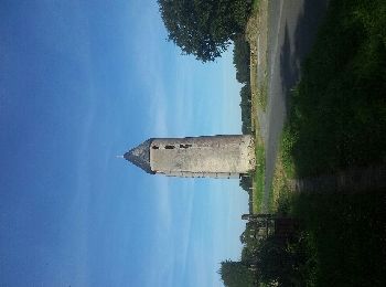
• Une des randos de l'édition 2009.
![Randonnée Marche Beaupréau-en-Mauges - 16/02/2025 le pin en mauges 2 - Photo](https://media.geolcdn.com/t/350/260/ext.jpg?maxdim=2&url=https%3A%2F%2Fstatic1.geolcdn.com%2Fsiteimages%2Fupload%2Ffiles%2F1553511878bg_sport_marche.png)
![Marche Marche](https://static1.geolcdn.com/sitytour/trail-icons/101.png)
Km
Marche
![](/images/other/stat-length.png)
![](https://static1.geolcdn.com/siteimages/upload/files/1508320355ic_sort_den_pos_24dp.png)
![](https://static1.geolcdn.com/siteimages/upload/files/1508320355ic_sort_den_neg_24dp.png)
![](https://static1.geolcdn.com/siteimages/upload/files/16400158638029165_repeat_loop_refresh_sync_direction_icon.png)
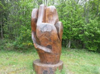
• départ place de l'église tracé modifié car le tracé visorando nous faisait passer par des endroits très humide
![Randonnée Marche Beaupréau-en-Mauges - Beaupréau: Le parc, le château, le Vigneau - Photo](https://media.geolcdn.com/t/350/260/ext.jpg?maxdim=2&url=https%3A%2F%2Fstatic1.geolcdn.com%2Fsiteimages%2Fupload%2Ffiles%2F1553511878bg_sport_marche.png)
![Marche Marche](https://static1.geolcdn.com/sitytour/trail-icons/101.png)
Km
Marche
![](/images/other/stat-length.png)
![](https://static1.geolcdn.com/siteimages/upload/files/1508320355ic_sort_den_pos_24dp.png)
![](https://static1.geolcdn.com/siteimages/upload/files/1508320355ic_sort_den_neg_24dp.png)
![](https://static1.geolcdn.com/siteimages/upload/files/16400158638029165_repeat_loop_refresh_sync_direction_icon.png)
• Départ Place du Grain d'Or, à Beaupréau, face à l'entrée du Parc. (D/A) Entrer dans le parc et partir sur le 1er che...
![Randonnée Marche Beaupréau-en-Mauges - Randonnée du cartable 20km - Photo](https://media.geolcdn.com/t/350/260/94e2f6cf-5c4c-45e9-874f-71bf578d1ae6.jpg&format=jpg&maxdim=2)
![Marche Marche](https://static1.geolcdn.com/sitytour/trail-icons/101.png)
Km
Marche
![](/images/other/stat-length.png)
![](https://static1.geolcdn.com/siteimages/upload/files/1508320355ic_sort_den_pos_24dp.png)
![](https://static1.geolcdn.com/siteimages/upload/files/1508320355ic_sort_den_neg_24dp.png)
![](https://static1.geolcdn.com/siteimages/upload/files/16400158638029165_repeat_loop_refresh_sync_direction_icon.png)
![Randonnée Marche Beaupréau-en-Mauges - randonnée du cartable 7km - Photo](https://media.geolcdn.com/t/350/260/df5a64aa-8f8a-482b-be7f-0194e38fd607.jpg&format=jpg&maxdim=2)
![Marche Marche](https://static1.geolcdn.com/sitytour/trail-icons/101.png)
Km
Marche
![](/images/other/stat-length.png)
![](https://static1.geolcdn.com/siteimages/upload/files/1508320355ic_sort_den_pos_24dp.png)
![](https://static1.geolcdn.com/siteimages/upload/files/1508320355ic_sort_den_neg_24dp.png)
![](https://static1.geolcdn.com/siteimages/upload/files/16400158638029165_repeat_loop_refresh_sync_direction_icon.png)
![Randonnée Marche Beaupréau-en-Mauges - variante Beaupréau-Bellefontaine - Photo](https://media.geolcdn.com/t/350/260/ext.jpg?maxdim=2&url=https%3A%2F%2Fstatic1.geolcdn.com%2Fsiteimages%2Fupload%2Ffiles%2F1553511878bg_sport_marche.png)
![Marche Marche](https://static1.geolcdn.com/sitytour/trail-icons/101.png)
Km
Marche
![](/images/other/stat-length.png)
![](https://static1.geolcdn.com/siteimages/upload/files/1508320355ic_sort_den_pos_24dp.png)
![](https://static1.geolcdn.com/siteimages/upload/files/1508320355ic_sort_den_neg_24dp.png)
![](https://static1.geolcdn.com/siteimages/upload/files/16400158638029165_repeat_loop_refresh_sync_direction_icon.png)
• Variante du chemin de St Jacques de Compostelle/le Mont St Michel
![Randonnée V.T.T. Beaupréau-en-Mauges - La Poitevinière 2019 - Photo](https://media.geolcdn.com/t/350/260/ext.jpg?maxdim=2&url=https%3A%2F%2Fstatic1.geolcdn.com%2Fsiteimages%2Fupload%2Ffiles%2F1524743154velo.jpg)
![V.T.T. V.T.T.](https://static1.geolcdn.com/sitytour/trail-icons/202.png)
Km
V.T.T.
![](/images/other/stat-length.png)
![](https://static1.geolcdn.com/siteimages/upload/files/1508320355ic_sort_den_pos_24dp.png)
![](https://static1.geolcdn.com/siteimages/upload/files/1508320355ic_sort_den_neg_24dp.png)
![](https://static1.geolcdn.com/siteimages/upload/files/16400158638029165_repeat_loop_refresh_sync_direction_icon.png)
• 14-07-2019 - Seul - Rando organisée
![Randonnée V.T.T. Beaupréau-en-Mauges - Beaupréau andreze 32km - Photo](https://media.geolcdn.com/t/350/260/ext.jpg?maxdim=2&url=https%3A%2F%2Fstatic1.geolcdn.com%2Fsiteimages%2Fupload%2Ffiles%2F1524743154velo.jpg)
![V.T.T. V.T.T.](https://static1.geolcdn.com/sitytour/trail-icons/202.png)
Km
V.T.T.
![](/images/other/stat-length.png)
![](https://static1.geolcdn.com/siteimages/upload/files/1508320355ic_sort_den_pos_24dp.png)
![](https://static1.geolcdn.com/siteimages/upload/files/1508320355ic_sort_den_neg_24dp.png)
![](https://static1.geolcdn.com/siteimages/upload/files/16400158638029165_repeat_loop_refresh_sync_direction_icon.png)
• agréable
![Randonnée Marche Beaupréau-en-Mauges - Les trois moulins de Saint Martin - Photo](https://media.geolcdn.com/t/350/260/ext.jpg?maxdim=2&url=https%3A%2F%2Fstatic1.geolcdn.com%2Fsiteimages%2Fupload%2Ffiles%2F1553511878bg_sport_marche.png)
![Marche Marche](https://static1.geolcdn.com/sitytour/trail-icons/101.png)
Km
Marche
![](/images/other/stat-length.png)
![](https://static1.geolcdn.com/siteimages/upload/files/1508320355ic_sort_den_pos_24dp.png)
![](https://static1.geolcdn.com/siteimages/upload/files/1508320355ic_sort_den_neg_24dp.png)
![](https://static1.geolcdn.com/siteimages/upload/files/16400158638029165_repeat_loop_refresh_sync_direction_icon.png)
• Deux heures trente de marche
![Randonnée V.T.T. Beaupréau-en-Mauges - Beaupréau-andreze - Photo](https://media.geolcdn.com/t/350/260/ext.jpg?maxdim=2&url=https%3A%2F%2Fstatic1.geolcdn.com%2Fsiteimages%2Fupload%2Ffiles%2F1524743154velo.jpg)
![V.T.T. V.T.T.](https://static1.geolcdn.com/sitytour/trail-icons/202.png)
Km
V.T.T.
![](/images/other/stat-length.png)
![](https://static1.geolcdn.com/siteimages/upload/files/1508320355ic_sort_den_pos_24dp.png)
![](https://static1.geolcdn.com/siteimages/upload/files/1508320355ic_sort_den_neg_24dp.png)
![](https://static1.geolcdn.com/siteimages/upload/files/16400158638029165_repeat_loop_refresh_sync_direction_icon.png)
• facile
![Randonnée Marche Beaupréau-en-Mauges - Le gué la Poitevinière - Photo](https://media.geolcdn.com/t/350/260/ext.jpg?maxdim=2&url=https%3A%2F%2Fstatic1.geolcdn.com%2Fsiteimages%2Fupload%2Ffiles%2F1553511878bg_sport_marche.png)
![Marche Marche](https://static1.geolcdn.com/sitytour/trail-icons/101.png)
Km
Marche
![](/images/other/stat-length.png)
![](https://static1.geolcdn.com/siteimages/upload/files/1508320355ic_sort_den_pos_24dp.png)
![](https://static1.geolcdn.com/siteimages/upload/files/1508320355ic_sort_den_neg_24dp.png)
![](https://static1.geolcdn.com/siteimages/upload/files/16400158638029165_repeat_loop_refresh_sync_direction_icon.png)
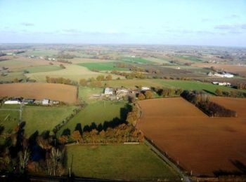
• Le Gué chemin en partie goudronné, vous parcourrez les chemins des vendéens et vous entendrez l'histoire sous vos pas...
![Randonnée Marche Beaupréau-en-Mauges - grand pédestre 2024 - Photo](https://media.geolcdn.com/t/350/260/ext.jpg?maxdim=2&url=https%3A%2F%2Fstatic1.geolcdn.com%2Fsiteimages%2Fupload%2Ffiles%2F1553511878bg_sport_marche.png)
![Marche Marche](https://static1.geolcdn.com/sitytour/trail-icons/101.png)
Km
Marche
![](/images/other/stat-length.png)
![](https://static1.geolcdn.com/siteimages/upload/files/1508320355ic_sort_den_pos_24dp.png)
![](https://static1.geolcdn.com/siteimages/upload/files/1508320355ic_sort_den_neg_24dp.png)
![](https://static1.geolcdn.com/siteimages/upload/files/16400158638029165_repeat_loop_refresh_sync_direction_icon.png)
![Randonnée Marche Beaupréau-en-Mauges - Beaupréau - Photo](https://media.geolcdn.com/t/350/260/ext.jpg?maxdim=2&url=https%3A%2F%2Fstatic1.geolcdn.com%2Fsiteimages%2Fupload%2Ffiles%2F1553511878bg_sport_marche.png)
![Marche Marche](https://static1.geolcdn.com/sitytour/trail-icons/101.png)
Km
Marche
![](/images/other/stat-length.png)
![](https://static1.geolcdn.com/siteimages/upload/files/1508320355ic_sort_den_pos_24dp.png)
![](https://static1.geolcdn.com/siteimages/upload/files/1508320355ic_sort_den_neg_24dp.png)
![](https://static1.geolcdn.com/siteimages/upload/files/16400158638029165_repeat_loop_refresh_sync_direction_icon.png)
![Randonnée Marche Beaupréau-en-Mauges - mtrv - Photo](https://media.geolcdn.com/t/350/260/ext.jpg?maxdim=2&url=https%3A%2F%2Fstatic1.geolcdn.com%2Fsiteimages%2Fupload%2Ffiles%2F1553511878bg_sport_marche.png)
![Marche Marche](https://static1.geolcdn.com/sitytour/trail-icons/101.png)
Km
Marche
![](/images/other/stat-length.png)
![](https://static1.geolcdn.com/siteimages/upload/files/1508320355ic_sort_den_pos_24dp.png)
![](https://static1.geolcdn.com/siteimages/upload/files/1508320355ic_sort_den_neg_24dp.png)
![](https://static1.geolcdn.com/siteimages/upload/files/16400158638029165_repeat_loop_refresh_sync_direction_icon.png)
20 randonnées affichées sur 45
Application GPS de randonnée GRATUITE