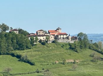
Livinhac-le-Haut, Aveyron : Les meilleures randonnées, itinéraires, parcours, balades et promenades

6 commentaires

Livinhac-le-Haut : découvrez les meilleures randonnées : 27 pédestres et 2 à vélo ou VTT. Tous ces circuits, parcours, itinéraires et activités en plein air sont disponibles dans nos applications SityTrail pour smartphones et tablettes.


Les meilleurs parcours (33)
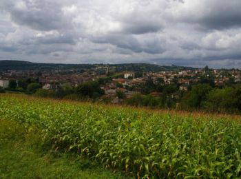
Randonnée Marche Livinhac-le-Haut - Livinhac le Haut - Figeac - Chemin de St-Jacques de Compostelle - Photo
Marche 25.542
Km

Marche

Très difficile
(4)
Livinhac-le-Haut, Occitanie, Aveyron, France
26 km | 33 km-effort
5h 0min
584 m
587 m
Non
tracegps

• Douzième étape sur notre Chemin de Compostelle qui nous mène de Livinhac le Haut à Figeac. (Km 230,75 à Km 256,380) D...
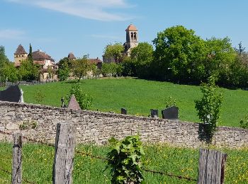
Randonnée Marche Livinhac-le-Haut - Levinhac le Haut Figeac Avril  2018 - Photo
Marche 23.546
Km
GUIDE

Marche

Moyen
Livinhac-le-Haut, Occitanie, Aveyron, France
24 km | 31 km-effort
6h 27min
522 m
538 m
Non
Kargil

• 11ème Etape depuis Le Puy

Randonnée Marche Livinhac-le-Haut - Compostelle 12 - Livinhac-le-haut -> Figeac - Photo
Marche 25.834
Km

Marche

Moyen
(1)
Livinhac-le-Haut, Occitanie, Aveyron, France
26 km | 33 km-effort
7h 4min
558 m
565 m
Non
uru2010

• Chemin de St Jacques de Compostelle Livinhac-le-haut -> Figeac
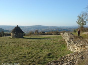
Randonnée Marche Livinhac-le-Haut - CC_Velay_CB_11_Livinhac-Haut_Figeac_20071102 - Photo
Marche 25.883
Km

Marche

Moyen
Livinhac-le-Haut, Occitanie, Aveyron, France
26 km | 34 km-effort
6h 40min
600 m
586 m
Non
patrickdanilo

• Randonnée Marche de 26 km à découvrir à Occitanie, Aveyron, Livinhac-le-Haut. Cette randonnée est proposée par patric...
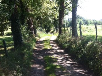
Randonnée Marche Livinhac-le-Haut - Livinhac le Haut vers Figeac - Photo
Marche 24.886
Km

Marche

Moyen
Livinhac-le-Haut, Occitanie, Aveyron, France
25 km | 32 km-effort
6h 1min
572 m
541 m
Non
choubaka77

• Beau chemin sans grande difficulté. Ne pas oublier d'acheter son pique nique ma veille à Livinhac car peut ou pas de ...

Randonnée V.T.T. Livinhac-le-Haut - rand-olt 2024  - Photo
V.T.T. 32.322
Km

V.T.T.

Moyen
Livinhac-le-Haut, Occitanie, Aveyron, France
32 km | 48 km-effort
3h 1min
1191 m
1197 m
Oui
kayakiste15

• rand'olt 2024 OTB12

Randonnée sport Livinhac-le-Haut - Saint-Jacques, 2024, deux Journé six - Photo
sport 23.641
Km

sport

Très facile
Livinhac-le-Haut, Occitanie, Aveyron, France
24 km | 31 km-effort
Inconnu
544 m
557 m
Non
ezola

Randonnée sport Livinhac-le-Haut - Saint-Jacques,m 2  livingnac>> figeac - Photo
sport 23.265
Km

sport

Très facile
(1)
Livinhac-le-Haut, Occitanie, Aveyron, France
23 km | 30 km-effort
Inconnu
535 m
549 m
Non
ezola

Randonnée V.T.T. Livinhac-le-Haut - 2eme rando lot à livinhac le haut.. - Photo
V.T.T. 47.938
Km

V.T.T.

Difficile
Livinhac-le-Haut, Occitanie, Aveyron, France
48 km | 68 km-effort
3h 51min
1476 m
1477 m
Oui
kayakiste15

• belle randonnée

Randonnée Marche Livinhac-le-Haut - livinhac-figeac - Photo
Marche 23.573
Km

Marche

Moyen
Livinhac-le-Haut, Occitanie, Aveyron, France
24 km | 31 km-effort
6h 42min
536 m
551 m
Non
fab0202

• belle rando au départ de livinhac jusqu'à miravel, ensuite un peu de route.

Randonnée A pied Livinhac-le-Haut - Livinhac-le-Haut  Figeac - Photo
A pied 24.322
Km

A pied

Difficile
Livinhac-le-Haut, Occitanie, Aveyron, France
24 km | 32 km-effort
7h 11min
547 m
561 m
Non
pensionisten71

• sur le chemin de Compostelle

Randonnée Marche Livinhac-le-Haut - 2020_07_La Colinie_Allongée - Photo
Marche 11.255
Km

Marche

Difficile
Livinhac-le-Haut, Occitanie, Aveyron, France
11,3 km | 18 km-effort
3h 0min
504 m
505 m
Oui
jeanlucien

• Balisage Jaune, Rouge et Blanc (Gr 65) Modifié à la balise Garrigou, prendre à droite début de la variante.

Randonnée Marche Livinhac-le-Haut - 70_09_Livinhac Le haut_Ferme de la Planquette - Photo
Marche 31.803
Km

Marche

Très difficile
Livinhac-le-Haut, Occitanie, Aveyron, France
32 km | 40 km-effort
7h 40min
665 m
574 m
Non
jeanlucien

• Si toujours Gite à la Ferme

Randonnée Marche Livinhac-le-Haut - StJ-J23-Livinhac le Haut-Figeac - Photo
Marche 24.455
Km

Marche

Très difficile
Livinhac-le-Haut, Occitanie, Aveyron, France
24 km | 32 km-effort
6h 48min
541 m
542 m
Non
Bonsaicd

• Livinhac le Haut > Figeac

Randonnée Marche Livinhac-le-Haut - Linvinhac  Felzins - Photo
Marche 15.383
Km

Marche

Facile
Livinhac-le-Haut, Occitanie, Aveyron, France
15,4 km | 20 km-effort
4h 21min
382 m
321 m
Non
lanoe68

• chemin compostelle

Randonnée Marche Livinhac-le-Haut - Livignac le haut à Figeac  - Photo
Marche 25.013
Km

Marche

Moyen
Livinhac-le-Haut, Occitanie, Aveyron, France
25 km | 33 km-effort
7h 48min
573 m
565 m
Non
bernardecarnot

Randonnée Marche Livinhac-le-Haut - J2 Livinhac le haut-Figeac - Photo
Marche 25.161
Km

Marche

Très difficile
Livinhac-le-Haut, Occitanie, Aveyron, France
25 km | 33 km-effort
7h 23min
547 m
563 m
Non
ABRIVARD

Randonnée Marche Livinhac-le-Haut - Saint Jacques 3 - Photo
Marche 23.687
Km

Marche

Très difficile
Livinhac-le-Haut, Occitanie, Aveyron, France
24 km | 31 km-effort
6h 57min
548 m
543 m
Non
jeanchristophepages

Randonnée Marche Livinhac-le-Haut - livinhac-figeac - Photo
Marche 24.2
Km

Marche

Très difficile
Livinhac-le-Haut, Occitanie, Aveyron, France
24 km | 32 km-effort
5h 49min
560 m
577 m
Non
bernard.bonafous@free.fr

Randonnée Marche Livinhac-le-Haut - livignac figeac - Photo
Marche 100.093
Km

Marche

Très facile
Livinhac-le-Haut, Occitanie, Aveyron, France
100 km | 123 km-effort
12h 0min
1723 m
1655 m
Non
darobes

20 randonnées affichées sur 33

Application GPS de randonnée GRATUITE

Logo SityTrail SityTrail

IGN / Instituts géographiques

Télécharger SityTrail sur l'App Store Télécharger SityTrail sur Google Play

Logo SityTrail SityTrail World

Le monde est à vous

Télécharger SityTrail sur l'App Store Télécharger SityTrail sur Google Play Télécharger SityTrail sur Huawei AppGallery

Activités

Fermer
Mes abonnements