![](/images/other/stat-length.png)
- Randonnées
- Outdoor
- France
- Occitanie
- Gard
- Saint-Sauveur-Camprieu
Saint-Sauveur-Camprieu, Gard : Les meilleures randonnées, itinéraires, parcours, balades et promenades
Saint-Sauveur-Camprieu : découvrez les meilleures randonnées : 73 pédestres et 2 à vélo ou VTT. Tous ces circuits, parcours, itinéraires et activités en plein air sont disponibles dans nos applications SityTrail pour smartphones et tablettes.
Les meilleurs parcours (80)
![Randonnée Marche Saint-Sauveur-Camprieu - Dourbies Camprieu boucle - Photo](https://media.geolcdn.com/t/350/260/773150fb-e481-46d1-aed3-630ac5bd1b85.jpg&format=jpg&maxdim=2)
![Marche Marche](https://static1.geolcdn.com/sitytour/trail-icons/101.png)
Km
Marche
![](/images/other/stat-length.png)
![](https://static1.geolcdn.com/siteimages/upload/files/1508320355ic_sort_den_pos_24dp.png)
![](https://static1.geolcdn.com/siteimages/upload/files/1508320355ic_sort_den_neg_24dp.png)
![](https://static1.geolcdn.com/siteimages/upload/files/16400158638029165_repeat_loop_refresh_sync_direction_icon.png)
• Manque 300 D+ et 3 km sur le tracé
![Randonnée Marche Saint-Sauveur-Camprieu - rando du bonheur - Photo](https://media.geolcdn.com/t/350/260/8d654987-9f06-4f64-a843-d27ca16ef4d7.jpg&format=jpg&maxdim=2)
![Marche Marche](https://static1.geolcdn.com/sitytour/trail-icons/101.png)
Km
Marche
![](/images/other/stat-length.png)
![](https://static1.geolcdn.com/siteimages/upload/files/1508320355ic_sort_den_pos_24dp.png)
![](https://static1.geolcdn.com/siteimages/upload/files/1508320355ic_sort_den_neg_24dp.png)
![](https://static1.geolcdn.com/siteimages/upload/files/16400158638029165_repeat_loop_refresh_sync_direction_icon.png)
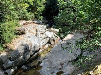
• Camprieu Prat Peyrot Abime de Bramabiau par la vallée du Bonheur
![Randonnée Marche Saint-Sauveur-Camprieu - les monts de Saint sauveur de camprieu - Photo](https://media.geolcdn.com/t/350/260/b7332eb8-007f-4971-afe2-01fb314b7900.jpg&format=jpg&maxdim=2)
![Marche Marche](https://static1.geolcdn.com/sitytour/trail-icons/101.png)
Km
Marche
![](/images/other/stat-length.png)
![](https://static1.geolcdn.com/siteimages/upload/files/1508320355ic_sort_den_pos_24dp.png)
![](https://static1.geolcdn.com/siteimages/upload/files/1508320355ic_sort_den_neg_24dp.png)
![](https://static1.geolcdn.com/siteimages/upload/files/16400158638029165_repeat_loop_refresh_sync_direction_icon.png)
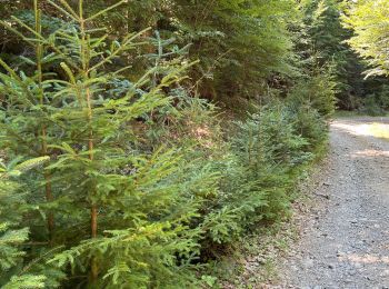
• superbe rando pas de difficultés + et de l'ombre en forêt A faire si dans la region
![Randonnée Marche Saint-Sauveur-Camprieu - Col du FAUBEL le Puey Barbut - Photo](https://media.geolcdn.com/t/350/260/98f69e29-1642-4fb5-a7e9-9dcbd06f1735.jpg&format=jpg&maxdim=2)
![Marche Marche](https://static1.geolcdn.com/sitytour/trail-icons/101.png)
Km
Marche
![](/images/other/stat-length.png)
![](https://static1.geolcdn.com/siteimages/upload/files/1508320355ic_sort_den_pos_24dp.png)
![](https://static1.geolcdn.com/siteimages/upload/files/1508320355ic_sort_den_neg_24dp.png)
![](https://static1.geolcdn.com/siteimages/upload/files/16400158638029165_repeat_loop_refresh_sync_direction_icon.png)
• Facile Super N1
![Randonnée Marche Saint-Sauveur-Camprieu - Camprieu col des Ubertes , col du suquet les mon - Photo](https://media.geolcdn.com/t/350/260/25c437fb-934c-4918-a66d-7fc07a42861e.jpg&format=jpg&maxdim=2)
![Marche Marche](https://static1.geolcdn.com/sitytour/trail-icons/101.png)
Km
Marche
![](/images/other/stat-length.png)
![](https://static1.geolcdn.com/siteimages/upload/files/1508320355ic_sort_den_pos_24dp.png)
![](https://static1.geolcdn.com/siteimages/upload/files/1508320355ic_sort_den_neg_24dp.png)
![](https://static1.geolcdn.com/siteimages/upload/files/16400158638029165_repeat_loop_refresh_sync_direction_icon.png)
• Super Ombragé
![Randonnée Marche Saint-Sauveur-Camprieu - Camprieu Peyre mâle - Photo](https://media.geolcdn.com/t/350/260/fb68a507-f040-49a8-b475-23db0f246f18.jpg&format=jpg&maxdim=2)
![Marche Marche](https://static1.geolcdn.com/sitytour/trail-icons/101.png)
Km
Marche
![](/images/other/stat-length.png)
![](https://static1.geolcdn.com/siteimages/upload/files/1508320355ic_sort_den_pos_24dp.png)
![](https://static1.geolcdn.com/siteimages/upload/files/1508320355ic_sort_den_neg_24dp.png)
![](https://static1.geolcdn.com/siteimages/upload/files/16400158638029165_repeat_loop_refresh_sync_direction_icon.png)
• Facile Beaucoup de sous bois Super en été
![Randonnée Marche Saint-Sauveur-Camprieu - Chemin des morts Camprieu Bramabiau - Photo](https://media.geolcdn.com/t/350/260/94fc5f7e-828d-41a8-a236-876d63b8ffef.jpg&format=jpg&maxdim=2)
![Marche Marche](https://static1.geolcdn.com/sitytour/trail-icons/101.png)
Km
Marche
![](/images/other/stat-length.png)
![](https://static1.geolcdn.com/siteimages/upload/files/1508320355ic_sort_den_pos_24dp.png)
![](https://static1.geolcdn.com/siteimages/upload/files/1508320355ic_sort_den_neg_24dp.png)
![](https://static1.geolcdn.com/siteimages/upload/files/16400158638029165_repeat_loop_refresh_sync_direction_icon.png)
• Facile
![Randonnée Marche Saint-Sauveur-Camprieu - Perte-Bonneur-Bramabiau - Photo](https://media.geolcdn.com/t/350/260/07b4cc47-8ad4-4bfd-91f8-50bddb04e6c5.jpg&format=jpg&maxdim=2)
![Marche Marche](https://static1.geolcdn.com/sitytour/trail-icons/101.png)
Km
Marche
![](/images/other/stat-length.png)
![](https://static1.geolcdn.com/siteimages/upload/files/1508320355ic_sort_den_pos_24dp.png)
![](https://static1.geolcdn.com/siteimages/upload/files/1508320355ic_sort_den_neg_24dp.png)
![](https://static1.geolcdn.com/siteimages/upload/files/16400158638029165_repeat_loop_refresh_sync_direction_icon.png)
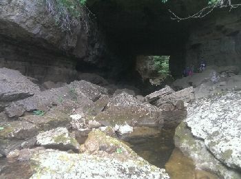
• Partant du parking de l'abîme de Bramabiau 9h00, vous redescendrez sur Camprieu en passant par la perte du Bonheur, p...
![Randonnée Marche Saint-Sauveur-Camprieu - Abîme de Bramabiau - Camprieu - Abbaye du Bonheur - Photo](https://media.geolcdn.com/t/350/260/5acfbfd6-ce8c-4407-bafc-8d06ea976db3.jpg&format=jpg&maxdim=2)
![Marche Marche](https://static1.geolcdn.com/sitytour/trail-icons/101.png)
Km
Marche
![](/images/other/stat-length.png)
![](https://static1.geolcdn.com/siteimages/upload/files/1508320355ic_sort_den_pos_24dp.png)
![](https://static1.geolcdn.com/siteimages/upload/files/1508320355ic_sort_den_neg_24dp.png)
![](https://static1.geolcdn.com/siteimages/upload/files/16400158638029165_repeat_loop_refresh_sync_direction_icon.png)
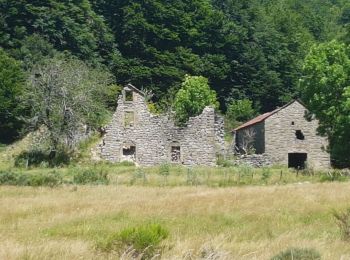
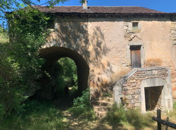
• Bienvenue dans la randonnée du Bonheur. Départ à proximité de l'abîme du Bramabiau pour découvrir une magnifique casc...
![Randonnée Marche Saint-Sauveur-Camprieu - Camprieu La Croix de Fer Saint Sauveur de Pourcil Csa - Photo](https://media.geolcdn.com/t/350/260/feb01087-0ee4-4e39-adc3-dcb2f257847f.jpg&format=jpg&maxdim=2)
![Marche Marche](https://static1.geolcdn.com/sitytour/trail-icons/101.png)
Km
Marche
![](/images/other/stat-length.png)
![](https://static1.geolcdn.com/siteimages/upload/files/1508320355ic_sort_den_pos_24dp.png)
![](https://static1.geolcdn.com/siteimages/upload/files/1508320355ic_sort_den_neg_24dp.png)
![](https://static1.geolcdn.com/siteimages/upload/files/16400158638029165_repeat_loop_refresh_sync_direction_icon.png)
• Faciles Départ terrain de Foot
![Randonnée Marche Saint-Sauveur-Camprieu - Marie Joseph - Photo](https://media.geolcdn.com/t/350/260/05a0d85f-d23f-4a6c-8444-e99ce06a763f.jpg&format=jpg&maxdim=2)
![Marche Marche](https://static1.geolcdn.com/sitytour/trail-icons/101.png)
Km
Marche
![](/images/other/stat-length.png)
![](https://static1.geolcdn.com/siteimages/upload/files/1508320355ic_sort_den_pos_24dp.png)
![](https://static1.geolcdn.com/siteimages/upload/files/1508320355ic_sort_den_neg_24dp.png)
![](https://static1.geolcdn.com/siteimages/upload/files/16400158638029165_repeat_loop_refresh_sync_direction_icon.png)
• Camprieu. col des Ubertes les Monts Saint Sauveur de Pourcil Camprieu
![Randonnée Marche Saint-Sauveur-Camprieu - Camprieu sentier des arbres St Sauveur - Photo](https://media.geolcdn.com/t/350/260/ext.jpg?maxdim=2&url=https%3A%2F%2Fservices.sitytrail.com%2FGeolivesWS%2FDownloadMedia.ashx%3FTrailID%3D336644%26Media%3Dfix__20140818160139.jpg)
![Marche Marche](https://static1.geolcdn.com/sitytour/trail-icons/101.png)
Km
Marche
![](/images/other/stat-length.png)
![](https://static1.geolcdn.com/siteimages/upload/files/1508320355ic_sort_den_pos_24dp.png)
![](https://static1.geolcdn.com/siteimages/upload/files/1508320355ic_sort_den_neg_24dp.png)
![](https://static1.geolcdn.com/siteimages/upload/files/16400158638029165_repeat_loop_refresh_sync_direction_icon.png)
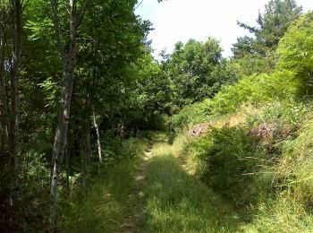
• Randonnée agréable sur le sentier des Morts avec un détour par le barrage et le sentier des arbres
![Randonnée Marche Saint-Sauveur-Camprieu - Saint-Sauveur des Pourcils - Photo](https://media.geolcdn.com/t/350/260/ext.jpg?maxdim=2&url=https%3A%2F%2Fservices.sitytrail.com%2FGeolivesWS%2FDownloadMedia.ashx%3FTrailID%3D172506%26Media%3D13865_3.jpg)
![Marche Marche](https://static1.geolcdn.com/sitytour/trail-icons/101.png)
Km
Marche
![](/images/other/stat-length.png)
![](https://static1.geolcdn.com/siteimages/upload/files/1508320355ic_sort_den_pos_24dp.png)
![](https://static1.geolcdn.com/siteimages/upload/files/1508320355ic_sort_den_neg_24dp.png)
![](https://static1.geolcdn.com/siteimages/upload/files/16400158638029165_repeat_loop_refresh_sync_direction_icon.png)
• Rando agréable, faire attention au passage à gué du Trévezel qui peut être difficile le lendemain d’orages. Arrivés à...
![Randonnée Marche Saint-Sauveur-Camprieu - De Camprieu au Mont Aigoual - Photo](https://media.geolcdn.com/t/350/260/ext.jpg?maxdim=2&url=https%3A%2F%2Fservices.sitytrail.com%2FGeolivesWS%2FDownloadMedia.ashx%3FTrailID%3D172496%26Media%3D13856_3.jpg)
![Marche Marche](https://static1.geolcdn.com/sitytour/trail-icons/101.png)
Km
Marche
![](/images/other/stat-length.png)
![](https://static1.geolcdn.com/siteimages/upload/files/1508320355ic_sort_den_pos_24dp.png)
![](https://static1.geolcdn.com/siteimages/upload/files/1508320355ic_sort_den_neg_24dp.png)
![](https://static1.geolcdn.com/siteimages/upload/files/16400158638029165_repeat_loop_refresh_sync_direction_icon.png)
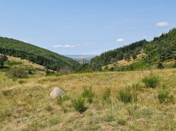
• Très belle randonnée au départ de Camprieu, par la Vallée du Bonheur, jusqu’au mont Aigoual. Quelques petites grimpet...
![Randonnée Marche Saint-Sauveur-Camprieu - VALLEE DU BONHEUR (Court) - Photo](https://media.geolcdn.com/t/350/260/82e207a3-2eb9-481d-a0e4-3f9738417328.jpg&format=jpg&maxdim=2)
![Marche Marche](https://static1.geolcdn.com/sitytour/trail-icons/101.png)
Km
Marche
![](/images/other/stat-length.png)
![](https://static1.geolcdn.com/siteimages/upload/files/1508320355ic_sort_den_pos_24dp.png)
![](https://static1.geolcdn.com/siteimages/upload/files/1508320355ic_sort_den_neg_24dp.png)
![](https://static1.geolcdn.com/siteimages/upload/files/16400158638029165_repeat_loop_refresh_sync_direction_icon.png)
![Randonnée Marche Saint-Sauveur-Camprieu - GR7 jour 12 Puechagut - Photo](https://media.geolcdn.com/t/350/260/09c88536-cd70-4bec-b802-6497c65a0401.jpg&format=jpg&maxdim=2)
![Marche Marche](https://static1.geolcdn.com/sitytour/trail-icons/101.png)
Km
Marche
![](/images/other/stat-length.png)
![](https://static1.geolcdn.com/siteimages/upload/files/1508320355ic_sort_den_pos_24dp.png)
![](https://static1.geolcdn.com/siteimages/upload/files/1508320355ic_sort_den_neg_24dp.png)
![](https://static1.geolcdn.com/siteimages/upload/files/16400158638029165_repeat_loop_refresh_sync_direction_icon.png)
![Randonnée Marche Saint-Sauveur-Camprieu - Col du Faubel par Camprieu le Lac - Photo](https://media.geolcdn.com/t/350/260/1659b15f-5ca7-4084-800e-6f2ce67b53b0.jpg&format=jpg&maxdim=2)
![Marche Marche](https://static1.geolcdn.com/sitytour/trail-icons/101.png)
Km
Marche
![](/images/other/stat-length.png)
![](https://static1.geolcdn.com/siteimages/upload/files/1508320355ic_sort_den_pos_24dp.png)
![](https://static1.geolcdn.com/siteimages/upload/files/1508320355ic_sort_den_neg_24dp.png)
![](https://static1.geolcdn.com/siteimages/upload/files/16400158638029165_repeat_loop_refresh_sync_direction_icon.png)
• Super Agréable
![Randonnée A pied Saint-Sauveur-Camprieu - GR 66A - Photo](https://media.geolcdn.com/t/350/260/0ebb1f5f-171e-4144-9d4a-2fc669591042.jpeg&format=jpg&maxdim=2)
![A pied A pied](https://static1.geolcdn.com/sitytour/trail-icons/100.png)
Km
A pied
![](/images/other/stat-length.png)
![](https://static1.geolcdn.com/siteimages/upload/files/1508320355ic_sort_den_pos_24dp.png)
![](https://static1.geolcdn.com/siteimages/upload/files/1508320355ic_sort_den_neg_24dp.png)
![](https://static1.geolcdn.com/siteimages/upload/files/16400158638029165_repeat_loop_refresh_sync_direction_icon.png)
![Randonnée Marche Saint-Sauveur-Camprieu - Camprieux - Photo](https://media.geolcdn.com/t/350/260/ada1244f-9f27-4afd-9211-dcd4e71f4200.jpg&format=jpg&maxdim=2)
![Marche Marche](https://static1.geolcdn.com/sitytour/trail-icons/101.png)
Km
Marche
![](/images/other/stat-length.png)
![](https://static1.geolcdn.com/siteimages/upload/files/1508320355ic_sort_den_pos_24dp.png)
![](https://static1.geolcdn.com/siteimages/upload/files/1508320355ic_sort_den_neg_24dp.png)
![](https://static1.geolcdn.com/siteimages/upload/files/16400158638029165_repeat_loop_refresh_sync_direction_icon.png)
![Randonnée Marche Saint-Sauveur-Camprieu - Col du Faubel lac Camprieu Col du faubel - Photo](https://media.geolcdn.com/t/350/260/f4354b0e-72cd-43f3-8af6-7147e8992e39.jpg&format=jpg&maxdim=2)
![Marche Marche](https://static1.geolcdn.com/sitytour/trail-icons/101.png)
Km
Marche
![](/images/other/stat-length.png)
![](https://static1.geolcdn.com/siteimages/upload/files/1508320355ic_sort_den_pos_24dp.png)
![](https://static1.geolcdn.com/siteimages/upload/files/1508320355ic_sort_den_neg_24dp.png)
![](https://static1.geolcdn.com/siteimages/upload/files/16400158638029165_repeat_loop_refresh_sync_direction_icon.png)
20 randonnées affichées sur 80
Application GPS de randonnée GRATUITE