


5 km | 6,8 km-effort
Comps : découvrez les meilleures randonnées : 17 pédestres et 3 à vélo ou VTT. Tous ces circuits, parcours, itinéraires et activités en plein air sont disponibles dans nos applications SityTrail pour smartphones et tablettes.

Marche


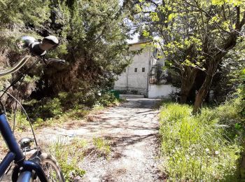
• Départ de l'Aqueduc de COMPS - visite de l'Abbaye (5,5 €) - visite du mont de l'Aiguille
V.T.C.
• Petite ballade à vélo de l'ancien château d'eau via Intersport pour finir au château médiéval de Beaucaire .
Marche
• Départ du parking des Arènes de Comps, parking original car l’on peut se garer à l’intérieur des Arènes. Des Arènes ,...
Marche
V.T.T.
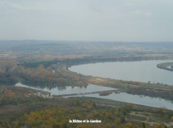
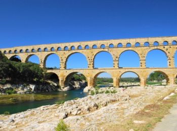
• Ce circuit part en suivant la rive gauche du Gard jusqu'au pont du Gard et revient en bordure des costières sur la ri...
Marche
Marche
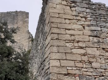
• COMPS - ABBAYE DE SAINT ROMAN 14.1Km - 04:30 Départ randonnée : Village de Comps (Gard 30) Abbaye de Saint Roman au d...
Marche
• COMPS - ABBAYE DE SAINT ROMAIN 2 9.5Km - 03:00 Départ randonnée : Village de Comps (Gard 30) De comps 30 à l'abbaye d...
Marche
• ce circuit nouds à conduit de comps à l'abbaye de saint romain en passant par la table d'orientation
Marche
• ce circuit nouds à conduit de comps à l'abbaye de saint romain en passant par la table d'orientation
Marche
• Départ de l'Aqueduc de COMPS - visite de l'Abbaye (5,5 €) - visite du mont de l'Aiguille
Marche
Marche
Marche
Marche

 5.83
5.83
sport

V.T.T.
Marche
Marche
Marche
20 randonnées affichées sur 22
Application GPS de randonnée GRATUITE
 SityTrail
IGN / Instituts géographiques
SityTrail World
Le monde est à vous