![](/images/other/stat-length.png)
- Randonnées
- Outdoor
- France
- Occitanie
- Pyrénées-Orientales
- Banyuls-dels-Aspres
Banyuls-dels-Aspres, Pyrénées-Orientales : Les meilleures randonnées, itinéraires, parcours, balades et promenades
Banyuls-dels-Aspres : découvrez les meilleures randonnées : 4 pédestres. Tous ces circuits, parcours, itinéraires et activités en plein air sont disponibles dans nos applications SityTrail pour smartphones et tablettes.
Les meilleurs parcours (4)
![Randonnée Marche Banyuls-dels-Aspres - banyul tels aspres . brouilla par les vigne retour le long du Tech - Photo](https://media.geolcdn.com/t/350/260/ext.jpg?maxdim=2&url=https%3A%2F%2Fservices.sitytrail.com%2FGeolivesWS%2FDownloadMedia.ashx%3FTrailID%3D1132690%26Media%3Dfix__20190409135151.jpg)
![Marche Marche](https://static1.geolcdn.com/sitytour/trail-icons/101.png)
Km
Marche
![](/images/other/stat-length.png)
![](https://static1.geolcdn.com/siteimages/upload/files/1508320355ic_sort_den_pos_24dp.png)
![](https://static1.geolcdn.com/siteimages/upload/files/1508320355ic_sort_den_neg_24dp.png)
![](https://static1.geolcdn.com/siteimages/upload/files/16400158638029165_repeat_loop_refresh_sync_direction_icon.png)
![Randonnée Marche Banyuls-dels-Aspres - 66 LE BOULOU - plans, pla et hameau de NIDOLÈRES, noeud autoroutier ferroviaire - Photo](https://media.geolcdn.com/t/350/260/ext.jpg?maxdim=2&url=https%3A%2F%2Fservices.sitytrail.com%2FGeolivesWS%2FDownloadMedia.ashx%3FTrailID%3D474242%26Media%3D20150921185232.jpg)
![Marche Marche](https://static1.geolcdn.com/sitytour/trail-icons/101.png)
Km
Marche
![](/images/other/stat-length.png)
![](https://static1.geolcdn.com/siteimages/upload/files/1508320355ic_sort_den_pos_24dp.png)
![](https://static1.geolcdn.com/siteimages/upload/files/1508320355ic_sort_den_neg_24dp.png)
![](https://static1.geolcdn.com/siteimages/upload/files/16400158638029165_repeat_loop_refresh_sync_direction_icon.png)
• 66 LE BOULOU - plans de NIDOLÈRES - poste électrique - auberge - vue sur les Albères - hameau de NIDOLÈRES, rue St él...
![Randonnée Marche Banyuls-dels-Aspres - BANUYLS-DELS-ASPRES 66 - BROUILLA - promenade entre Aspres, Tech et Albères - Photo](https://media.geolcdn.com/t/350/260/ext.jpg?maxdim=2&url=https%3A%2F%2Fservices.sitytrail.com%2FGeolivesWS%2FDownloadMedia.ashx%3FTrailID%3D448639%26Media%3D20150722181332.jpg)
![Marche Marche](https://static1.geolcdn.com/sitytour/trail-icons/101.png)
Km
Marche
![](/images/other/stat-length.png)
![](https://static1.geolcdn.com/siteimages/upload/files/1508320355ic_sort_den_pos_24dp.png)
![](https://static1.geolcdn.com/siteimages/upload/files/1508320355ic_sort_den_neg_24dp.png)
![](https://static1.geolcdn.com/siteimages/upload/files/16400158638029165_repeat_loop_refresh_sync_direction_icon.png)
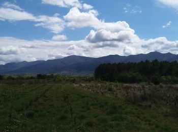
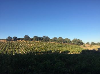
• BANUYLS-DELS-ASPRES 66 - parking de la cave coopérative - les trillots - passage à gué puis voie ferrée - chemin de t...
![Randonnée Marche Banyuls-dels-Aspres - banyuls des aspres - Photo](https://media.geolcdn.com/t/350/260/13ec234f-69e9-42f6-a691-a3014a563d64.jpg&format=jpg&maxdim=2)
![Marche Marche](https://static1.geolcdn.com/sitytour/trail-icons/101.png)
Km
Marche
![](/images/other/stat-length.png)
![](https://static1.geolcdn.com/siteimages/upload/files/1508320355ic_sort_den_pos_24dp.png)
![](https://static1.geolcdn.com/siteimages/upload/files/1508320355ic_sort_den_neg_24dp.png)
![](https://static1.geolcdn.com/siteimages/upload/files/16400158638029165_repeat_loop_refresh_sync_direction_icon.png)
4 randonnées affichées sur 4
Application GPS de randonnée GRATUITE