


75 km | 90 km-effort
Belflou : découvrez les meilleures randonnées : 2 pédestres et 4 à vélo ou VTT. Tous ces circuits, parcours, itinéraires et activités en plein air sont disponibles dans nos applications SityTrail pour smartphones et tablettes.

Moto


V.T.T.
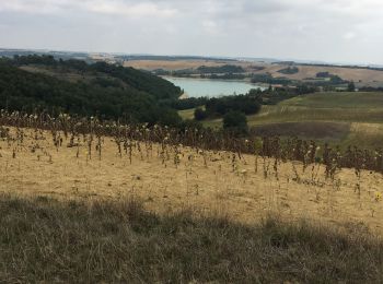
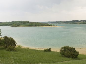
• Au départ de la Base Nautique de Ganguise un circuit du Vélo Club Salhersien. Le lac de la Ganguise est un lac de bar...

Marche
• Au départ de la Base Nautique de Ganguise un circuit du Vélo Club Salhersien. Le lac de la Ganguise est un lac de bar...
Marche
V.T.T.
• Au départ de la Base Nautique de Ganguise un circuit du Vélo Club Salhersien.
V.T.T.
• Au départ de la Base Nautique de Ganguise un circuit du Vélo Club Salhersien.
V.T.T.
• Au départ de la Base Nautique de Ganguise un circuit du Vélo Club Salhersien.
Moto
Moto
Moto
Moto-cross
Moto
Moto
Moto
Moto
Moto
16 randonnées affichées sur 16
Application GPS de randonnée GRATUITE
 SityTrail
IGN / Instituts géographiques
SityTrail World
Le monde est à vous