Reillanne, Alpes-de-Haute-Provence : Les meilleures randonnées, itinéraires, parcours, balades et promenades

Reillanne : découvrez les meilleures randonnées : 12 pédestres et 11 à vélo ou VTT. Tous ces circuits, parcours, itinéraires et activités en plein air sont disponibles dans nos applications SityTrail pour smartphones et tablettes.


Les meilleurs parcours (25)

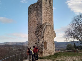
Randonnée Marche Reillanne - 2024-03-01 Tour de Reillanne  - Photo
Marche 17.874
Km
GUIDE

Marche

Difficile
Reillanne, Provence-Alpes-Côte d'Azur, Alpes-de-Haute-Provence, France
17,9 km | 24 km-effort
5h 30min
475 m
475 m
Oui
Kargil

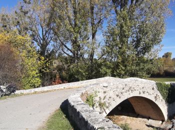
Randonnée Marche Reillanne - CR_Domitia_BG_05_Reillanne_St-Michel-Observatoire_20160907 - Photo
Marche 11.238
Km

Marche

Moyen
Reillanne, Provence-Alpes-Côte d'Azur, Alpes-de-Haute-Provence, France
11,2 km | 15,8 km-effort
3h 22min
343 m
330 m
Non
patrickdanilo

• Randonnée Marche de 11,2 km à découvrir à Provence-Alpes-Côte d'Azur, Alpes-de-Haute-Provence, Reillanne. Cette rando...
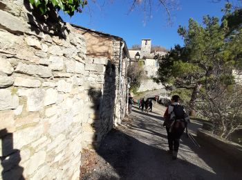
Randonnée Marche Reillanne - REILLANNE . Pierrefeu . SAINTE CROIX A LAUZE . VACHERES o - Photo
Marche 15.895
Km

Marche

Difficile
Reillanne, Provence-Alpes-Côte d'Azur, Alpes-de-Haute-Provence, France
15,9 km | 23 km-effort
6h 48min
513 m
512 m
Oui
RobinMicheline

• Belle rando , sentiers sympas , village de Vacheres magnifique
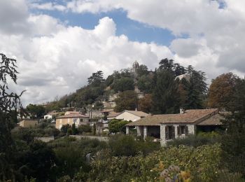
Randonnée Cyclotourisme Reillanne - 04 tour du Lubéron  J6/6 - Photo
Cyclotourisme 68.028
Km

Cyclotourisme

Difficile
Reillanne, Provence-Alpes-Côte d'Azur, Alpes-de-Haute-Provence, France
68 km | 83 km-effort
8h 0min
1079 m
1166 m
Non
ericf64

• Cereste à Manosque

Randonnée Marche Reillanne - lincel - Photo
Marche 11.515
Km

Marche

Difficile
Reillanne, Provence-Alpes-Côte d'Azur, Alpes-de-Haute-Provence, France
11,5 km | 16,6 km-effort
5h 32min
382 m
385 m
Oui
cocojean

• facile

Randonnée Cyclotourisme Reillanne - Luberon J2 - Photo
Cyclotourisme 58.433
Km

Cyclotourisme

Moyen
Reillanne, Provence-Alpes-Côte d'Azur, Alpes-de-Haute-Provence, France
58 km | 74 km-effort
4h 6min
1101 m
1369 m
Non
mzonzon05

Randonnée Autre activité Reillanne - Reillanne - Photo
Autre activité 12.495
Km

Autre activité

Très facile
Reillanne, Provence-Alpes-Côte d'Azur, Alpes-de-Haute-Provence, France
12,5 km | 16 km-effort
3h 54min
260 m
259 m
Oui
PITOUSSAINT

• Reullanne

Randonnée Marche Reillanne - Reillanne - Photo
Marche 10.738
Km

Marche

Facile
Reillanne, Provence-Alpes-Côte d'Azur, Alpes-de-Haute-Provence, France
10,7 km | 13,4 km-effort
2h 13min
199 m
205 m
Oui
vlentma

• Prieuré de Carluc

Randonnée Vélo Reillanne - f-frankrijk-route-in-de-streek-van-de-luberon - Photo
Vélo 62.294
Km

Vélo

Très facile
Reillanne, Provence-Alpes-Côte d'Azur, Alpes-de-Haute-Provence, France
62 km | 79 km-effort
Inconnu
1278 m
1274 m
Oui
gpstracks

• More information on GPStracks.nl : http://www.gpstracks.nl

Randonnée Vélo Reillanne - f-frankrijk-omgeving-luberon - Photo
Vélo 63.874
Km

Vélo

Très facile
Reillanne, Provence-Alpes-Côte d'Azur, Alpes-de-Haute-Provence, France
64 km | 81 km-effort
Inconnu
1285 m
1290 m
Oui
gpstracks

• More information on GPStracks.nl : http://www.gpstracks.nl

Randonnée V.T.T. Reillanne - Reillanne Carluc - Photo
V.T.T. 11.643
Km

V.T.T.

Difficile
Reillanne, Provence-Alpes-Côte d'Azur, Alpes-de-Haute-Provence, France
11,6 km | 14,5 km-effort
1h 29min
218 m
218 m
Oui
yamty35

Randonnée Marche Reillanne - le prieure de carluc - Photo
Marche 10.487
Km

Marche

Difficile
Reillanne, Provence-Alpes-Côte d'Azur, Alpes-de-Haute-Provence, France
10,5 km | 13,2 km-effort
3h 0min
205 m
206 m
Oui
nobir

Randonnée Marche Reillanne - reillane  - Photo
Marche 32.291
Km

Marche

Très difficile
Reillanne, Provence-Alpes-Côte d'Azur, Alpes-de-Haute-Provence, France
32 km | 38 km-effort
3h 36min
391 m
508 m
Non
Jemasa9

Randonnée Marche Reillanne - Reillane - Photo
Marche 4.828
Km

Marche

Moyen
Reillanne, Provence-Alpes-Côte d'Azur, Alpes-de-Haute-Provence, France
4,8 km | 6,2 km-effort
1h 39min
100 m
116 m
Non
Jemasa9

Randonnée Marche Reillanne - ancel - Photo
Marche 14.402
Km

Marche

Facile
Reillanne, Provence-Alpes-Côte d'Azur, Alpes-de-Haute-Provence, France
14,4 km | 19,5 km-effort
5h 9min
381 m
377 m
Oui
Jean-Claude BOURGUE

Randonnée Vélo électrique Reillanne - Reillanne - Vachère - AubenasLesAlpes - StMichel L'Observatoire - Lincel - Photo
Vélo électrique 43.892
Km

Vélo électrique

Moyen
Reillanne, Provence-Alpes-Côte d'Azur, Alpes-de-Haute-Provence, France
44 km | 55 km-effort
2h 40min
833 m
834 m
Oui
lviallet

Randonnée V.T.T. Reillanne - opedette  - Photo
V.T.T. 34.155
Km

V.T.T.

Très difficile
Reillanne, Provence-Alpes-Côte d'Azur, Alpes-de-Haute-Provence, France
34 km | 48 km-effort
3h 35min
1048 m
1058 m
Oui
charlmars

Randonnée Vélo électrique Reillanne - crete Luberon - Photo
Vélo électrique 17.63
Km

Vélo électrique

Difficile
Reillanne, Provence-Alpes-Côte d'Azur, Alpes-de-Haute-Provence, France
17,6 km | 30 km-effort
4h 23min
895 m
1049 m
Non
madashop

Randonnée Vélo électrique Reillanne - Revest des brousses - Photo
Vélo électrique 31.72
Km

Vélo électrique

Moyen
Reillanne, Provence-Alpes-Côte d'Azur, Alpes-de-Haute-Provence, France
32 km | 43 km-effort
5h 42min
878 m
843 m
Non
madashop

Randonnée Vélo électrique Reillanne - boucle lincel - Photo
Vélo électrique 21.805
Km

Vélo électrique

Difficile
Reillanne, Provence-Alpes-Côte d'Azur, Alpes-de-Haute-Provence, France
22 km | 29 km-effort
2h 44min
571 m
572 m
Oui
madashop

20 randonnées affichées sur 25

Application GPS de randonnée GRATUITE

Logo SityTrail SityTrail

IGN / Instituts géographiques

Télécharger SityTrail sur l'App Store Télécharger SityTrail sur Google Play

Logo SityTrail SityTrail World

Le monde est à vous

Télécharger SityTrail sur l'App Store Télécharger SityTrail sur Google Play Télécharger SityTrail sur Huawei AppGallery

Activités

Fermer
Mes abonnements