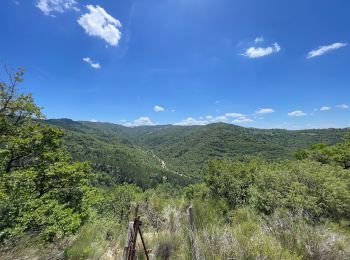
Le Chaffaut-Saint-Jurson, Alpes-de-Haute-Provence : Les meilleures randonnées, itinéraires, parcours, balades et promenades

Le Chaffaut-Saint-Jurson : découvrez les meilleures randonnées : 11 pédestres et 2 à vélo ou VTT. Tous ces circuits, parcours, itinéraires et activités en plein air sont disponibles dans nos applications SityTrail pour smartphones et tablettes.


Les meilleurs parcours (15)
Randonnée Marche Le Chaffaut-Saint-Jurson - ESPINOUSSE . LES RAGOTS O L S - Photo
Marche 8.039
Km

Marche

Facile
Le Chaffaut-Saint-Jurson, Provence-Alpes-Côte d'Azur, Alpes-de-Haute-Provence, France
8 km | 12,6 km-effort
2h 12min
344 m
345 m
Oui
RobinMicheline

• Bien indiqué. facile . agreable

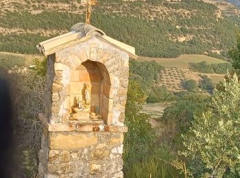
Randonnée sport Le Chaffaut-Saint-Jurson - Chapelle de lagrumuse - Photo
sport 5.745
Km

sport

Très facile
Le Chaffaut-Saint-Jurson, Provence-Alpes-Côte d'Azur, Alpes-de-Haute-Provence, France
5,7 km | 9,2 km-effort
Inconnu
260 m
263 m
Oui
michelpaulin

Randonnée A pied Le Chaffaut-Saint-Jurson - Le Hameau d'Espinouse - Photo
A pied 7.734
Km
GUIDE+

A pied

Facile
Le Chaffaut-Saint-Jurson, Provence-Alpes-Côte d'Azur, Alpes-de-Haute-Provence, France
7,7 km | 12,1 km-effort
2h 44min
325 m
327 m
Oui
SityTrail - itinéraires balisés pédestres

Randonnée Marche Le Chaffaut-Saint-Jurson - la Gremuse  - Photo
Marche 4.644
Km

Marche

Moyen
Le Chaffaut-Saint-Jurson, Provence-Alpes-Côte d'Azur, Alpes-de-Haute-Provence, France
4,6 km | 7,9 km-effort
2h 4min
246 m
246 m
Oui
francisdean

Randonnée Marche Le Chaffaut-Saint-Jurson - 04 _Le Chaffaut_Marcoux_J8_rea_corrigé - Photo
Marche 20.818
Km

Marche

Moyen
Le Chaffaut-Saint-Jurson, Provence-Alpes-Côte d'Azur, Alpes-de-Haute-Provence, France
21 km | 26 km-effort
5h 49min
452 m
300 m
Non
jab31

Randonnée Marche Le Chaffaut-Saint-Jurson - 4ygjk - Photo
Marche 3.035
Km

Marche

Facile
Le Chaffaut-Saint-Jurson, Provence-Alpes-Côte d'Azur, Alpes-de-Haute-Provence, France
3 km | 5 km-effort
58min
146 m
144 m
Oui
Clo0413

Randonnée Marche Le Chaffaut-Saint-Jurson - ryik - Photo
Marche 6.535
Km

Marche

Moyen
Le Chaffaut-Saint-Jurson, Provence-Alpes-Côte d'Azur, Alpes-de-Haute-Provence, France
6,5 km | 8,7 km-effort
2h 0min
161 m
159 m
Oui
Clo0413

Randonnée Marche Le Chaffaut-Saint-Jurson - Atour de Lagremuse - Photo
Marche 6.031
Km

Marche

Facile
Le Chaffaut-Saint-Jurson, Provence-Alpes-Côte d'Azur, Alpes-de-Haute-Provence, France
6 km | 9,9 km-effort
1h 43min
292 m
290 m
Oui
Clo0413

Randonnée sport Le Chaffaut-Saint-Jurson - 2021-07-29_22h55m59_04 Les ragots-Espinouse - Photo
sport 13.695
Km

sport

Très facile
Le Chaffaut-Saint-Jurson, Provence-Alpes-Côte d'Azur, Alpes-de-Haute-Provence, France
13,7 km | 21 km-effort
Inconnu
563 m
561 m
Oui
patrice.marckt

Randonnée Marche nordique Le Chaffaut-Saint-Jurson - les hermite - Photo
Marche nordique 4.79
Km

Marche nordique

Très facile
Le Chaffaut-Saint-Jurson, Provence-Alpes-Côte d'Azur, Alpes-de-Haute-Provence, France
4,8 km | 6,2 km-effort
1h 58min
106 m
120 m
Oui
Clo0413

Randonnée Marche Le Chaffaut-Saint-Jurson - Espinousse - Les ragots - Photo
Marche 8.142
Km

Marche

Moyen
Le Chaffaut-Saint-Jurson, Provence-Alpes-Côte d'Azur, Alpes-de-Haute-Provence, France
8,1 km | 12,6 km-effort
2h 36min
336 m
335 m
Oui
patrice.marckt

Randonnée V.T.T. Le Chaffaut-Saint-Jurson - Le Chaffaut/Espinouse - Photo
V.T.T. 19.608
Km

V.T.T.

Moyen
Le Chaffaut-Saint-Jurson, Provence-Alpes-Côte d'Azur, Alpes-de-Haute-Provence, France
19,6 km | 30 km-effort
1h 58min
810 m
811 m
Oui
remizzi

Randonnée V.T.T. Le Chaffaut-Saint-Jurson - Le Chaffaut - Photo
V.T.T. 19.369
Km

V.T.T.

Moyen
Le Chaffaut-Saint-Jurson, Provence-Alpes-Côte d'Azur, Alpes-de-Haute-Provence, France
19,4 km | 26 km-effort
1h 45min
526 m
523 m
Oui
remizzi

Randonnée Marche Le Chaffaut-Saint-Jurson - fjji - Photo
Marche 1.582
Km

Marche

Facile
Le Chaffaut-Saint-Jurson, Provence-Alpes-Côte d'Azur, Alpes-de-Haute-Provence, France
1,6 km | 1,7 km-effort
20min
8 m
15 m
Non
Clo0413

Randonnée Marche Le Chaffaut-Saint-Jurson - stui - Photo
Marche 0.113
Km

Marche

Facile
Le Chaffaut-Saint-Jurson, Provence-Alpes-Côte d'Azur, Alpes-de-Haute-Provence, France
113 m | 113 m-effort
2min
0 m
0 m
Non
Clo0413

15 randonnées affichées sur 15

Application GPS de randonnée GRATUITE

Logo SityTrail SityTrail

IGN / Instituts géographiques

Télécharger SityTrail sur l'App Store Télécharger SityTrail sur Google Play

Logo SityTrail SityTrail World

Le monde est à vous

Télécharger SityTrail sur l'App Store Télécharger SityTrail sur Google Play Télécharger SityTrail sur Huawei AppGallery

Activités

Régions proches

Fermer
Mes abonnements