![](/images/other/stat-length.png)
- Randonnées
- Outdoor
- France
- Provence-Alpes-Côte d'Azur
- Var
- Plan-d'Aups-Sainte-Baume
Plan-d'Aups-Sainte-Baume, Var : Les meilleures randonnées, itinéraires, parcours, balades et promenades
Plan-d'Aups-Sainte-Baume : découvrez les meilleures randonnées : 367 pédestres et 16 à vélo ou VTT. Tous ces circuits, parcours, itinéraires et activités en plein air sont disponibles dans nos applications SityTrail pour smartphones et tablettes.
Les meilleurs parcours (404)
![Randonnée Marche Plan-d'Aups-Sainte-Baume - Sainte Baume 8,5 km - Photo](https://media.geolcdn.com/t/350/260/02bfd54c-87ac-472a-9dd7-603e289d99c6.jpeg&format=jpg&maxdim=2)
![Marche Marche](https://static1.geolcdn.com/sitytour/trail-icons/101.png)
Km
Marche
![](/images/other/stat-length.png)
![](https://static1.geolcdn.com/siteimages/upload/files/1508320355ic_sort_den_pos_24dp.png)
![](https://static1.geolcdn.com/siteimages/upload/files/1508320355ic_sort_den_neg_24dp.png)
![](https://static1.geolcdn.com/siteimages/upload/files/16400158638029165_repeat_loop_refresh_sync_direction_icon.png)
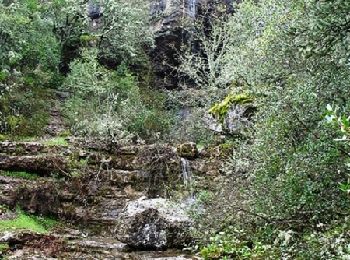
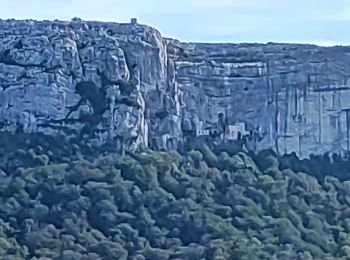
• Parcours classique vers la grotte de Ste Baume et la chapelle St Pilon, toutes dédiées à Marie Madeleine. Le présent ...
![Randonnée Marche Plan-d'Aups-Sainte-Baume - Sentier merveilleux - Le paradis - La Grotte Ste Marie Madeleine - Photo](https://media.geolcdn.com/t/350/260/e69b33b5-1427-482e-bef6-59e868e7cd87.jpg&format=jpg&maxdim=2)
![Marche Marche](https://static1.geolcdn.com/sitytour/trail-icons/101.png)
Km
Marche
![](/images/other/stat-length.png)
![](https://static1.geolcdn.com/siteimages/upload/files/1508320355ic_sort_den_pos_24dp.png)
![](https://static1.geolcdn.com/siteimages/upload/files/1508320355ic_sort_den_neg_24dp.png)
![](https://static1.geolcdn.com/siteimages/upload/files/16400158638029165_repeat_loop_refresh_sync_direction_icon.png)
![Randonnée Marche Plan-d'Aups-Sainte-Baume - Crêts de la Ste Baume - Photo](https://media.geolcdn.com/t/350/260/ext.jpg?maxdim=2&url=https%3A%2F%2Fservices.sitytrail.com%2FGeolivesWS%2FDownloadMedia.ashx%3FTrailID%3D214866%26Media%3D15409_2.jpg)
![Marche Marche](https://static1.geolcdn.com/sitytour/trail-icons/101.png)
Km
Marche
![](/images/other/stat-length.png)
![](https://static1.geolcdn.com/siteimages/upload/files/1508320355ic_sort_den_pos_24dp.png)
![](https://static1.geolcdn.com/siteimages/upload/files/1508320355ic_sort_den_neg_24dp.png)
![](https://static1.geolcdn.com/siteimages/upload/files/16400158638029165_repeat_loop_refresh_sync_direction_icon.png)
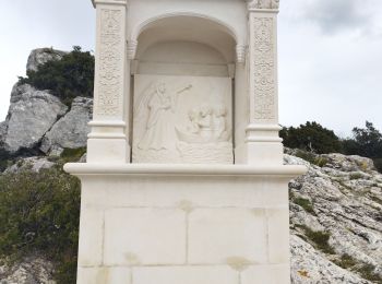
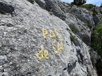
• Départ de l'Hôtellerie de la Ste Baume, le col du Pilon, la chapelle du Pilon, retour par le pas de l Ail, passage di...
![Randonnée Marche Plan-d'Aups-Sainte-Baume - Du Col du Saint-Pilon au Pas de l'Aï, Sainte Baume - Photo](https://media.geolcdn.com/t/350/260/ext.jpg?maxdim=2&url=https%3A%2F%2Fservices.sitytrail.com%2FGeolivesWS%2FDownloadMedia.ashx%3FTrailID%3D107608%26Media%3D12576_1.jpg)
![Marche Marche](https://static1.geolcdn.com/sitytour/trail-icons/101.png)
Km
Marche
![](/images/other/stat-length.png)
![](https://static1.geolcdn.com/siteimages/upload/files/1508320355ic_sort_den_pos_24dp.png)
![](https://static1.geolcdn.com/siteimages/upload/files/1508320355ic_sort_den_neg_24dp.png)
![](https://static1.geolcdn.com/siteimages/upload/files/16400158638029165_repeat_loop_refresh_sync_direction_icon.png)
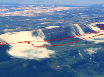
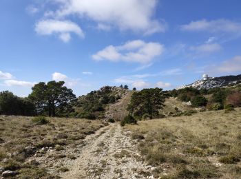
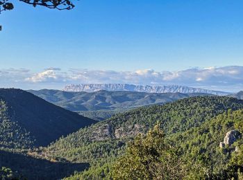
• Massif de la Sainte-Baume. Un splendide parcours qui traverse l'Est des crêtes de la Sainte-Baume en passant par le p...
![Randonnée Marche Plan-d'Aups-Sainte-Baume - La Grotte aux oiseaux - Plan d'Aups - Photo](https://media.geolcdn.com/t/350/260/ext.jpg?maxdim=2&url=https%3A%2F%2Fservices.sitytrail.com%2FGeolivesWS%2FDownloadMedia.ashx%3FTrailID%3D103826%26Media%3D6600_1.jpg)
![Marche Marche](https://static1.geolcdn.com/sitytour/trail-icons/101.png)
Km
Marche
![](/images/other/stat-length.png)
![](https://static1.geolcdn.com/siteimages/upload/files/1508320355ic_sort_den_pos_24dp.png)
![](https://static1.geolcdn.com/siteimages/upload/files/1508320355ic_sort_den_neg_24dp.png)
![](https://static1.geolcdn.com/siteimages/upload/files/16400158638029165_repeat_loop_refresh_sync_direction_icon.png)
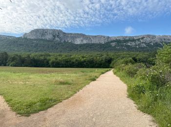
• Belle randonnée de niveau 3. Parking Plan d'Aups. Belles vues sur la montagne sainte Baume et la forêt domaniale. D’a...
![Randonnée A pied Plan-d'Aups-Sainte-Baume - Massif Sainte Baume et pas de l’Aï 15 km - Photo](https://media.geolcdn.com/t/350/260/54842a9c-9634-48d7-ac63-66e02dee4ec6.jpg&format=jpg&maxdim=2)
![A pied A pied](https://static1.geolcdn.com/sitytour/trail-icons/100.png)
Km
A pied
![](/images/other/stat-length.png)
![](https://static1.geolcdn.com/siteimages/upload/files/1508320355ic_sort_den_pos_24dp.png)
![](https://static1.geolcdn.com/siteimages/upload/files/1508320355ic_sort_den_neg_24dp.png)
![](https://static1.geolcdn.com/siteimages/upload/files/16400158638029165_repeat_loop_refresh_sync_direction_icon.png)
• Bonne randonnée montagnarde sur la crête du massif de Sainte Baume. Elle démarre avec une longue et douce montée vers...
![Randonnée Marche Plan-d'Aups-Sainte-Baume - Sainte Baume par le sentier Marcel d'Estruch - Photo](https://media.geolcdn.com/t/350/260/39d64878-6331-46dd-a0a2-1e73bc67147d.jpg&format=jpg&maxdim=2)
![Marche Marche](https://static1.geolcdn.com/sitytour/trail-icons/101.png)
Km
Marche
![](/images/other/stat-length.png)
![](https://static1.geolcdn.com/siteimages/upload/files/1508320355ic_sort_den_pos_24dp.png)
![](https://static1.geolcdn.com/siteimages/upload/files/1508320355ic_sort_den_neg_24dp.png)
![](https://static1.geolcdn.com/siteimages/upload/files/16400158638029165_repeat_loop_refresh_sync_direction_icon.png)
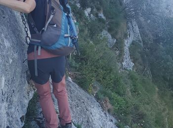
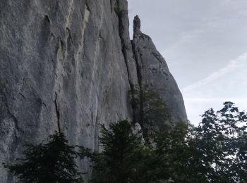
• Passages d'escalade en 3. chaînes Très joli parcours varié.
![Randonnée Marche Plan-d'Aups-Sainte-Baume - Marcel estruche - Photo](https://media.geolcdn.com/t/350/260/cd96c828-8909-494f-85c8-96787c0e1fdc.jpg&format=jpg&maxdim=2)
![Marche Marche](https://static1.geolcdn.com/sitytour/trail-icons/101.png)
Km
Marche
![](/images/other/stat-length.png)
![](https://static1.geolcdn.com/siteimages/upload/files/1508320355ic_sort_den_pos_24dp.png)
![](https://static1.geolcdn.com/siteimages/upload/files/1508320355ic_sort_den_neg_24dp.png)
![](https://static1.geolcdn.com/siteimages/upload/files/16400158638029165_repeat_loop_refresh_sync_direction_icon.png)
• Randonnée aérienne. Passage 3b.chaines
![Randonnée Marche Plan-d'Aups-Sainte-Baume - Pic de Bertagne - Grotte Betton - Le plan d'aups - Photo](https://media.geolcdn.com/t/350/260/ad49718c-76f4-4694-8c1c-399f42429ef6.jpg&format=jpg&maxdim=2)
![Marche Marche](https://static1.geolcdn.com/sitytour/trail-icons/101.png)
Km
Marche
![](/images/other/stat-length.png)
![](https://static1.geolcdn.com/siteimages/upload/files/1508320355ic_sort_den_pos_24dp.png)
![](https://static1.geolcdn.com/siteimages/upload/files/1508320355ic_sort_den_neg_24dp.png)
![](https://static1.geolcdn.com/siteimages/upload/files/16400158638029165_repeat_loop_refresh_sync_direction_icon.png)
• Une seule difficultée la montée au Pic de Bertagne. Magnifiques points de vue depuis le sommet. La grotte Betton se m...
![Randonnée Marche Plan-d'Aups-Sainte-Baume - Sentier merveilleux - La Ste baume - Le Plan d'aups - Photo](https://media.geolcdn.com/t/350/260/6be37cfb-7b02-4bd8-89c9-a7cfa3aa9e84.jpg&format=jpg&maxdim=2)
![Marche Marche](https://static1.geolcdn.com/sitytour/trail-icons/101.png)
Km
Marche
![](/images/other/stat-length.png)
![](https://static1.geolcdn.com/siteimages/upload/files/1508320355ic_sort_den_pos_24dp.png)
![](https://static1.geolcdn.com/siteimages/upload/files/1508320355ic_sort_den_neg_24dp.png)
![](https://static1.geolcdn.com/siteimages/upload/files/16400158638029165_repeat_loop_refresh_sync_direction_icon.png)
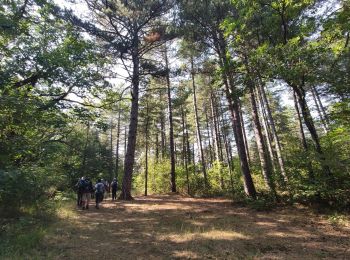
• Randonnée facile en foret
![Randonnée Marche Plan-d'Aups-Sainte-Baume - Source de l'Huveaune depuis l'hôtellerie de la Sainte Baume - Photo](https://media.geolcdn.com/t/350/260/bc93f9aa-4d4b-45ee-9d44-974fc0b2c778.jpg&format=jpg&maxdim=2)
![Marche Marche](https://static1.geolcdn.com/sitytour/trail-icons/101.png)
Km
Marche
![](/images/other/stat-length.png)
![](https://static1.geolcdn.com/siteimages/upload/files/1508320355ic_sort_den_pos_24dp.png)
![](https://static1.geolcdn.com/siteimages/upload/files/1508320355ic_sort_den_neg_24dp.png)
![](https://static1.geolcdn.com/siteimages/upload/files/16400158638029165_repeat_loop_refresh_sync_direction_icon.png)
• Plus d'information sur: http://pixels13.free.fr
![Randonnée Marche Plan-d'Aups-Sainte-Baume - Tour Cauvin, Dent de Roque Forcade, grotte de la Grande Baume - Photo](https://media.geolcdn.com/t/350/260/bc01032a-b83b-4472-9a16-75fe460f864f.jpg&format=jpg&maxdim=2)
![Marche Marche](https://static1.geolcdn.com/sitytour/trail-icons/101.png)
Km
Marche
![](/images/other/stat-length.png)
![](https://static1.geolcdn.com/siteimages/upload/files/1508320355ic_sort_den_pos_24dp.png)
![](https://static1.geolcdn.com/siteimages/upload/files/1508320355ic_sort_den_neg_24dp.png)
![](https://static1.geolcdn.com/siteimages/upload/files/16400158638029165_repeat_loop_refresh_sync_direction_icon.png)
• Marche sac à dos Roquebrune Amitié
![Randonnée sport Plan-d'Aups-Sainte-Baume - ST BAUME PAS DE L AIL CHEMIN MERVEILLEUX - Photo](https://media.geolcdn.com/t/350/260/3b604a37-2d12-423c-a0ab-b00beeaa8575.jpg&format=jpg&maxdim=2)
Km
sport
![](/images/other/stat-length.png)
![](https://static1.geolcdn.com/siteimages/upload/files/1508320355ic_sort_den_pos_24dp.png)
![](https://static1.geolcdn.com/siteimages/upload/files/1508320355ic_sort_den_neg_24dp.png)
![](https://static1.geolcdn.com/siteimages/upload/files/16400158638029165_repeat_loop_refresh_sync_direction_icon.png)
• Magnifique rando
![Randonnée Marche Plan-d'Aups-Sainte-Baume - Sources de l'Huveaune - Photo](https://media.geolcdn.com/t/350/260/3ef35af4-96eb-4b3b-8bd4-e8e296a1838a.jpg&format=jpg&maxdim=2)
![Marche Marche](https://static1.geolcdn.com/sitytour/trail-icons/101.png)
Km
Marche
![](/images/other/stat-length.png)
![](https://static1.geolcdn.com/siteimages/upload/files/1508320355ic_sort_den_pos_24dp.png)
![](https://static1.geolcdn.com/siteimages/upload/files/1508320355ic_sort_den_neg_24dp.png)
![](https://static1.geolcdn.com/siteimages/upload/files/16400158638029165_repeat_loop_refresh_sync_direction_icon.png)
• Belle rando. Quelques passages raides. Prévoir une lampe pour la grotte.
![Randonnée Marche Plan-d'Aups-Sainte-Baume - Dent de la Roque Forcade après reco - Photo](https://media.geolcdn.com/t/350/260/ae6321b0-21ff-417f-a95d-66052918644d.jpg&format=jpg&maxdim=2)
![Marche Marche](https://static1.geolcdn.com/sitytour/trail-icons/101.png)
Km
Marche
![](/images/other/stat-length.png)
![](https://static1.geolcdn.com/siteimages/upload/files/1508320355ic_sort_den_pos_24dp.png)
![](https://static1.geolcdn.com/siteimages/upload/files/1508320355ic_sort_den_neg_24dp.png)
![](https://static1.geolcdn.com/siteimages/upload/files/16400158638029165_repeat_loop_refresh_sync_direction_icon.png)
• Montée coriace au départ et pente très forte après montagne de Cauvin
![Randonnée Marche Plan-d'Aups-Sainte-Baume - st beaume hostellerie source de l'huveaune - Photo](https://media.geolcdn.com/t/350/260/88815d47-f50c-427f-ab15-4e8afcbcef8f.jpg&format=jpg&maxdim=2)
![Marche Marche](https://static1.geolcdn.com/sitytour/trail-icons/101.png)
Km
Marche
![](/images/other/stat-length.png)
![](https://static1.geolcdn.com/siteimages/upload/files/1508320355ic_sort_den_pos_24dp.png)
![](https://static1.geolcdn.com/siteimages/upload/files/1508320355ic_sort_den_neg_24dp.png)
![](https://static1.geolcdn.com/siteimages/upload/files/16400158638029165_repeat_loop_refresh_sync_direction_icon.png)
• avec détour la grotte de Castelette
![Randonnée Marche Plan-d'Aups-Sainte-Baume - boucle sentier merveilleux 13 km - Photo](https://media.geolcdn.com/t/350/260/d63c4f3b-27eb-4824-a828-ce939e9d91ce.jpg&format=jpg&maxdim=2)
![Marche Marche](https://static1.geolcdn.com/sitytour/trail-icons/101.png)
Km
Marche
![](/images/other/stat-length.png)
![](https://static1.geolcdn.com/siteimages/upload/files/1508320355ic_sort_den_pos_24dp.png)
![](https://static1.geolcdn.com/siteimages/upload/files/1508320355ic_sort_den_neg_24dp.png)
![](https://static1.geolcdn.com/siteimages/upload/files/16400158638029165_repeat_loop_refresh_sync_direction_icon.png)
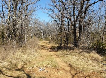
• petite boucle trés agréable pour les couleurs d'automne avec une boucle en aller retopur sur le sentier merveilleux e...
![Randonnée Marche Plan-d'Aups-Sainte-Baume - Boucle St Baume Huveaune - Photo](https://media.geolcdn.com/t/350/260/c6e94abc-e0d4-4c72-bc69-9b6e8870e3c8.jpg&format=jpg&maxdim=2)
![Marche Marche](https://static1.geolcdn.com/sitytour/trail-icons/101.png)
Km
Marche
![](/images/other/stat-length.png)
![](https://static1.geolcdn.com/siteimages/upload/files/1508320355ic_sort_den_pos_24dp.png)
![](https://static1.geolcdn.com/siteimages/upload/files/1508320355ic_sort_den_neg_24dp.png)
![](https://static1.geolcdn.com/siteimages/upload/files/16400158638029165_repeat_loop_refresh_sync_direction_icon.png)
• Une descente abrupte
![Randonnée Marche Plan-d'Aups-Sainte-Baume - Plan d'Aups La Sainte Baume l'ajouco de l'aigle - Photo](https://media.geolcdn.com/t/350/260/9863c4f5-aa11-42fa-ad3a-8fc207e73a22.jpg&format=jpg&maxdim=2)
![Marche Marche](https://static1.geolcdn.com/sitytour/trail-icons/101.png)
Km
Marche
![](/images/other/stat-length.png)
![](https://static1.geolcdn.com/siteimages/upload/files/1508320355ic_sort_den_pos_24dp.png)
![](https://static1.geolcdn.com/siteimages/upload/files/1508320355ic_sort_den_neg_24dp.png)
![](https://static1.geolcdn.com/siteimages/upload/files/16400158638029165_repeat_loop_refresh_sync_direction_icon.png)
• superbes points de vue
![Randonnée Marche Plan-d'Aups-Sainte-Baume - Sainte baume - Photo](https://media.geolcdn.com/t/350/260/70701c44-ec1e-4926-ae70-83fc974c452e.jpg&format=jpg&maxdim=2)
![Marche Marche](https://static1.geolcdn.com/sitytour/trail-icons/101.png)
Km
Marche
![](/images/other/stat-length.png)
![](https://static1.geolcdn.com/siteimages/upload/files/1508320355ic_sort_den_pos_24dp.png)
![](https://static1.geolcdn.com/siteimages/upload/files/1508320355ic_sort_den_neg_24dp.png)
![](https://static1.geolcdn.com/siteimages/upload/files/16400158638029165_repeat_loop_refresh_sync_direction_icon.png)
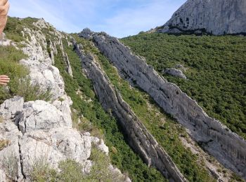
• En partant des trois chênes, montée jusqu'au "chemin merveilleux", qui serpente dans la forêt au pied de la barre. Pu...
20 randonnées affichées sur 404
Application GPS de randonnée GRATUITE