


19,3 km | 25 km-effort
La Chapelle : découvrez les meilleures randonnées : 2 pédestres, 1 à vélo ou VTT et 3 parcours équestres. Tous ces circuits, parcours, itinéraires et activités en plein air sont disponibles dans nos applications SityTrail pour smartphones et tablettes.
Randonnée équestre


• De la frontière française vers Bouillon, Dohan en passant par des gués, relais : hébergements, restauration et halte....

Attelage
• Non balisé
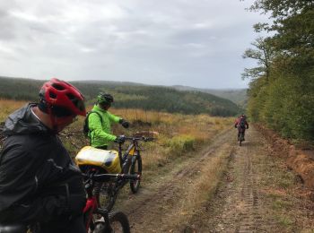
V.T.T.
• Bououououe le long de la frontière belge
Randonnée équestre

Marche
Marche

Ski de fond
7 randonnées affichées sur 7
Application GPS de randonnée GRATUITE
 SityTrail
IGN / Instituts géographiques
SityTrail World
Le monde est à vous