![](/images/other/stat-length.png)
- Randonnées
- Outdoor
- France
- Auvergne-Rhône-Alpes
- Isère
- Saint-Christophe-sur-Guiers
Saint-Christophe-sur-Guiers, Isère : Les meilleures randonnées, itinéraires, parcours, balades et promenades
Saint-Christophe-sur-Guiers : découvrez les meilleures randonnées : 59 pédestres, 1 à vélo ou VTT et 2 parcours équestres. Tous ces circuits, parcours, itinéraires et activités en plein air sont disponibles dans nos applications SityTrail pour smartphones et tablettes.
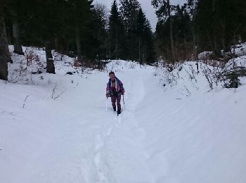
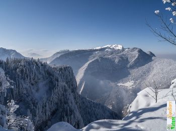
Les meilleurs parcours (103)
![Randonnée Raquettes à neige Saint-Christophe-sur-Guiers - Le Belvédère d'Arpison - Photo](https://media.geolcdn.com/t/350/260/ext.jpg?maxdim=2&url=https%3A%2F%2Fservices.sitytrail.com%2FGeolivesWS%2FDownloadMedia.ashx%3FTrailID%3D699429%26Media%3Dfix__20170216145739.jpg)
![Raquettes à neige Raquettes à neige](https://static1.geolcdn.com/sitytour/trail-icons/504.png)
Km
Raquettes à neige
![](/images/other/stat-length.png)
![](https://static1.geolcdn.com/siteimages/upload/files/1508320355ic_sort_den_pos_24dp.png)
![](https://static1.geolcdn.com/siteimages/upload/files/1508320355ic_sort_den_neg_24dp.png)
![](https://static1.geolcdn.com/siteimages/upload/files/16400158638029165_repeat_loop_refresh_sync_direction_icon.png)
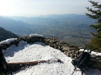
• Belle boucle, mais comme souvent en Chartreuse avec Beaucoup de foret, très dense à la fin de la descente. Il vaut mi...
![Randonnée Marche Saint-Christophe-sur-Guiers - Petit Som 1772m, depuis La Ruchère - Photo](https://media.geolcdn.com/t/350/260/ext.jpg?maxdim=2&url=https%3A%2F%2Fservices.sitytrail.com%2FGeolivesWS%2FDownloadMedia.ashx%3FTrailID%3D101428%26Media%3D1421_1.jpg)
![Marche Marche](https://static1.geolcdn.com/sitytour/trail-icons/101.png)
Km
Marche
![](/images/other/stat-length.png)
![](https://static1.geolcdn.com/siteimages/upload/files/1508320355ic_sort_den_pos_24dp.png)
![](https://static1.geolcdn.com/siteimages/upload/files/1508320355ic_sort_den_neg_24dp.png)
![](https://static1.geolcdn.com/siteimages/upload/files/16400158638029165_repeat_loop_refresh_sync_direction_icon.png)
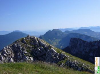
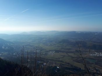
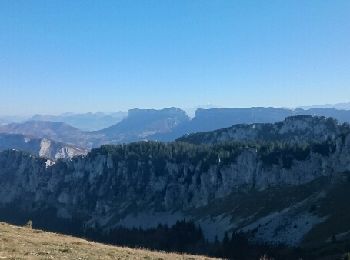
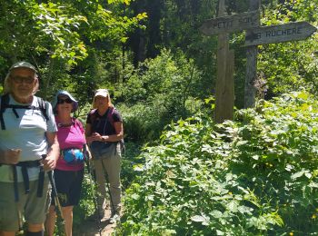
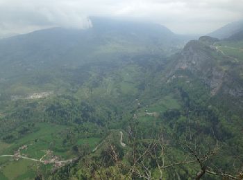
• Situé au cœur de la Chartreuse, le Petit Som offre de jolis points de vue sur le massif et une ambiance qui associe l...
![Randonnée Marche Saint-Christophe-sur-Guiers - 38 grand som par sente intermediaire - Photo](https://media.geolcdn.com/t/350/260/d5932087-ede9-44fd-a20e-8bcb7625b7eb.jpg&format=jpg&maxdim=2)
![Marche Marche](https://static1.geolcdn.com/sitytour/trail-icons/101.png)
Km
Marche
![](/images/other/stat-length.png)
![](https://static1.geolcdn.com/siteimages/upload/files/1508320355ic_sort_den_pos_24dp.png)
![](https://static1.geolcdn.com/siteimages/upload/files/1508320355ic_sort_den_neg_24dp.png)
![](https://static1.geolcdn.com/siteimages/upload/files/16400158638029165_repeat_loop_refresh_sync_direction_icon.png)
• pat.chant.29.170.22
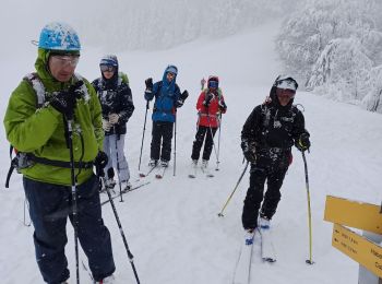
![Randonnée Ski de randonnée Saint-Christophe-sur-Guiers - Col de mauvernay, de Bovinant, du Frêt et Petit Som - Photo](https://media.geolcdn.com/t/350/260/419264db-ef9b-4542-9a8f-6ba6585137b1.jpg&format=jpg&maxdim=2)
![Ski de randonnée Ski de randonnée](https://static1.geolcdn.com/sitytour/trail-icons/503.png)
Km
Ski de randonnée
![](/images/other/stat-length.png)
![](https://static1.geolcdn.com/siteimages/upload/files/1508320355ic_sort_den_pos_24dp.png)
![](https://static1.geolcdn.com/siteimages/upload/files/1508320355ic_sort_den_neg_24dp.png)
![](https://static1.geolcdn.com/siteimages/upload/files/16400158638029165_repeat_loop_refresh_sync_direction_icon.png)
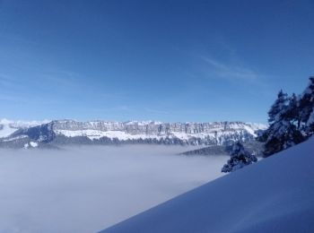
• Très beau tour avec de la poudreuse.
![Randonnée Marche Saint-Christophe-sur-Guiers - Petit Som par le Col de la Ruchère - Photo](https://media.geolcdn.com/t/350/260/ext.jpg?maxdim=2&url=https%3A%2F%2Fservices.sitytrail.com%2FGeolivesWS%2FDownloadMedia.ashx%3FTrailID%3D187990%26Media%3D84dca246-9935-47c1-bea7-9350caca3e85.JPG)
![Marche Marche](https://static1.geolcdn.com/sitytour/trail-icons/101.png)
Km
Marche
![](/images/other/stat-length.png)
![](https://static1.geolcdn.com/siteimages/upload/files/1508320355ic_sort_den_pos_24dp.png)
![](https://static1.geolcdn.com/siteimages/upload/files/1508320355ic_sort_den_neg_24dp.png)
![](https://static1.geolcdn.com/siteimages/upload/files/16400158638029165_repeat_loop_refresh_sync_direction_icon.png)
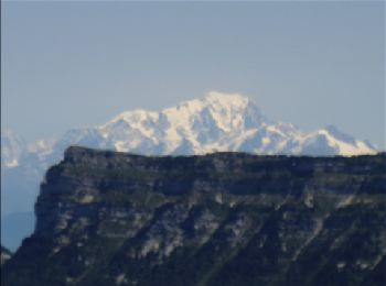
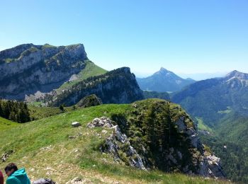
• Départ du Habert direction le col de la Ruchère. Ensuite montée finale. Au sommet: vue splendide sur le Mont-Blanc. R...
![Randonnée Marche Saint-Christophe-sur-Guiers - Petit Som 8 km - Photo](https://media.geolcdn.com/t/350/260/57c6de03-4d33-4c2b-aa76-08717bde9c90.jpg&format=jpg&maxdim=2)
![Marche Marche](https://static1.geolcdn.com/sitytour/trail-icons/101.png)
Km
Marche
![](/images/other/stat-length.png)
![](https://static1.geolcdn.com/siteimages/upload/files/1508320355ic_sort_den_pos_24dp.png)
![](https://static1.geolcdn.com/siteimages/upload/files/1508320355ic_sort_den_neg_24dp.png)
![](https://static1.geolcdn.com/siteimages/upload/files/16400158638029165_repeat_loop_refresh_sync_direction_icon.png)
![Randonnée Marche Saint-Christophe-sur-Guiers - La Ruchere - Col de l'Allienard - Photo](https://media.geolcdn.com/t/350/260/1c89a1f1-64a1-4fbc-ba6e-11130f03ffcd.jpg&format=jpg&maxdim=2)
![Marche Marche](https://static1.geolcdn.com/sitytour/trail-icons/101.png)
Km
Marche
![](/images/other/stat-length.png)
![](https://static1.geolcdn.com/siteimages/upload/files/1508320355ic_sort_den_pos_24dp.png)
![](https://static1.geolcdn.com/siteimages/upload/files/1508320355ic_sort_den_neg_24dp.png)
![](https://static1.geolcdn.com/siteimages/upload/files/16400158638029165_repeat_loop_refresh_sync_direction_icon.png)
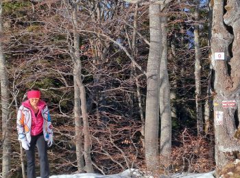
• Sentier raquette rouge (3) au début jusqu au col de l Allienard. Puis sentier raquette bleu (2) pour retour, sans pas...
![Randonnée Marche Saint-Christophe-sur-Guiers - COL DE LA RUCHERE - Photo](https://media.geolcdn.com/t/350/260/623cf2e6-26af-4150-8be1-33444e1d1085.jpg&format=jpg&maxdim=2)
![Marche Marche](https://static1.geolcdn.com/sitytour/trail-icons/101.png)
Km
Marche
![](/images/other/stat-length.png)
![](https://static1.geolcdn.com/siteimages/upload/files/1508320355ic_sort_den_pos_24dp.png)
![](https://static1.geolcdn.com/siteimages/upload/files/1508320355ic_sort_den_neg_24dp.png)
![](https://static1.geolcdn.com/siteimages/upload/files/16400158638029165_repeat_loop_refresh_sync_direction_icon.png)
• départ du foyer de ski de fond. un peu de route puis montée continue jusqu'au col. quelques beaux paysages.la descent...
![Randonnée Marche Saint-Christophe-sur-Guiers - Le Petit Som - Photo](https://media.geolcdn.com/t/350/260/ext.jpg?maxdim=2&url=https%3A%2F%2Fservices.sitytrail.com%2FGeolivesWS%2FDownloadMedia.ashx%3FTrailID%3D936096%26Media%3Dfix__20171018104412.jpg)
![Marche Marche](https://static1.geolcdn.com/sitytour/trail-icons/101.png)
Km
Marche
![](/images/other/stat-length.png)
![](https://static1.geolcdn.com/siteimages/upload/files/1508320355ic_sort_den_pos_24dp.png)
![](https://static1.geolcdn.com/siteimages/upload/files/1508320355ic_sort_den_neg_24dp.png)
![](https://static1.geolcdn.com/siteimages/upload/files/16400158638029165_repeat_loop_refresh_sync_direction_icon.png)
• Retour par le pas du loup
![Randonnée Marche Saint-Christophe-sur-Guiers - Col de la Ruchere - Photo](https://media.geolcdn.com/t/350/260/ext.jpg?maxdim=2&url=https%3A%2F%2Fservices.sitytrail.com%2FGeolivesWS%2FDownloadMedia.ashx%3FTrailID%3D745905%26Media%3Dfix__20170503142109.jpg)
![Marche Marche](https://static1.geolcdn.com/sitytour/trail-icons/101.png)
Km
Marche
![](/images/other/stat-length.png)
![](https://static1.geolcdn.com/siteimages/upload/files/1508320355ic_sort_den_pos_24dp.png)
![](https://static1.geolcdn.com/siteimages/upload/files/1508320355ic_sort_den_neg_24dp.png)
![](https://static1.geolcdn.com/siteimages/upload/files/16400158638029165_repeat_loop_refresh_sync_direction_icon.png)
• Reco du 03/05/17
![Randonnée Marche Saint-Christophe-sur-Guiers - Le petit Som par La Ruchere - retour par le pas du Loup - Photo](https://media.geolcdn.com/t/350/260/ext.jpg?maxdim=2&url=https%3A%2F%2Fservices.sitytrail.com%2FGeolivesWS%2FDownloadMedia.ashx%3FTrailID%3D598585%26Media%3Dfix__20160715114812.jpg)
![Marche Marche](https://static1.geolcdn.com/sitytour/trail-icons/101.png)
Km
Marche
![](/images/other/stat-length.png)
![](https://static1.geolcdn.com/siteimages/upload/files/1508320355ic_sort_den_pos_24dp.png)
![](https://static1.geolcdn.com/siteimages/upload/files/1508320355ic_sort_den_neg_24dp.png)
![](https://static1.geolcdn.com/siteimages/upload/files/16400158638029165_repeat_loop_refresh_sync_direction_icon.png)
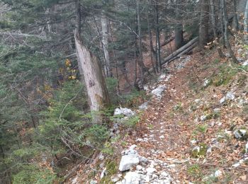
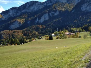
• Montée par le Nord sur un itinéraire peu fréquenté. Retour par Bovinant et le Pas de Loup. Pas difficultés particuliè...
![Randonnée Autre activité Saint-Christophe-sur-Guiers - berland - Photo](https://media.geolcdn.com/t/350/260/ext.jpg?maxdim=2&url=https%3A%2F%2Fstatic1.geolcdn.com%2Fsiteimages%2Fupload%2Ffiles%2F1545311037marcheuse_200dpi.jpg)
![Autre activité Autre activité](https://static1.geolcdn.com/sitytour/trail-icons/900.png)
Km
Autre activité
![](/images/other/stat-length.png)
![](https://static1.geolcdn.com/siteimages/upload/files/1508320355ic_sort_den_pos_24dp.png)
![](https://static1.geolcdn.com/siteimages/upload/files/1508320355ic_sort_den_neg_24dp.png)
![](https://static1.geolcdn.com/siteimages/upload/files/16400158638029165_repeat_loop_refresh_sync_direction_icon.png)
![Randonnée Raquettes à neige Saint-Christophe-sur-Guiers - La ruchère - Photo](https://media.geolcdn.com/t/350/260/ed4ee8ff-3d47-4a5a-98f7-bdfe2773c4b1.jpg&format=jpg&maxdim=2)
![Raquettes à neige Raquettes à neige](https://static1.geolcdn.com/sitytour/trail-icons/504.png)
Km
Raquettes à neige
![](/images/other/stat-length.png)
![](https://static1.geolcdn.com/siteimages/upload/files/1508320355ic_sort_den_pos_24dp.png)
![](https://static1.geolcdn.com/siteimages/upload/files/1508320355ic_sort_den_neg_24dp.png)
![](https://static1.geolcdn.com/siteimages/upload/files/16400158638029165_repeat_loop_refresh_sync_direction_icon.png)
• Rando raquettes
![Randonnée Marche Saint-Christophe-sur-Guiers - Petit Som en circuit - Photo](https://media.geolcdn.com/t/350/260/98d790c3-0f06-4e79-a8b7-6da1522f7452.jpg&format=jpg&maxdim=2)
![Marche Marche](https://static1.geolcdn.com/sitytour/trail-icons/101.png)
Km
Marche
![](/images/other/stat-length.png)
![](https://static1.geolcdn.com/siteimages/upload/files/1508320355ic_sort_den_pos_24dp.png)
![](https://static1.geolcdn.com/siteimages/upload/files/1508320355ic_sort_den_neg_24dp.png)
![](https://static1.geolcdn.com/siteimages/upload/files/16400158638029165_repeat_loop_refresh_sync_direction_icon.png)
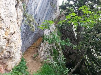
• A la montée, l'accès au sommet raide (cheminée assez aisée si bonne condition) et à faire absolument par temps sec. A...
![Randonnée Marche Saint-Christophe-sur-Guiers - 20220703 petit som - Photo](https://media.geolcdn.com/t/350/260/97605844-0e97-416c-b346-e0570c4328af.jpg&format=jpg&maxdim=2)
![Marche Marche](https://static1.geolcdn.com/sitytour/trail-icons/101.png)
Km
Marche
![](/images/other/stat-length.png)
![](https://static1.geolcdn.com/siteimages/upload/files/1508320355ic_sort_den_pos_24dp.png)
![](https://static1.geolcdn.com/siteimages/upload/files/1508320355ic_sort_den_neg_24dp.png)
![](https://static1.geolcdn.com/siteimages/upload/files/16400158638029165_repeat_loop_refresh_sync_direction_icon.png)
![Randonnée Ski de randonnée Saint-Christophe-sur-Guiers - la morte - Photo](https://media.geolcdn.com/t/350/260/7d0cd76b-4337-4c27-aa25-0796124fe94b.jpg&format=jpg&maxdim=2)
![Ski de randonnée Ski de randonnée](https://static1.geolcdn.com/sitytour/trail-icons/503.png)
Km
Ski de randonnée
![](/images/other/stat-length.png)
![](https://static1.geolcdn.com/siteimages/upload/files/1508320355ic_sort_den_pos_24dp.png)
![](https://static1.geolcdn.com/siteimages/upload/files/1508320355ic_sort_den_neg_24dp.png)
![](https://static1.geolcdn.com/siteimages/upload/files/16400158638029165_repeat_loop_refresh_sync_direction_icon.png)
![Randonnée Marche Saint-Christophe-sur-Guiers - Le Petit Som par La Cheminée et Le Pas du loup - Photo](https://media.geolcdn.com/t/350/260/ext.jpg?maxdim=2&url=https%3A%2F%2Fservices.sitytrail.com%2FGeolivesWS%2FDownloadMedia.ashx%3FTrailID%3D769315%26Media%3Dfix__20170608115929.jpg)
![Marche Marche](https://static1.geolcdn.com/sitytour/trail-icons/101.png)
Km
Marche
![](/images/other/stat-length.png)
![](https://static1.geolcdn.com/siteimages/upload/files/1508320355ic_sort_den_pos_24dp.png)
![](https://static1.geolcdn.com/siteimages/upload/files/1508320355ic_sort_den_neg_24dp.png)
![](https://static1.geolcdn.com/siteimages/upload/files/16400158638029165_repeat_loop_refresh_sync_direction_icon.png)
• Belle Boucle - Sentiers bien tracés, même dans la cheminée. Tranquillement: 2h de montée, 2,5 h de descente.
![Randonnée Marche Saint-Christophe-sur-Guiers - 2013 05 05 Rocher du Frou - Photo](https://media.geolcdn.com/t/350/260/ext.jpg?maxdim=2&url=https%3A%2F%2Fservices.sitytrail.com%2FGeolivesWS%2FDownloadMedia.ashx%3FTrailID%3D189212%26Media%3D20130505123416.jpg)
![Marche Marche](https://static1.geolcdn.com/sitytour/trail-icons/101.png)
Km
Marche
![](/images/other/stat-length.png)
![](https://static1.geolcdn.com/siteimages/upload/files/1508320355ic_sort_den_pos_24dp.png)
![](https://static1.geolcdn.com/siteimages/upload/files/1508320355ic_sort_den_neg_24dp.png)
![](https://static1.geolcdn.com/siteimages/upload/files/16400158638029165_repeat_loop_refresh_sync_direction_icon.png)
•
![Randonnée Raquettes à neige Saint-Christophe-sur-Guiers - Le Belvédère d'Arpison en raquettes, depuis la Ruchère - Photo](https://media.geolcdn.com/t/350/260/ext.jpg?maxdim=2&url=https%3A%2F%2Fservices.sitytrail.com%2FGeolivesWS%2FDownloadMedia.ashx%3FTrailID%3D107746%26Media%3D12814_1.jpg)
![Raquettes à neige Raquettes à neige](https://static1.geolcdn.com/sitytour/trail-icons/504.png)
Km
Raquettes à neige
![](/images/other/stat-length.png)
![](https://static1.geolcdn.com/siteimages/upload/files/1508320355ic_sort_den_pos_24dp.png)
![](https://static1.geolcdn.com/siteimages/upload/files/1508320355ic_sort_den_neg_24dp.png)
![](https://static1.geolcdn.com/siteimages/upload/files/16400158638029165_repeat_loop_refresh_sync_direction_icon.png)
• Randonnée en raquettes. Le Centre de Ski Nordique de la Ruchère offre aussi des circuits balisés en raquettes. Le plu...
![Randonnée Marche Saint-Christophe-sur-Guiers - Le Belvédère d'Arpison en raquettes, depuis la Ruchère - Photo](https://media.geolcdn.com/t/350/260/ext.jpg?maxdim=2&url=https%3A%2F%2Fservices.sitytrail.com%2FGeolivesWS%2FDownloadMedia.ashx%3FTrailID%3D107745%26Media%3D12814_1.jpg)
![Marche Marche](https://static1.geolcdn.com/sitytour/trail-icons/101.png)
Km
Marche
![](/images/other/stat-length.png)
![](https://static1.geolcdn.com/siteimages/upload/files/1508320355ic_sort_den_pos_24dp.png)
![](https://static1.geolcdn.com/siteimages/upload/files/1508320355ic_sort_den_neg_24dp.png)
![](https://static1.geolcdn.com/siteimages/upload/files/16400158638029165_repeat_loop_refresh_sync_direction_icon.png)
• Randonnée en raquettes. Le Centre de Ski Nordique de la Ruchère offre aussi des circuits balisés en raquettes. Le plu...
20 randonnées affichées sur 103
Application GPS de randonnée GRATUITE