


8,2 km | 8,8 km-effort
Aoste : découvrez les meilleures randonnées : 2 pédestres, 3 à vélo ou VTT et 1 parcours équestres. Tous ces circuits, parcours, itinéraires et activités en plein air sont disponibles dans nos applications SityTrail pour smartphones et tablettes.

Marche


• balade facile sans difficultés
Marche
• randonnée
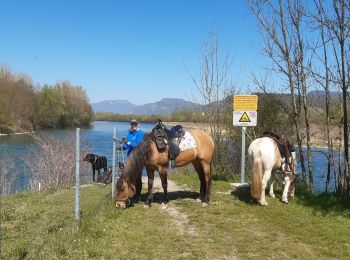
Randonnée équestre

Vélo
• Entraînement du premier jour
Vélo
• De St Genix-sur-Guiers à Groslée en VAE
Vélo
• Boucle en remontant le Rhône vers La Balme au départ de l'hôtel Bellet (le Coq en Velours)

Quad
7 randonnées affichées sur 7
Application GPS de randonnée GRATUITE
 SityTrail
IGN / Instituts géographiques
SityTrail World
Le monde est à vous