


18 km | 24 km-effort
Pinay : découvrez les meilleures randonnées : 3 pédestres et 2 à vélo ou VTT. Tous ces circuits, parcours, itinéraires et activités en plein air sont disponibles dans nos applications SityTrail pour smartphones et tablettes.
Marche


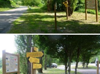
• Parking et départ du panneau sous le pont de la Loire. L’itinéraire N° 5 fait partie du Topoguide Grande Randonnée de...

V.T.T.
• Parking et départ du panneau sous le pont de la Loire. L’itinéraire N° 5 fait partie du Topoguide Grande Randonnée de...
V.T.T.
• Parking et départ de la place proche de la mairie. Pour plus d’infos, visitez le site de l' Office de Tourisme des Mo...

Marche

A pied
5 randonnées affichées sur 5
Application GPS de randonnée GRATUITE
 SityTrail
IGN / Instituts géographiques
SityTrail World
Le monde est à vous