![](/images/other/stat-length.png)
- Randonnées
- Outdoor
- France
- Hauts-de-France
- Aisne
- Chassemy
Chassemy, Aisne : Les meilleures randonnées, itinéraires, parcours, balades et promenades
Chassemy : découvrez les meilleures randonnées : 3 pédestres. Tous ces circuits, parcours, itinéraires et activités en plein air sont disponibles dans nos applications SityTrail pour smartphones et tablettes.
Les meilleurs parcours (3)
![Randonnée Marche Chassemy - Chassemy - Le temps perdu - Photo](https://media.geolcdn.com/t/350/260/ext.jpg?maxdim=2&url=https%3A%2F%2Fservices.sitytrail.com%2FGeolivesWS%2FDownloadMedia.ashx%3FTrailID%3D110394%26Media%3D5850_1.jpg)
![Marche Marche](https://static1.geolcdn.com/sitytour/trail-icons/101.png)
Km
#1 - Chassemy - Le temps perdu
Marche
Moyen
Chassemy,
Hauts-de-France,
Aisne,
France
![](/images/other/stat-length.png)
14,3 km | 17,5 km-effort
3h 45min
![](https://static1.geolcdn.com/siteimages/upload/files/1508320355ic_sort_den_pos_24dp.png)
236 m
![](https://static1.geolcdn.com/siteimages/upload/files/1508320355ic_sort_den_neg_24dp.png)
239 m
![](https://static1.geolcdn.com/siteimages/upload/files/16400158638029165_repeat_loop_refresh_sync_direction_icon.png)
Oui
tracegps
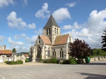
• Entre les deux vallées de l’Aisne et de la Vesle, on peut voir les « boves », ces grottes creusées près de Notre-Dame...
![Randonnée Marche Chassemy - Le temps perdu - Photo](https://media.geolcdn.com/t/350/260/ext.jpg?maxdim=2&url=https%3A%2F%2Fstatic1.geolcdn.com%2Fsiteimages%2Fupload%2Ffiles%2F1553511878bg_sport_marche.png)
![Marche Marche](https://static1.geolcdn.com/sitytour/trail-icons/101.png)
Km
#2 - Le temps perdu
Marche
Difficile
Chassemy,
Hauts-de-France,
Aisne,
France
![](/images/other/stat-length.png)
11,5 km | 14,1 km-effort
3h 12min
![](https://static1.geolcdn.com/siteimages/upload/files/1508320355ic_sort_den_pos_24dp.png)
198 m
![](https://static1.geolcdn.com/siteimages/upload/files/1508320355ic_sort_den_neg_24dp.png)
198 m
![](https://static1.geolcdn.com/siteimages/upload/files/16400158638029165_repeat_loop_refresh_sync_direction_icon.png)
Oui
José800
![Randonnée Marche Chassemy - rando dodo mai 21 4 - Photo](https://media.geolcdn.com/t/350/260/ext.jpg?maxdim=2&url=https%3A%2F%2Fstatic1.geolcdn.com%2Fsiteimages%2Fupload%2Ffiles%2F1553511878bg_sport_marche.png)
![Marche Marche](https://static1.geolcdn.com/sitytour/trail-icons/101.png)
Km
#3 - rando dodo mai 21 4
Marche
Moyen
Chassemy,
Hauts-de-France,
Aisne,
France
![](/images/other/stat-length.png)
8 km | 9,1 km-effort
1h 41min
![](https://static1.geolcdn.com/siteimages/upload/files/1508320355ic_sort_den_pos_24dp.png)
80 m
![](https://static1.geolcdn.com/siteimages/upload/files/1508320355ic_sort_den_neg_24dp.png)
80 m
![](https://static1.geolcdn.com/siteimages/upload/files/16400158638029165_repeat_loop_refresh_sync_direction_icon.png)
Oui
avallee
3 randonnées affichées sur 3
Application GPS de randonnée GRATUITE