Le Mesnil-en-Thelle, Oise : Les meilleures randonnées, itinéraires, parcours, balades et promenades

1 commentaires

Le Mesnil-en-Thelle : découvrez les meilleures randonnées : 45 pédestres et 2 à vélo ou VTT. Tous ces circuits, parcours, itinéraires et activités en plein air sont disponibles dans nos applications SityTrail pour smartphones et tablettes.


Les meilleurs parcours (47)

Randonnée Marche Le Mesnil-en-Thelle - Mesnil 20190914 - Photo
Marche 14.672
Km

Marche

Très facile
Le Mesnil-en-Thelle, Hauts-de-France, Oise, France
14,7 km | 16,3 km-effort
2h 46min
123 m
124 m
Non
PhilippeBenatier

Randonnée V.T.T. Le Mesnil-en-Thelle - Mesnilloise 2012 - Photo
V.T.T. 52.523
Km

V.T.T.

Difficile
Le Mesnil-en-Thelle, Hauts-de-France, Oise, France
53 km | 62 km-effort
3h 0min
735 m
734 m
Oui
tracegps

• Superbe rando vtt départ du Mesnil en Thelle
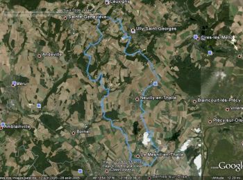
Randonnée V.T.T. Le Mesnil-en-Thelle - La Mesniloise 2009 - Photo
V.T.T. 43.781
Km

V.T.T.

Difficile
Le Mesnil-en-Thelle, Hauts-de-France, Oise, France
44 km | 53 km-effort
2h 30min
664 m
664 m
Oui
tracegps

• Édition 2009 de La Mesniloise

Randonnée A pied Le Mesnil-en-Thelle - Mesnil en Thelle, Morangles, Fresnoy en Thelle et retour.(parcours de la rando-lune) - Photo
A pied 14.541
Km

A pied

Facile
Le Mesnil-en-Thelle, Hauts-de-France, Oise, France
14,5 km | 16 km-effort
3h 38min
112 m
112 m
Oui
95 Pierre

• variante de 15 kms de la rando-lune

Randonnée Marche Le Mesnil-en-Thelle - Le Mesnil en Thelle, parcours rando/lune 14 kms - Photo
Marche 14.396
Km

Marche

Difficile
Le Mesnil-en-Thelle, Hauts-de-France, Oise, France
14,4 km | 15,9 km-effort
3h 37min
115 m
116 m
Oui
95 Pierre

• parcours relativement plat sans difficulté particulière de 14 kms effectifs.

Randonnée Marche Le Mesnil-en-Thelle - Le Mesnil en Thelle parcours de rando/lune - Photo
Marche 10.387
Km

Marche

Moyen
Le Mesnil-en-Thelle, Hauts-de-France, Oise, France
10,4 km | 11,8 km-effort
2h 41min
108 m
109 m
Oui
95 Pierre

• rando de 10kms environ sans trop de dénivelé.

Randonnée Marche Le Mesnil-en-Thelle - Mesnil en thellr - Photo
Marche 13.549
Km

Marche

(1)
Le Mesnil-en-Thelle, Hauts-de-France, Oise, France
13,5 km | 15 km-effort
2h 35min
112 m
112 m
Oui
yvonber

Randonnée Marche Le Mesnil-en-Thelle - Mesnil 20201231 - Photo
Marche 15.473
Km

Marche

Facile
Le Mesnil-en-Thelle, Hauts-de-France, Oise, France
15,5 km | 17,2 km-effort
2h 54min
126 m
126 m
Oui
PhilippeBenatier

Randonnée Marche Le Mesnil-en-Thelle - Mesnil 20200921 - Photo
Marche 16.437
Km

Marche

Le Mesnil-en-Thelle, Hauts-de-France, Oise, France
16,4 km | 18,2 km-effort
2h 47min
134 m
134 m
Oui
PhilippeBenatier

Randonnée Marche Le Mesnil-en-Thelle - Mesnil 20200914 - Photo
Marche 15.594
Km

Marche

Le Mesnil-en-Thelle, Hauts-de-France, Oise, France
15,6 km | 17,3 km-effort
2h 53min
127 m
127 m
Oui
PhilippeBenatier

Randonnée Marche Le Mesnil-en-Thelle - Mesnil 20200530 - Photo
Marche 11.488
Km

Marche

Le Mesnil-en-Thelle, Hauts-de-France, Oise, France
11,5 km | 12,7 km-effort
1h 45min
94 m
91 m
Oui
PhilippeBenatier

Randonnée Marche Le Mesnil-en-Thelle - Mesnil 20200118 - Photo
Marche 15.764
Km

Marche

Très facile
Le Mesnil-en-Thelle, Hauts-de-France, Oise, France
15,8 km | 17,4 km-effort
2h 53min
126 m
125 m
Oui
PhilippeBenatier

Randonnée Marche Le Mesnil-en-Thelle - Mesnil 20200113 - Photo
Marche 15.741
Km

Marche

Très facile
Le Mesnil-en-Thelle, Hauts-de-France, Oise, France
15,7 km | 17,4 km-effort
2h 52min
126 m
126 m
Oui
PhilippeBenatier

Randonnée Marche Le Mesnil-en-Thelle - Mesnil 20200106 - Photo
Marche 15.591
Km

Marche

Très facile
Le Mesnil-en-Thelle, Hauts-de-France, Oise, France
15,6 km | 17,3 km-effort
2h 51min
126 m
126 m
Oui
PhilippeBenatier

Randonnée Marche Le Mesnil-en-Thelle - Mesnil 20200103 - Photo
Marche 15.732
Km

Marche

Très facile
Le Mesnil-en-Thelle, Hauts-de-France, Oise, France
15,7 km | 17,4 km-effort
2h 55min
127 m
127 m
Oui
PhilippeBenatier

Randonnée Marche Le Mesnil-en-Thelle - Mesnil 20191231 - Photo
Marche 15.732
Km

Marche

Très facile
Le Mesnil-en-Thelle, Hauts-de-France, Oise, France
15,7 km | 17,4 km-effort
2h 51min
127 m
127 m
Oui
PhilippeBenatier

Randonnée Marche Le Mesnil-en-Thelle - Mesnil 20191218 - Photo
Marche 15.503
Km

Marche

Très facile
Le Mesnil-en-Thelle, Hauts-de-France, Oise, France
15,5 km | 17,2 km-effort
2h 54min
128 m
128 m
Oui
PhilippeBenatier

Randonnée Marche Le Mesnil-en-Thelle - Mesnil 20191207 - Photo
Marche 15.619
Km

Marche

Très facile
Le Mesnil-en-Thelle, Hauts-de-France, Oise, France
15,6 km | 17,3 km-effort
2h 55min
127 m
127 m
Oui
PhilippeBenatier

Randonnée Marche Le Mesnil-en-Thelle - Mesnil 20191202 - Photo
Marche 15.565
Km

Marche

Très facile
Le Mesnil-en-Thelle, Hauts-de-France, Oise, France
15,6 km | 17,2 km-effort
2h 49min
126 m
126 m
Oui
PhilippeBenatier

Randonnée Marche Le Mesnil-en-Thelle - Mesnil 20192130 - Photo
Marche 15.449
Km

Marche

Très facile
Le Mesnil-en-Thelle, Hauts-de-France, Oise, France
15,4 km | 17,1 km-effort
2h 50min
127 m
127 m
Oui
PhilippeBenatier

20 randonnées affichées sur 47

Application GPS de randonnée GRATUITE

Logo SityTrail SityTrail

IGN / Instituts géographiques

Télécharger SityTrail sur l'App Store Télécharger SityTrail sur Google Play

Logo SityTrail SityTrail World

Le monde est à vous

Télécharger SityTrail sur l'App Store Télécharger SityTrail sur Google Play Télécharger SityTrail sur Huawei AppGallery

Activités

Fermer
Mes abonnements