


3 km | 3,9 km-effort
San Vicente de la Barquera : découvrez les meilleures randonnées : 5 pédestres et 5 à vélo ou VTT. Tous ces circuits, parcours, itinéraires et activités en plein air sont disponibles dans nos applications SityTrail pour smartphones et tablettes.
Marche


•
Marche
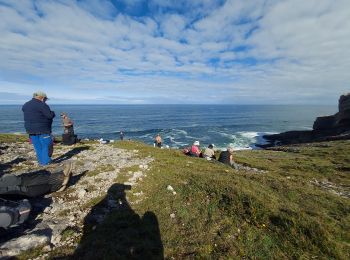
• Réveilla à llanes
Marche
• Réveilla à llanes

Vélo de route
• Visite de Comillas , dénivelé 419m distance 22 km au départ du camping Oyambre
Vélo de route
• Dénivelé 450 m distance 21km au départ du camping Oyambre
V.T.T.
• 02/08/2019 - Rando libre - Seul
V.T.T.
V.T.T.

Autre activité
Autre activité

Marche
Marche
12 randonnées affichées sur 12
Application GPS de randonnée GRATUITE
 SityTrail
IGN / Instituts géographiques
SityTrail World
Le monde est à vous