![](/images/other/stat-length.png)
- Randonnées
- Outdoor
- Allemagne
- Hesse
- Landkreis Darmstadt-Dieburg
- Groß-Umstadt
Groß-Umstadt, Landkreis Darmstadt-Dieburg : Les meilleures randonnées, itinéraires, parcours, balades et promenades
Groß-Umstadt : découvrez les meilleures randonnées : 23 pédestres. Tous ces circuits, parcours, itinéraires et activités en plein air sont disponibles dans nos applications SityTrail pour smartphones et tablettes.
Les meilleurs parcours (23)
![Randonnée A pied Groß-Umstadt - Rundwanderweg Groß-Umstadt Binselberg 3: - Photo](https://media.geolcdn.com/t/350/260/70f7817b-6187-40b6-8dba-0772576a52e5.jpeg&format=jpg&maxdim=2)
![A pied A pied](https://static1.geolcdn.com/sitytour/trail-icons/100.png)
Km
A pied
![](/images/other/stat-length.png)
![](https://static1.geolcdn.com/siteimages/upload/files/1508320355ic_sort_den_pos_24dp.png)
![](https://static1.geolcdn.com/siteimages/upload/files/1508320355ic_sort_den_neg_24dp.png)
![](https://static1.geolcdn.com/siteimages/upload/files/16400158638029165_repeat_loop_refresh_sync_direction_icon.png)
• Randonnée créée par Geo-Naturpark Bergstraße-Odenwald. Symbole: gelbe 3 im gelben Kreis
![Randonnée A pied Groß-Umstadt - Rundwanderweg Breuberg 1 : - Photo](https://media.geolcdn.com/t/350/260/8a2633e8-4e89-4fbf-8f73-ce6b69a01100.jpeg&format=jpg&maxdim=2)
![A pied A pied](https://static1.geolcdn.com/sitytour/trail-icons/100.png)
Km
A pied
![](/images/other/stat-length.png)
![](https://static1.geolcdn.com/siteimages/upload/files/1508320355ic_sort_den_pos_24dp.png)
![](https://static1.geolcdn.com/siteimages/upload/files/1508320355ic_sort_den_neg_24dp.png)
![](https://static1.geolcdn.com/siteimages/upload/files/16400158638029165_repeat_loop_refresh_sync_direction_icon.png)
• Randonnée créée par Geo-Naturpark Bergstraße-Odenwald.
![Randonnée A pied Groß-Umstadt - Rundwanderweg Richen 2 : Mittelforst-Weg - Photo](https://media.geolcdn.com/t/350/260/ee55d140-ecab-4acf-953b-88a1936387ed.jpeg&format=jpg&maxdim=2)
![A pied A pied](https://static1.geolcdn.com/sitytour/trail-icons/100.png)
Km
A pied
![](/images/other/stat-length.png)
![](https://static1.geolcdn.com/siteimages/upload/files/1508320355ic_sort_den_pos_24dp.png)
![](https://static1.geolcdn.com/siteimages/upload/files/1508320355ic_sort_den_neg_24dp.png)
![](https://static1.geolcdn.com/siteimages/upload/files/16400158638029165_repeat_loop_refresh_sync_direction_icon.png)
• Randonnée créée par Geo-Naturpark Bergstraße-Odenwald.
![Randonnée A pied Groß-Umstadt - Rundwanderweg Richen 1 : Rödergrund-Weg - Photo](https://media.geolcdn.com/t/350/260/ee55d140-ecab-4acf-953b-88a1936387ed.jpeg&format=jpg&maxdim=2)
![A pied A pied](https://static1.geolcdn.com/sitytour/trail-icons/100.png)
Km
A pied
![](/images/other/stat-length.png)
![](https://static1.geolcdn.com/siteimages/upload/files/1508320355ic_sort_den_pos_24dp.png)
![](https://static1.geolcdn.com/siteimages/upload/files/1508320355ic_sort_den_neg_24dp.png)
![](https://static1.geolcdn.com/siteimages/upload/files/16400158638029165_repeat_loop_refresh_sync_direction_icon.png)
• Randonnée créée par Geo-Naturpark Bergstraße-Odenwald.
![Randonnée A pied Groß-Umstadt - Parkplatzrundwanderweg Hainrich 4 : Hardberg-Weg - Photo](https://media.geolcdn.com/t/350/260/b75911dd-a227-4a77-8cb3-b9d201ede84a.jpeg&format=jpg&maxdim=2)
![A pied A pied](https://static1.geolcdn.com/sitytour/trail-icons/100.png)
Km
A pied
![](/images/other/stat-length.png)
![](https://static1.geolcdn.com/siteimages/upload/files/1508320355ic_sort_den_pos_24dp.png)
![](https://static1.geolcdn.com/siteimages/upload/files/1508320355ic_sort_den_neg_24dp.png)
![](https://static1.geolcdn.com/siteimages/upload/files/16400158638029165_repeat_loop_refresh_sync_direction_icon.png)
• Randonnée créée par Geo-Naturpark Bergstraße-Odenwald.
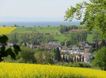
![Randonnée A pied Groß-Umstadt - Rundwanderweg Groß-Umstadt 2: WeininselWanderWeg - Photo](https://media.geolcdn.com/t/350/260/dc949064-4917-470e-8f7b-90b1617b6c1d.jpeg&format=jpg&maxdim=2)
![A pied A pied](https://static1.geolcdn.com/sitytour/trail-icons/100.png)
Km
A pied
![](/images/other/stat-length.png)
![](https://static1.geolcdn.com/siteimages/upload/files/1508320355ic_sort_den_pos_24dp.png)
![](https://static1.geolcdn.com/siteimages/upload/files/1508320355ic_sort_den_neg_24dp.png)
![](https://static1.geolcdn.com/siteimages/upload/files/16400158638029165_repeat_loop_refresh_sync_direction_icon.png)
• Randonnée créée par Geo-Naturpark Bergstraße-Odenwald. Symbole: grüner, oben offener Kreis. Darin eine 2, darüber ei...
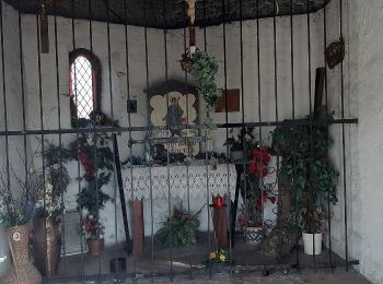
![Randonnée A pied Groß-Umstadt - Rundwanderweg Klein-Umstadt 2 : Raibach-Weg - Photo](https://media.geolcdn.com/t/350/260/833b59ea-140c-4fc2-9665-b61810953f2d.jpeg&format=jpg&maxdim=2)
![A pied A pied](https://static1.geolcdn.com/sitytour/trail-icons/100.png)
Km
A pied
![](/images/other/stat-length.png)
![](https://static1.geolcdn.com/siteimages/upload/files/1508320355ic_sort_den_pos_24dp.png)
![](https://static1.geolcdn.com/siteimages/upload/files/1508320355ic_sort_den_neg_24dp.png)
![](https://static1.geolcdn.com/siteimages/upload/files/16400158638029165_repeat_loop_refresh_sync_direction_icon.png)
• Randonnée créée par Geo-Naturpark Bergstraße-Odenwald. Symbole: weiße 2 im oben offenen Kreis, darin ein 'KU'
![Randonnée A pied Groß-Umstadt - Rundwanderweg Klein-Umstadt 1 : Sonnenhof-Weg - Photo](https://media.geolcdn.com/t/350/260/833b59ea-140c-4fc2-9665-b61810953f2d.jpeg&format=jpg&maxdim=2)
![A pied A pied](https://static1.geolcdn.com/sitytour/trail-icons/100.png)
Km
A pied
![](/images/other/stat-length.png)
![](https://static1.geolcdn.com/siteimages/upload/files/1508320355ic_sort_den_pos_24dp.png)
![](https://static1.geolcdn.com/siteimages/upload/files/1508320355ic_sort_den_neg_24dp.png)
![](https://static1.geolcdn.com/siteimages/upload/files/16400158638029165_repeat_loop_refresh_sync_direction_icon.png)
• Randonnée créée par Geo-Naturpark Bergstraße-Odenwald. Symbole: weiße 1 im oben offenen Kreis, darin ein 'KU'
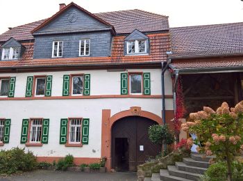
![Randonnée A pied Groß-Umstadt - Rundwanderweg Groß-Umstadt 1: Umstädter Panoramarunde - Photo](https://media.geolcdn.com/t/350/260/6acb663b-b931-463d-a576-335b9ca88fee.jpeg&format=jpg&maxdim=2)
![A pied A pied](https://static1.geolcdn.com/sitytour/trail-icons/100.png)
Km
A pied
![](/images/other/stat-length.png)
![](https://static1.geolcdn.com/siteimages/upload/files/1508320355ic_sort_den_pos_24dp.png)
![](https://static1.geolcdn.com/siteimages/upload/files/1508320355ic_sort_den_neg_24dp.png)
![](https://static1.geolcdn.com/siteimages/upload/files/16400158638029165_repeat_loop_refresh_sync_direction_icon.png)
• Randonnée créée par Geo-Naturpark Bergstraße-Odenwald. Symbole: grüner, oben offener Kreis. Darin eine 1, darüber ei...
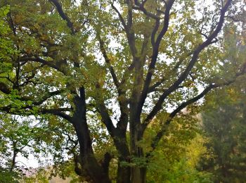
![Randonnée A pied Groß-Umstadt - Rundwanderweg Groß-Umstadt Kleine Zinshecke 8: Sausteige-Weg - Photo](https://media.geolcdn.com/t/350/260/fba749ed-3d72-4cec-9993-7dd4dc932ffc.jpeg&format=jpg&maxdim=2)
![A pied A pied](https://static1.geolcdn.com/sitytour/trail-icons/100.png)
Km
A pied
![](/images/other/stat-length.png)
![](https://static1.geolcdn.com/siteimages/upload/files/1508320355ic_sort_den_pos_24dp.png)
![](https://static1.geolcdn.com/siteimages/upload/files/1508320355ic_sort_den_neg_24dp.png)
![](https://static1.geolcdn.com/siteimages/upload/files/16400158638029165_repeat_loop_refresh_sync_direction_icon.png)
• Randonnée créée par Geo-Naturpark Bergstraße-Odenwald. Symbole: gelbe 8 im gelben Kreis
![Randonnée A pied Groß-Umstadt - Rundwanderweg Groß-Umstadt Kellergrund 7: Rund ums Sausteigetal - Photo](https://media.geolcdn.com/t/350/260/e9133c84-384b-4ad2-b90e-9817ecd8547c.jpeg&format=jpg&maxdim=2)
![A pied A pied](https://static1.geolcdn.com/sitytour/trail-icons/100.png)
Km
A pied
![](/images/other/stat-length.png)
![](https://static1.geolcdn.com/siteimages/upload/files/1508320355ic_sort_den_pos_24dp.png)
![](https://static1.geolcdn.com/siteimages/upload/files/1508320355ic_sort_den_neg_24dp.png)
![](https://static1.geolcdn.com/siteimages/upload/files/16400158638029165_repeat_loop_refresh_sync_direction_icon.png)
• Randonnée créée par Geo-Naturpark Bergstraße-Odenwald.
![Randonnée A pied Groß-Umstadt - Geo-Lehrpfad Klein-Umstadt : Die Kleine Bergstraße – Landschaft, Mensch und Umwelt - Photo](https://media.geolcdn.com/t/350/260/202962ba-95ee-4a9a-9c45-ae353e89580d.jpeg&format=jpg&maxdim=2)
![A pied A pied](https://static1.geolcdn.com/sitytour/trail-icons/100.png)
Km
A pied
![](/images/other/stat-length.png)
![](https://static1.geolcdn.com/siteimages/upload/files/1508320355ic_sort_den_pos_24dp.png)
![](https://static1.geolcdn.com/siteimages/upload/files/1508320355ic_sort_den_neg_24dp.png)
![](https://static1.geolcdn.com/siteimages/upload/files/16400158638029165_repeat_loop_refresh_sync_direction_icon.png)
• Symbole: gelbes L in gelbem Kreis
![Randonnée A pied Groß-Umstadt - Rundwanderweg](https://media.geolcdn.com/t/350/260/6acb663b-b931-463d-a576-335b9ca88fee.jpeg&format=jpg&maxdim=2)
![A pied A pied](https://static1.geolcdn.com/sitytour/trail-icons/100.png)
Km
A pied
![](/images/other/stat-length.png)
![](https://static1.geolcdn.com/siteimages/upload/files/1508320355ic_sort_den_pos_24dp.png)
![](https://static1.geolcdn.com/siteimages/upload/files/1508320355ic_sort_den_neg_24dp.png)
![](https://static1.geolcdn.com/siteimages/upload/files/16400158638029165_repeat_loop_refresh_sync_direction_icon.png)
• Randonnée créée par Sparkasse Dieburg. Symbole: weiße 3 im oben offenen Kreis, darin ein 'S'
![Randonnée A pied Groß-Umstadt - Rundwanderweg Raibach 1 : Kuckucks-Weg - Photo](https://media.geolcdn.com/t/350/260/dc949064-4917-470e-8f7b-90b1617b6c1d.jpeg&format=jpg&maxdim=2)
![A pied A pied](https://static1.geolcdn.com/sitytour/trail-icons/100.png)
Km
A pied
![](/images/other/stat-length.png)
![](https://static1.geolcdn.com/siteimages/upload/files/1508320355ic_sort_den_pos_24dp.png)
![](https://static1.geolcdn.com/siteimages/upload/files/1508320355ic_sort_den_neg_24dp.png)
![](https://static1.geolcdn.com/siteimages/upload/files/16400158638029165_repeat_loop_refresh_sync_direction_icon.png)
• Randonnée créée par Geo-Naturpark Bergstraße-Odenwald. Symbole: weißes Kreissegment, oben offen. In der Öffnung R, i...
![Randonnée A pied Groß-Umstadt - Rundwanderweg Groß-Umstadt Kellergrund 9: Heidestock-Weg - Photo](https://media.geolcdn.com/t/350/260/e9133c84-384b-4ad2-b90e-9817ecd8547c.jpeg&format=jpg&maxdim=2)
![A pied A pied](https://static1.geolcdn.com/sitytour/trail-icons/100.png)
Km
A pied
![](/images/other/stat-length.png)
![](https://static1.geolcdn.com/siteimages/upload/files/1508320355ic_sort_den_pos_24dp.png)
![](https://static1.geolcdn.com/siteimages/upload/files/1508320355ic_sort_den_neg_24dp.png)
![](https://static1.geolcdn.com/siteimages/upload/files/16400158638029165_repeat_loop_refresh_sync_direction_icon.png)
• Randonnée créée par Geo-Naturpark Bergstraße-Odenwald.
![Randonnée A pied Groß-Umstadt - Rundwanderweg Heubach 3 : Rosselborn-Weg - Photo](https://media.geolcdn.com/t/350/260/e9133c84-384b-4ad2-b90e-9817ecd8547c.jpeg&format=jpg&maxdim=2)
![A pied A pied](https://static1.geolcdn.com/sitytour/trail-icons/100.png)
Km
A pied
![](/images/other/stat-length.png)
![](https://static1.geolcdn.com/siteimages/upload/files/1508320355ic_sort_den_pos_24dp.png)
![](https://static1.geolcdn.com/siteimages/upload/files/1508320355ic_sort_den_neg_24dp.png)
![](https://static1.geolcdn.com/siteimages/upload/files/16400158638029165_repeat_loop_refresh_sync_direction_icon.png)
• Randonnée créée par Geo-Naturpark Bergstraße-Odenwald. Symbole: weißes Kreissegment, oben offen. In der Öffnung Hb, ...
![Randonnée A pied Groß-Umstadt - Rundwanderweg Groß-Umstadt Kellergrund 8: Schucksteinweg - Photo](https://media.geolcdn.com/t/350/260/e9133c84-384b-4ad2-b90e-9817ecd8547c.jpeg&format=jpg&maxdim=2)
![A pied A pied](https://static1.geolcdn.com/sitytour/trail-icons/100.png)
Km
A pied
![](/images/other/stat-length.png)
![](https://static1.geolcdn.com/siteimages/upload/files/1508320355ic_sort_den_pos_24dp.png)
![](https://static1.geolcdn.com/siteimages/upload/files/1508320355ic_sort_den_neg_24dp.png)
![](https://static1.geolcdn.com/siteimages/upload/files/16400158638029165_repeat_loop_refresh_sync_direction_icon.png)
• Randonnée créée par Geo-Naturpark Bergstraße-Odenwald.
![Randonnée A pied Groß-Umstadt - Rundwanderweg Groß-Umstadt Binselberg 1: Hegwald-Weg - Photo](https://media.geolcdn.com/t/350/260/ext.jpg?maxdim=2&url=https%3A%2F%2Fstatic1.geolcdn.com%2Fsiteimages%2Fupload%2Ffiles%2F1545311037marcheuse_200dpi.jpg)
![A pied A pied](https://static1.geolcdn.com/sitytour/trail-icons/100.png)
Km
A pied
![](/images/other/stat-length.png)
![](https://static1.geolcdn.com/siteimages/upload/files/1508320355ic_sort_den_pos_24dp.png)
![](https://static1.geolcdn.com/siteimages/upload/files/1508320355ic_sort_den_neg_24dp.png)
![](https://static1.geolcdn.com/siteimages/upload/files/16400158638029165_repeat_loop_refresh_sync_direction_icon.png)
• Randonnée créée par Geo-Naturpark Bergstraße-Odenwald. Symbole: Gelbe 1 im gelben Kreis
![Randonnée A pied Groß-Umstadt - Rundwanderweg Heubach 2 : Hexenhäuschen-Weg - Photo](https://media.geolcdn.com/t/350/260/ext.jpg?maxdim=2&url=https%3A%2F%2Fstatic1.geolcdn.com%2Fsiteimages%2Fupload%2Ffiles%2F1545311037marcheuse_200dpi.jpg)
![A pied A pied](https://static1.geolcdn.com/sitytour/trail-icons/100.png)
Km
A pied
![](/images/other/stat-length.png)
![](https://static1.geolcdn.com/siteimages/upload/files/1508320355ic_sort_den_pos_24dp.png)
![](https://static1.geolcdn.com/siteimages/upload/files/1508320355ic_sort_den_neg_24dp.png)
![](https://static1.geolcdn.com/siteimages/upload/files/16400158638029165_repeat_loop_refresh_sync_direction_icon.png)
• Randonnée créée par Geo-Naturpark Bergstraße-Odenwald. Symbole: weißes Kreissegment, oben offen. In der Öffnung Hb, ...
![Randonnée A pied Groß-Umstadt - Rundwanderweg Heubach 1 : Rund ums Ockerstal - Photo](https://media.geolcdn.com/t/350/260/ext.jpg?maxdim=2&url=https%3A%2F%2Fstatic1.geolcdn.com%2Fsiteimages%2Fupload%2Ffiles%2F1545311037marcheuse_200dpi.jpg)
![A pied A pied](https://static1.geolcdn.com/sitytour/trail-icons/100.png)
Km
A pied
![](/images/other/stat-length.png)
![](https://static1.geolcdn.com/siteimages/upload/files/1508320355ic_sort_den_pos_24dp.png)
![](https://static1.geolcdn.com/siteimages/upload/files/1508320355ic_sort_den_neg_24dp.png)
![](https://static1.geolcdn.com/siteimages/upload/files/16400158638029165_repeat_loop_refresh_sync_direction_icon.png)
• Randonnée créée par Geo-Naturpark Bergstraße-Odenwald. Symbole: weißes Kreissegment, oben offen. In der Öffnung Hb, ...
20 randonnées affichées sur 23
Application GPS de randonnée GRATUITE