![](/images/other/stat-length.png)
- Randonnées
- Outdoor
- Allemagne
- Hesse
- Main-Kinzig-Kreis
- Sinntal
Sinntal, Main-Kinzig-Kreis : Les meilleures randonnées, itinéraires, parcours, balades et promenades
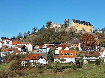
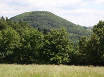
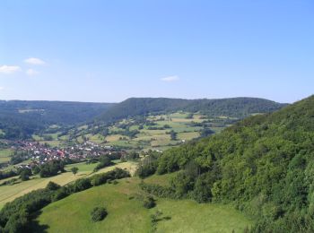
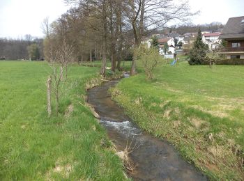
Sinntal : découvrez les meilleures randonnées : 23 pédestres. Tous ces circuits, parcours, itinéraires et activités en plein air sont disponibles dans nos applications SityTrail pour smartphones et tablettes.
Les meilleurs parcours (23)
![Randonnée A pied Sinntal - Spessartspuren - Jossa-Sinn-Blick - Photo](https://media.geolcdn.com/t/350/260/cd33c038-9e0b-4efb-b676-5a195b30aedb.jpeg&format=jpg&maxdim=2)
![A pied A pied](https://static1.geolcdn.com/sitytour/trail-icons/100.png)
Km
A pied
![](/images/other/stat-length.png)
![](https://static1.geolcdn.com/siteimages/upload/files/1508320355ic_sort_den_pos_24dp.png)
![](https://static1.geolcdn.com/siteimages/upload/files/1508320355ic_sort_den_neg_24dp.png)
![](https://static1.geolcdn.com/siteimages/upload/files/16400158638029165_repeat_loop_refresh_sync_direction_icon.png)
• Randonnée créée par Naturpark Hessischer Spessart. Symbole: Blauer Strich und grüner Bogen über gelbem Rechteck auf ...
![Randonnée A pied Sinntal - Sterbfritz - Rundweg 5 - Photo](https://media.geolcdn.com/t/350/260/b749f20d-5637-434d-8033-94a053a83247.jpeg&format=jpg&maxdim=2)
![A pied A pied](https://static1.geolcdn.com/sitytour/trail-icons/100.png)
Km
A pied
![](/images/other/stat-length.png)
![](https://static1.geolcdn.com/siteimages/upload/files/1508320355ic_sort_den_pos_24dp.png)
![](https://static1.geolcdn.com/siteimages/upload/files/1508320355ic_sort_den_neg_24dp.png)
![](https://static1.geolcdn.com/siteimages/upload/files/16400158638029165_repeat_loop_refresh_sync_direction_icon.png)
• Randonnée créée par Rhönklub Zweigverein Sterbfritz. Symbole: Weiße 5 auf blauem Hintergrund
![Randonnée A pied Sinntal - Sterbfritz - Rundweg 2 - Photo](https://media.geolcdn.com/t/350/260/0692c028-afe7-427d-a641-8c356599369f.jpeg&format=jpg&maxdim=2)
![A pied A pied](https://static1.geolcdn.com/sitytour/trail-icons/100.png)
Km
A pied
![](/images/other/stat-length.png)
![](https://static1.geolcdn.com/siteimages/upload/files/1508320355ic_sort_den_pos_24dp.png)
![](https://static1.geolcdn.com/siteimages/upload/files/1508320355ic_sort_den_neg_24dp.png)
![](https://static1.geolcdn.com/siteimages/upload/files/16400158638029165_repeat_loop_refresh_sync_direction_icon.png)
• Randonnée créée par Rhönklub Zweigverein Sterbfritz. Symbole: Weiße 2 auf blauem Hintergrund
![Randonnée A pied Sinntal - Oberzell - Rundwanderweg Hemmersbach - Photo](https://media.geolcdn.com/t/350/260/4e962bfc-8421-43f7-8dea-a30191c785e8.jpeg&format=jpg&maxdim=2)
![A pied A pied](https://static1.geolcdn.com/sitytour/trail-icons/100.png)
Km
A pied
![](/images/other/stat-length.png)
![](https://static1.geolcdn.com/siteimages/upload/files/1508320355ic_sort_den_pos_24dp.png)
![](https://static1.geolcdn.com/siteimages/upload/files/1508320355ic_sort_den_neg_24dp.png)
![](https://static1.geolcdn.com/siteimages/upload/files/16400158638029165_repeat_loop_refresh_sync_direction_icon.png)
• Randonnée créée par Rhönfalken Oberzell. Symbole: Schwarze 5 auf gelbem Hintergrund
![Randonnée A pied Sinntal - Spessartspuren - Schwarzenfelser Sonnenseite - Photo](https://media.geolcdn.com/t/350/260/2a05401e-dc40-44c1-afe1-0448727b6160.jpeg&format=jpg&maxdim=2)
![A pied A pied](https://static1.geolcdn.com/sitytour/trail-icons/100.png)
Km
A pied
![](/images/other/stat-length.png)
![](https://static1.geolcdn.com/siteimages/upload/files/1508320355ic_sort_den_pos_24dp.png)
![](https://static1.geolcdn.com/siteimages/upload/files/1508320355ic_sort_den_neg_24dp.png)
![](https://static1.geolcdn.com/siteimages/upload/files/16400158638029165_repeat_loop_refresh_sync_direction_icon.png)
• Randonnée créée par Naturpark Hessischer Spessart. Symbole: Blauer Strich und grüner Bogen über gelbem Rechteck auf ...
![Randonnée A pied Sinntal - Weichersbach - Rote Geiß - Photo](https://media.geolcdn.com/t/350/260/4e962bfc-8421-43f7-8dea-a30191c785e8.jpeg&format=jpg&maxdim=2)
![A pied A pied](https://static1.geolcdn.com/sitytour/trail-icons/100.png)
Km
A pied
![](/images/other/stat-length.png)
![](https://static1.geolcdn.com/siteimages/upload/files/1508320355ic_sort_den_pos_24dp.png)
![](https://static1.geolcdn.com/siteimages/upload/files/1508320355ic_sort_den_neg_24dp.png)
![](https://static1.geolcdn.com/siteimages/upload/files/16400158638029165_repeat_loop_refresh_sync_direction_icon.png)
• Randonnée créée par Ortsbeirat Weichersbach. Symbole: Rote Geiß auf weißem Hintergrund
![Randonnée A pied Sinntal - Oberzell - Rundwanderweg Sandberg - Photo](https://media.geolcdn.com/t/350/260/4e962bfc-8421-43f7-8dea-a30191c785e8.jpeg&format=jpg&maxdim=2)
![A pied A pied](https://static1.geolcdn.com/sitytour/trail-icons/100.png)
Km
A pied
![](/images/other/stat-length.png)
![](https://static1.geolcdn.com/siteimages/upload/files/1508320355ic_sort_den_pos_24dp.png)
![](https://static1.geolcdn.com/siteimages/upload/files/1508320355ic_sort_den_neg_24dp.png)
![](https://static1.geolcdn.com/siteimages/upload/files/16400158638029165_repeat_loop_refresh_sync_direction_icon.png)
• Randonnée créée par Rhönfalken Oberzell. Symbole: Schwarze 2 auf gelbem Hintergrund
![Randonnée A pied Sinntal - Oberzell - Rundwanderweg Sinngrund - Photo](https://media.geolcdn.com/t/350/260/4e962bfc-8421-43f7-8dea-a30191c785e8.jpeg&format=jpg&maxdim=2)
![A pied A pied](https://static1.geolcdn.com/sitytour/trail-icons/100.png)
Km
A pied
![](/images/other/stat-length.png)
![](https://static1.geolcdn.com/siteimages/upload/files/1508320355ic_sort_den_pos_24dp.png)
![](https://static1.geolcdn.com/siteimages/upload/files/1508320355ic_sort_den_neg_24dp.png)
![](https://static1.geolcdn.com/siteimages/upload/files/16400158638029165_repeat_loop_refresh_sync_direction_icon.png)
• Randonnée créée par Rhönfalken Oberzell. Symbole: Schwarze 4 auf gelbem Hintergrund
![Randonnée A pied Sinntal - Oberzell - Rundwanderweg Haag - Photo](https://media.geolcdn.com/t/350/260/4e962bfc-8421-43f7-8dea-a30191c785e8.jpeg&format=jpg&maxdim=2)
![A pied A pied](https://static1.geolcdn.com/sitytour/trail-icons/100.png)
Km
A pied
![](/images/other/stat-length.png)
![](https://static1.geolcdn.com/siteimages/upload/files/1508320355ic_sort_den_pos_24dp.png)
![](https://static1.geolcdn.com/siteimages/upload/files/1508320355ic_sort_den_neg_24dp.png)
![](https://static1.geolcdn.com/siteimages/upload/files/16400158638029165_repeat_loop_refresh_sync_direction_icon.png)
• Randonnée créée par Rhönfalken Oberzell. Symbole: Schwarze 3 auf gelbem Hintergrund
![Randonnée A pied Sinntal - Ulrich von Hutten Pfad - Photo](https://media.geolcdn.com/t/350/260/5b879310-8a98-493b-9adc-0b7d48451c38.jpeg&format=jpg&maxdim=2)
![A pied A pied](https://static1.geolcdn.com/sitytour/trail-icons/100.png)
Km
A pied
![](/images/other/stat-length.png)
![](https://static1.geolcdn.com/siteimages/upload/files/1508320355ic_sort_den_pos_24dp.png)
![](https://static1.geolcdn.com/siteimages/upload/files/1508320355ic_sort_den_neg_24dp.png)
![](https://static1.geolcdn.com/siteimages/upload/files/16400158638029165_repeat_loop_refresh_sync_direction_icon.png)
• Randonnée créée par Rhönklub. Symbole: Gelber Keil auf weißem Hintergrund Site web: http://www.naturerlebnis-rhoen...
![Randonnée A pied Sinntal - Schwarzenfels - Rundweg Hopfenberg - Photo](https://media.geolcdn.com/t/350/260/0c5ed552-a6a0-4bda-8d29-34005d04c934.jpeg&format=jpg&maxdim=2)
![A pied A pied](https://static1.geolcdn.com/sitytour/trail-icons/100.png)
Km
A pied
![](/images/other/stat-length.png)
![](https://static1.geolcdn.com/siteimages/upload/files/1508320355ic_sort_den_pos_24dp.png)
![](https://static1.geolcdn.com/siteimages/upload/files/1508320355ic_sort_den_neg_24dp.png)
![](https://static1.geolcdn.com/siteimages/upload/files/16400158638029165_repeat_loop_refresh_sync_direction_icon.png)
• Randonnée créée par Heimat- und Wanderfreunde Schwarzenfels. Symbole: Blau S4 auf weißem Hintergrund
![Randonnée A pied Sinntal - Sterbfritz - Rundweg 1 - Photo](https://media.geolcdn.com/t/350/260/0692c028-afe7-427d-a641-8c356599369f.jpeg&format=jpg&maxdim=2)
![A pied A pied](https://static1.geolcdn.com/sitytour/trail-icons/100.png)
Km
A pied
![](/images/other/stat-length.png)
![](https://static1.geolcdn.com/siteimages/upload/files/1508320355ic_sort_den_pos_24dp.png)
![](https://static1.geolcdn.com/siteimages/upload/files/1508320355ic_sort_den_neg_24dp.png)
![](https://static1.geolcdn.com/siteimages/upload/files/16400158638029165_repeat_loop_refresh_sync_direction_icon.png)
• Randonnée créée par Rhönklub Zweigverein Sterbfritz. Symbole: Weiße 1 auf blauem Hintergrund
![Randonnée A pied Sinntal - Altengronau - Rundweg am Grauberg - Tanne - Photo](https://media.geolcdn.com/t/350/260/0ef20a43-b85e-4c2a-83fd-467522358db3.jpeg&format=jpg&maxdim=2)
![A pied A pied](https://static1.geolcdn.com/sitytour/trail-icons/100.png)
Km
A pied
![](/images/other/stat-length.png)
![](https://static1.geolcdn.com/siteimages/upload/files/1508320355ic_sort_den_pos_24dp.png)
![](https://static1.geolcdn.com/siteimages/upload/files/1508320355ic_sort_den_neg_24dp.png)
![](https://static1.geolcdn.com/siteimages/upload/files/16400158638029165_repeat_loop_refresh_sync_direction_icon.png)
• Randonnée créée par Verkehrs- u. Heimatverein Altengronau. sehr schlecht ausgeschildert Symbole: Grüne Tanne auf we...
![Randonnée A pied Sinntal - Altengronau - Rundweg am Grauberg - Marder - Photo](https://media.geolcdn.com/t/350/260/ebd9626f-dc33-4061-98a8-e6766f40ff47.jpeg&format=jpg&maxdim=2)
![A pied A pied](https://static1.geolcdn.com/sitytour/trail-icons/100.png)
Km
A pied
![](/images/other/stat-length.png)
![](https://static1.geolcdn.com/siteimages/upload/files/1508320355ic_sort_den_pos_24dp.png)
![](https://static1.geolcdn.com/siteimages/upload/files/1508320355ic_sort_den_neg_24dp.png)
![](https://static1.geolcdn.com/siteimages/upload/files/16400158638029165_repeat_loop_refresh_sync_direction_icon.png)
• Randonnée créée par Verkehrs- u. Heimatverein Altengronau. sehr schlecht ausgeschildert Symbole: Schwarzer Marder a...
![Randonnée A pied Sinntal - Gebietswanderweg Roter Doppelbalken Altengronau - Streitrain - Photo](https://media.geolcdn.com/t/350/260/0ef20a43-b85e-4c2a-83fd-467522358db3.jpeg&format=jpg&maxdim=2)
![A pied A pied](https://static1.geolcdn.com/sitytour/trail-icons/100.png)
Km
A pied
![](/images/other/stat-length.png)
![](https://static1.geolcdn.com/siteimages/upload/files/1508320355ic_sort_den_pos_24dp.png)
![](https://static1.geolcdn.com/siteimages/upload/files/1508320355ic_sort_den_neg_24dp.png)
![](https://static1.geolcdn.com/siteimages/upload/files/16400158638029165_repeat_loop_refresh_sync_direction_icon.png)
• Randonnée créée par Spessartbund. Symbole: Roter Doppelbalken auf weißem Quadrat
![Randonnée A pied Sinntal - Spessartbogen Zubringer Jossa - Willingsgrundweiher - Photo](https://media.geolcdn.com/t/350/260/cd33c038-9e0b-4efb-b676-5a195b30aedb.jpeg&format=jpg&maxdim=2)
![A pied A pied](https://static1.geolcdn.com/sitytour/trail-icons/100.png)
Km
A pied
![](/images/other/stat-length.png)
![](https://static1.geolcdn.com/siteimages/upload/files/1508320355ic_sort_den_pos_24dp.png)
![](https://static1.geolcdn.com/siteimages/upload/files/1508320355ic_sort_den_neg_24dp.png)
![](https://static1.geolcdn.com/siteimages/upload/files/16400158638029165_repeat_loop_refresh_sync_direction_icon.png)
• Randonnée créée par Naturpark Hessischer Spessart. Symbole: dunkelgrauer Strich und mittelgrauer Bogen über hellgrau...
![Randonnée A pied Sinntal - Jossa - Rundwanderweg Geweih - Photo](https://media.geolcdn.com/t/350/260/00e2761a-eb87-45c0-a571-0f475fa19fbc.jpeg&format=jpg&maxdim=2)
![A pied A pied](https://static1.geolcdn.com/sitytour/trail-icons/100.png)
Km
A pied
![](/images/other/stat-length.png)
![](https://static1.geolcdn.com/siteimages/upload/files/1508320355ic_sort_den_pos_24dp.png)
![](https://static1.geolcdn.com/siteimages/upload/files/1508320355ic_sort_den_neg_24dp.png)
![](https://static1.geolcdn.com/siteimages/upload/files/16400158638029165_repeat_loop_refresh_sync_direction_icon.png)
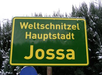
• Randonnée créée par Verkehrs- u. Heimatverein Jossa. Symbole: schwarzes Hirschgeweih auf weißem Hintergrund Site w...
![Randonnée A pied Sinntal - Spessartbogen Zubringer Jossa - Marjoß - Photo](https://media.geolcdn.com/t/350/260/00e2761a-eb87-45c0-a571-0f475fa19fbc.jpeg&format=jpg&maxdim=2)
![A pied A pied](https://static1.geolcdn.com/sitytour/trail-icons/100.png)
Km
A pied
![](/images/other/stat-length.png)
![](https://static1.geolcdn.com/siteimages/upload/files/1508320355ic_sort_den_pos_24dp.png)
![](https://static1.geolcdn.com/siteimages/upload/files/1508320355ic_sort_den_neg_24dp.png)
![](https://static1.geolcdn.com/siteimages/upload/files/16400158638029165_repeat_loop_refresh_sync_direction_icon.png)
• Randonnée créée par Naturpark Hessischer Spessart. Symbole: dunkelgrauer Strich und mittelgrauer Bogen über hellgrau...
![Randonnée A pied Sinntal - Quellwinkel Kinzig ( Spessartfährten ) - Photo](https://media.geolcdn.com/t/350/260/b749f20d-5637-434d-8033-94a053a83247.jpeg&format=jpg&maxdim=2)
![A pied A pied](https://static1.geolcdn.com/sitytour/trail-icons/100.png)
Km
A pied
![](/images/other/stat-length.png)
![](https://static1.geolcdn.com/siteimages/upload/files/1508320355ic_sort_den_pos_24dp.png)
![](https://static1.geolcdn.com/siteimages/upload/files/1508320355ic_sort_den_neg_24dp.png)
![](https://static1.geolcdn.com/siteimages/upload/files/16400158638029165_repeat_loop_refresh_sync_direction_icon.png)
• Randonnée créée par Naturpark Hessischer Spessart, Main Kinzig Kreis. Symbole: blauer Strich und grüner Bogen über g...
![Randonnée A pied Sinntal - Oberzell - Rundwanderweg Hirschberg - Photo](https://media.geolcdn.com/t/350/260/4e962bfc-8421-43f7-8dea-a30191c785e8.jpeg&format=jpg&maxdim=2)
![A pied A pied](https://static1.geolcdn.com/sitytour/trail-icons/100.png)
Km
A pied
![](/images/other/stat-length.png)
![](https://static1.geolcdn.com/siteimages/upload/files/1508320355ic_sort_den_pos_24dp.png)
![](https://static1.geolcdn.com/siteimages/upload/files/1508320355ic_sort_den_neg_24dp.png)
![](https://static1.geolcdn.com/siteimages/upload/files/16400158638029165_repeat_loop_refresh_sync_direction_icon.png)
• Randonnée créée par Rhönfalken Oberzell. Symbole: Schwarze 1 auf gelbem Hintergrund
20 randonnées affichées sur 23
Application GPS de randonnée GRATUITE