![](/images/other/stat-length.png)
- Randonnées
- Outdoor
- Allemagne
- Hesse
- Main-Kinzig-Kreis
- Schlüchtern
Schlüchtern, Main-Kinzig-Kreis : Les meilleures randonnées, itinéraires, parcours, balades et promenades
Schlüchtern : découvrez les meilleures randonnées : 27 pédestres. Tous ces circuits, parcours, itinéraires et activités en plein air sont disponibles dans nos applications SityTrail pour smartphones et tablettes.
Les meilleurs parcours (27)
![Randonnée A pied Schlüchtern - Vollmerz Wanderweg VOL1 - Photo](https://media.geolcdn.com/t/350/260/abe3a7c8-dfc9-4fc7-ac45-ba512d6431de.jpeg&format=jpg&maxdim=2)
![A pied A pied](https://static1.geolcdn.com/sitytour/trail-icons/100.png)
Km
A pied
![](/images/other/stat-length.png)
![](https://static1.geolcdn.com/siteimages/upload/files/1508320355ic_sort_den_pos_24dp.png)
![](https://static1.geolcdn.com/siteimages/upload/files/1508320355ic_sort_den_neg_24dp.png)
![](https://static1.geolcdn.com/siteimages/upload/files/16400158638029165_repeat_loop_refresh_sync_direction_icon.png)
• Symbole: Weißes VOL1 auf blauem Hintergrund
![Randonnée A pied Schlüchtern - Vollmerz Wanderweg VOL2 - Photo](https://media.geolcdn.com/t/350/260/abe3a7c8-dfc9-4fc7-ac45-ba512d6431de.jpeg&format=jpg&maxdim=2)
![A pied A pied](https://static1.geolcdn.com/sitytour/trail-icons/100.png)
Km
A pied
![](/images/other/stat-length.png)
![](https://static1.geolcdn.com/siteimages/upload/files/1508320355ic_sort_den_pos_24dp.png)
![](https://static1.geolcdn.com/siteimages/upload/files/1508320355ic_sort_den_neg_24dp.png)
![](https://static1.geolcdn.com/siteimages/upload/files/16400158638029165_repeat_loop_refresh_sync_direction_icon.png)
• Symbole: Weißes VOL2 auf blauem Hintergrund
![Randonnée A pied Schlüchtern - Schlüchtern Wanderweg SLÜ2 - Photo](https://media.geolcdn.com/t/350/260/630225c9-c620-44e6-8281-1a784b232469.jpeg&format=jpg&maxdim=2)
![A pied A pied](https://static1.geolcdn.com/sitytour/trail-icons/100.png)
Km
A pied
![](/images/other/stat-length.png)
![](https://static1.geolcdn.com/siteimages/upload/files/1508320355ic_sort_den_pos_24dp.png)
![](https://static1.geolcdn.com/siteimages/upload/files/1508320355ic_sort_den_neg_24dp.png)
![](https://static1.geolcdn.com/siteimages/upload/files/16400158638029165_repeat_loop_refresh_sync_direction_icon.png)
• Symbole: Weißes SLÜ2 auf blauem Hintergrund
![Randonnée A pied Schlüchtern - BUND-Schlüchtern-Rundweg 7 - Photo](https://media.geolcdn.com/t/350/260/1a367717-348e-48b6-90c0-72ccb4fd28ee.jpeg&format=jpg&maxdim=2)
![A pied A pied](https://static1.geolcdn.com/sitytour/trail-icons/100.png)
Km
A pied
![](/images/other/stat-length.png)
![](https://static1.geolcdn.com/siteimages/upload/files/1508320355ic_sort_den_pos_24dp.png)
![](https://static1.geolcdn.com/siteimages/upload/files/1508320355ic_sort_den_neg_24dp.png)
![](https://static1.geolcdn.com/siteimages/upload/files/16400158638029165_repeat_loop_refresh_sync_direction_icon.png)
• Der 47 km lange Schlüchtern-Rundweg des BUND (Wegbeschreibung) zeigt Landschaft und Sehenswürdigkeiten im Umkreis der...
![Randonnée A pied Schlüchtern - BUND-Schlüchtern-Rundweg 1 - Photo](https://media.geolcdn.com/t/350/260/96846348-56e8-41eb-ac74-99d018458889.jpeg&format=jpg&maxdim=2)
![A pied A pied](https://static1.geolcdn.com/sitytour/trail-icons/100.png)
Km
A pied
![](/images/other/stat-length.png)
![](https://static1.geolcdn.com/siteimages/upload/files/1508320355ic_sort_den_pos_24dp.png)
![](https://static1.geolcdn.com/siteimages/upload/files/1508320355ic_sort_den_neg_24dp.png)
![](https://static1.geolcdn.com/siteimages/upload/files/16400158638029165_repeat_loop_refresh_sync_direction_icon.png)
• Der 47 km lange Schlüchtern-Rundweg des BUND (Wegbeschreibung) zeigt Landschaft und Sehenswürdigkeiten im Umkreis der...
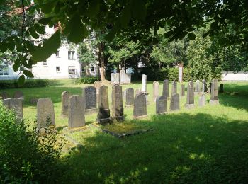
![Randonnée A pied Schlüchtern - BUND-Schlüchtern-Rundweg 2 - Photo](https://media.geolcdn.com/t/350/260/91df87f9-846d-4ad6-988d-9c9f017be7f3.jpeg&format=jpg&maxdim=2)
![A pied A pied](https://static1.geolcdn.com/sitytour/trail-icons/100.png)
Km
A pied
![](/images/other/stat-length.png)
![](https://static1.geolcdn.com/siteimages/upload/files/1508320355ic_sort_den_pos_24dp.png)
![](https://static1.geolcdn.com/siteimages/upload/files/1508320355ic_sort_den_neg_24dp.png)
![](https://static1.geolcdn.com/siteimages/upload/files/16400158638029165_repeat_loop_refresh_sync_direction_icon.png)
• Der 47 km lange Schlüchtern-Rundweg des BUND (Wegbeschreibung) zeigt Landschaft und Sehenswürdigkeiten im Umkreis der...
![Randonnée A pied Schlüchtern - BUND-Schlüchtern-Rundweg 4 - Photo](https://media.geolcdn.com/t/350/260/91df87f9-846d-4ad6-988d-9c9f017be7f3.jpeg&format=jpg&maxdim=2)
![A pied A pied](https://static1.geolcdn.com/sitytour/trail-icons/100.png)
Km
A pied
![](/images/other/stat-length.png)
![](https://static1.geolcdn.com/siteimages/upload/files/1508320355ic_sort_den_pos_24dp.png)
![](https://static1.geolcdn.com/siteimages/upload/files/1508320355ic_sort_den_neg_24dp.png)
![](https://static1.geolcdn.com/siteimages/upload/files/16400158638029165_repeat_loop_refresh_sync_direction_icon.png)
• Der 47 km lange Schlüchtern-Rundweg des BUND (Wegbeschreibung) zeigt Landschaft und Sehenswürdigkeiten im Umkreis der...
![Randonnée A pied Schlüchtern - Schlüchtern Wanderweg SLÜ4 - Photo](https://media.geolcdn.com/t/350/260/630225c9-c620-44e6-8281-1a784b232469.jpeg&format=jpg&maxdim=2)
![A pied A pied](https://static1.geolcdn.com/sitytour/trail-icons/100.png)
Km
A pied
![](/images/other/stat-length.png)
![](https://static1.geolcdn.com/siteimages/upload/files/1508320355ic_sort_den_pos_24dp.png)
![](https://static1.geolcdn.com/siteimages/upload/files/1508320355ic_sort_den_neg_24dp.png)
![](https://static1.geolcdn.com/siteimages/upload/files/16400158638029165_repeat_loop_refresh_sync_direction_icon.png)
• Symbole: Weißes SLÜ4 auf blauem Hintergrund
![Randonnée A pied Schlüchtern - Schlüchtern Wanderweg SLÜ6 - Photo](https://media.geolcdn.com/t/350/260/630225c9-c620-44e6-8281-1a784b232469.jpeg&format=jpg&maxdim=2)
![A pied A pied](https://static1.geolcdn.com/sitytour/trail-icons/100.png)
Km
A pied
![](/images/other/stat-length.png)
![](https://static1.geolcdn.com/siteimages/upload/files/1508320355ic_sort_den_pos_24dp.png)
![](https://static1.geolcdn.com/siteimages/upload/files/1508320355ic_sort_den_neg_24dp.png)
![](https://static1.geolcdn.com/siteimages/upload/files/16400158638029165_repeat_loop_refresh_sync_direction_icon.png)
• Symbole: Weiß SLÜ6 auf blauem Hintergrund
![Randonnée A pied Schlüchtern - BUND-Schlüchtern-Rundweg 3 - Photo](https://media.geolcdn.com/t/350/260/91df87f9-846d-4ad6-988d-9c9f017be7f3.jpeg&format=jpg&maxdim=2)
![A pied A pied](https://static1.geolcdn.com/sitytour/trail-icons/100.png)
Km
A pied
![](/images/other/stat-length.png)
![](https://static1.geolcdn.com/siteimages/upload/files/1508320355ic_sort_den_pos_24dp.png)
![](https://static1.geolcdn.com/siteimages/upload/files/1508320355ic_sort_den_neg_24dp.png)
![](https://static1.geolcdn.com/siteimages/upload/files/16400158638029165_repeat_loop_refresh_sync_direction_icon.png)
• Der 47 km lange Schlüchtern-Rundweg des BUND (Wegbeschreibung) zeigt Landschaft und Sehenswürdigkeiten im Umkreis der...
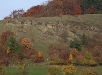
![Randonnée A pied Schlüchtern - BUND-Schlüchtern-Rundweg - Hauptroute - Photo](https://media.geolcdn.com/t/350/260/dc0eba0c-d099-4d00-9c12-271c891696f1.jpeg&format=jpg&maxdim=2)
![A pied A pied](https://static1.geolcdn.com/sitytour/trail-icons/100.png)
Km
A pied
![](/images/other/stat-length.png)
![](https://static1.geolcdn.com/siteimages/upload/files/1508320355ic_sort_den_pos_24dp.png)
![](https://static1.geolcdn.com/siteimages/upload/files/1508320355ic_sort_den_neg_24dp.png)
![](https://static1.geolcdn.com/siteimages/upload/files/16400158638029165_repeat_loop_refresh_sync_direction_icon.png)
• Der 47 km lange Schlüchtern-Rundweg des BUND (Wegbeschreibung) zeigt Landschaft und Sehenswürdigkeiten im Umkreis der...
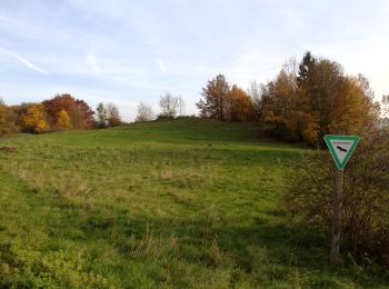
![Randonnée A pied Schlüchtern - Hutten - Rundwanderweg Eichblatt - Photo](https://media.geolcdn.com/t/350/260/3ece24b7-6bac-4809-87a0-c32f93f00806.jpeg&format=jpg&maxdim=2)
![A pied A pied](https://static1.geolcdn.com/sitytour/trail-icons/100.png)
Km
A pied
![](/images/other/stat-length.png)
![](https://static1.geolcdn.com/siteimages/upload/files/1508320355ic_sort_den_pos_24dp.png)
![](https://static1.geolcdn.com/siteimages/upload/files/1508320355ic_sort_den_neg_24dp.png)
![](https://static1.geolcdn.com/siteimages/upload/files/16400158638029165_repeat_loop_refresh_sync_direction_icon.png)
• Randonnée créée par Heimat- und Wanderfreunde Hutten. Symbole: Grünes Eichenblatt auf weißem Hintergrund
![Randonnée A pied Schlüchtern - BUND-Schlüchtern-Rundweg 6 - Photo](https://media.geolcdn.com/t/350/260/1a367717-348e-48b6-90c0-72ccb4fd28ee.jpeg&format=jpg&maxdim=2)
![A pied A pied](https://static1.geolcdn.com/sitytour/trail-icons/100.png)
Km
A pied
![](/images/other/stat-length.png)
![](https://static1.geolcdn.com/siteimages/upload/files/1508320355ic_sort_den_pos_24dp.png)
![](https://static1.geolcdn.com/siteimages/upload/files/1508320355ic_sort_den_neg_24dp.png)
![](https://static1.geolcdn.com/siteimages/upload/files/16400158638029165_repeat_loop_refresh_sync_direction_icon.png)
• Der 47 km lange Schlüchtern-Rundweg des BUND (Wegbeschreibung) zeigt Landschaft und Sehenswürdigkeiten im Umkreis der...
![Randonnée A pied Schlüchtern - Drei-Burgen-Weg - Photo](https://media.geolcdn.com/t/350/260/96846348-56e8-41eb-ac74-99d018458889.jpeg&format=jpg&maxdim=2)
![A pied A pied](https://static1.geolcdn.com/sitytour/trail-icons/100.png)
Km
A pied
![](/images/other/stat-length.png)
![](https://static1.geolcdn.com/siteimages/upload/files/1508320355ic_sort_den_pos_24dp.png)
![](https://static1.geolcdn.com/siteimages/upload/files/1508320355ic_sort_den_neg_24dp.png)
![](https://static1.geolcdn.com/siteimages/upload/files/16400158638029165_repeat_loop_refresh_sync_direction_icon.png)
• Randonnée créée par Rhönklub. Symbole: yellow droplet on white Site web: http://www.naturerlebnis-rhoen.de/wanderw...
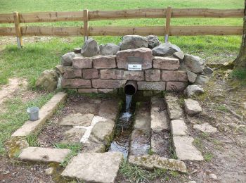
![Randonnée A pied Schlüchtern - Gebietswanderweg Hohenzell - Sterbfritz - Photo](https://media.geolcdn.com/t/350/260/b749f20d-5637-434d-8033-94a053a83247.jpeg&format=jpg&maxdim=2)
![A pied A pied](https://static1.geolcdn.com/sitytour/trail-icons/100.png)
Km
A pied
![](/images/other/stat-length.png)
![](https://static1.geolcdn.com/siteimages/upload/files/1508320355ic_sort_den_pos_24dp.png)
![](https://static1.geolcdn.com/siteimages/upload/files/1508320355ic_sort_den_neg_24dp.png)
![](https://static1.geolcdn.com/siteimages/upload/files/16400158638029165_repeat_loop_refresh_sync_direction_icon.png)
• Randonnée créée par Spessartbund. Symbole: Rotes Dreieck auf weißem Hintergrund
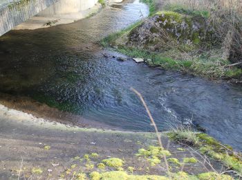
![Randonnée A pied Schlüchtern - Elm - Rundwanderweg ELM4 - Photo](https://media.geolcdn.com/t/350/260/1e9f9814-f1be-491d-a203-911876e58df1.jpeg&format=jpg&maxdim=2)
![A pied A pied](https://static1.geolcdn.com/sitytour/trail-icons/100.png)
Km
A pied
![](/images/other/stat-length.png)
![](https://static1.geolcdn.com/siteimages/upload/files/1508320355ic_sort_den_pos_24dp.png)
![](https://static1.geolcdn.com/siteimages/upload/files/1508320355ic_sort_den_neg_24dp.png)
![](https://static1.geolcdn.com/siteimages/upload/files/16400158638029165_repeat_loop_refresh_sync_direction_icon.png)
• Randonnée créée par Rhönklub Zweigverein Elm. Symbole: Weiße 4 auf blauem Schild
![Randonnée A pied Schlüchtern - Elm - Rundwanderweg ELM3 - Photo](https://media.geolcdn.com/t/350/260/1e9f9814-f1be-491d-a203-911876e58df1.jpeg&format=jpg&maxdim=2)
![A pied A pied](https://static1.geolcdn.com/sitytour/trail-icons/100.png)
Km
A pied
![](/images/other/stat-length.png)
![](https://static1.geolcdn.com/siteimages/upload/files/1508320355ic_sort_den_pos_24dp.png)
![](https://static1.geolcdn.com/siteimages/upload/files/1508320355ic_sort_den_neg_24dp.png)
![](https://static1.geolcdn.com/siteimages/upload/files/16400158638029165_repeat_loop_refresh_sync_direction_icon.png)
• Randonnée créée par Rhönklub Zweigverein Elm. Symbole: Weiße 3 auf blauem Schild
![Randonnée A pied Schlüchtern - Elm - Rundwanderweg ELM2 - Photo](https://media.geolcdn.com/t/350/260/1e9f9814-f1be-491d-a203-911876e58df1.jpeg&format=jpg&maxdim=2)
![A pied A pied](https://static1.geolcdn.com/sitytour/trail-icons/100.png)
Km
A pied
![](/images/other/stat-length.png)
![](https://static1.geolcdn.com/siteimages/upload/files/1508320355ic_sort_den_pos_24dp.png)
![](https://static1.geolcdn.com/siteimages/upload/files/1508320355ic_sort_den_neg_24dp.png)
![](https://static1.geolcdn.com/siteimages/upload/files/16400158638029165_repeat_loop_refresh_sync_direction_icon.png)
• Randonnée créée par Rhönklub Zweigverein Elm. Symbole: Weiße 2 auf blauem Schild
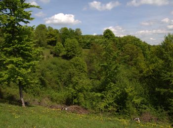
![Randonnée A pied Schlüchtern - Elm - Rundwanderweg ELM1 - Photo](https://media.geolcdn.com/t/350/260/1eec6b3a-d287-425e-9283-93fd939ea79d.jpeg&format=jpg&maxdim=2)
![A pied A pied](https://static1.geolcdn.com/sitytour/trail-icons/100.png)
Km
A pied
![](/images/other/stat-length.png)
![](https://static1.geolcdn.com/siteimages/upload/files/1508320355ic_sort_den_pos_24dp.png)
![](https://static1.geolcdn.com/siteimages/upload/files/1508320355ic_sort_den_neg_24dp.png)
![](https://static1.geolcdn.com/siteimages/upload/files/16400158638029165_repeat_loop_refresh_sync_direction_icon.png)
• Randonnée créée par Rhönklub Zweigverein Elm. Symbole: Weiße 1 auf blauem Schild
![Randonnée A pied Schlüchtern - unknown_Spessartbund_Schluechtern - Photo](https://media.geolcdn.com/t/350/260/630225c9-c620-44e6-8281-1a784b232469.jpeg&format=jpg&maxdim=2)
![A pied A pied](https://static1.geolcdn.com/sitytour/trail-icons/100.png)
Km
A pied
![](/images/other/stat-length.png)
![](https://static1.geolcdn.com/siteimages/upload/files/1508320355ic_sort_den_pos_24dp.png)
![](https://static1.geolcdn.com/siteimages/upload/files/1508320355ic_sort_den_neg_24dp.png)
![](https://static1.geolcdn.com/siteimages/upload/files/16400158638029165_repeat_loop_refresh_sync_direction_icon.png)
• Randonnée créée par Spessartbund. improve me / check Symbole: yellow slash on white
20 randonnées affichées sur 27
Application GPS de randonnée GRATUITE